Browse Listings in Europe > British Isles > British Counties
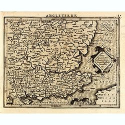
Warwicum Northampton, Huntingdon Cantabr etc.
Showing the south-eastern part of England. From his Atlas Minor. French text on verso.
- $100 / ≈ €87
Date: Amsterdam, c.1630
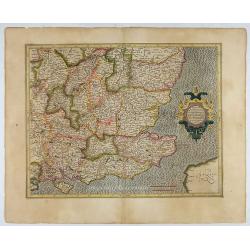
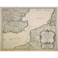
Warwicum Northamtonia Huntingdonia Cantabrigia..
Showing the south-eastern part of England.
Date: Amsterdam, 1630
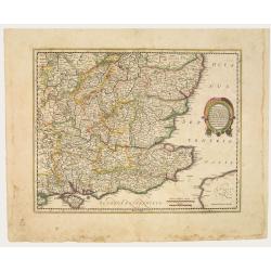
Warwicum Northamtonia Huntingdonia Cantabrigia..
Showing the south-eastern part of England.
Date: Amsterdam, 1642
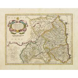
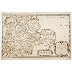
Northumbria, Cumberlandia et Dunelmensis Episcopatus..
Showing the most northern part of England. The map shows Cumbria, Northumberland, Westmorland, Durham, and adjacent parts of Lancashire, Yorkshire, and Scotland.
Date: Amsterdam, 1642
Anciens Royaumes de Kent, d'Essex, et de Sussex. . .
The standard map of South Eastern England with Kent and Essex, Sussex and Cornwall in 17th century France. Engraved by A.Peyrouin.Nicolas Sanson was to bring about the ri...
Date: Paris, 1654-1659
Anciens Royaumes de Mercie, et East Angles. . .
The standard map of the Middle Eastern part of England with Chester, Leicester, Oxford, Cambridge, etc., in 17th century France. Engraved by A.Peyrouin.Nicolas Sanson was...
Date: Paris, 1654-1659
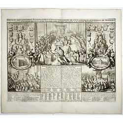
Carte du gouvernement ecclesiastique d'Angleterre . . .
Elegant engraving of the ecclesiastical government of England, with an engraving showing three images: in the centre, an ecclesiastical assembly (Convocation of the Clerg...
- $100 / ≈ €87
Date: Amsterdam, 1720
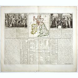
Carte du gouvernement d'Angleterre où l'on représente l'Etat des officiers de Guerre. . .
Decorative map on the British Isles, with idyllic scenes showing councils of the various military officers of the British Isles. Henri Abraham Chatelain (1684 – 1743) w...
- $50 / ≈ €44
Date: Amsterdam, 1720
![[Oxford Canal from Oxford to Coventry].](/uploads/cache/37232-250x250.jpg)
[Oxford Canal from Oxford to Coventry].
Manuscript map covering the Oxford Canal. Orientated East to the North. The Oxford Canal is a 78-mile-long (126 km) narrow canal in central England linking Oxford with Co...
- $140 / ≈ €122
Date: ca. 1900
