Search Listings matching "philippines"

China Southeast Coast.
A very large US Army and Naval map of the south east coast of China, published during the second world war. Map extent is from Kweichow Province in the west, to Kwangsi P...
- $1250 / ≈ €1079
Date: [New York], 1944
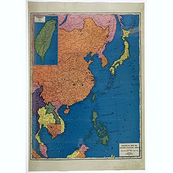
Political Map of Asiatic Coastal Area.
A strongly colored, large map of the Asiatic Coastal countries. All countries are color coded. Maps coverage is from China and Japan in the north, south to the tips of Su...
- $450 / ≈ €388
Date: Chicago, ca 1952
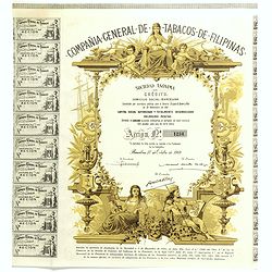
Compania General De Tabacos De Filipinas - (Certificate) Accion ordinarias de 500 Pesetas, Barcelona, 27.10.1969.
Beautifully engraved certificate from the Compania General De Tabacos De Filipinas issued in 1985. This historic document has an ornate border around it with a vignette o...
Date: Barcelona, 1969
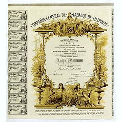
Compañia General de Tabacos de Filipinas (Certificate).
Decorative certificate with a decorative vignette and map / globe oriented to show the Philippines.Tabacalera was the popular name of Compañia General de Tabacos de Fili...
Date: Barcelone, 1969
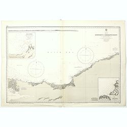
Black sea - Sheet IX - Bosporus to Kerempe Burnu . . .
A highly corrected version of Admiralty chart 2238 originally published 16th June 1854. Edition Date 1980.Detailed chart of Bosporus. With prohibited landing places in pu...
- $100 / ≈ €86
Date: London, 1854-1980
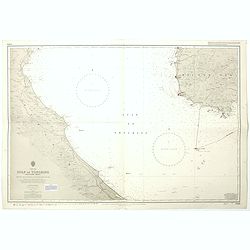
China sea Gulf of Tongking (Southern sheet).
A highly corrected version of Admiralty chart 3989 originally published 11 Mai 1962 under the Superintendence of Captain EG Irving. Detailed chart including the coasts of...
- $80 / ≈ €69
Date: London, 1962 - 1992
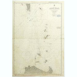
China Sea Luzon Strait between Luzon and Tai-Wan from the United States & Japanese Government chartsto 1929. . . (3804)
A highly corrected version of Admiralty chart 3804 originally published 18 September 1925 under the Superintendence of Captain P.H. Douglas. New Editions 18th December 19...
- $150 / ≈ €129
Date: London, 1929 / 1992
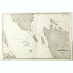
China Sea Philippine Islands - San Bernandino Strait and approaches. (3370)
A highly corrected version of Admiralty chart 3370 originally published 14th November 1924 under the Superintendence of Captain H.P. Douglas. Edition Date 1982 with furth...
- $150 / ≈ €129
Date: London, 1924 / 1996

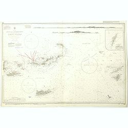
Philippine Islands - Semirara, Ilin and Ambulong 1.s with part of Mindoro. (971)
A highly corrected version of Admiralty chart 971 originally published 15th February 1866 under the Superintendence of Captain G.H. Richards. Edition Date 1991 with furth...
- $150 / ≈ €129
Date: London, 1866 / 1999
West Indies Anguilla to Puerto Rico showing the approaches to the Virgin Islands . . .
A highly corrected version of Admiralty chart 130 originally published 22nd June 1868 under the Superintendence of Captain G.H. Richards. Edition Date 1974 with further c...
- $100 / ≈ €86
Date: London, 1868 - 1999

Philippine Islands - Mindanao West Coast - Basilan Strait to Camiguin Island including Tubbataha Reefs. . . (3811)
A highly corrected version of this oversized Admiralty chart 3811 originally published 26th February 1925 under the Superintendence of Captain P.H. Douglas. Edition Date ...
- $150 / ≈ €129
Date: London, 1925 / 2005