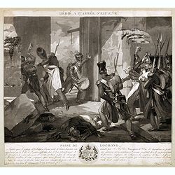
Dédié à l'armée d'Espagne. Prise de Logrono.
Very decorative plate showing the taking of Logrono in 1823, decorative mezzotint by Louis-François Charon (1783-1839) after F.N.Martinet. Published by Jean, Editeur, Ma...
- $75 / ≈ €70
Place & Date: Paris, 1825
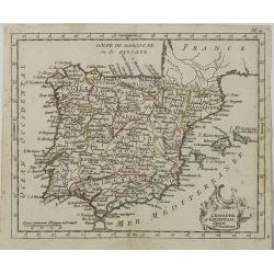
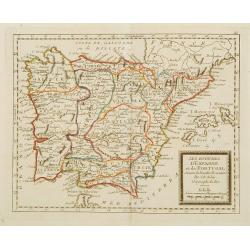
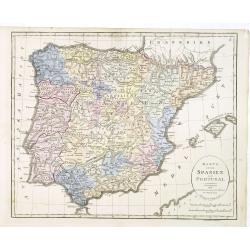
L' Espagne et le Portugal . . .
Map of Spain and Portugal, from Atlas moderne portatif composé de vingt-huit cartes sur toutes les parties du globe terrestre .. A l'usage des Colléges, des Pensions &a...
Place & Date: Paris, Prudhomme, Levrault, Debray, 1806
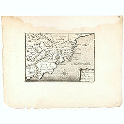
Carte du Gouvernement de Blanes.
Decorative print of the area around Blanes, in Catalonia. Engraved by Pérelle. Embellished with a compass rose.
- $80 / ≈ €75
Place & Date: Paris ca. 1660
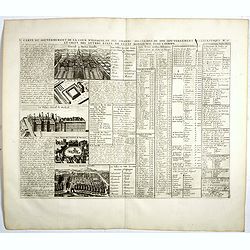
Carte du Gouvernement de la Cour d'Espagne. . .
Engraved text sheet, providing a detailed description of the infrastructure of Spain's ecclesiastical and military government as well as information listed in a lengthy t...
- $75 / ≈ €70
Place & Date: Amsterdam, ca. 1720
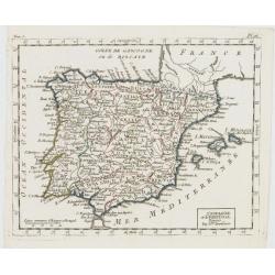
L'Espagne et le Portugal. Divisés Par Gdes. Provinces.
Map of Spain and Portugal, including the Balearic Islands archipelago. From Atlas de la Géographie de toutes les parties du monde .. Ouvrage destiné pour l'education, e...
- $80 / ≈ €75
Place & Date: Paris, Prudhomme, Levrault, Debray, 1806
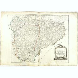
Etats de la Couronne d'Aragon...
Detailed map of the eastern part of Spain. Numerous place-names of counties, cities, towns, physical features.Prepared by "Robert de Vaugondy fils," to whom San...
- $150 / ≈ €140
Place & Date: Venice, 1776 - 1784
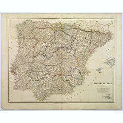
Spain & Portugal.
A large steel engraved map of European neighbours of Spain and Portugal. Including Balearic Islands, with a further inset map of Minorca. Numerous place names and physica...
Place & Date: London, 1839
Les Royaumes d'Espagne et de Portugal ..
Rare map of Spain and Portugal prepared by J.B.Nolin and published by Monhare for his Atlas Général a l'usage des colleges et maisons d'education.. Louis Joseph Mondhar...
- $120 / ≈ €112
Place & Date: Paris, 1783
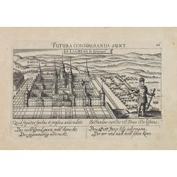
S. Laurens in Escurial.
A very nice picture representing the monastery of San Lorenzo del Escorial. On the foreground the god Jano, with two faces. With a verse in two languages underneath the p...
- $90 / ≈ €84
Place & Date: Frankfurt 1623-1678
Karta öfver Spanien och Portugal.
An very rare map of Spain and Portugal with Swedish text. This is an updated version of his map of 1819 and is now dated 1833.From his atlas "Geographisk Hand-Atlas&...
- $100 / ≈ €94
Place & Date: A. Wiborgs förlag, Stockholm, ca. 1848