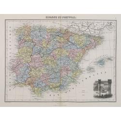
Espagne et Portugal.
A decorative map of Spain and Portugal from Géographie Universelle, Atlas Migeon. With an engraving of the Alhambra in the lower right corner. Published by J. Migeon. Fr...
- $35 / ≈ €33
Place & Date: Paris, 1874
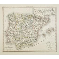
Espagne et Portugal . . .
Detailed map of Spain and Portugal, Majorca and Minorca, etc., prepared by A. H. Basset, rue Saint-Jacques, no. 64, Paris and published in Atlas Classique et Universel de...
- $100 / ≈ €94
Place & Date: Paris, A.H. Basset, 1828
![Hardales in Hispanien. [Spain].](/uploads/cache/13750-250x250.jpg)
Hardales in Hispanien. [Spain].
A very nice view of the city Hardales On the foreground, a man hunting a beaver. With a verse in Latin and German underneath the image.The poet and topographer from Comot...
- $60 / ≈ €56
Place & Date: Frankfurt, 1623-1678
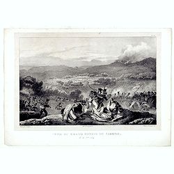
Prise du Grand Convoi de Girone le 26 Fbie 1809.
Fine lithography showing a battle scene during Third Siege of Girona by Godefroy Engelmann" after a drawing by C. Langlois. Godefroy Engelmann was born in 1788 in M�...
- $75 / ≈ €70
Place & Date: Paris, ca. 1820
Hispania.
Small map of the Iberian peninsula with the Balearic Islands, surrounded by text in Dutch.Nicolaes de Clerck (de Klerc) was active as an engraver and publisher in Delft f...
- $100 / ≈ €94
Place & Date: Amsterdam, Cloppenburch, 1621
Royaumes d'Espagne et du Portugal.
Map of Spain and Portugal. By C. F. Delamarche, successor of Robert de Vaugondy, Geographer.
- $80 / ≈ €75
Place & Date: Paris, 1794 - 1806
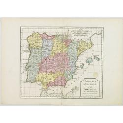
Spain and Portugal.
Uncommon miniature map of Spain and Portugal, engraved by Thomas Kitching for "A New General and Universal Atlas Containing Forty five Maps by Andrew Dury".This...
- $60 / ≈ €56
Place & Date: London, 1761-1763
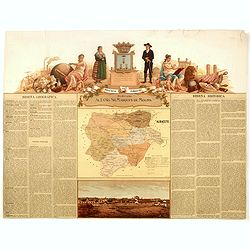
Provincia de Albacete.
Chromolithography published in "Atlas geográfico histórico de las Provincias de España". Map made by M. Vierge, Dedicated to Ilmo. Sr. Dn. Vicente Barrantes....
- $60 / ≈ €56
Place & Date: Madrid, c. 1875
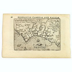
Valentia.
A fine miniature map of the Spanish province of Valencia, published by Petrus Bertius in Amsterdam early in the seventeenth century. The map features a nice strap-work ti...
Place & Date: Amsterdam, 1606
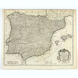
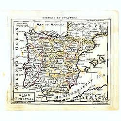
A mapof the Kingdom of Spain and Portugal from the latest & best Observations. . .
An interesting copper engraved map of Spain and Portugal, with an attractive rococo cartouche. Nicholas Tindal (1687-1774) / Paul de Rapin (1661-1725) were responsible fo...
Place & Date: London, 1743