Browse Listings in Europe > Spain > Spain General Maps
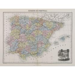
Espagne et Portugal.
A decorative map of Spain and Portugal from Géographie Universelle, Atlas Migeon. With an engraving of the Alhambra in the lower right corner. Published by J. Migeon. Fr...
- $35 / ≈ €33
Place & Date: Paris, 1874
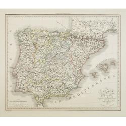
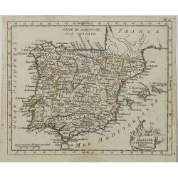
Espagne et Portugal . . .
Detailed map of Spain and Portugal, Majorca and Minorca, etc., prepared by A. H. Basset, rue Saint-Jacques, no. 64, Paris and published in Atlas Classique et Universel de...
- $100 / ≈ €94
Place & Date: Paris, A.H. Basset, 1828
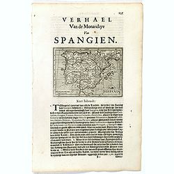
Hispania.
Small map of the Iberian peninsula with the Balearic Islands, surrounded by text in Dutch.Nicolaes de Clerck (de Klerc) was active as an engraver and publisher in Delft f...
- $100 / ≈ €94
Place & Date: Amsterdam, Cloppenburch, 1621
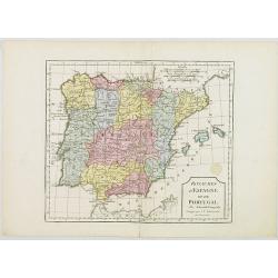
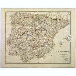
Royaumes d'Espagne et du Portugal.
Map of Spain and Portugal. By C. F. Delamarche, successor of Robert de Vaugondy, Geographer.
- $80 / ≈ €75
Place & Date: Paris, 1794 - 1806
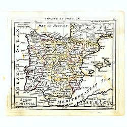
Spain and Portugal.
Uncommon miniature map of Spain and Portugal, engraved by Thomas Kitching for "A New General and Universal Atlas Containing Forty five Maps by Andrew Dury".This...
- $60 / ≈ €56
Place & Date: London, 1761-1763
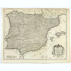
A mapof the Kingdom of Spain and Portugal from the latest & best Observations. . .
An interesting copper engraved map of Spain and Portugal, with an attractive rococo cartouche. Nicholas Tindal (1687-1774) / Paul de Rapin (1661-1725) were responsible fo...
Place & Date: London, 1743
L' Espagne et le Portugal . . .
Map of Spain and Portugal, from Atlas moderne portatif composé de vingt-huit cartes sur toutes les parties du globe terrestre .. A l'usage des Colléges, des Pensions &a...
Place & Date: Paris, Prudhomme, Levrault, Debray, 1806
Spain & Portugal.
A large steel engraved map of European neighbours of Spain and Portugal. Including Balearic Islands, with a further inset map of Minorca. Numerous place names and physica...
Place & Date: London, 1839
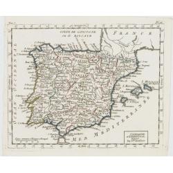
L'Espagne et le Portugal. Divisés Par Gdes. Provinces.
Map of Spain and Portugal, including the Balearic Islands archipelago. From Atlas de la Géographie de toutes les parties du monde .. Ouvrage destiné pour l'education, e...
- $80 / ≈ €75
Place & Date: Paris, Prudhomme, Levrault, Debray, 1806
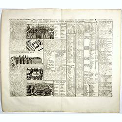
Carte du Gouvernement de la Cour d'Espagne. . .
Engraved text sheet, providing a detailed description of the infrastructure of Spain's ecclesiastical and military government as well as information listed in a lengthy t...
- $75 / ≈ €70
Place & Date: Amsterdam, ca. 1720