Search Listings matching "hondius" in Europe
![[Lot of 6 Maps of Germany] PALATINATUS BAVARIAE.](/uploads/cache/IMG_2319-250x250.jpg)
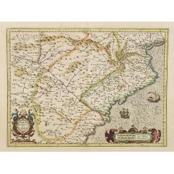
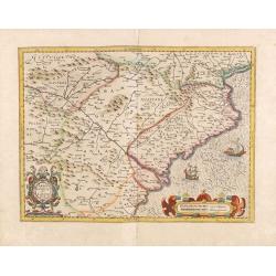
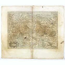
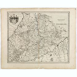
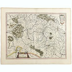
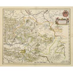
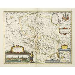
[Lot of 6 Maps of Germany] PALATINATUS BAVARIAE.
[Lot of 6 Maps of Germany]- Palatinatus Bavariae. (H.Hondius & G.Mercator) circa. 1619 (490x370 mm)- La Basse Partie Du Cercle Du Haut Rhein divisé en tous ses ...
- $750 / ≈ €641
Place & Date: Amsterdam, 1619
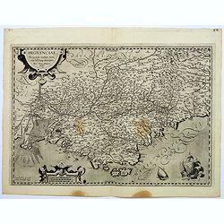
Provinciae, Regionis galliae, vera exactissimaq. Descriptio
This is a highly detailed and well engraved map of Provence in southern France. Engraved by H.Picart and published by Jean le Clerc.Jean le Clerc (1560-1621) was an engra...
- $500 / ≈ €427
Place & Date: Paris, ca. 1620
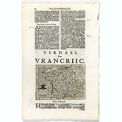
Gallia.
Small map of France, surrounded by text in Dutch. Nicolaes de Clerck (de Klerc) was active as engraver and publisher in Delft from 1599-1621.Included in the rare book : W...
- $70 / ≈ €60
Place & Date: Amsterdam, Cloppenburch, 1621
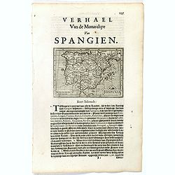
Hispania.
Small map of the Iberian peninsula with the Balearic Islands, surrounded by text in Dutch.Nicolaes de Clerck (de Klerc) was active as an engraver and publisher in Delft f...
- $100 / ≈ €85
Place & Date: Amsterdam, Cloppenburch, 1621
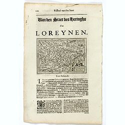
Lotaringia Ducatus.
Small map of Lorraine, oriented with West on top and surrounded by text in Dutch. Nicolaes de Clerck (de Klerc) was active as an engraver and publisher in Delft from 1599...
- $75 / ≈ €64
Place & Date: Amsterdam, Cloppenburch, 1621
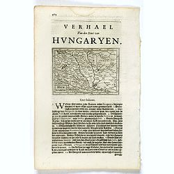
Hungaria.
Small map of Hungary, surrounded by text in Dutch. Nicolaes de Clerck (de Klerc) was active as engraver and publisher in Delft from 1599-1621.Included in the rare book : ...
- $100 / ≈ €85
Place & Date: Amsterdam, Cloppenburch, 1621
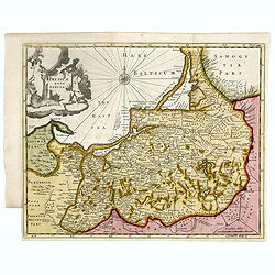
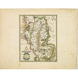
Prussiae nova tabula.
Rare map of Prussia with nowadays Poland. The map features a bold title cartouche, a ship, a compass rose, and a sea monster in the Baltic Sea. The map was prepared by th...
- $550 / ≈ €470
Place & Date: London, 1624
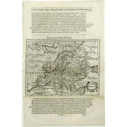
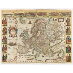
Europa.
The rare Samuel Purchas' edition of the Mercator/Hondius Atlas Minor atlas map. Early map of Europe published in his famous collection of voyages His Pilgrimes . With des...
- $150 / ≈ €128
Place & Date: London, 1625

A new mape of Ye XVII Provinces of Low Germanie.
Showing all 17 Provinces of the Netherlands before the split between Spain and the Protestant Provinces under the House of Orange. The map was published while the war of ...
- $2300 / ≈ €1966
Place & Date: London, George Humble, 1626 [1627
Carte de L'Europe, corrigée et augmentée desus toutes les autres . . .
Rare map of Europe, dated 1627. First state, issued by Melchior Tavernier. Most probably engraved by Cornelis Danckerts (the elder), a highly skilled engraver. Most proba...
- $2250 / ≈ €1924
Place & Date: Paris, 1627
Arragonia et Catalonia
Aragon and Catalonia. Decorative map with mountain relief and river. 2 finely engraved sailing boats.Mercator was born in Rupelmonde in Flanders and studied in Louvain un...
- $600 / ≈ €513
Place & Date: Amsterdam, 1628
Arragonia et Catalonia.
Aragon and Catalonia. Decorative map with mountain relief and river. 2 finely engraved sailing boats.Mercator was born in Rupelmonde in Flanders and studied in Louvain un...
- $250 / ≈ €214
Place & Date: Amsterdam, 1628
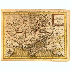
Taurica Chersonesus.
One of the earliest detailed maps of the Crimea and Ukraine between the northern coast of the Black Sea and Moscow.With the signature of Gerard Mercator in lower left cor...
Place & Date: Amsterdam, 1628

Coloniensis Archiepisscopatus.
Extremely rare first edition of this beautiful map of Cologne and Dusseldorff.Jodocus Hondius Jr. planned to produce a new modern atlas less dependent on the Mercator pla...
Place & Date: Amsterdam, 1629
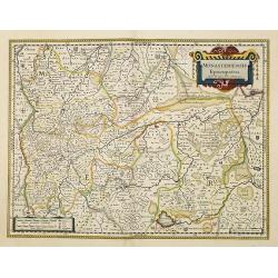
Monasteriensis Episcopatus.
The extremely rare first edition of this beautiful map of Munster.Jodocus Hondius Jr. planned to produce a new modern atlas less dependent on the Mercator plates that his...
Place & Date: Amsterdam, 1629
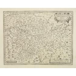
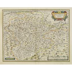
Westphalia Ducatus.
Extremely rare first edition of this beautiful map of Westphalia.Jodocus Hondius Jr. planned to produce a new modern atlas less dependent on the Mercator plates that his ...
Place & Date: Amsterdam, 1629
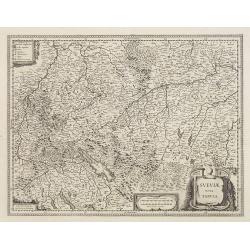
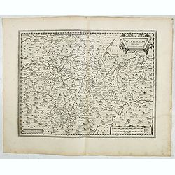
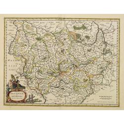
Sueviae Nova Tabula.
Extremely rare first edition of this beautiful map of Swaben, including Ulm, Augsburg, Stuttgart, Zurich, Lucerne and Lake Constance.Jodocus Hondius Jr. planned to produc...
Place & Date: Amsterdam, 1629
Alpinae seu Foederatae Rhaetiae . . .
Extremely rare first edition of this beautiful map of Graubünden Canton in Switzerland. Including Chur, Davos, St.Moritz, etc.Jodocus Hondius Jr. planned to produce a ne...
- $750 / ≈ €641
Place & Date: Amsterdam, 1629
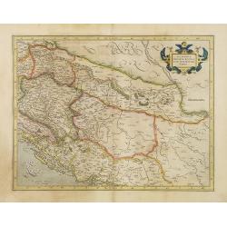
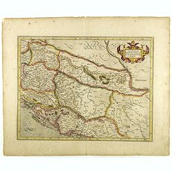
Sclavonia, Croatia, Bosnia cum Dalmatiae parte.
Nice map of the Eastern Balkans with the political divisions of Slovenia, Croatia, Bosnia and Dalmatia.Mercator was born in Rupelmonde in Flanders and studied in Louvain ...
- $300 / ≈ €256
Place & Date: Amsterdam 1630
Udrone Irlandiae in Catherlagh Baronia.
A detailed map of the Barony of Udrone (modern Idrone) in County Carlow, Ireland The title is surrounded by a strapwork design cartouche topped with calipers & a mile...
- $200 / ≈ €171
Place & Date: Amsterdam, 1630

Irlandiae Regnum.
A very nice map from Ireland.Mercator was born in Rupelmonde in Flanders and studied in Louvain under Gemma Frisius, Dutch writer, astronomer and mathematician. The excel...
Place & Date: Amsterdam, 1630
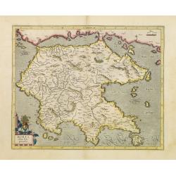
Morea olim Peloponnesus.
Gerard Mercator's map of the Greece's Peloponnesus peninsula called and labeled Morea. A few of the other smaller islands appear included the larger Cerigo (today's Cythe...
- $300 / ≈ €256
Place & Date: Amsterdam, 1630
Taurica Chersonesus . . .
An attractive, detailed and early map of the Ukraine, Russia and surrounding regions between the northern coast of the Black Sea and Moscow.Shows ports, fortified cities ...
- $300 / ≈ €256
Place & Date: Amsterdam, 1630
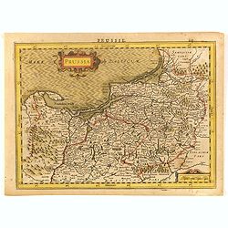
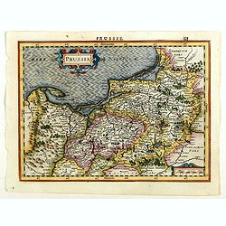
Prussia.
An attractive, detailed and early map of present-day Poland and Lithuania. From the Cloppenburg edition slightly larger format and more scarce edition of the Mercator/Hon...
- $450 / ≈ €385
Place & Date: Amsterdam, 1630
Marca Brandeburgensis & Pomerania.
Centered on the towns of Brandenburg and Berlin. Based on the map by Elias Cameriarus (abt.1530-1581).RARE second state, with both the signatures of Gerard Mercator and H...
- $75 / ≈ €64
Place & Date: Amsterdam, 1630
Westfaliae.
A nice map showing the province of Westphalia.Mercator was born in Rupelmonde in Flanders and studied in Louvain under Gemma Frisius, Dutch writer, astronomer and mathema...
Place & Date: Amsterdam, 1630
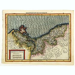
Pomeraniae Ducatus.
Pomerania map from the rare Cloppenburg edition slightly larger format and more scarce edition of the Mercator/Hondius "Atlas Minor". Small and detailed map of ...
Place & Date: Amsterdam, 1630
Prussia.
An attractive, detailed and early map of present-day Poland and Lithuania from the rare Cloppenburg edition slightly larger format and more scarce edition of the Mercator...
Place & Date: Amsterdam, 1630
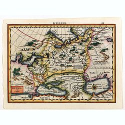
Russia.
Russia map from the rare Cloppenburg edition slightly larger format and more scarce edition of the Mercator/Hondius "Atlas Minor". Engraved by Pieter Van Den Ke...
Place & Date: Amsterdam, 1630
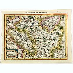
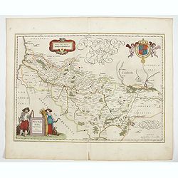
Polonia et Silesia.
Map of Poland and Silesia from the rare Cloppenburg edition slightly larger format and more scarce edition of the Mercator/Hondius "Atlas Minor". Engraved by Pi...
Place & Date: Amsterdam, 1630
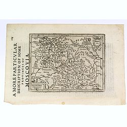
A More Particular Description of some Provinces of Moscovia.
From the English edition of the popular Mercator - Hondius atlas. English text to verso. This map elegantly depicts the Muscovy region of western Russia, with Moscow in t...
- $225 / ≈ €192
Place & Date: Amsterdam, 1630
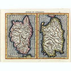
Corsse et Sardaigne.
Maps of Corsica and Sardinia from the rare Cloppenburg edition slightly larger format and more scarce edition of the Mercator/Hondius "Atlas Minor". Engraved by...
- $300 / ≈ €256
Place & Date: Amsterdam, 1630
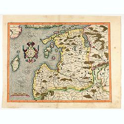
Livonia. 1627
Detailed map of the northern Baltic region. The map is centered on Riga and extends south to Memel, west to Poland and part of Russia and north to the Strait between Finl...
- $500 / ≈ €427
Place & Date: Amsterdam, ca. 1630
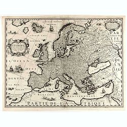
Nova Europae descriptio.
Rare early issue of the map of Europe with the lower border removed and without text on the reverse. Variant : The map has no longer the lower border, doesn't have text o...
Place & Date: Amsterdam, after 1630
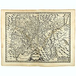
Bresse.
Early map of Eastern France with Lyon to the lower left corner and part of Switzerland. Geneva in upper right corner. Engraved by Hondius. From a French composite atlas.R...
- $150 / ≈ €128
Place & Date: Amsterdam, 1631

Belgii sive Germaniae Inferioris accuratissima tabula.
Very rare and very decorative map with in the right and left borders costumed figures and town plans alternately. In top and bottom border town plans and views.Separate p...
Place & Date: Amsterdam, 1631

Episcop. Ultraiectinus.
A very detailed map based on Utrecht. Scale cartouche held by a surveyor. Based on the map by B.F.van Berckenrode (1620-21) and engraved by the master engraver Evert Sijm...
Place & Date: Amsterdam, 1630-1632
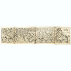
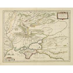
Totius Rheni, ab eius Capitibus ad Oceanu usque Germanicum in quem se Exonerat Novissima Descriptio.
The course of the Rhine river by Henricus Hondius. Originally engraved as two parts on one sheet. Here separated and joined to one large map. The map is showing the compl...
- $300 / ≈ €256
Place & Date: Amsterdam, ca. 1632
Sclavonia, Croatia, Bosnia cum Dalmatiae parte.
Nice map of the Eastern Balkans with the geographical & political divisions of Dalmatia, Croatia, Slavonia, Bosnia, Serbia, etc.Mercator was born in Rupelmonde in Fla...
- $250 / ≈ €214
Place & Date: Amsterdam, 1632
Polonia et Silesia.
Fine and important map of Poland, including Warsaw, Krakow, Oppeln, Breslau, Gnezna, Graudenz, Lublin etc.Mercator was born in Rupelmonde in Flanders and studied in Leuve...
Place & Date: Amsterdam, 1633

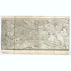
Tractus Danubii, Fluminis in Europa Maximi, A Fontibus, Per Germaniam. . .
This is Blaeu’s first map of the Danube and surrounding regions. The Danube River runs through the map from the top left with its headwaters in the German Black Forest ...
Place & Date: Amsterdam, 1634
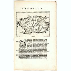
Sardinia Insula.
FIRST EDITION, FIRST ISSUE OF THIS MAP. Map of the Italian island of Sardinia in a copper engraving on a sheet with letterpress with German text description of the island...
Place & Date: Amsterdam, 1634
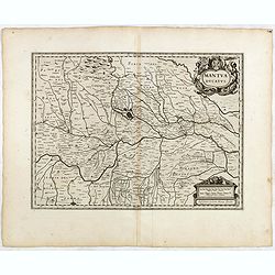
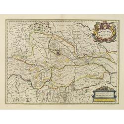
Mantua ducatus.
Originally engraved for Jodocus Hondius II, at his death in August 1629 this map was, among 39 other copper plates, purchased by Willem Blaeu who deleted Hondius' name an...
- $300 / ≈ €256
Place & Date: Amsterdam, 1634
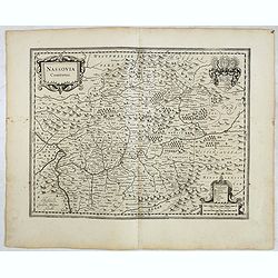
Nassovia comitatus.
Elegantly engraved map of the region including Koblenz, Sigen and Dillenburg. The mountainous topography is graphically depicted and there is a coats of arms in the corne...
- $100 / ≈ €85
Place & Date: Amsterdam, 1634
Westphalia Ducatus.
Originally engraved for Jodocus Hondius II, at his death in August 1629 this map was, among 39 other copper plates,purchased by Willem Blaeu who deleted Hondius' name and...
- $100 / ≈ €85
Place & Date: Amsterdam, 1634
Osnabrugensis Episcopatus.
Originally engraved for Jodocus Hondius II, at his death in August 1629 this map was, among 39 other copper plates, purchased by Willem Blaeu who deleted Hondius' name an...
- $150 / ≈ €128
Place & Date: Amsterdam, 1634
Tractus Danubii, Fluminis in Europa Maximi, A Fontibus, Per Germaniam. . .
This is Blaeu’s first map of the Danube and surrounding regions. The Danube River runs through the map from the top left with its headwaters in the German Black Forest ...
Place & Date: Amsterdam, 1634
Wirtenberg Ducatus.
FIRST EDITION, FIRST ISSUE OF THIS MAP. From the 1634 edition of Blaeu's Atlas Novus, the first edition of this work. PROOF STATE with blank upper right corner, only incl...
- $100 / ≈ €85
Place & Date: Amsterdam, 1634

Argow cum parte merid. Zurichgow.
Nice map of Canton Aargau and parts of the Cantons Schwyz, Zürich and Glarus. Includes the cities of Bern and Luzern.Based on the cartography of Gerard Mercator and very...
- $100 / ≈ €85
Place & Date: Amsterdam, 1634
Das Wiflispurgergow.
Detailed map of South-western Switzerland after Gerhard Mercator's map of the same. With ornamental title cartouche and German text on the verso.It shows Geneva, Lake Gen...
Place & Date: Amsterdam, 1634
Helvetia cum finitimis regionibus confoederatis.
Detailed and finely engraved map of Switzerland with a pair of fine cartouches.From early on Willem Jansz. Blaeu aimed of publishing an atlas to compete with the Hondius-...
Place & Date: Amsterdam, 1634
Ducatus Holsatiae nova tabula.
Finely engraved map centered on the area north of Hamburg and Lubeck with two insets. This is a second state of a map initially made by Jodocus Hondius.
- $250 / ≈ €214
Place & Date: Amsterdam, 1635

Nouvelle et exacte Carte du Duche de Brabant. . .
A very rare example of a map of the Duchy of Brabant. Title cartouche in the lower left-hand corner. A very rare issue of this map of Brabant. Cornelis Danckerts II. copi...
Place & Date: Amsterdam, 1635
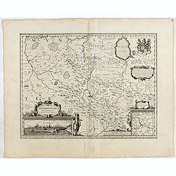
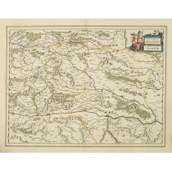
Franconia vulgo Franckenlandt.
Fine copy centered on Bamberg, Nuremberg, Würzburg, and Nuremberg. French text on verso. Würzburg is the main city in Franconian wine country. Grapevines cover the stee...
Place & Date: Amsterdam, 1635
Germaniae nova et accurata delineatio.. 1631.
Striking example of Hondius' map of the German Empire, extending from the Low Countries in the Northwest to the Baltic, Poland and Russia in the Northeast and Italy and t...
- $400 / ≈ €342
Place & Date: Amsterdam, 1636

Ducatus Limburg.
A very rare issue of this map of Limburg. Cornelis Danckerts II. copied the folio map of H.Hondius.The publisher's address was placed in the lower right-hand corner. The ...
Place & Date: Amsterdam, 1636
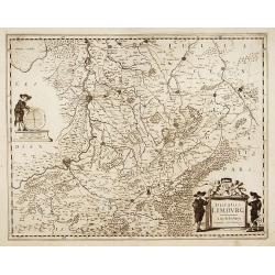
Ducatus Limburg.
A very rare issue of this map of Limburg. Cornelis Danckerts II. copied the folio map of H.Hondius.The publisher's address was placed in the lower right-hand corner. The ...
Place & Date: Amsterdam, 1636
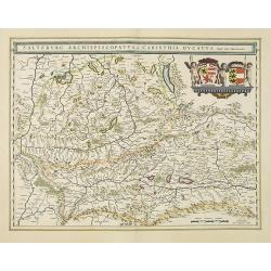
Saltzburg Archiepiscopatus, et Carinthia Ducatus
Handsome map of the archbishopric of Salzburg and the Duchy of Carinthia.Title in banner form with two coats of arms and three cherubs decorating the map.As Willem Blaeu ...
Place & Date: Amsterdam, 1638

Danubius Fluvius Europae Maximus, a Fontibus ad Ostia..
Depicts the course of the Danube River, from its sources in the Alps to the Black Sea..Because of the dimensions the map was printed from two copper plates.With two very ...
Place & Date: Amsterdam, 1638
Taurica Chersonesus, Nostra aetate Przecopsca, et Gazara dicitur.
Part of Russia with in the north Smolensk and Moscow and in the south the Black Sea.As Willem Blaeu died in 1638 most of his maps are actually published by his son Joan. ...
Place & Date: Amsterdam, 1638
Stiria Steyermarck.
Covering the eastern part of Austria, Styria and Carinthia, centered on the town of Graz.As Willem Blaeu died in 1638 most of his maps are actually published by his son J...
Place & Date: Amsterdam, 1638
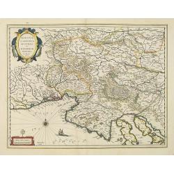
Walachia, Servia, Bulgaria, Romania.
Striking map of the region centered on the Lower Danube, Bulgaria, Romania, Serbia and Macedonia. Includes decorative cartouche, coat of arms, etc. Latin text on verso.Th...
Place & Date: Amsterdam, 1638
Karstia, Camiola, Histria et Windorum Marchia.
Including the Gulf of Trieste, Venice and the northern part of former Yugoslavia. Prepared by Gerard Mercator.As Willem Blaeu died in 1638 most of his maps are actually p...
Place & Date: Amsterdam, 1638

Dominio Veneto nell' Italia.
With the Gulf of Venice. Including the towns of Cremona, Brescia, Venice, etc.As Willem Blaeu died in 1638 most of his maps are actually published by his son Joan. This m...
Place & Date: Amsterdam, 1638
Mantua ducatus.
Centered at the town of Mantua.As Willem Blaeu died in 1638 most of his maps are actually published by his son Joan. This map carries his (engraved) signature and was act...
Place & Date: Amsterdam, 1638
Mediolanum Ducatus.
Very fine map centered on Milan Including Lake Como, Lake Garda, Lake Majore, Parma, etc.As Willem Blaeu died in 1638 most of his maps are actually published by his son J...
Place & Date: Amsterdam, 1638
Rugia Insula ac ducatus. . .
Willem Blaeu's highly decorative map of the island of Rugen in the Baltic Sea from a map by Eihard Lubin. Embellished with a title-cartouches, and 30 coats-of-arms in the...
- $300 / ≈ €256
Place & Date: Amsterdam, 1638
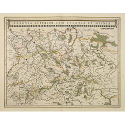
Saxonia Superior, cum Lusatia et Misnia.
Finely engraved and detailed map of Saxony including Halle, Leipzig, Meissen, and Dresden. Filled with forests and tiny villages. It presents Prague close to the centre o...
Place & Date: Amsterdam, 1638
Mansfeldia Comitatus. . .
Centered on Mansfield and prepared by Telemann Stella (1527-1589) a German cartographer who made maps of Germany and the Holy Land.As Willem Blaeu died in 1638 most of hi...
Place & Date: Amsterdam, 1638
Monasteriensis Episcopatus.
A very detailed map of Germany centered on Munster and Linge. Also showing Wessel to the top of the map and Oldenburg to the right. North to the right. The map is adorned...
Place & Date: Amsterdam, 1638
Bravnswyck et Meydburg. . .
As Willem Blaeu died in 1638 most of his maps are actually published by his son Joan. This maps carries his (engraved) signature and was actually published in volume II o...
Place & Date: Amsterdam, 1638
Westphalia Ducatus.
Elegantly engraved map of Westphalia including Hamm and Lippstadt. The mountainous topography is graphically depicted and several small coats of arms dot the map. Strapwo...
Place & Date: Amsterdam, 1638
Osnabrugensis episcopatus.
A beautiful map of Munster centered on the city of Osnabruck. Prepared by Joannes Michael Gigas (1580-1650+), a doctor, mathematician and geographer. Showing an inset wit...
Place & Date: Amsterdam, 1638
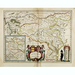
Comitatus Marchia et Ravensberg.
With an inset of Ravensberg comitatus. Decorative title cartouche with coats of arms. Scale cartouche with a surveyor.As Willem Blaeu died in 1638 most of his maps are ac...
- $80 / ≈ €68
Place & Date: Amsterdam, 1638
Nova Italiae delineatio.
Originally engraved for Jodocus Hondius II, at his death in August 1629 this map was, among other copper plates,purchased by Willem Blaeu who trimmed the figured borders,...
Place & Date: Amsterdam, 1638
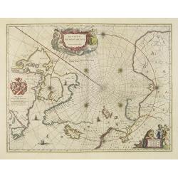
Regiones Sub Polo Arctico.
One of the many cases of duplication by the firms of Blaeu and Hondius/Jansson. In this case, Blaeu has copied Janssonius's map of 1637. It depicts rhumb lines radiating ...
- $850 / ≈ €727
Place & Date: Amsterdam, 1640
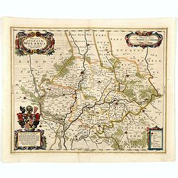
Ducatus silasiae Wolanus. . .
An engraved 17th-century map of the Duchy of Wohlau in Poland with four cartouches in the corners. Orientated with east at the top. The decorative cartouche displaying th...
- $550 / ≈ €470
Place & Date: Amsterdam, ca. 1641
-250x250.jpg)
Helvetia cum finitimis regionibus confoederatis.
A typically detailed and finely engraved map of Switzerland by Blaeu, including the cities of Basel, Zürich, Bern, Lucerne, Fribourg, etc. The map is embellished with tw...
Place & Date: Amsterdam, 1643
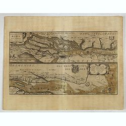
Celeberrimi Fluvis Albis nova delineatio. . .
A decorative map from a 1640's Latin text edition of Blaeu's "Theatrum Orbis Terrarum, Sive Atlas Novis." The River Elbe is depicted in two sections from the mo...
- $80 / ≈ €68
Place & Date: Amsterdam, 1644
Picardia Regio Belgica.
Map of the northern region of Picardy. The region is well known due to the 4 major battles fought between France, Britain and Germany between 1915-18 during World War I. ...
- $400 / ≈ €342
Place & Date: Amsterdam, 1644