Subscribe to be notified if similar examples become available.
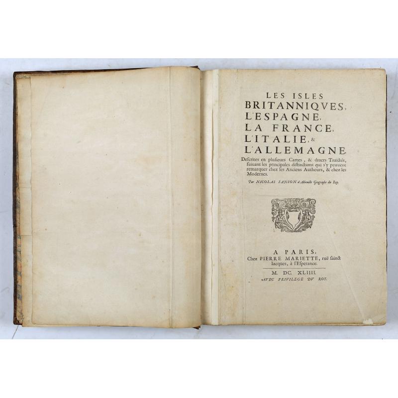
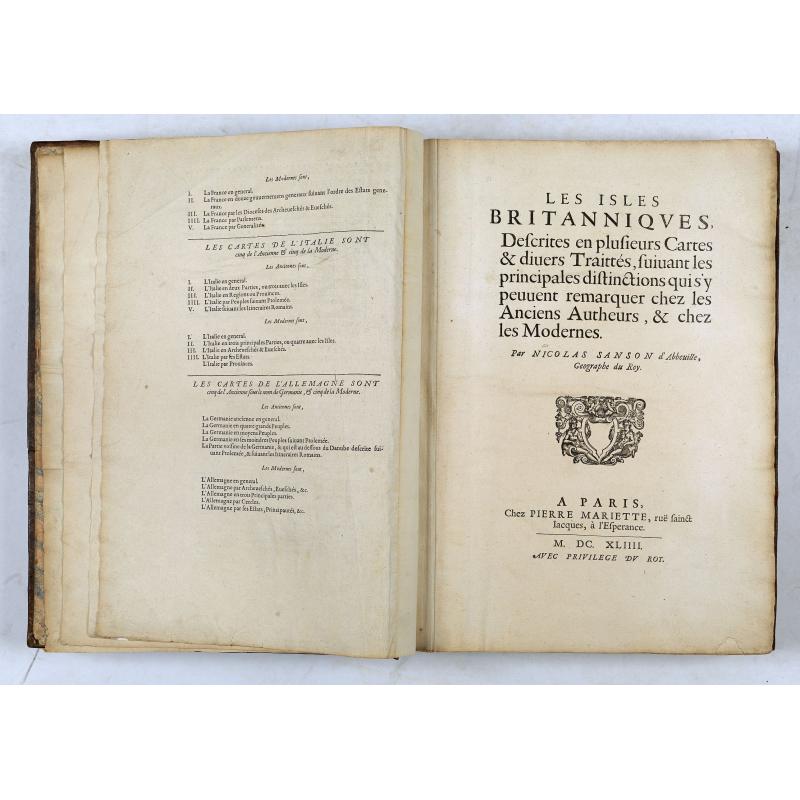


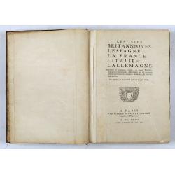

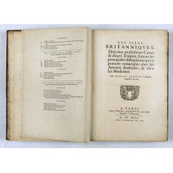
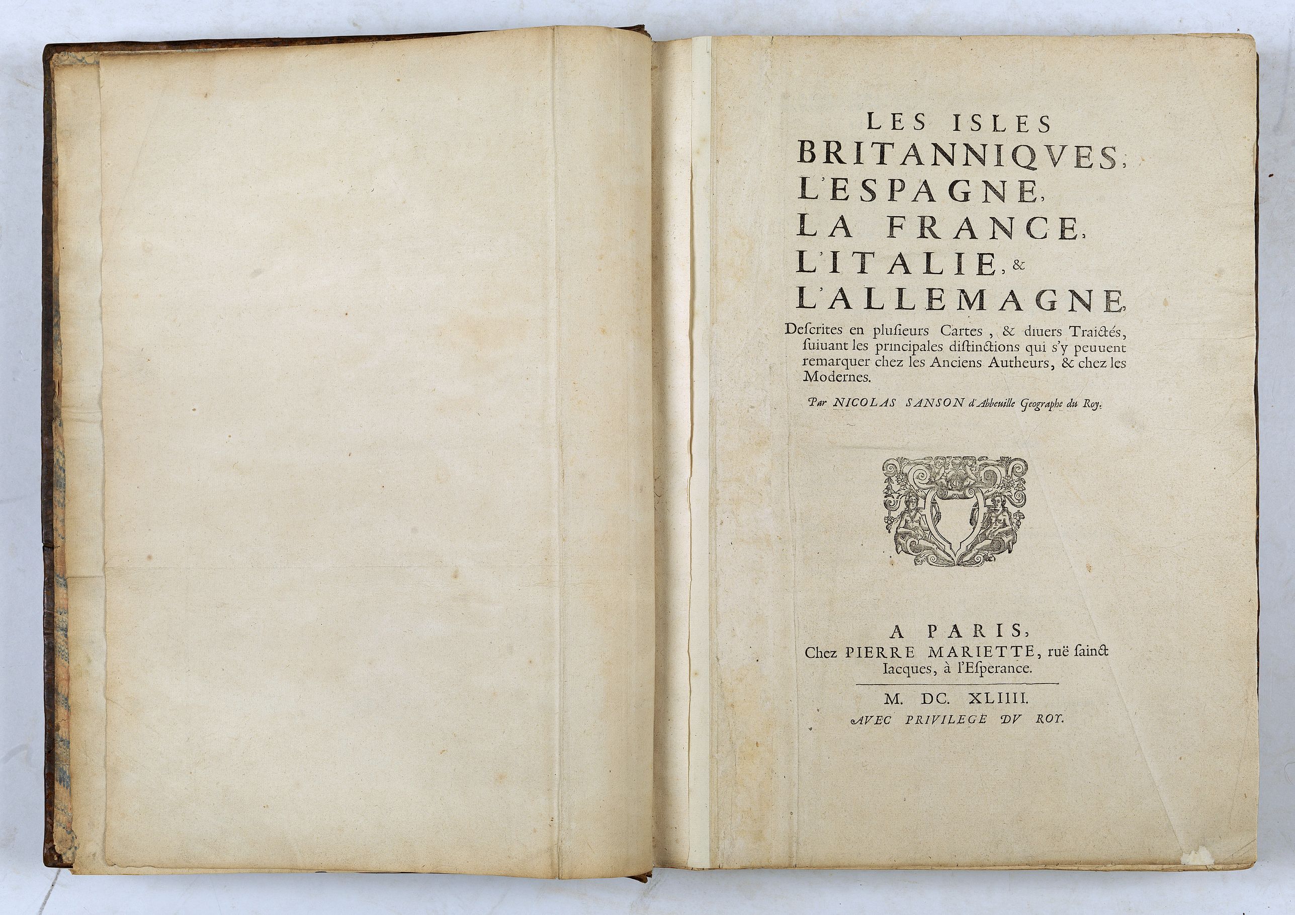
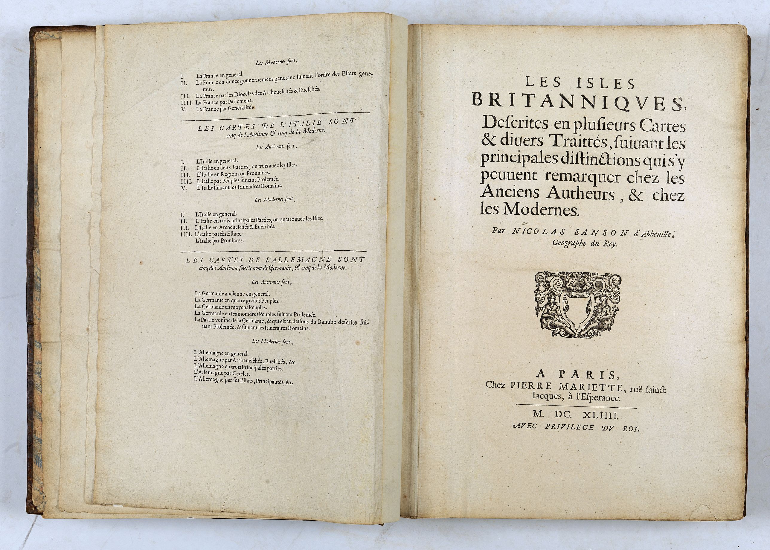
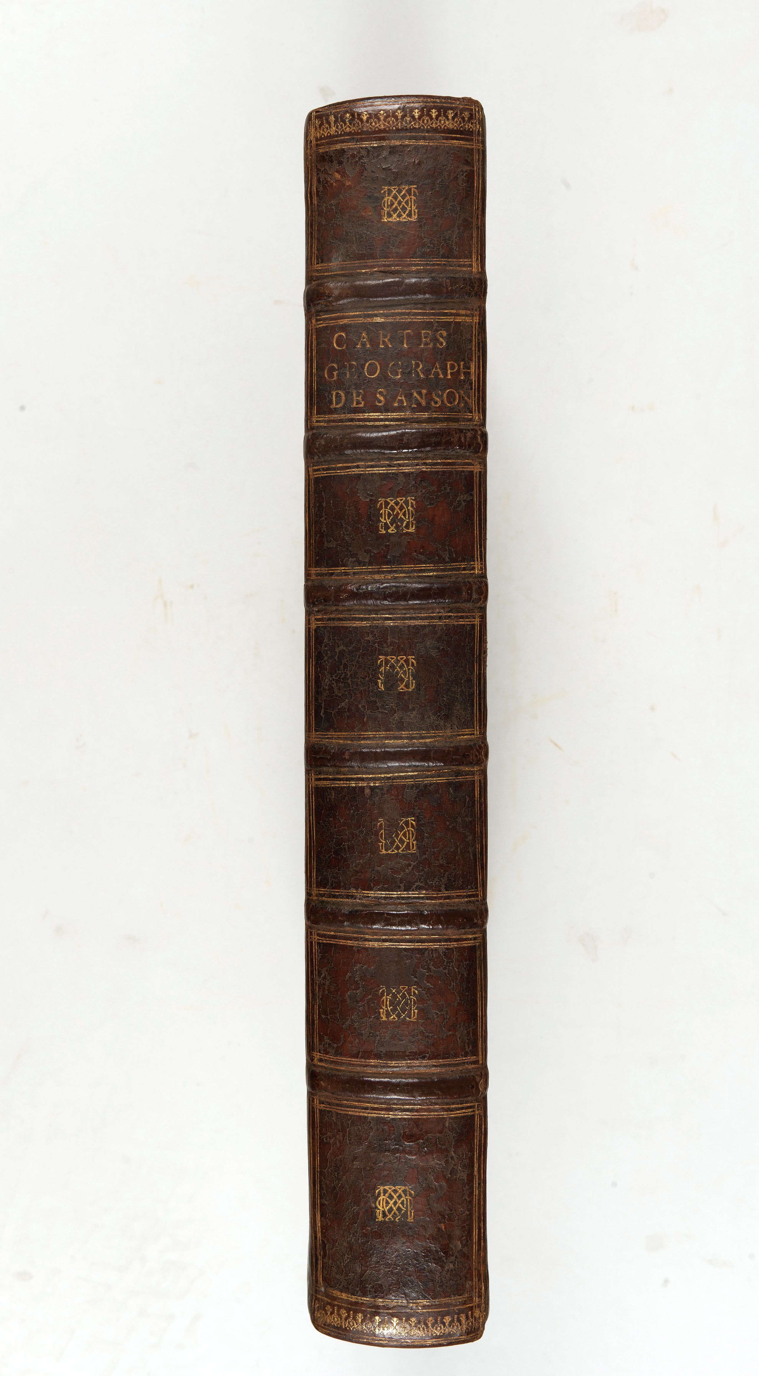
Les Isles Britanniques, l'Espagne, la France, l'Italie, & l'Allemagne, Descrites en plusieurs cartes & divers Traictés… ("Les cinq royaumes"). |
||||||||||||||||||||
|
||||||||||||||||||||
|
|
||||||||||||||||||||
Description
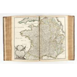
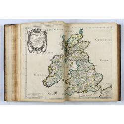
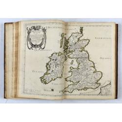
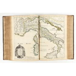
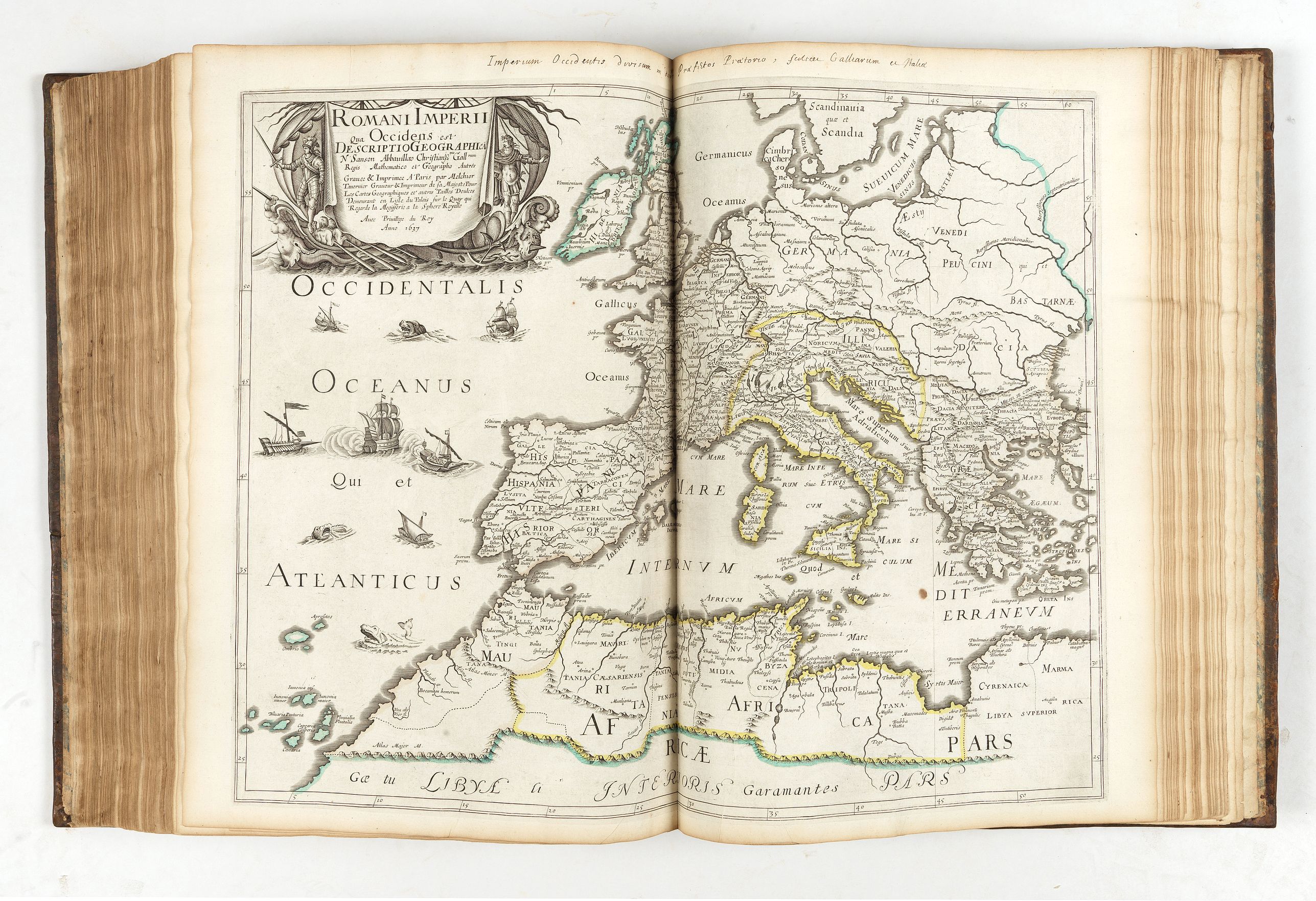
First edition of the atlas of the "Five Kingdoms" (Great Britain, Spain, France, Italy and Germany) bound with the description and maps of the Eastern and Western Roman Empire (1638) " Romani utriusque Imperii Orientis scilicer et Occidentis" (7 maps) and with the Ancient Greece (1638) "Graeciae antiquae descriptio geographica" (4 maps).
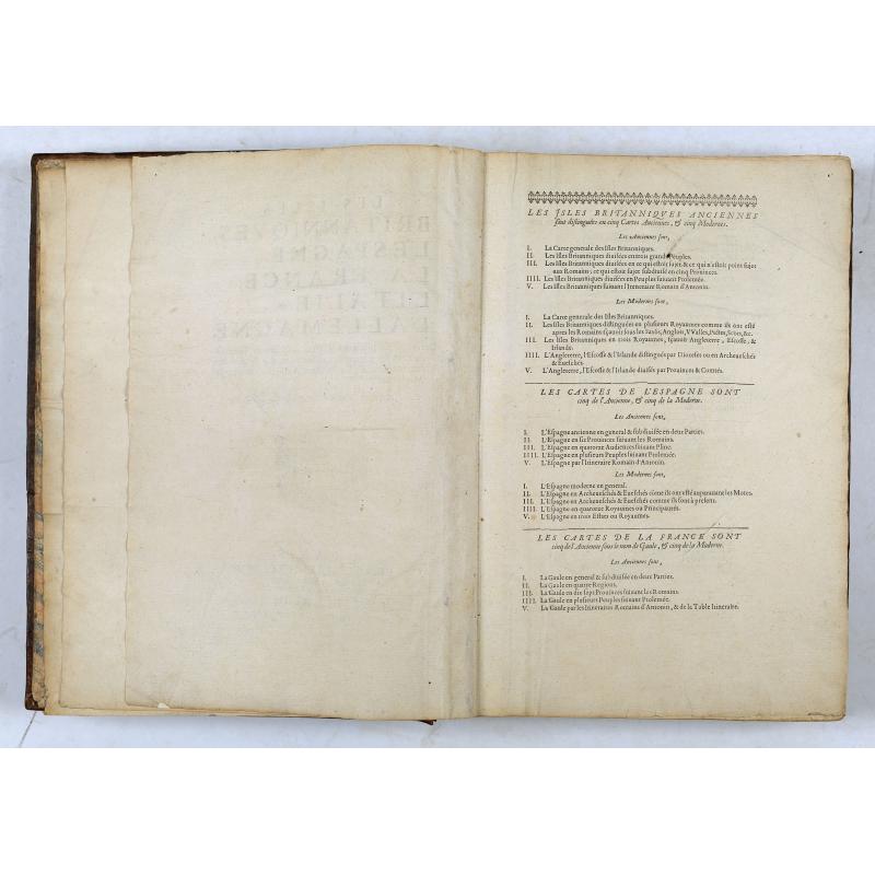
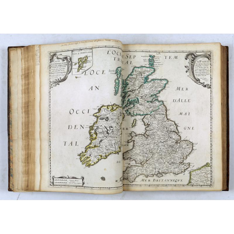
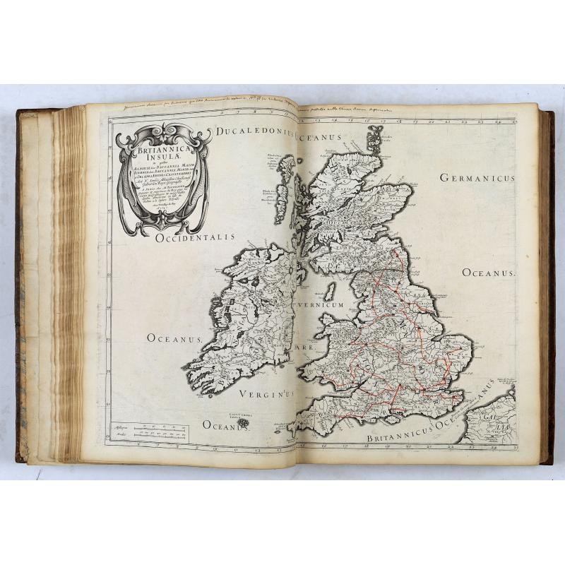
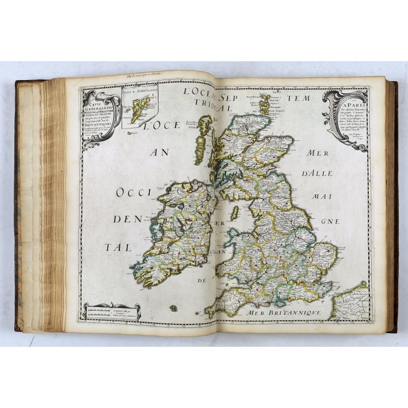
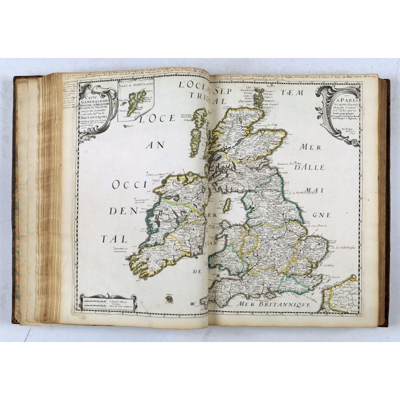
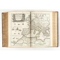
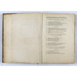
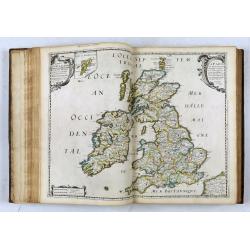
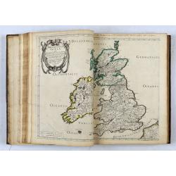
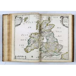
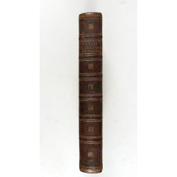
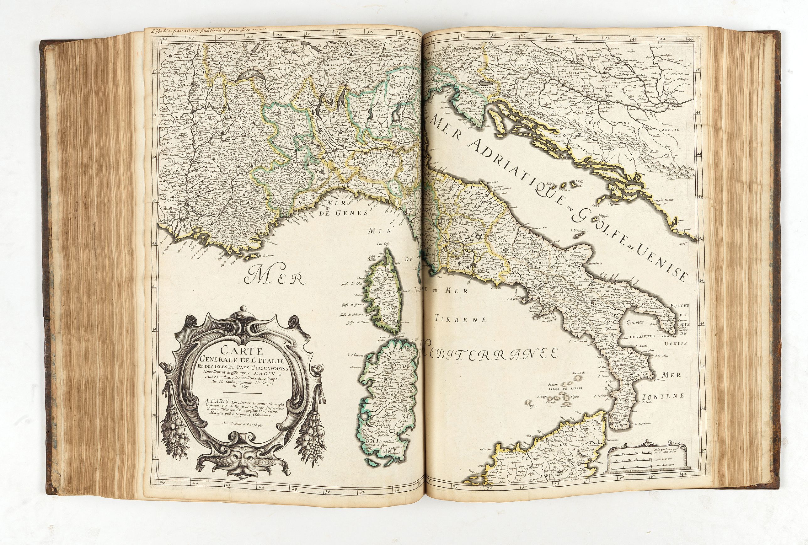
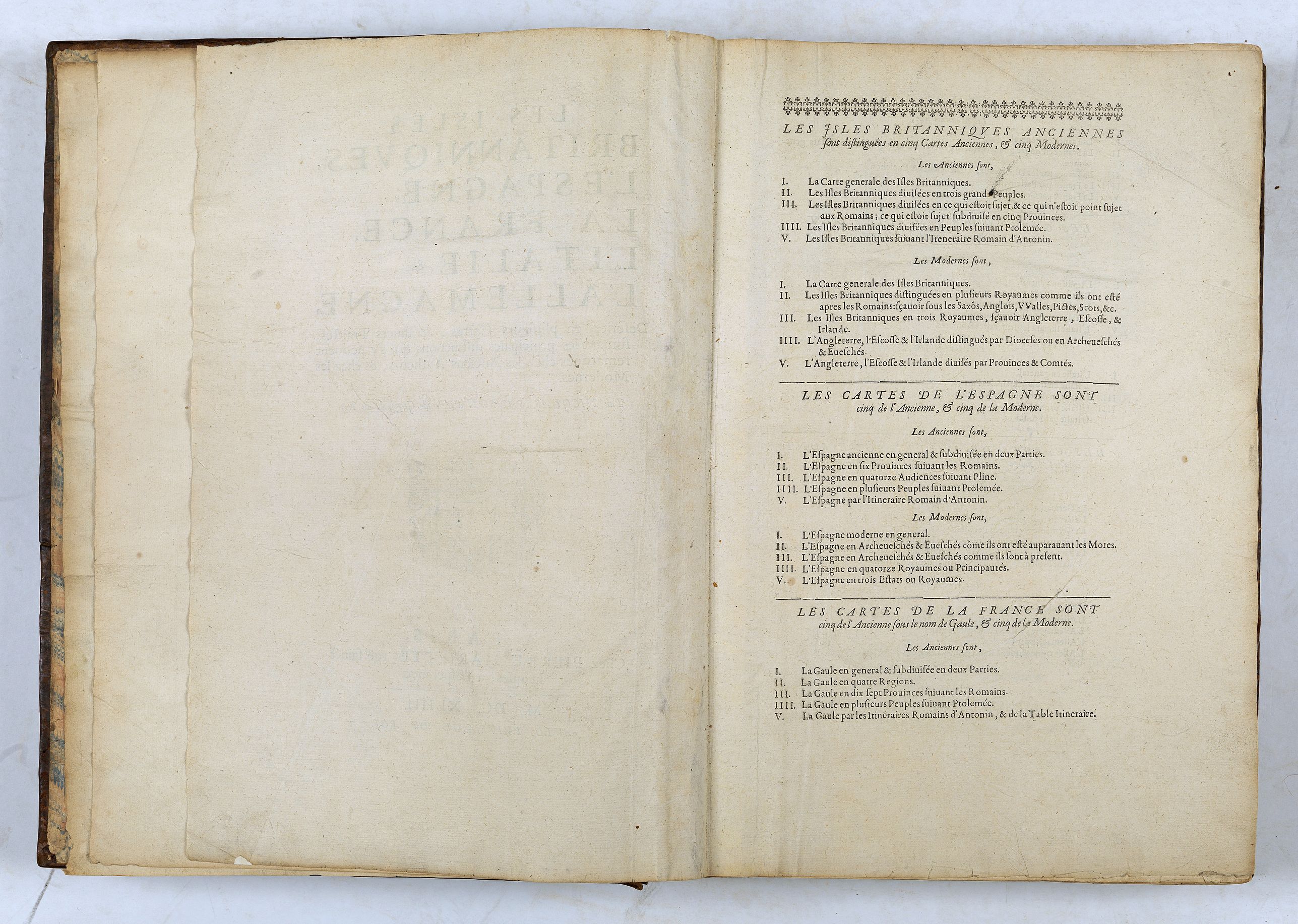
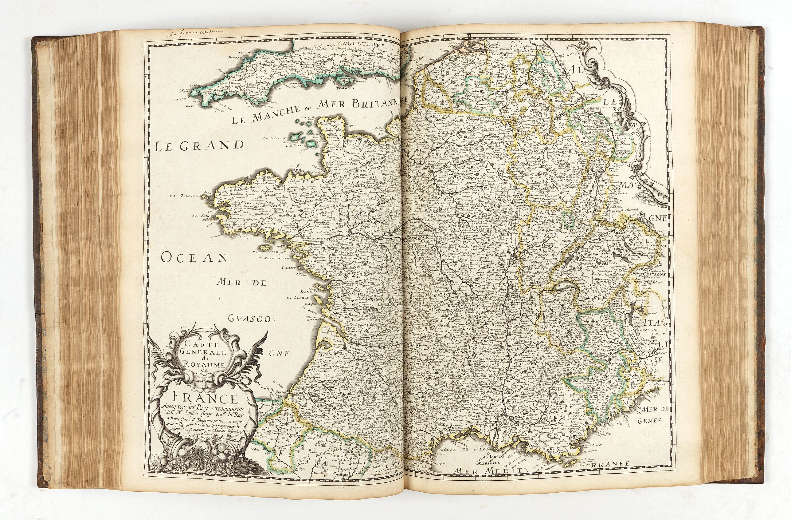
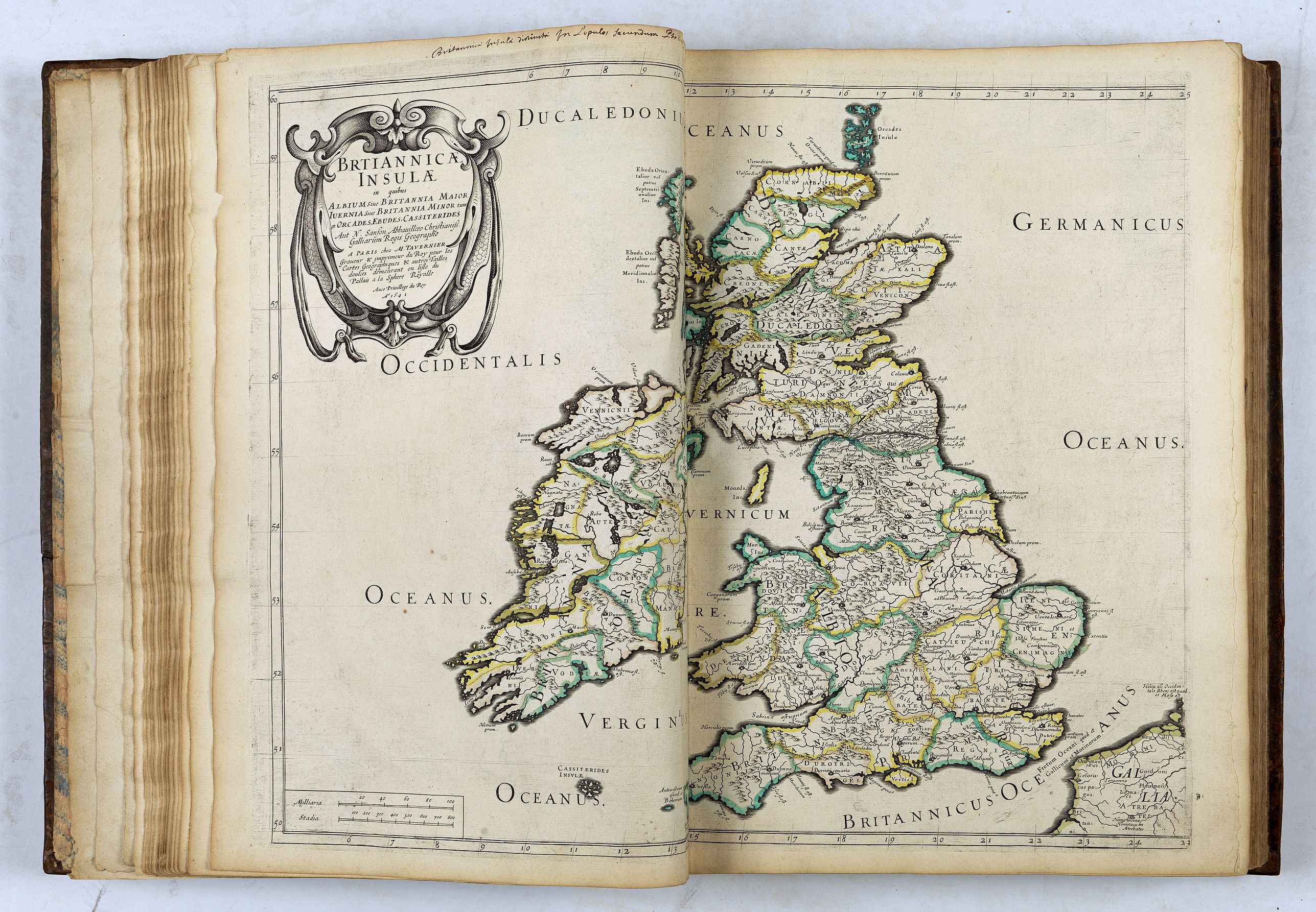
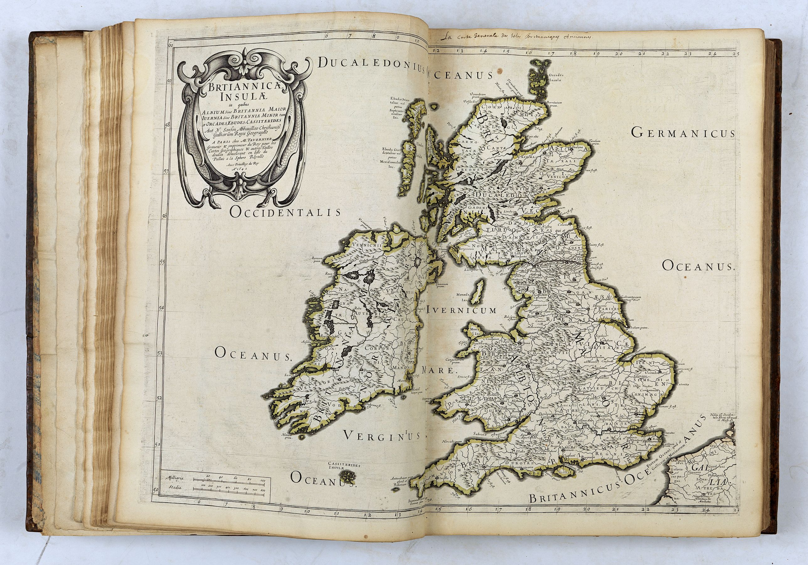
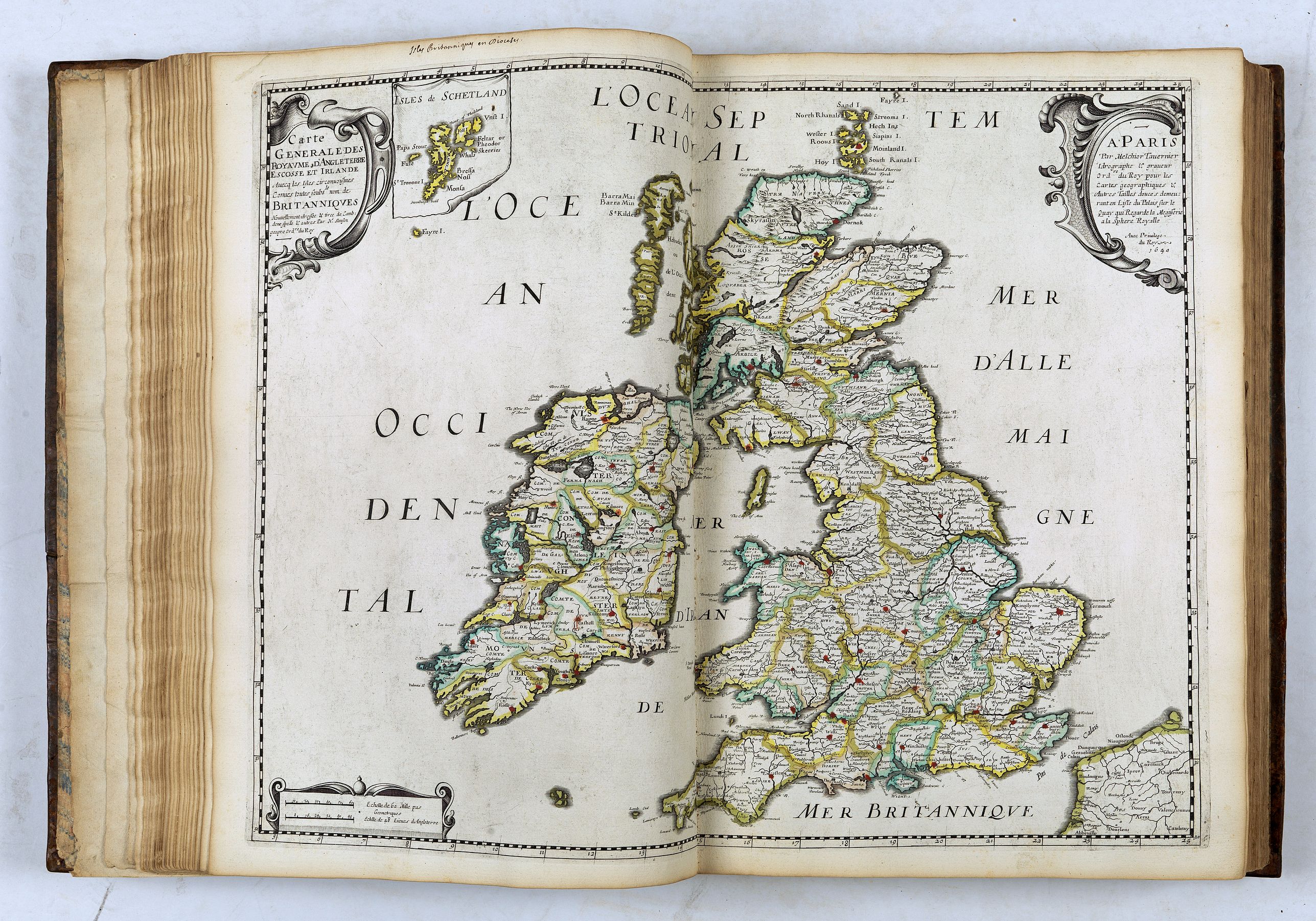
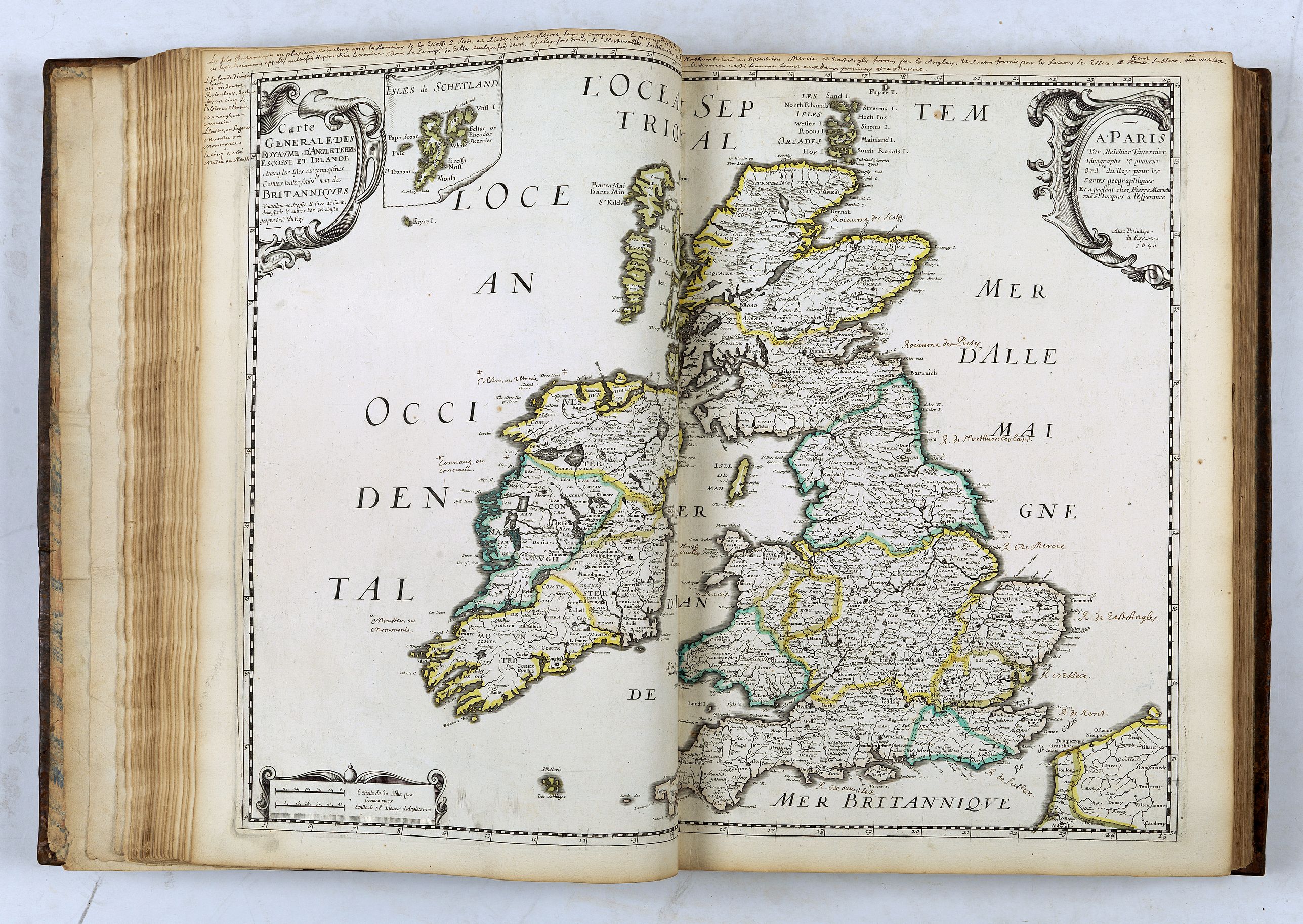
The atlas is divided in 7 parts illustrated with 64 maps in original outline colors. The atlas of the "Five Kingdoms" begins with a general title page and a table, each section begins with a title page and a list of contents.
The few examples held in public libraries are often missing the maps, the BnF holds one copy with 50 maps (Gaston d'Orléans collection) and one copy with only 25 maps.
The atlas, or treatise, "des cinq royaumes" was Sanson's first publication with Mariette, in 1644. This atlas is a compendium of historical and administrative geography.
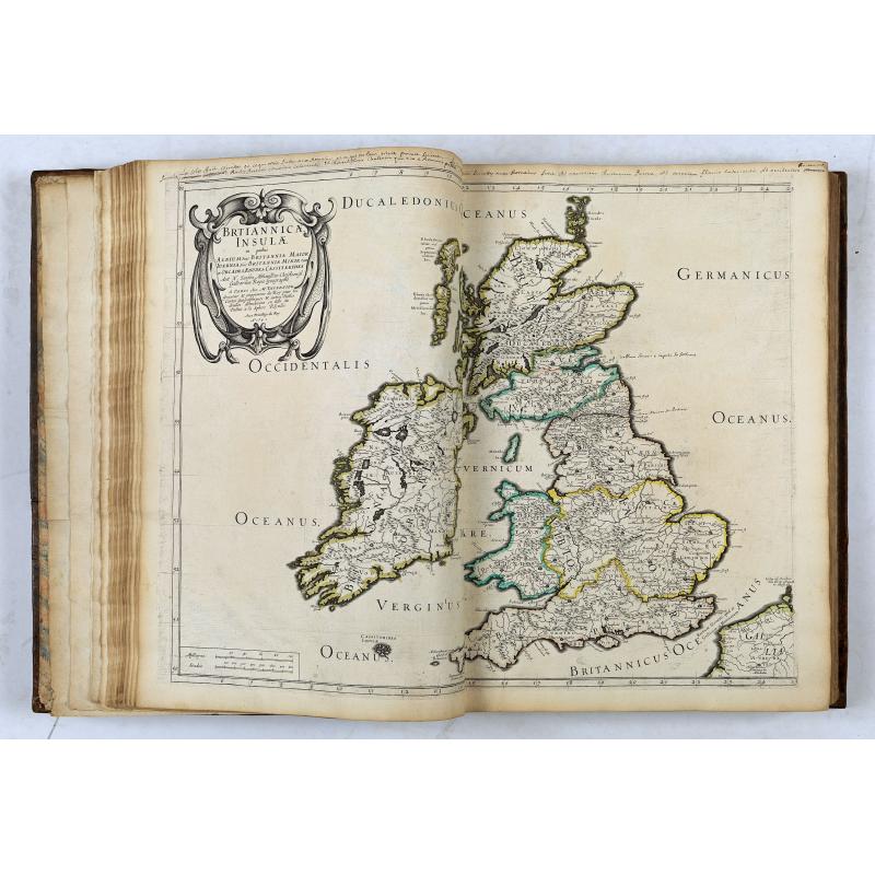
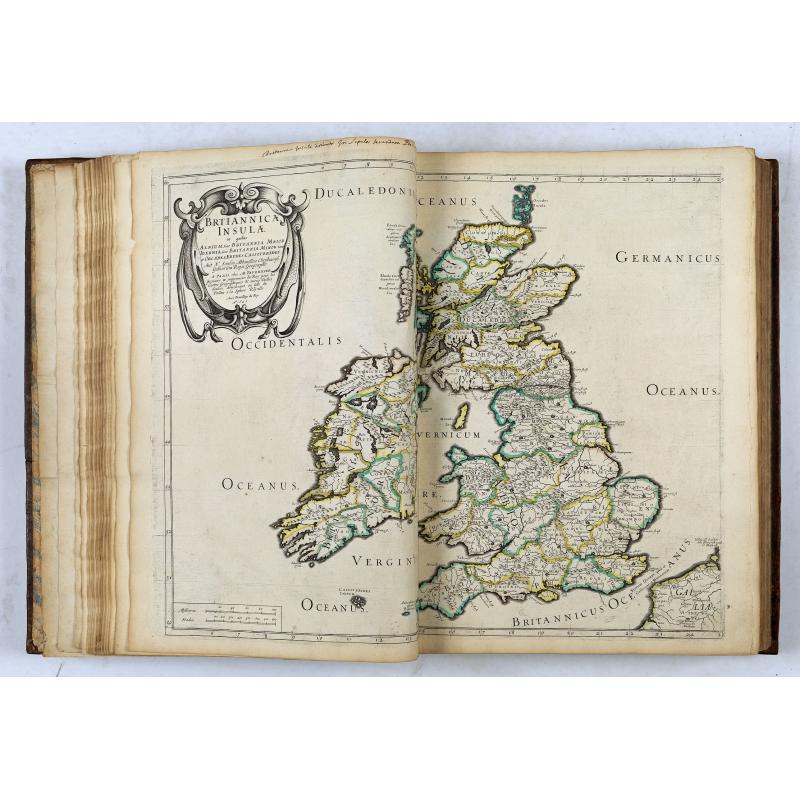
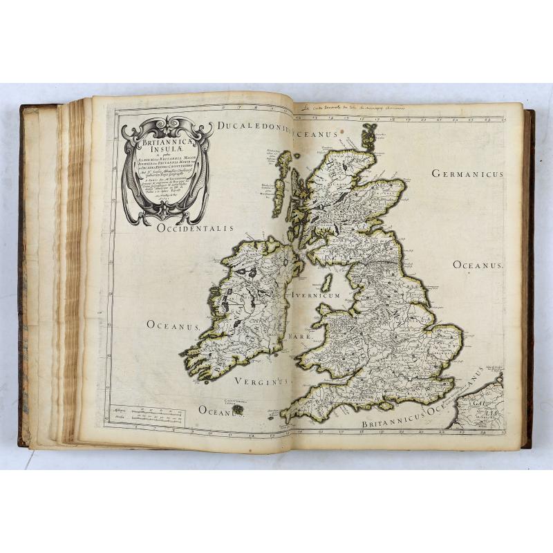
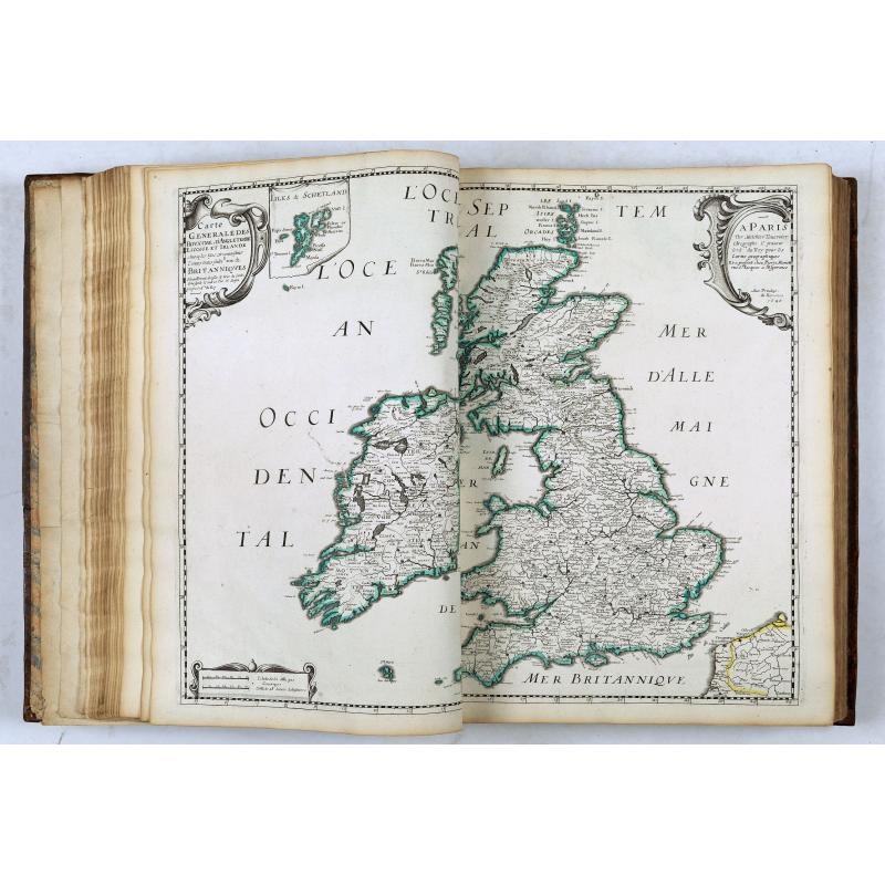
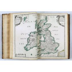
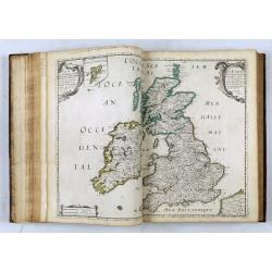
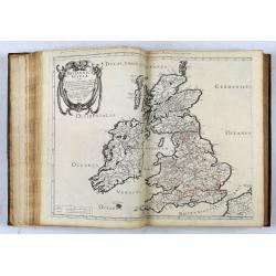
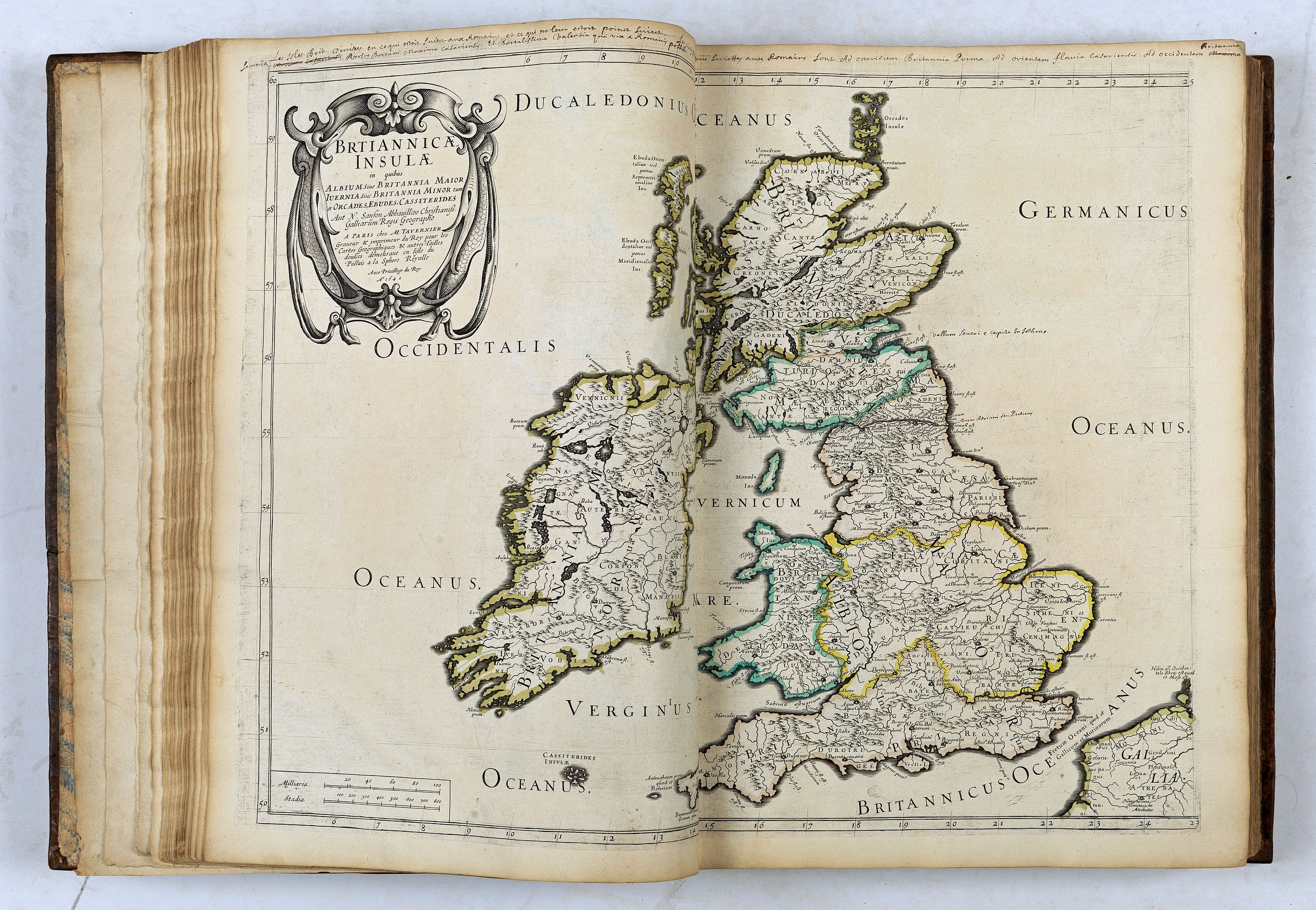
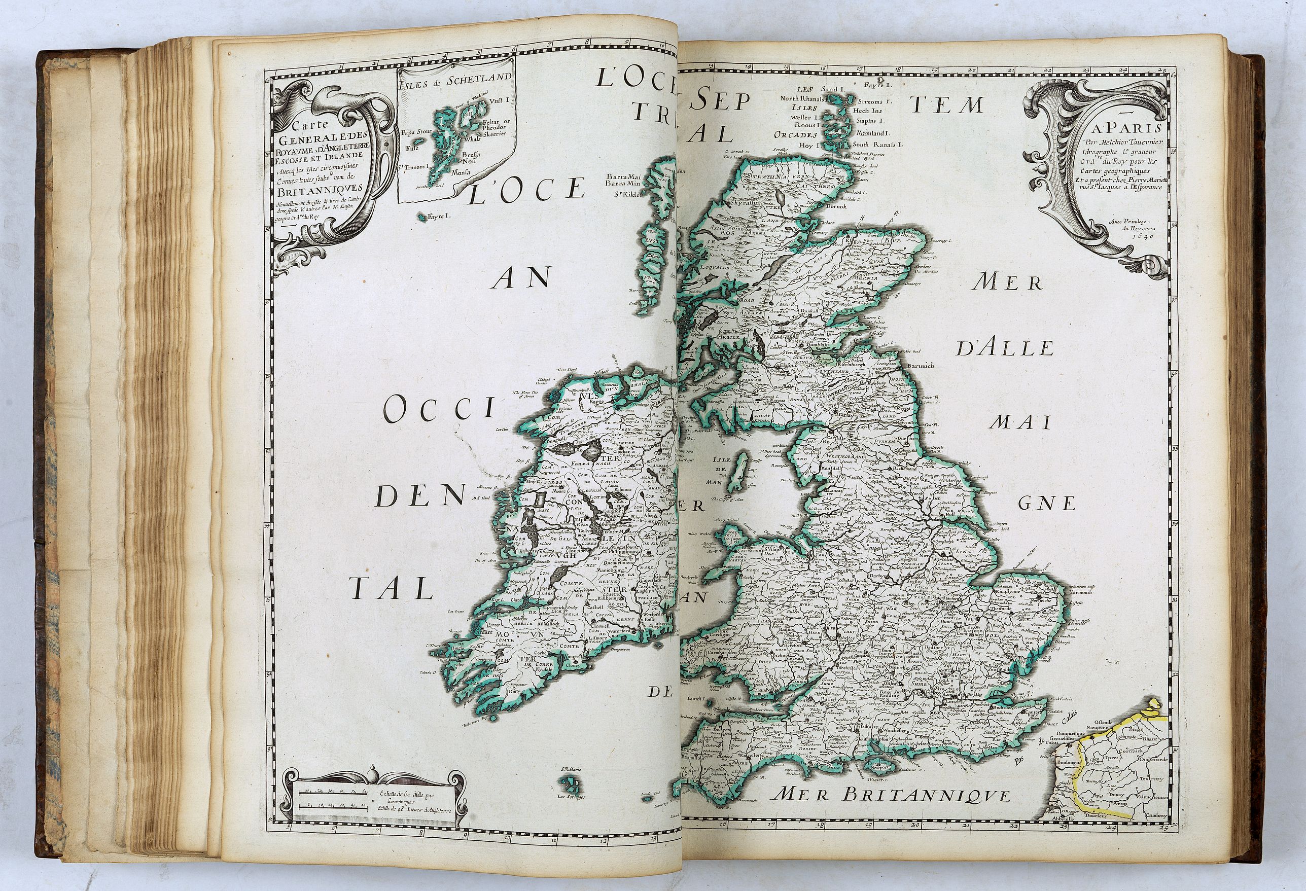
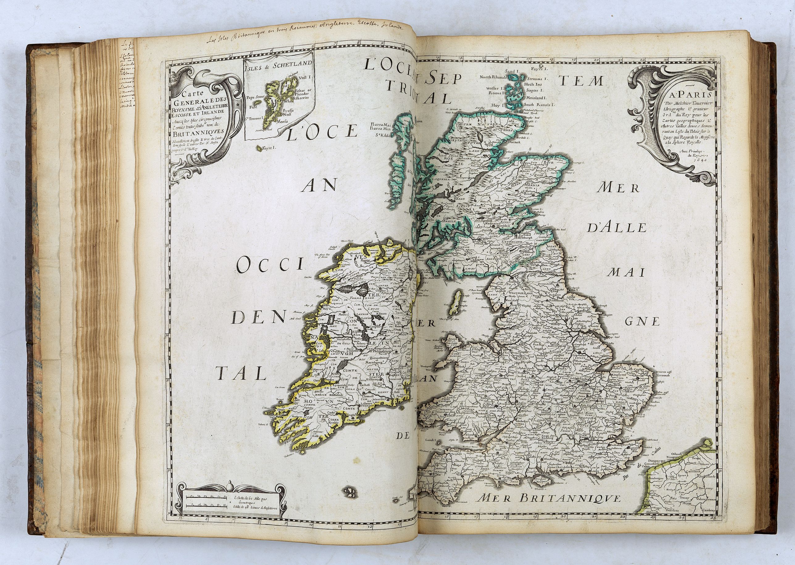
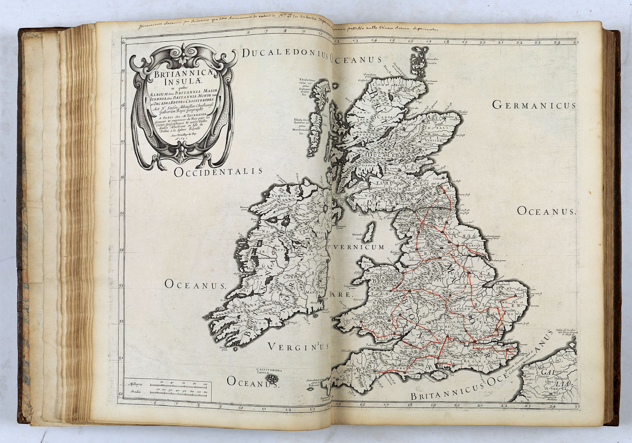
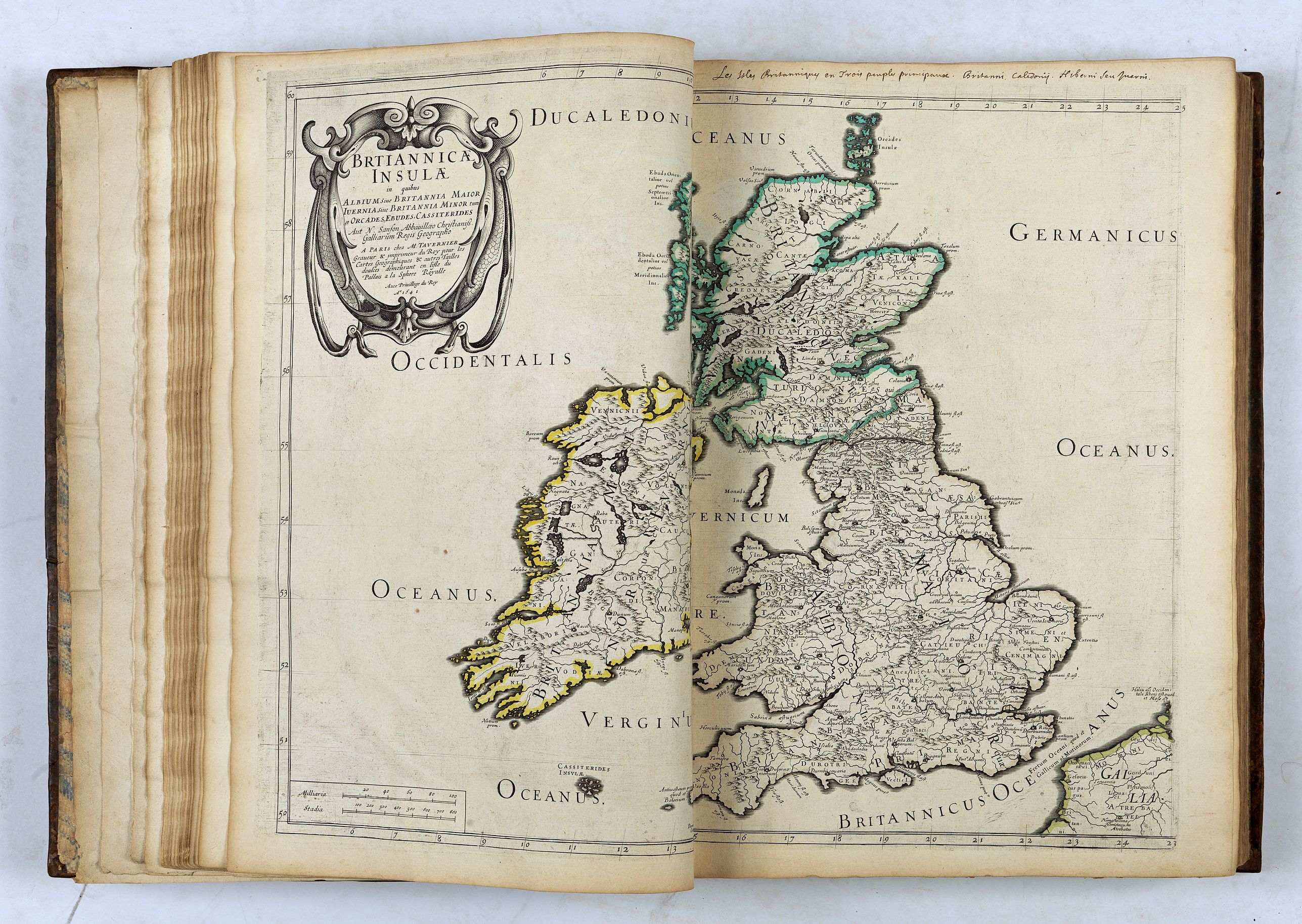
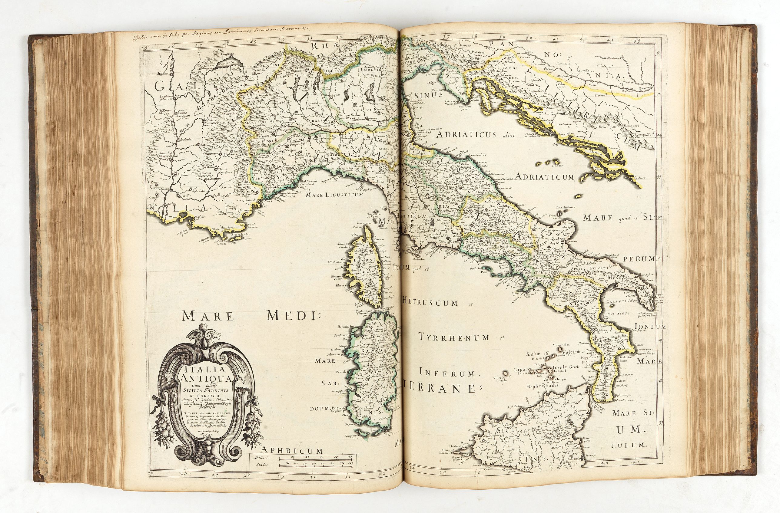
Each Nation is represented by his « ancient » map, which appears 5 times and by the « modern » one, which also appears 5 times. The maps should have a different title pasted on the printed title (according to Pastoureau) in order to differentiate the various historical and administrative divisions with the maps colored according to the different boundaries.
1 - the general map.
2 - the country divided into peoples, or parts, or regions.
3 - the country under Roman conquest.
4 - peoples according to Ptolemy.
5 - the division of Antonin's itinerary.
Same pattern for the modern map, which is repeated 5 times to indicate the regional boundaries, kingdom boundaries, archbishopric and bishopric boundaries and other districts.
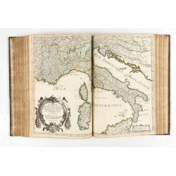
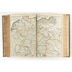
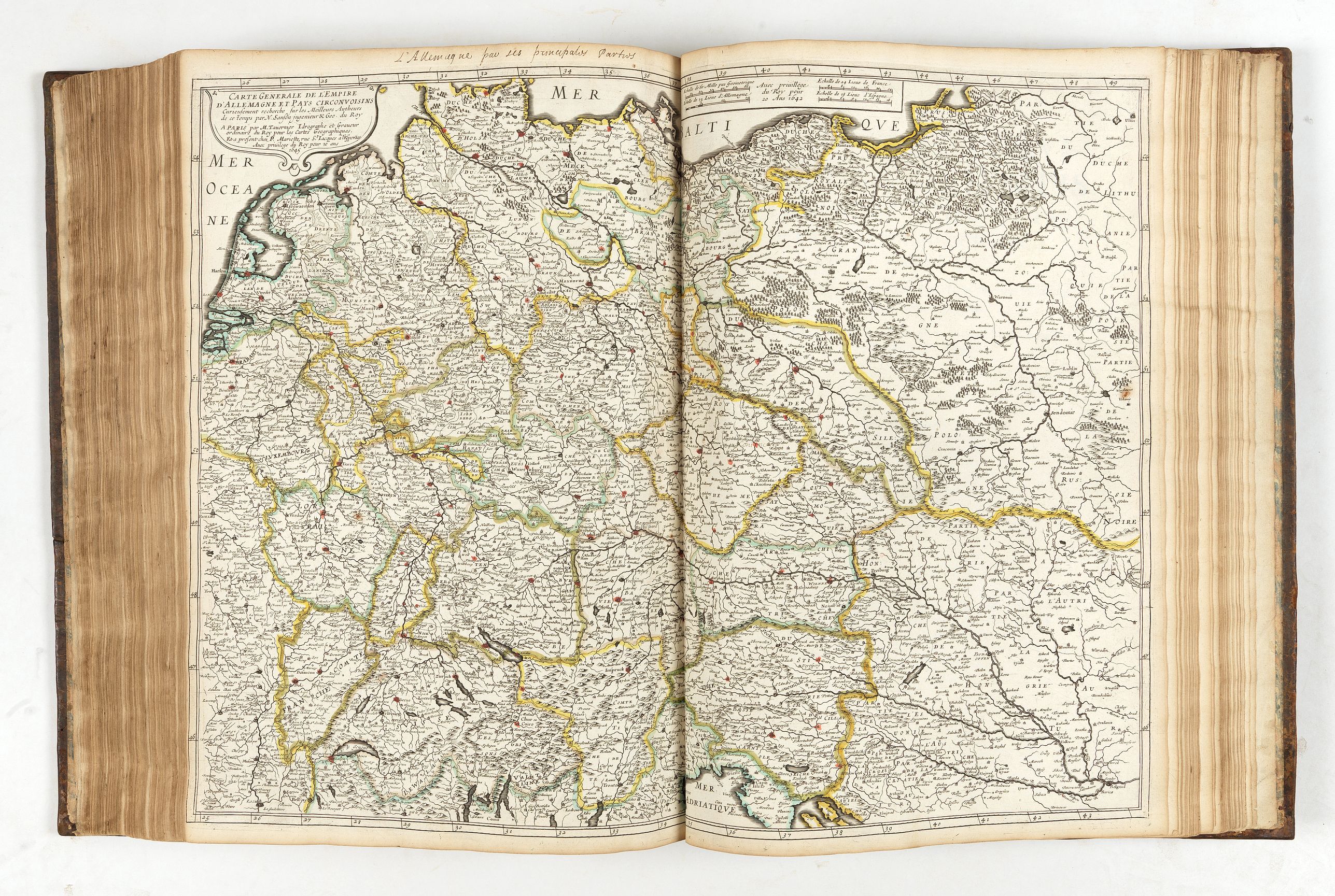
Our copy contents 53 maps for the « Five Kingdoms » atlas, 3 more than described in Pastoureau. It do not have a paste-on applied on the maps but the maps are colored according to the different boundaries. However the different boundaries are indicated in the upper margins in a contemporary handwriting. Another difference is that the book has a specific title page to each country, as in the 1651 edition. In addition, it contains the description and maps of the Eastern and Western Roman Empire (1638) " Romani utriusque Imperii Orientis scilicer et Occidentis" (7 maps) and of the Ancient Greece (1638) "Graeciae antiquae descriptio geographica" (4 maps). The Italy section contains 11 maps (1 more) and Germany 12 maps (2 more). The two maps in the Germany section are different, the first one is entitled « Germania Antiqua… 1642 », in place of « La Germanie Ancienne…1641 », the second one is entitled « Carte Générale de l’Empire d’Allemagne et des Pays Circonvoisins… chez P. Mariette, rue St. Jacques à l’Espérance…1645 » in place of « l’Allemagne en general…à Paris par M. Tavernier…en l’isle du Palais a la Sphère Royale…1642 ».
The present copy appears to be an intermediate state before the second state but could also be a made-to-order atlas for Guillaume de Lamoignon.
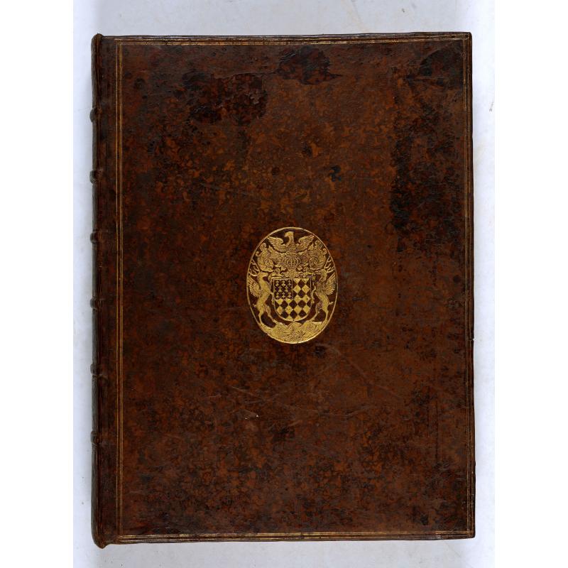
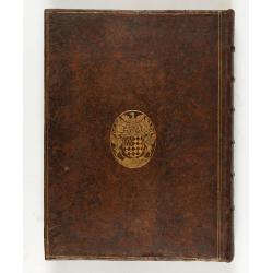
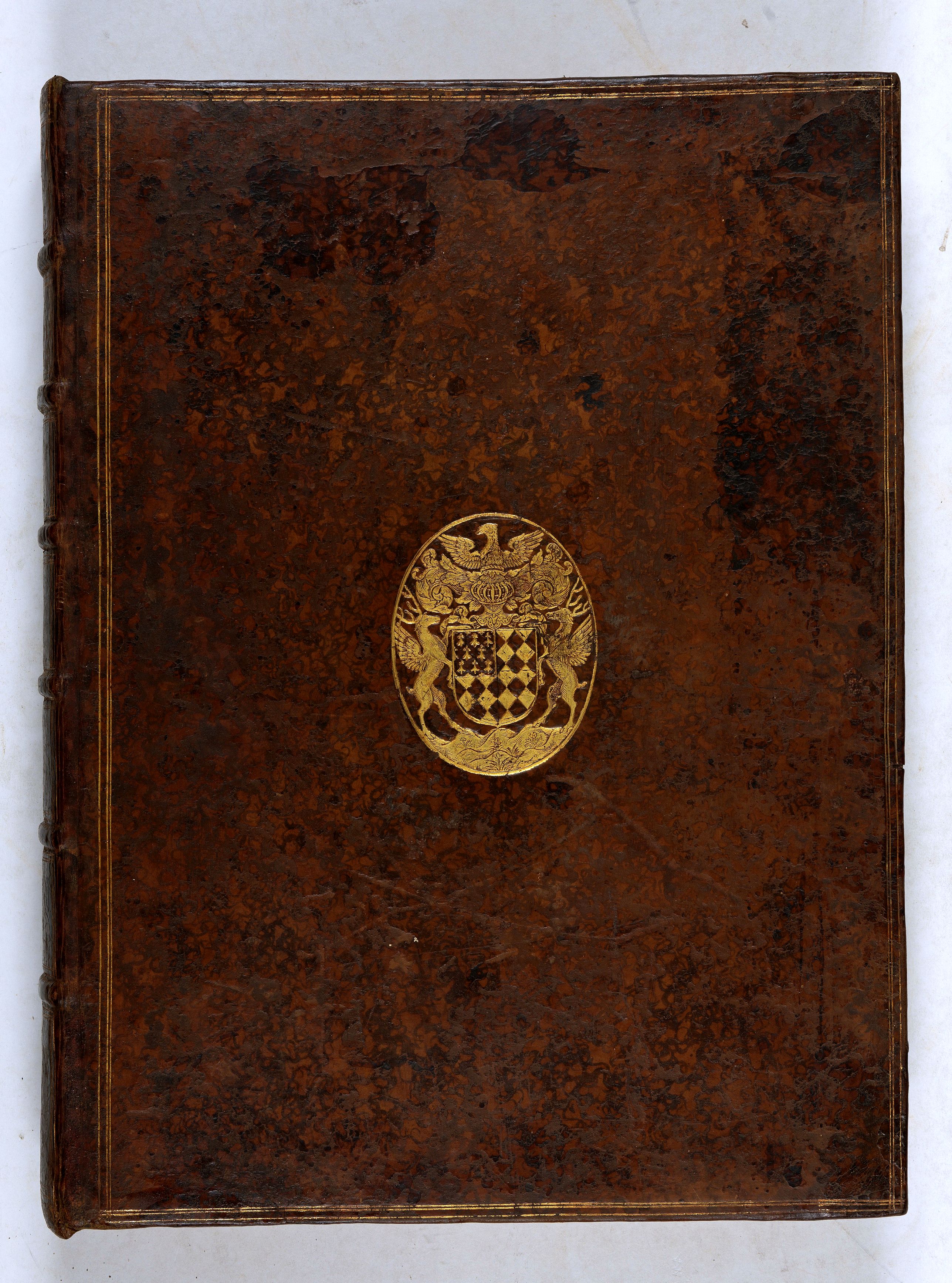
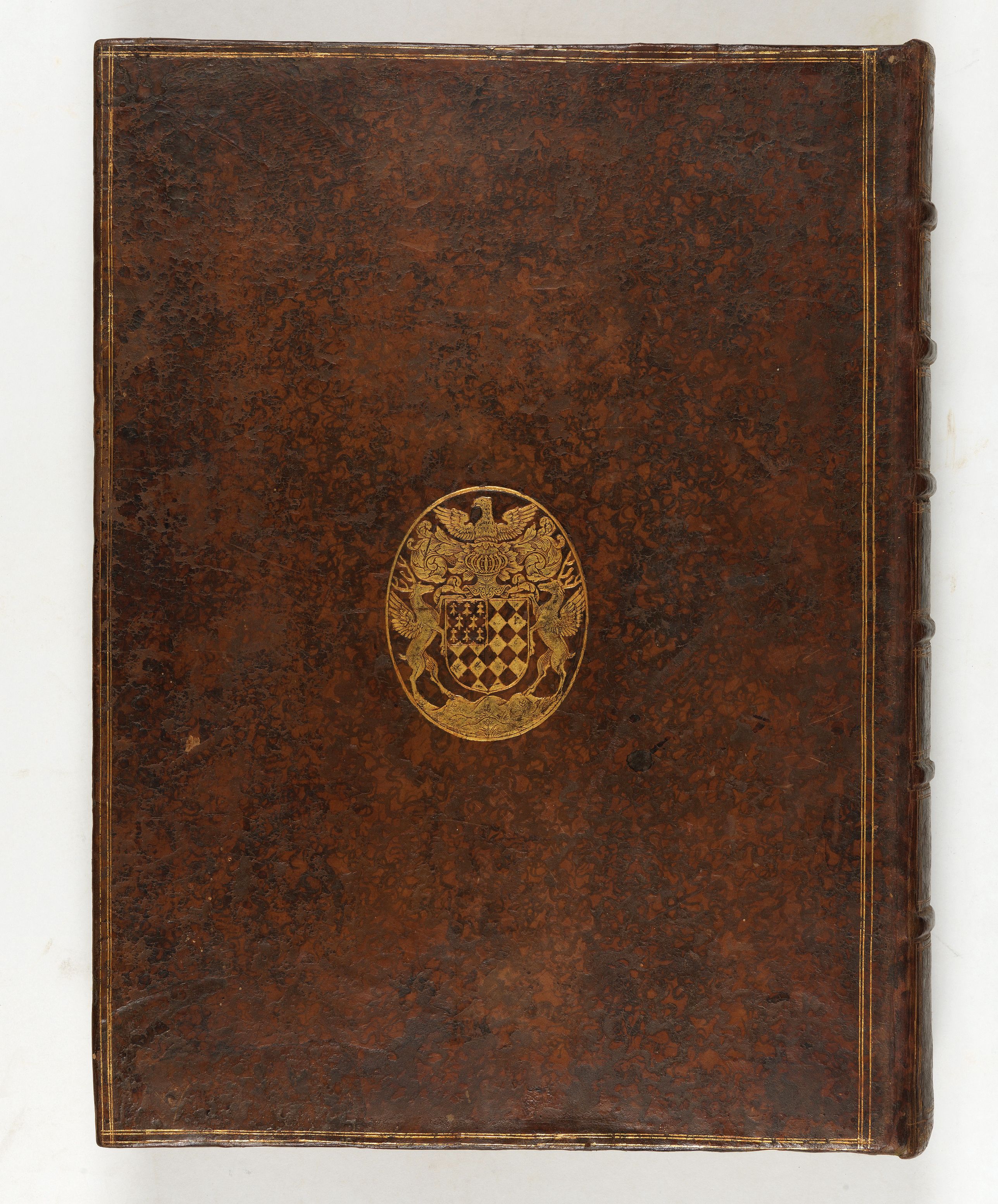
Atlas bearing the family coat of arms and cipher “GDL” of Guillaume de Lamoignon.
Guillaume de Lamoignon built up a rich library, whose books bear his coat of arms, “Losangé argent et sable, au franc quartier d'hermines” (Sable and Silver Lozenge with Ermine Quarter).
The "Bibliotheca Lamoniana", Lamoignon Library, created by Guillaume de Lamoignon (1617-1677) in the mid-seventeenth century, remained in the same family for almost one hundred and fifty years.
The “Bibliotheca Lamoniana” was sold en bloc in 1792 to the English bookseller Thomas Payne, who published the catalog the following year.
Bibliotheca Lamoniana :
Guillaume de Lamoignon (Paris, October 23, 1617-December 10, 1677) was admitted to the bar, became a member of the Parlement in 1635, maître des requêtes in 1644, and was appointed first president of the Parlement de Paris in 1658. He behaved with impartiality at Fouquet's trial (1662) and took part in drafting the civil ordinance of 1667 and the criminal ordinance of 1670.
He was a lifelong patron of the literati, and took pleasure in gathering at his home every week a number of the most distinguished among them, including Louis Bourdaloue, Jean-François Regnard, Jean Racine, Nicolas Boileau, the Marquise de Sévigné and Gui Patin.
In 1650, he bought the library of a law professor, comprising 2,500 works. He built up a rich library whose books bear his coat of arms, “Losangé d'argent et de sable, au franc quartier d'hermines”, or his cipher “GDL”, or both.
The Lamoniana library was enriched over the years by his heirs, in particular by Chrétien François II de Lamoignon, who added to it his father-in-law's library.
The library, bibliotheca lamoniana, remained in the Lamoignon family for 150 years, before being sold in its entirety in 1792 to the English bookseller and publisher Thomas Payne (c.1718-1799), who regularly published catalogs of the works in his possession.
Chrétien-François Ier de Lamoignon was the eldest son of Guillaume Ier de Lamoignon, and served as avocat général for a quarter of a century from 1673. At the same time, he pursued a career in the judiciary, becoming a member of the Parlement in 1666. In 1690, he was appointed Président à Mortier of the Parlement de Paris.
He continued the family tradition, initiated by his father, of welcoming renowned literati and ecclesiastics: Molière, Racine, Regnard and above all Boileau. He was a member of the Académie des Inscriptions et des Belles-lettres, which he chaired in 1705.
He left a remarkable library of no fewer than 1,550 volumes.
The “Bibliotheca Lamoniana” was sold en bloc in 1792 to the English bookseller Thomas Payne, who published the catalog the following year.
Reference: - Pastoureau : Les atlas français XVIe-XVIIe siècles, Sanson VIII A 1644
The atlas is divided in 7 parts illustrated with 64 maps in original outline colors. The atlas of the "Five Kingdoms" begins with a general title page and a table, each section begins with a title page and a list of contents.
The few examples held in public libraries are often missing the maps, the BnF holds one copy with 50 maps (Gaston d'Orléans collection) and one copy with only 25 maps.
The atlas, or treatise, "des cinq royaumes" was Sanson's first publication with Mariette, in 1644. This atlas is a compendium of historical and administrative geography.
Each Nation is represented by his « ancient » map, which appears 5 times and by the « modern » one, which also appears 5 times. The maps should have a different title pasted on the printed title (according to Pastoureau) in order to differentiate the various historical and administrative divisions with the maps colored according to the different boundaries.
1 - the general map.
2 - the country divided into peoples, or parts, or regions.
3 - the country under Roman conquest.
4 - peoples according to Ptolemy.
5 - the division of Antonin's itinerary.
Same pattern for the modern map, which is repeated 5 times to indicate the regional boundaries, kingdom boundaries, archbishopric and bishopric boundaries and other districts.
Our copy contents 53 maps for the « Five Kingdoms » atlas, 3 more than described in Pastoureau. It do not have a paste-on applied on the maps but the maps are colored according to the different boundaries. However the different boundaries are indicated in the upper margins in a contemporary handwriting. Another difference is that the book has a specific title page to each country, as in the 1651 edition. In addition, it contains the description and maps of the Eastern and Western Roman Empire (1638) " Romani utriusque Imperii Orientis scilicer et Occidentis" (7 maps) and of the Ancient Greece (1638) "Graeciae antiquae descriptio geographica" (4 maps). The Italy section contains 11 maps (1 more) and Germany 12 maps (2 more). The two maps in the Germany section are different, the first one is entitled « Germania Antiqua… 1642 », in place of « La Germanie Ancienne…1641 », the second one is entitled « Carte Générale de l’Empire d’Allemagne et des Pays Circonvoisins… chez P. Mariette, rue St. Jacques à l’Espérance…1645 » in place of « l’Allemagne en general…à Paris par M. Tavernier…en l’isle du Palais a la Sphère Royale…1642 ».
The present copy appears to be an intermediate state before the second state but could also be a made-to-order atlas for Guillaume de Lamoignon.
Atlas bearing the family coat of arms and cipher “GDL” of Guillaume de Lamoignon.
Guillaume de Lamoignon built up a rich library, whose books bear his coat of arms, “Losangé argent et sable, au franc quartier d'hermines” (Sable and Silver Lozenge with Ermine Quarter).
The "Bibliotheca Lamoniana", Lamoignon Library, created by Guillaume de Lamoignon (1617-1677) in the mid-seventeenth century, remained in the same family for almost one hundred and fifty years.
The “Bibliotheca Lamoniana” was sold en bloc in 1792 to the English bookseller Thomas Payne, who published the catalog the following year.
Bibliotheca Lamoniana :
Guillaume de Lamoignon (Paris, October 23, 1617-December 10, 1677) was admitted to the bar, became a member of the Parlement in 1635, maître des requêtes in 1644, and was appointed first president of the Parlement de Paris in 1658. He behaved with impartiality at Fouquet's trial (1662) and took part in drafting the civil ordinance of 1667 and the criminal ordinance of 1670.
He was a lifelong patron of the literati, and took pleasure in gathering at his home every week a number of the most distinguished among them, including Louis Bourdaloue, Jean-François Regnard, Jean Racine, Nicolas Boileau, the Marquise de Sévigné and Gui Patin.
In 1650, he bought the library of a law professor, comprising 2,500 works. He built up a rich library whose books bear his coat of arms, “Losangé d'argent et de sable, au franc quartier d'hermines”, or his cipher “GDL”, or both.
The Lamoniana library was enriched over the years by his heirs, in particular by Chrétien François II de Lamoignon, who added to it his father-in-law's library.
The library, bibliotheca lamoniana, remained in the Lamoignon family for 150 years, before being sold in its entirety in 1792 to the English bookseller and publisher Thomas Payne (c.1718-1799), who regularly published catalogs of the works in his possession.
Chrétien-François Ier de Lamoignon was the eldest son of Guillaume Ier de Lamoignon, and served as avocat général for a quarter of a century from 1673. At the same time, he pursued a career in the judiciary, becoming a member of the Parlement in 1666. In 1690, he was appointed Président à Mortier of the Parlement de Paris.
He continued the family tradition, initiated by his father, of welcoming renowned literati and ecclesiastics: Molière, Racine, Regnard and above all Boileau. He was a member of the Académie des Inscriptions et des Belles-lettres, which he chaired in 1705.
He left a remarkable library of no fewer than 1,550 volumes.
The “Bibliotheca Lamoniana” was sold en bloc in 1792 to the English bookseller Thomas Payne, who published the catalog the following year.
Reference: - Pastoureau : Les atlas français XVIe-XVIIe siècles, Sanson VIII A 1644
FAQ - Guarantee - Shipping
Buying in the BuyNow Gallery
This item is available for immediate purchase when a "Add to Cart" or "Inquire Now" button is shown.
Payments are accepted in Euros or US Dollars. We accept most major credit cards, PayPal and bank transfer.
Authenticity Guarantee
 We provide professional descriptions, condition report and HiBCoR rating (based on 45 years experience in the map business)
We fully guarantee the authenticity of items we sell. We provide a certificate of authenticity for each purchased item.
Condition / Coloring
We indicate the condition of each item and use our unnique HiBCoR grading system in which four key items determine a map's value: Historical Importance, Beauty, Condition/Coloring and Rarity.
We offer many maps in their original black and white condition. We do not systematically color-up maps to make them more sellable to the general public or buyer.
Copper engraved or wood block maps are always hand colored. Maps were initially colored for aesthetic reasons and to improve readability. Nowadays, it is becoming a challenge to find maps in their original colors and are therefor more valuable.
We use the following color keys in our catalog:
Original colors; mean that the colors have been applied around the time the map was issued.
Colored; If the colors are applied recently or at the end of the 20th century, then "colored", or "attractive colors" will be used.
Original o/l colors; means the map has only the borders colored at the time of publication.
Read more about coloring of maps [+]
FAQ
Please have a look for more information about buying in the BuyNow gallery.
Many answers are likely to find in the general help section.
Virtual Collection
![]()
With Virtual Collection you can collect all your favorite items in one place. It is free, and anyone can create his or her Virtual map collection.
Unless you are logged in, the item is only saved for this session. You have to be registed and logged-in if you want to save this item permanently to your Virtual Collection.
Read More [+]
If you want to save the items permanently, please sign in
or create account first. ![]()
Registering Here, it is and you do not need a credit card.
Add this item to
Virtual Collection
or click the following link to see my Virtual Collection.
Invoice
The invoice and certificates of authenticity are available in the client center >Invoices
| Digital Image Download | |
|
Paulus Swaen maintains an archive of most of our high-resolution rare maps, prints, posters and medieval manuscript scans. We make them freely available for download and study. Read more about free image download |
Click the image for a free small image download. |
In accordance with the EU Consumer Rights Directive and habitually reside in the European Union you have the right to cancel the contract for the purchase of a lot, without giving any reason.
The cancellation period will expire 14 calendar days from the day after the date on which you or a third party (other than the carrier and indicated by you) acquires, physical possession of the lot. To exercise the right to cancel you must inform Paulus Swaen Inc, of your decision to cancel this contract by a clear statement (e.g. a letter sent by post, or e-mail (amsterdam@swaen.com).
To meet the cancellation deadline, it is sufficient for you to send your communication concerning your exercise of the right to cancel before the cancellation period has expired.

