Browse Listings
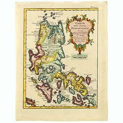
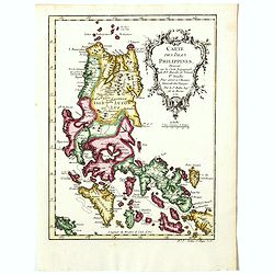
Carte des isles Philippines, dressée sur la carte espagnole du R.P. Murillo de Velarde. Ire feuille. . .
Fine map of the northern islands of the Philippines.Jacques Nicolas Bellin (1703-1772) was one of the most important and proficient French cartographers of the mid-eighte...
Date: Paris, 1752
Selling price: ????
Please login to see price!
Sold in 2016
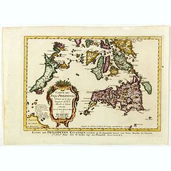
Carte Des Isles Philippines.. 2e. Feuille. . . / Kaart der Philippines Eilanden. . .
Detailed edition of this fine map of the southern portion of the Philippines, extending from Masbate and Oetablas Islands to Jolo Island and centered on Mindanao and Leyt...
Date: Paris, 1752
Selling price: ????
Please login to see price!
Sold in 2016
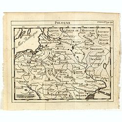
Pologne.
Scarce small map of Poland based on cartography of Guillaume Delisle (. Published in "Nouveau traité de geographie par M**** ", published by La veuve Lottin &a...
Date: Paris, 1752
Selling price: ????
Please login to see price!
Sold in 2015
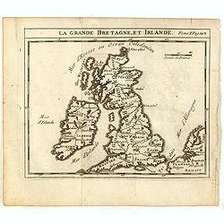
La Grande Bretagne, et Irlande.
Scarce small map of Great Britain of based on cartography of Guillaume Delisle (. Published in "Nouveau traité de geographie par M**** ", published by La veuve...
Date: Paris, 1752
Selling price: ????
Please login to see price!
Sold in 2015
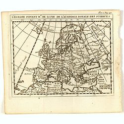
L'Europe suivant Mr. De Lisle de L'Academie Royale des Scienes.
Scarce small map of Europe based on cartography of Guillaume Delisle (. Published in "Nouveau traité de geographie par M**** ", published by La veuve Lottin &a...
Date: Paris, 1752
Selling price: ????
Please login to see price!
Sold in 2017
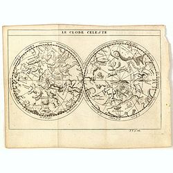
Le globe celeste.
Scarce small celestial chart in double hemispheres based on cartography of Guillaume Delisle (. Published in "Nouveau traité de geographie par M**** ", publish...
Date: Paris, 1752
Selling price: ????
Please login to see price!
Sold in 2021
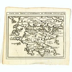
Carte pour servir a l'intelligence de l'histoire Grecque.
Scarce small map of Greece based on cartography of Guillaume Delisle. Published in "Nouveau traité de geographie par M**** ", published by La veuve Lottin &...
Date: Paris, 1752
Selling price: ????
Please login to see price!
Sold in 2020
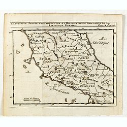
Carte pour servir d'introduction à l histoire de la naissance de la republique Romaine.
Scarce small map of central Italy based on cartography of Guillaume Delisle (. Published in "Nouveau traité de geographie par M**** ", published by La veuve Lo...
Date: Paris, 1752
Selling price: ????
Please login to see price!
Sold in 2015
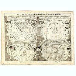
Système de Copernic de Ticho Brahe, etde Decartes.
Four models of the earth, sun and planets, based upon Ptolemy, Copernicus, Tycho Brahe and Descartes. Published in "Nouveau traité de geographie par M**** ", p...
Date: Paris, 1752
Selling price: ????
Please login to see price!
Sold in 2017
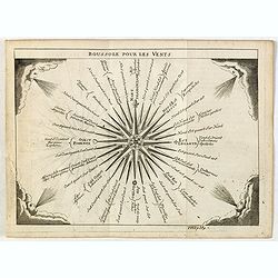
Boussole pour les Vents.
Attractive small print of a compass rose with decorative wind heads at each corner. Published in "Nouveau traité de geographie par M**** ", published by La veu...
Date: Paris, 1752
Selling price: ????
Please login to see price!
Sold in 2015
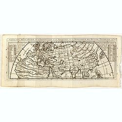
Carte pour servir d'entrée et d'introduction à la geographie et à l'itelligence de l'histoire universele.
Scarce small map of central Italy based on cartography of Nicolas Sanson. Published in "Nouveau traité de geographie par M**** ", published by La veuve Lottin ...
Date: Paris, 1752
Selling price: ????
Please login to see price!
Sold in 2015
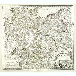
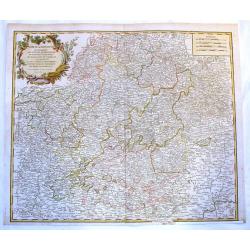
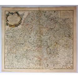
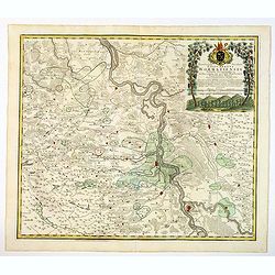
Cercle de Basse Saxe. . .
Detailed map of Northern Germany. Relief shown pictorially. Ornamental cartouche from his "Atlas Universel".Gilles Robert de Vaugondy (1688–1766), also known ...
Date: Paris, 1752
Selling price: ????
Please login to see price!
Sold in 2015
Cercle de Franconie Qui Comprehend Les Eveches de Wurtzbourg.
Fine Vaugondy map of Franconia, Germany centered on Würtzburg, Nuremberg & Bamberg. Engraved by Catherine Haussard and included in "ATLAS UNIVERSELLE". Fea...
Date: Paris, 1752
Selling price: ????
Please login to see price!
Sold in 2017
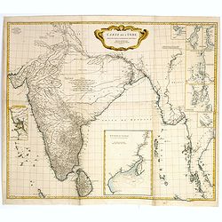
Carte de l'Inde Dressee pour la Compagnie des Indes par le Sr. d'Anville Secretaire de S.A.S.Mgr. le Duc d'Orleans Novembre 1752.
A decorative large scale map printed on four joined sheets by the renowned and influential French map maker Jean-Baptiste D'Anville. D'Anville based his cartography on Je...
Date: Paris, 1752
Selling price: ????
Please login to see price!
Sold
A New & Accurate Map of the Netherlands or Low Countries.
Fine copper-engraved map with good detail of roads, towns, and canals. Also shown are the Barrier Towns as designated by the Barrier Treaty, concluded at Antwerp in 1715...
Date: London, 1752
Selling price: ????
Please login to see price!
Sold in 2018
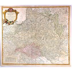
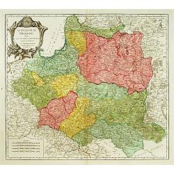
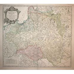
Le Royaume de Pologne, divise en ses duches et Provinces, et subdivise en Palatinats
A fine map of the Kingdom of Poland by Vaugondy. It features Poland, Lithuania and parts of the Russian Empire, Transylvania and Latvia. The map details both topographica...
Date: Paris, 1752
Selling price: ????
Please login to see price!
Sold in 2016
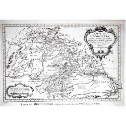
Carte de l' Indoustan Ie Feuille, 1752.
Jaques Nicolas Bellin (1702-720) was the most important French hydrographer of the 18th century. Sea-atlas 'Hydrographique Français', 1756-65, an atlas to accompany Pré...
Date: Paris, 1752
Selling price: ????
Please login to see price!
Sold in 2017
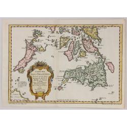
Cartes des Isles Philippines...
A striking map of southern part of the Philippines, based upon Pedro Murillo Velarde’s map, by the mapmaker, Nicolas Bellin in 1752 and published in Prevost’s “D' E...
Date: Paris, 1752
Selling price: ????
Please login to see price!
Sold in 2017
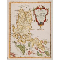
Carte des Isles Philippines. . .
Detailed map of the northern part of the Philippines, including Manilla.Jacques Nicolas Bellin (1703-1772) was one of the most important and proficient French cartographe...
Date: Paris, 1752
Selling price: ????
Please login to see price!
Sold in 2016
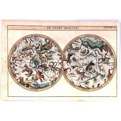
Le Globe Celeste.
Scarce decorative double hemisphere celestial map, based on the cartography of De L’Isle. Published in “Nouveau Traite de Geography”. The map exhibits the constella...
Date: Paris, 1752
Selling price: ????
Please login to see price!
Sold in 2020
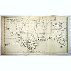
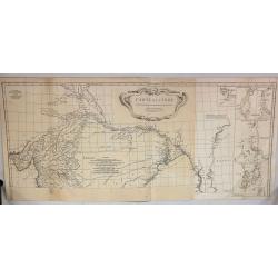
Carte de la Louisiane. . .
This map provides an accurate rendition of the lower Mississippi, the Arkansas, the Red, the Osage, and the lower Missouri rivers. Thomas Jefferson bought seven maps by A...
Date: Paris, 1752
Selling price: ????
Please login to see price!
Sold in 2016
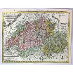
Helvetia Tredicim Statibus Liberis.
Detailed map of Switzerland along with parts of Italy, France, Germany, and Austria. The map notes fortified cities, villages, roads, bridges, forests, castles, and topog...
Date: Nuremberg, 1752
Selling price: ????
Please login to see price!
Sold in 2016
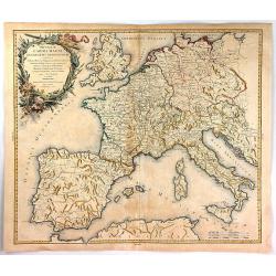
Imperium Caroli Magni Occidentis Imperations.
A pleasing map of Europe and the Empire of Charlemagne by Vaugondy. It covers Europe and the European Empire of Charles the Great from England south as far as northern Af...
Date: Paris, 1752
Selling price: ????
Please login to see price!
Sold in 2018
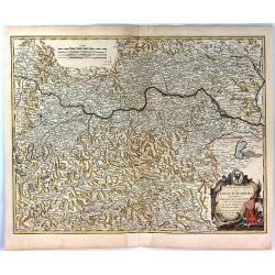
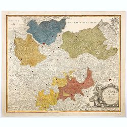
Partie Septentrionale du Cercle D'Autriche
A fine map of northern Austria by Robert de Vaugondy. It covers from Radstadt north to Scharding and east as far as Bratislava.The entire region is depicted in detail, of...
Date: Paris, 1752
Selling price: ????
Please login to see price!
Sold in 2017
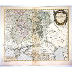
Partie Meridionale de la Russie Europeenne...
Large, finely engraved map showing topographical detail of mountains, rivers, lakes and forests. Moscow is in the upper center of the map and the Volga River in the east ...
Date: Paris , 1752
Selling price: ????
Please login to see price!
Sold in 2018
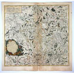
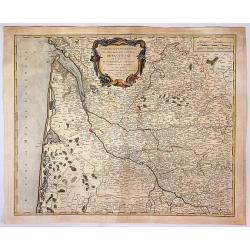
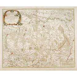
Partie Septentrionale du Gouvernement General de Bourgogne...
A detailed regional map with a large decorative Rococo cartouche. Shows fortified cities, towns, rivers, castles, churches, roads, woods, mountains, lakes, etc. It covers...
Date: Paris , 1752
Selling price: ????
Please login to see price!
Sold in 2018
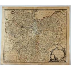
Cercles de Basse Saxe.
A German map including the northern Duchy's of Holstein, Mecklenbourg, Eveches, Hildesheime and Halbersstadt, including the river Elbe, with Hamburg until Potsdam.In the ...
Date: Paris, 1752
Selling price: ????
Please login to see price!
Sold in 2017
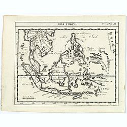
Les Indes.
A scarce small map of South East Asia with Indonesia, Thailand, Philippines and including New Guinee.
Date: Paris, ca. 1752
Selling price: ????
Please login to see price!
Sold in 2017
Cercle de Franconie...
A detailed 1752 map of the Circle of Franconia, Germany by de Vaugondy. Franconia is a region in Germany, and it commonly refers to the eastern part of the historical Fr...
Date: Paris, 1752
Selling price: ????
Please login to see price!
Sold in 2019
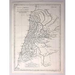
Carte de la Phoenicie et des Environs de Damas.
The eastern part of the Ancient Roman Empire by Anville. It covers the areas of Phoenicia around the city of Damas in Egypt Engraved by De La Haye.Jean Baptiste Bourguig...
Date: Paris, 1752
Selling price: ????
Please login to see price!
Sold in 2017
Partie Orientale du Gouvernement General de la Guienne...
A pleasing map of the Eastern Guyenne region of France by Vaugondy. It depicts the southern portion of France from Samatan east, to Bruide, and south as far as Toulouse, ...
Date: Paris, 1752
Selling price: ????
Please login to see price!
Sold in 2019
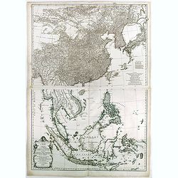
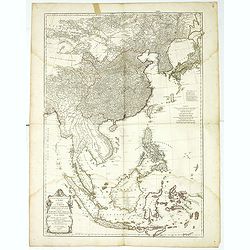
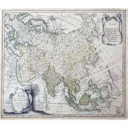
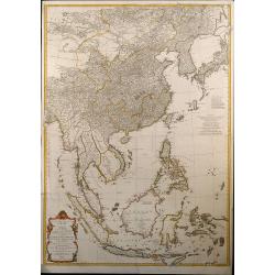
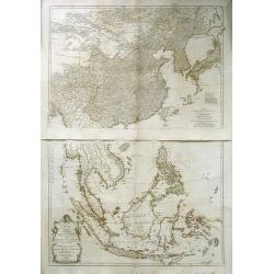
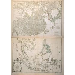
Seconde partie de la carte d'Asie contenant la Chine et partie de la Tartarie, l'Inde au-delà du Gange, les Isles Sumatra, Java, Borneo, Molusques, Philippines et du Japon.
Two-sheet map of South East Asia with very good detail of Philippines. Containing China and part of Tartary, India beyond the Ganges, Sumatra Isles, Java, Borneo, Molucca...
Date: Paris, 1752
Selling price: ????
Please login to see price!
Sold in 2023
Carte de L'Inde Dressee pour la Compagnie des Indes.
The TOP HALF ONLY of the large format map of 18th century India, published by D'Anville. This map draws from numerous sources, including Ptolemy, Turkish and Indian geogr...
Date: Paris, 1752
Selling price: ????
Please login to see price!
Sold in 2018
Seconde partie de la carte d'Asie contenant la Chine et partie de la Tartarie, l'Inde au-delà du Gange, les Isles Sumatra, Java, Borneo, Molusques, Philippines et du Japon.
A wall map size map of South East Asia with very good detail of Philippines. Containing China and part of Tartary, India beyond the Ganges, Sumatra Isles, Java, Borneo, M...
Date: Paris, 1752
Selling price: ????
Please login to see price!
Sold in 2018
Carte des Isles Philippines . . . (1ere feuille)
The northern part of the Philippines, including the town of Manila.Jacques Nicolas Bellin (1703-1772) was one of the most important and proficient French cartographers of...
Date: Paris, 1752
Selling price: ????
Please login to see price!
Sold in 2018
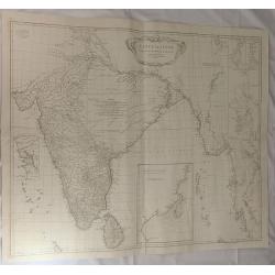
Carte de L'inde Dresse pour la Compagni des Indes. . .
A large map of 18th century India, published by D'Anville in 1752. It reflects the state of knowledge of this area mid-century. The map shows excellent detail of Southern...
Date: Paris, 1752
Selling price: ????
Please login to see price!
Sold in 2019
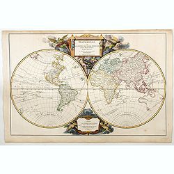
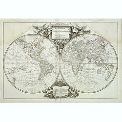
Mappemonde ou Description du Globe Terrestre. . .
A beautiful World map in two hemispheres from the 1757 first edition of Giles and Didier Robert De Vaugondy's famous Atlas Universal.The map shows the voyages of Anson in...
Date: Paris, 1752
Selling price: ????
Please login to see price!
Sold in 2023
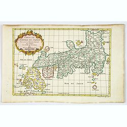
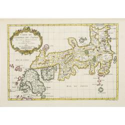
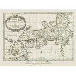
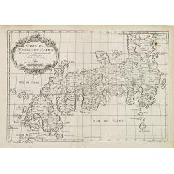
Carte de L'Empire du Japon.
A fine map of the islands of Japan embellished with fine baroque decorations.Bellin influenced other cartographers with his erroneous portrayals of Japan. This is seen in...
Date: Paris, 1752
Selling price: ????
Please login to see price!
Sold in 2020
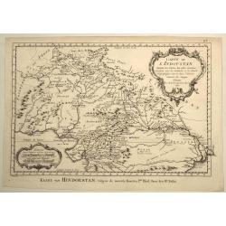
Carte de L'Indoustan Suivant les Cartes les Plus Recentes...
This pleasing map depicts the northern section of the Indian subcontinent and includes present-day Pakistan, Afghanistan, Nepal, and Tibet, in addition to northern India....
Date: Paris, 1752
Selling price: ????
Please login to see price!
Sold in 2021
Territorium Seculare Episcopatus Wormatiensis. . .
Johann Baptist Homann's well-engraved map has a large decorative title cartouche with a vineyard and two vine tendrils with the episcopal coat of arms. A fine and detaile...
Date: Nuremberg, 1752
Selling price: ????
Please login to see price!
Sold in 2020
Carte de la Louisiane.
This map provides an accurate rendition of the lower Mississippi, the Arkansas, the Red, the Osage, and the lower Missouri rivers. Thomas Jefferson bought seven maps by d...
Date: Paris, 1752
Selling price: ????
Please login to see price!
Sold in 2020
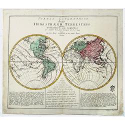
Tabula Geographica utriusque HEMISPHAERII TERRESTRIS.
A decorative, old color, double hemisphere map of the World, which appeared in Leonard Von Euler's world atlas, published in Berlin. The map provides a highly scientific ...
Date: Berlin, 1752
Selling price: ????
Please login to see price!
Sold in 2019
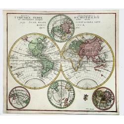
Mappa Geographica UTRIUSQUE TERRAE HEMISPHAERII...
Decorative, double hemisphere map of the World, which appeared in Leonard Euler's world atlas, published in Berlin.The map provides a highly scientific look at the world,...
Date: Berlin 1752
Selling price: ????
Please login to see price!
Sold in 2021
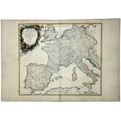
Imperium CAROLIMAGNI Occidentis Imperatoris.
An attractive and detailed map of Charlemagne's empire, covering the British Isles, Denmark, the Low Countries, Germany, France, Spain, Switzerland, Austria, Italy, Hunga...
Date: Paris, 1752
Selling price: ????
Please login to see price!
Sold in 2020
Circulus Saxoniae Inferioris in omnes suos Status et Principatus. . .
Homann's detailed map of Germany's Lower Saxony region, extending from the Baltic to Berlin, Hall, Gottingen, Bremen and Minden, centered on the course of the Elbe River....
Date: Nuremberg, ca 1752
Selling price: ????
Please login to see price!
Sold in 2021
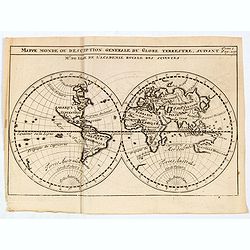
Mappe monde ou description generale du globe terrestre suivant Mr.de Lisle de l'academie Royale des sciences.
A scarce small map of the world by Guillaume Delisle. A copper engraving published in, "Nouveau traité de geographie..." Curiosities include a misshapen Japan ...
Date: Paris, 1752
Selling price: ????
Please login to see price!
Sold in 2020
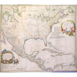
North America, Performed under the Patronage of Louis Duke of Orleans, First Prince of the Blood. By the Sieur d'Anville. . .
A lovely copper engraved map from 'The Universal Dictionary of Trade and Commerce (vols. 1 & 2)', by Malachy Postlethwayt / published by Paul Knapton, London, in 1755...
Date: London, 1752
Selling price: ????
Please login to see price!
Sold in 2020
Tab. Geogr. Asiae ad emendatiora,...
Scarce map of Asia also parts of Africa and Europe. With good detail and interesting names throughout. Curious shapes and some notes. Unfinished New Guinea. A banner held...
Date: Berlin, ca. 1752
Selling price: ????
Please login to see price!
Sold in 2022
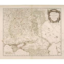
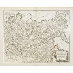
Partie Méridionale de la Russie Européenne..
Detailed map of Ukraine, the Crimea and the northern part of the Caspian Sea.
Date: Paris 1752
Selling price: ????
Please login to see price!
Sold
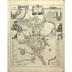
Plan de Nancy Avec les Changements que le Roy de Pologne Duc de Lorraine et de Bar a fait Dedié à sa Majesté Polonoise Par Le Rouge
A Rare plan of Nancy by Georges-Louis le RougeA large and detailed copper engraved plan of Nancy, published by le Rouge in 1752. Surrounded by important buildings of the ...
Date: Paris, 1752
Selling price: ????
Please login to see price!
Sold in 2011
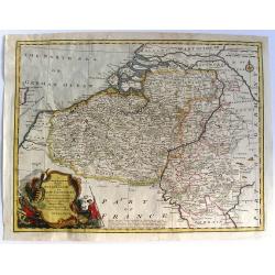
Partie septentrionale du duche de Brabant
A handsome map of the Northern half of Brabant, includes the area north of Mechelen. Includes a decorative title cartouche and a set of scales.Relief shown pictorially.
Date: Paris 1752
Selling price: ????
Please login to see price!
Sold
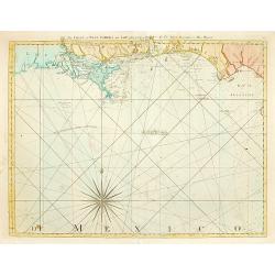
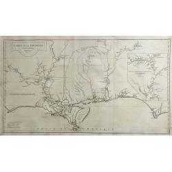
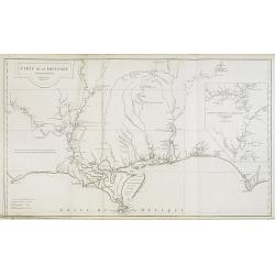
The Coast of West Florida and Louisiana..
Rare and important chart of Louisiana. Jeffery's was one of the most prolific and important English map publishers of the 18th century. His earliest known work was a plan...
Date: London 1752
Selling price: ????
Please login to see price!
Sold
Le Royaume de Pologne..
Detailed map of Poland, including Lithuania, Ukraine, East Prussia, etc.
Date: Paris 1752
Selling price: ????
Please login to see price!
Sold
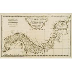
Carte particuliere de L'Isthme de Panama, Golfe de Darien, Côte de Carthagene..
This map provides an accurate picture of Panama.Jean Baptiste Bourguignon d'Anville (1697-1782) engraved his first map at age fifteen and produced many maps of high quali...
Date: Paris 1752
Selling price: ????
Please login to see price!
Sold
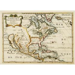
Amerique Septentrionale par N. Sanson.
Small decorative map of the Americas with a very large CALIFORNIA AS AN ISLAND.
Date: Amsterdam 1752
Selling price: ????
Please login to see price!
Sold
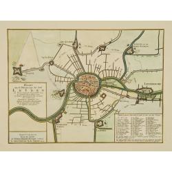
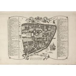
Kaart van de belegeringe der stad Leyden..
Very detailed map of the siege of Leiden from 1573-1574. With extensive key to the important building in the town. After a design by Joost Janssen Bilhamer.
Date: Amsterdam, 1752
Selling price: ????
Please login to see price!
Sold
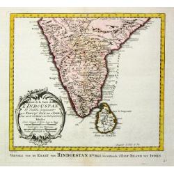
Carte de l' Indoustan IIe Feuille, comprenant la Presqu' Isle de l' Inde. 1752.
Jaques Nicolas Bellin (1702-720) was the most important French hydrographer of the 18th century. Sea-atlas 'Hydrographique Français' , 1756-65, atlas to accompany Prévo...
Date: Paris, 1752
Selling price: ????
Please login to see price!
Sold
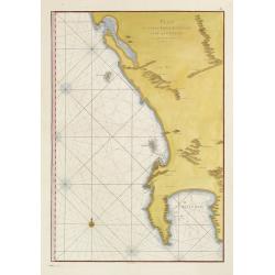
Plan du Cap de Bonne-Esperance et ses environs..
Large and detailed sea chart of the Cape of Good Hope from Saldahna Bay to False Bay. Probably from Neptune Oriental, published in 1745. Note that this version differs in...
Date: Paris, 1752
Selling price: ????
Please login to see price!
Sold
Carte de L'Empire du Japon.
A fine map of the islands of Japan embellished with fine baroque decorations.Bellin influenced other cartographers with his erroneous portrayals of Japan. This is seen in...
Date: Paris 1752
Selling price: ????
Please login to see price!
Sold
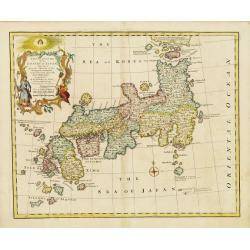
A New and Accurate Map of the Empire of Japan.
An interesting and detailed English map of the lands of Japan closely modeled on Nicolas Bellin's map of 1735.
Date: London, 1752
Selling price: ????
Please login to see price!
Sold in 2008
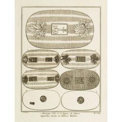
Monnoyes d'Or et d'Argent du Japon. Pl. VII.
Decorative print illustrating Golden and silver coins from Japan. From Histoire générale des voyages..> by Antoine François Prévost.Title in French and Dutch.
Date: Paris, 1752
Selling price: ????
Please login to see price!
Sold
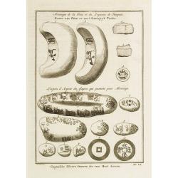
Monnoyes de la Chine et du Royaume de Tunquin. - Lingots d\'Argent du Japon qui passent pour Monnoye. Pl. VI.
Decorative print illustrating coins and silver ingots from China and Japan. From Histoire générale des voyages.. by Antoine François Prévost.Titles in French and Dutc...
Date: Paris, 1752
Selling price: ????
Please login to see price!
Sold in 2008
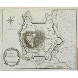
La Ville de Cayenne.
Plan of the city of Cayenne from Histoire générale des voyages … by Antoine François Prévost, published by Didot.
Date: Paris, 1752
Selling price: ????
Please login to see price!
Sold in 2011
Seconde partie de la carte d'Asie contenant la Chine et partie de la Tartarie, l'Inde ... Sumatra, Java, Borneo, Moluques, Philippines et du Japon
Attractive large map of Asia from G. de la Haye by J.B.B. d'Anville. Showing southeast Asia with Japan and Korea. Printed on two plates, joined.
Date: Paris, 1752
Selling price: ????
Please login to see price!
Sold in 2009
Partie Orientale de l'Empire de Russie en Asie.
Detailed map of the north-eastern part of Russia, including Siberia.
Date: Paris, 1752
Selling price: ????
Please login to see price!
Sold in 2009
Seconde partie de la carte d\'Asie contenant la Chine et partie de la Tratarie, l\'Inde ... Sumatra, Java, Borneo, Moluques, Philippines et du Japon
Attractive large map of Asia from G. de la Haye by J.B.B. d\'Anville. Showing south east Asia with Japan and Korea. Printed on two plates
Date: Paris, 1752
Selling price: ????
Please login to see price!
Sold in 2008
Carte de L'Empire du Japon.
A fine map of the islands of Japan embellished with fine baroque decorations.Bellin influenced other cartographers with his erroneous portrayals of Japan. This is seen in...
Date: Amsterdam, 1752
Selling price: ????
Please login to see price!
Sold in 2008
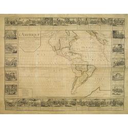
L'Amerique divisée en ses principalesparties. . .
RARE WALL MAP OF THE AMERICAS WITH DECORATIVE BORDERS. This wall map by Daudet is first described by Mcguirk, in his work about the "Mer de l'Ouest Mythe, see "...
Date: Lyon, 1752
Selling price: ????
Please login to see price!
Sold
Le Royaume de Pologne,
Detailed map of Poland. The map is filled with towns and topographic details like the river systems. An exquisite cartouche surrounds the title at the top.
Date: Paris, 1752
Selling price: ????
Please login to see price!
Sold in 2008
Carte de L'Empire du Japon.
A fine map of the islands of Japan embellished with fine baroque decorations. Bellin influenced other cartographers with his erroneous portrayals of Japan. This is seen i...
Date: Paris, 1752
Selling price: ????
Please login to see price!
Sold in 2008
Carte de la Louisiane.
This map provides an accurate rendition of the lower Mississippi, the Arkansas, the Red, the Osage, and the lower Missouri rivers. Thomas Jefferson bought seven maps by A...
Date: Paris, 1752
Selling price: ????
Please login to see price!
Sold in 2009
Seconde partie de la carte d'Asie contenant la Chine et partie de la Tratarie, l'Inde . . . Sumatra, Java, Borneo, Moluques, Philippines et du Japon.
An attractive large map of Asia from G. de la Haye by J.B.B. d'Anville. Showing south east Asia with Japan and Korea. Printed on two plates.
Date: Paris, 1752
Selling price: ????
Please login to see price!
Sold in 2010
![[4 maps] Partie Orientale de l'Empire de Russie ? / Partie Occidentale de l'Empire de Russie ? / Partie Septentrionale de la Russie Européenne ? / Partie Méridionale de la Russie Européenne ?](/uploads/cache/99444-250x250.jpg)
[4 maps] Partie Orientale de l'Empire de Russie ? / Partie Occidentale de l'Empire de Russie ? / Partie Septentrionale de la Russie Européenne ? / Partie Méridionale de la Russie Européenne ?
Detailed maps of the different regions of Russia.
Date: Paris, 1752
Selling price: ????
Please login to see price!
Sold in 2010
The Seraglio & Gardens of the Grand Seignior.
Rare plan of the Topkapi Palace in IstanbulThis rare plan of the Topkapi Palace in Istanbul was published by John Rocque, an English engraver, active in London from 1734....
Date: London, 1752
Selling price: ????
Please login to see price!
Sold in 2010
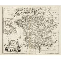
Nuova ed Esatta carta della Francia. . .
General map of France, after Emanuel Bowen, but from an Italian text edition. With an elegant baroque title cartouche. With inset charts of the harbors of Toulon & Br...
Date: London, 1752
Selling price: ????
Please login to see price!
Sold
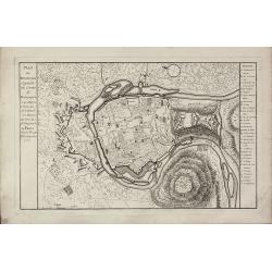
Plan de Besancon. Capitalle du Compté de Bourgogne.
A rare plan of Besancon in the Bourgogne by Le Rouge. Showing the fortified city with the adjacent streets, title to the left, and a keys to the right. We could not locat...
Date: Paris, 1752
Selling price: ????
Please login to see price!
Sold
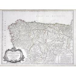
Partie Septentrionale de la Couronne de Castille ou se trouvent Les Royaumes de Castille Vieille de Leon, de Gallice, des Asturies, La Biscaye et la Navarre...
Highly detailed map of Northwestern Spain, including the regions of Gallicia, Leon, Asturias, Castille and Biscaya by Robert de Vaugondy. In the southern portion of the m...
Date: Paris, 1752
Selling price: ????
Please login to see price!
Sold in 2010
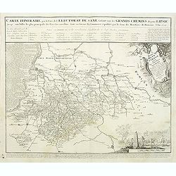
Carte Itineraire par le Pays de l'Electorat de Saxe faisant voir les Grands Chemins depuis Lipsic jusqu' aux Villes les plus principales des Pays Circonvoisins. . .
Detailed map of post road mapsroad system around Leipzig, prepared by J. C. K. Reichenb. Varisco in 1728. The map has a French title in top and the distances marked betwe...
Date: Nuremberg, 1752
Selling price: ????
Please login to see price!
Sold in 2011
Orbis Vetus in utraque continente. . .
Impressive, large double hemisphere map of the ancient world beautifully engraved in the robust style characteristic of Robert de Vaugondy. The map presents a historical ...
Date: Paris, 1752
Selling price: ????
Please login to see price!
Sold in 2011
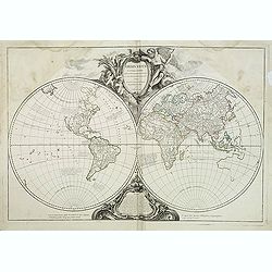
Mappemonde ou description du globe terrestre, dressee sur les memoires les plus nouveaux, et assujettie aux observations astronomiques. . .
Beautiful world map in two hemispheres from the Delamarche edition of Giles and Didier Robert De Vaugondy's famous Atlas Universal. Map shows the voyages of Anson in 1740...
Date: Paris, 1752
Selling price: ????
Please login to see price!
Sold in 2011