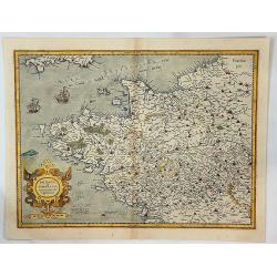
Britannia & Normandia cum Consinib Regionibus.
A Mercator & Hondius map of Brittany and Normandy, including part of Picardy. One of the earliest maps of Brittany and Normandy, it was first published by Mercator in...
Date: Amsterdam, 1610
Selling price: ????
Please login to see price!
Sold in 2017
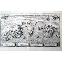
Abriß der Dreyen, gegeneinander Correspondierenden Vestungen Monaco, Capo di Sant Spirito, und Niza die Provenza.
Nice view of the coast in southern France, from Nice to Monaco, including Villefranche-sur-Mer and Saint-Jean-Cap-Ferrat! A very decorative and informative map, with t...
Date: Frankfurt, c1650
Selling price: ????
Please login to see price!
Sold in 2011
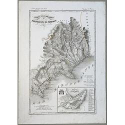
Carta Topografica del Principato Di Monaco.
A map of the Princedom of Monaco. Nice 19th Century map with insert at lower right: 'Topografia della Città Di Monaco', with legend 1-30. Original border-colored. From: ...
Date: Florence, 1844
Selling price: ????
Please login to see price!
Sold in 2020
