Browse Listings in Europe > Eastern Europe
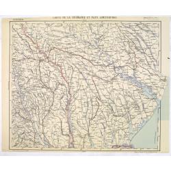
Carte de la Roumanie et Pays limitrophes. Balta. ODESSA.
Very detailed (1:750.000) map centered on Odessa and Moldova and Ukraine territory. Made after an Austrian map. The French Service géographique des armées was founded i...
Place & Date: Paris, 1912
Selling price: $100
Sold in 2014
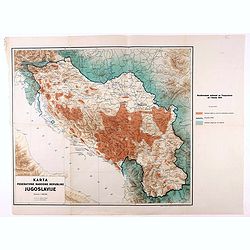
Karta Federativne Narodne Republike Jugoslavije.
Rare map of Yugoslavia. With color key. The map was made in the year of the 1941 invasion of Yugoslavia, also known as the April War was a German-led attack on the Kingdo...
Place & Date: Yugoslavia, 1946
Selling price: $200
Sold in 2021
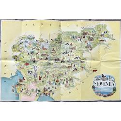
Slovenija - Jugoslavija
A fine tourist pictorial map of Slovenia. On the backside with a map showing roads and railroads. Also text information in english, french and german.
Place & Date: Ljubljana, 1954
SCLAVONIA ODER WINDISCH MARCK. . .
A detailed and attractive wood block map by Munster of the region that included Istria and extends to include some of Slovenia, Croatia, Dalmatia, and northeastern Italy....
Place & Date: Basel, ca 1550
Selling price: $130
Sold in 2021
Behemer Koenigreich. . .
Münsters first map [of 2] of Bohemia, published in Basel, circa 1550. An early woodcut map of Bohemia, (Czech Republic) by Sebastian Münster oriented to the South. The ...
Place & Date: Basel, ca 1550
Selling price: $150
Sold in 2021
![Die Siebenbürg. . .Transylvania,Romania]](/uploads/cache/85024-250x250.jpg)
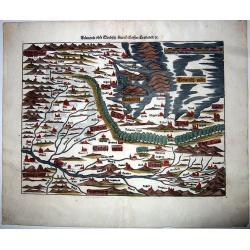
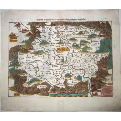
Die Siebenbürg. . .Transylvania,Romania]
Münsters first map [of 2] of Bohemia, published in Basel, circa 1550. An early woodcut map of Transylvania, Romania by Sebastian Münster oriented to the North. The titl...
Place & Date: Basel, ca 1550
Selling price: $130
Sold in 2021
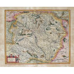
HUNGARIA Per Gerardum Mercatorem
This is Mercator's map of the Kingdom of Hungary. The Danube River runs through the map from the top left to the bottom right. Transylvania borders the map on the righ...
Place & Date: Duisburg and later Amsterdam, (1585-95) 1613
Selling price: $230
Sold in 2012
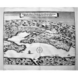
Delineatio Situsve Provinciae Clissam & spalatum. Abbildung oder Situation der Landschafft Clissa vnd Spalato.
An important copper engraving from Merian's Theatrum Europäum, 1652 (see Fauser Nr. 13238). It shows a bird's-eye view of the region of Split with the islands of Solta u...
Place & Date: Frankfurt a. M., 1654
Selling price: $120
Sold in 2019
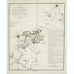
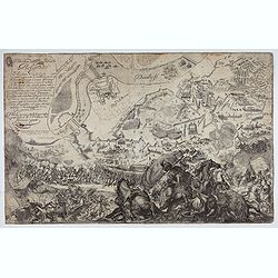
Plan de la bataille d'Austerlitz gagnée par la gde armée française commandée par l'empereur Napoléon sur l'armée austro-russe commandée par les empereurs de Russie et d'Allemagne en personnes le 11 frimaire XIV.
Map of the Battle of Austerlitz of 1805. With a color-key to the French, Russian and Austrian armies. Explicative key for the battle in lower right: A-Q and a -d. prepare...
Place & Date: Paris, 18056
Selling price: $100
Sold in 2013
Delineatione della Piazza Forza di Belgrado.
Bird's-eye-bird view of The siege of Belgrade by the Austrian troops under the command of Prince Eugene of Savoy to capture the strategically important city from the Otto...
Place & Date: Rome, ca. 1700