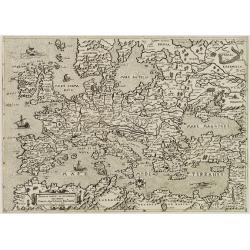
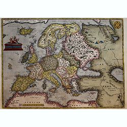
Nova Europae Descriptio.
A fine uncolored version of Hondius' second map of Europe, first issued in 1606. From: Jodocus Hondius, 'Atlas sive cosmographicæ meditationes de fabrica mundi et fabric...
Place & Date: Amsterdam, 1621-/23
Selling price: $615
Sold in 2020
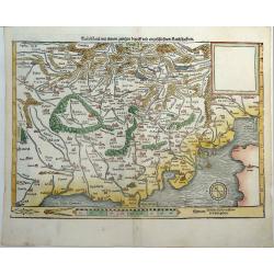
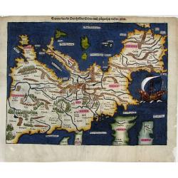
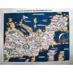
![[Northern Europe with Poland]](/uploads/cache/90950-250x250.jpg)
[Northern Europe with Poland]
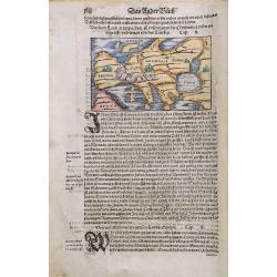
Map of Northern Europe and centered on Poland. First issue, with Latin text colophon and date on verso. The map is deemed to be the first printed map of Germany, even if ...
Place & Date: Nuremberg, 12 July 1493
Selling price: $2000
Sold in 2016
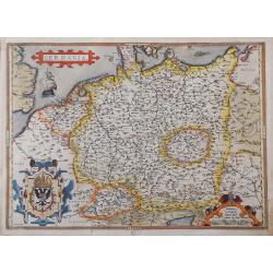
![[Germania Magna]](/uploads/cache/92822-250x250.jpg)
[Germania Magna]
Map of Northern Europe and centered on Poland. First issue, with Latin text colophon and date on verso. The map is deemed to be the first printed map of Germany, even if ...
Place & Date: Nuremberg, 1493
Selling price: $3100
Sold in 2013
![[Northern Europe with Poland]](/uploads/cache/36852-250x250.jpg)
[Northern Europe with Poland]
Map of Northern Europe and centered on Poland. First issue, with Latin text colophon and date on verso. The map is deemed to be the first printed map of Germany, even if ...
Place & Date: Nuremberg, 12 July 1493
Selling price: $6200
Sold in 2016
![[Germania Magna].](/uploads/cache/98756-250x250.jpg)
[Germania Magna].
A woodcut colored map of northern and central Europe. The first modern map of the area. Second printed map of the North, after the woodcut map published in the 'Ulm' Ptol...
Place & Date: Nuremberg, 1493
Selling price: $5800
Sold in 2017
![[Northern Europe with Poland.]](/uploads/cache/81098-250x250.jpg)
[Northern Europe with Poland.]
A map of Northern Europe and centred on Poland. First issue, with Latin text colophon and date on verso. The map is deemed to be the first printed map of Germany, even if...
Place & Date: Nuremberg, 1493
Selling price: $4700
Sold in 2018
![Anglia / Hispania [England and Spain, two views on one page]](/uploads/cache/84790-250x250.jpg)
Anglia / Hispania [England and Spain, two views on one page]
Incunable sheet with two woodcut engravings of imaginary Views of 'Anglia'/England or Great Britain, and 'Hispania'/Spain on the back [Please view additional picture From...
Place & Date: Nuremberg, 1493
Selling price: $150
Sold in 2020
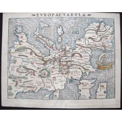
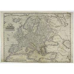
Europae Tabula
At the time Sebastian Münster published this map, it was not yet conventional to locate the North at the top of the map. Münster‘s orientation to the South was taken ...
Place & Date: Basle, 1540
Selling price: $800
Sold in 2015
TEÜTSCHLAND MIT SEINEM GANTZEN BEGRIFF UND EINGSCHLOSZNEN LANDSCHAFFTEN.
A very rare state of Europe or Germany by Sebastian Münster, unlike most maps of Germany from the Cosmographia. Attractively colored and oriented to the South. Showing t...
Place & Date: Basel, ca 1540
Selling price: $350
Sold in 2019
![[Map of Europe]](/uploads/cache/31463-250x250.jpg)
[Map of Europe]
Page with an early representation of Europe. The continent is filled with the Alps mountains and the rivers Rhine and Danube.This text page with a fine wood block printed...
Place & Date: Basle, Michael Isengrin, 1544
Selling price: $500
Sold in 2011
![[Map of Europe]](/uploads/cache/31501-250x250.jpg)
[Map of Europe]
Page with an early representation of Europe. This text page with a fine wood block printed map is from the rare work "C. Iulii Solini Polyhistor, Rerum Toto Orbe Mem...
Place & Date: Basle, Michael Isengrin, 1544
Selling price: $225
Sold in 2013
Von dem Europa, das zu unsern zeiten die Christenheit under im begreifft und etwas von der Türkey.
An attractive map of Europe from the famous 'Cosmographia' by Sebastian Münster, in very nice colors. Europe has almost already taken the shape of Regina Europa. On ve...
Place & Date: Basel, 1544
Selling price: $100
Sold in 2022
Europa, das ein Drittheil der Erden, nach gelegenheit unsern zeiten
Attractive woodcut map showing the European continent with South on top. From a German edition of Cosmographia by Sebastian Munster printed from Petri in Basel around 154...
Place & Date: Basle, 1545
Selling price: $500
Sold in 2009
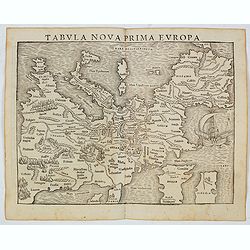
Tabula Nova Prima Europa. (Europe - 1st edition)
The FIRST edition of Munster's first modern map of Europe, with south oriented at the top which appeared in his "Geographia Universalis", first published in 154...
Place & Date: Basel, Heinrich Petri, 1545
Selling price: $300
Sold in 2022
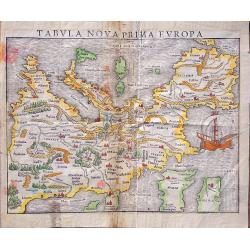
Tabula nova prima Europa.
This map comes from The first edition of Munster's "Geographia Universalis", first published in 1540. It is thus the first modern map of Europe, with south orie...
Place & Date: Basel, Heinrich Petri, 1545
Selling price: $1090
Sold in 2014
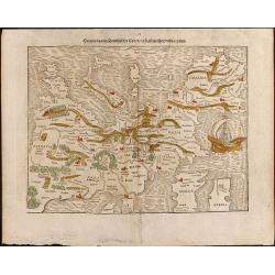
Die erst Tafel, innhaltend das Schweytzerlandt, mit den anstossenden Ländern / Die ander Tafel des Rheinstroms, begreiffend die Pfaltz, Westereich, Eyfel ec. . .
A monumental map of the course of the Rhine river. This is a three-sheet woodcut map showing the Rhine from the headwaters in Switzerland to its mouth in the North Sea. T...
Place & Date: Basel, H.Petri, ca. 1550
Selling price: $375
Sold in 2020
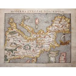
Moderna Evropae descriptio.
This important map represents one of the first printed maps of the European continent as a whole. Printed initially around 1550 in the famous Cosmographia, it was then re...
Place & Date: Basel, ca. 1550
Selling price: $700
Sold in 2013
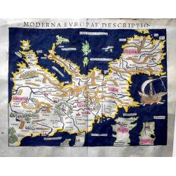
Moderna Evropa descriptio.
At the time Sebastian Münster published this map, it was not yet conventional to orient the North at the top. The uncommon orientation to the South for this map was deri...
Place & Date: Basle, 1550
Selling price: $1650
Sold in 2013
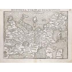
Moderna Evropae Descriptio.
One of the first printed maps of the European continent as a whole. Initially, it appeared in the famous Cosmographia (CIRCA 1550) and then re-issued several times before...
Place & Date: Basel, circa 1550
Selling price: $2100
Sold in 2015
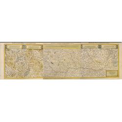
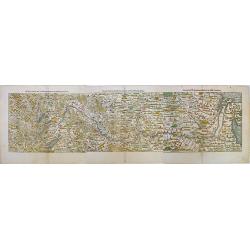
Die erst Tafel, innhaltend das Schweytzerlandt, mit den anstossenden Ländern / Die ander Tafel des Rheinstroms, begreiffend die Pfaltz, Westereich, Eyfel ec. . .
A monumental map of the course of the Rhine river. The three-sheet woodcut map showing the Rhine from the headwaters in Switzerland to its mouth in the North Sea. The map...
Place & Date: Basel, H.Petri, ca. 1550
Selling price: $325
Sold in 2020
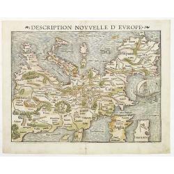
Description nouvelle d'Europe.
Sebastian Münster's (1488–1552) modern map of Europe from a French text edition.Sebastian Münster (Ingelheim, c.1489-1552, Basel), originally a Franciscan friar, beca...
Place & Date: Basle, 1552
Selling price: $1550
Sold in 2010
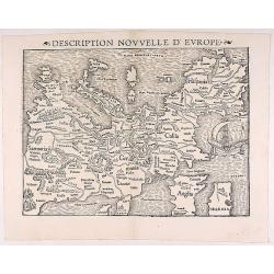
Description Nouvelle d'Europe.
The first map of the continent of Europe! The map is oriented with south at the top and includes a large sailing ship off the coast of Spain and France. Latin text on ver...
Place & Date: Basle, 1552
Selling price: $950
Sold in 2017
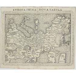
Europa Prima Nova Tabula
Very rare issue of one of the earliest printed maps of the European continent oriented to the south. Shows the continent from Constantinople and Greece to the east and Sp...
Place & Date: Basel, 1552
Europa / das ein Drittheil der Erden / nach gelegenheit unsern zeiten.
A decorative, full color example of Munster's map of Europe. It belongs to an early German edition of Munster's 'Cosmographia', which has been one of the most influential...
Place & Date: Basle, 1560
Selling price: $1225
Sold in 2016
De Europa
A small, attractive map of Europe from the famous 'Cosmographia' by Sebastian Munster, in very nice colors.
Place & Date: Basel, ca. 1560
Selling price: $120
Sold in 2018
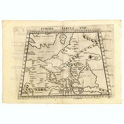
Europae Tabula VIII.
Ptolemaic map of eastern Europe, including a portion of Scandinavia, Poland, Lithuania, Ukraine and Russia, stretching from the Swedish island of Gotland (Gothia Insula) ...
Place & Date: Venice, 1561
Selling price: $200
Sold in 2015
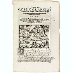
Descriptio Germanicae nationis propter . . .
One text page with a small wood cut map of central Europe (10 x 13,5 cm) with south to the top. On verso, Latin text with German locals. From Münster's Cosmographia Univ...
Place & Date: Basle, ca. 1564
Selling price: $25
Sold in 2019
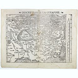
Description de la Germanie.
A wood cut printed map of Germany, The Low Countries, Poland, Austria and Switzerland (345 x 250). South to the top and a scale to the right. On verso French text.From M�...
Place & Date: Basle, ca. 1564
Selling price: $80
Sold in 2016
Europae Brevis AC Novissima descriptio Venetis. Apud Johannem Ern.Camotiu..
Collector's item. The first Italian map of Europe in folio format. The general outline is copied from the Gastaldi wall map of the world of ca. 1561. Punctual additions o...
Place & Date: Italy 1568
Selling price: $12700
Sold
Europa, das ein Drittheil der Erden, nach gelegenheit unsern zeiten.
A very important, attractive woodcut map showing the European continent with South at the top.It comes from a German edition of the famous 'Cosmographia Universalis' by S...
Place & Date: Basel, ca 1570
Selling price: $1200
Sold in 2016
Europae.
The first edition Ortelius’ map of Europe. The map is based upon several important maps of Europe, including Gerard Mercator’s 1554 map of Europe. Mapping of Greenlan...
Place & Date: Antwerp, 1570
Selling price: $600
Sold in 2021
Germania
Striking map of central Europe from the rare 1572/73 German edition of Ortelius' important Atlas "Theatrum oder Schawplatz des Erdbodems, Gielis Coppens van Diest&qu...
Place & Date: Antwerp, 1573
Europae.
Early edition of the classic Europa map by Ortelius. Somewhat distorted land masses: vignette of Europe being carried off by the bull (Zeus). The first plate with title A...
Place & Date: Antwerp, 1574
Selling price: $925
Sold in 2017
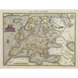
Europae. La carte d'Europe.
In 1575 Sebastian Münster's Cosmographia was translated into French and published in Paris by François de Belle-Forest. The Europe map being a folding woodcut copy of O...
Place & Date: Paris, 1575
Selling price: $2000
Sold
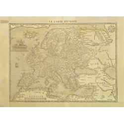
Europae. La carte d'Europe.
In 1575 Sebastian Münster's Cosmographia was translated into French and published in Paris by François de Belle-Forest. The Europe map being a folding woodcut copy of O...
Place & Date: Paris, 1575
Selling price: $750
Sold in 2008
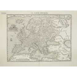
Europae. La carte d\'Europe.
In 1575 Sebastian Münster's Cosmographia was translated into French and published in Paris by François de Belle-Forest. The Europe map being a folding woodcut copy of O...
Place & Date: Paris, 1575
Selling price: $1300
Sold in 2008
Europe.
Uncommon wood-cut map of Europe. The surrounding sea is cut in very great detail. The seas are teeming with numerous small sailing vessels of different shapes and sizes t...
Place & Date: Paris, 1575
Selling price: $1000
Sold in 2014
Europae totius orbis partium amoenissimae..
Map of Europe from the extremely rare first edition.With ''cum priuilegio'' added.Engraved by Joannes and Lucas van Deutecum, who's signature is in the lower left corner...
Place & Date: Antwerp 1578
Selling price: $6125
Sold
![[Europe in the shape of a Queen.]](/uploads/cache/94509-250x250.jpg)
[Europe in the shape of a Queen.]
From 'Cosmographia, das ist: Beschreibung der Gantzen Welt,...'; German edition. wood engraving; overall size 34 x 21 cm. On verso: German text with high-lightened capita...
Place & Date: Basle, c1578
Selling price: $1450
Sold in 2016
Europa, das ein Drittheil der Erden / nach gelegenheit unsern zeiten.
At the time Sebastian Münster published this map, it was not yet conventional to orient the North at the top. The uncommon orientation to the South for this map was deri...
Place & Date: Basel, 1578
Selling price: $800
Sold in 2018