Browse Listings in Europe
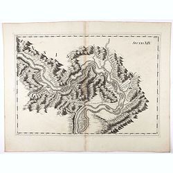
Sectio XIV.
Map of part of the Danube showing section in Romania. Prepared by Count Luigi Ferdinando Marsili (1658 - 1730) who was an Italian scholar and eminent natural scientist. P...
Date: Amsterdam, 1744
Selling price: ????
Please login to see price!
Sold in 2020
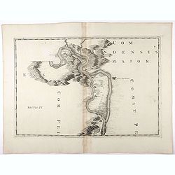
Tab : IV. (Danube)
Map of part of the Danube River showing section in Germany with Weitzen, etc. Prepared by Count Luigi Ferdinando Marsili (1658 - 1730) who was an Italian scholar and emin...
Date: Amsterdam, 1744
Selling price: ????
Please login to see price!
Sold in 2020
![[The Plans of the Principal Towns, Forts & Harbours in Ireland]](/uploads/cache/47406-250x250.jpg)
[The Plans of the Principal Towns, Forts & Harbours in Ireland]
A selection of 16 city views (Kilkenny), town plans (Dublin, Londonderry, Coleraine, Gallway, Carrickfergus, Cork, Athlone, Waterford, Belfast, Limerick), forts (Drogheda...
Date: London , 1744
Selling price: ????
Please login to see price!
Sold in 2021
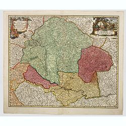
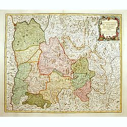
Regni Hungariae tabula generalis. . .
Johann Baptist Homann's well-engraved map of Hungary. With a fine decorative title cartouche and another hunting cartouche in the opposite corner housing the mileage scal...
Date: Neurenberg, 1744
Selling price: ????
Please login to see price!
Sold in 2023
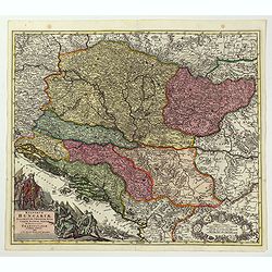
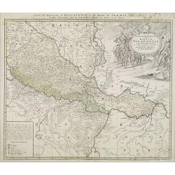
Regnorum Hungariae, Dalmatiae, Croatiae. . .
Johann Baptist Homann's well-engraved map of Hungary. With a fine decorative title cartouche showing the Hapsburg victors of war and the vanquihsed Ottomans in equal meas...
Date: Nuremberg, 1744
Selling price: ????
Please login to see price!
Sold in 2022
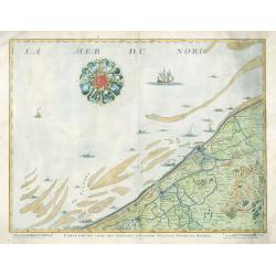
Carte Particuliere Des Environs D'Ostende Neuport Furnes et Autres
This is a seldom seen map of the coast of Belgium by one of the most prolific Belgian publishers of the 18th century, Eugène-Henri Fricx (1644-1740 c.). The map feature...
Date: Brussels, 1744
Selling price: ????
Please login to see price!
Sold in 2023
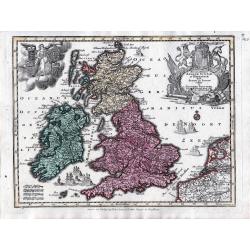
Accuratissima Angliae, Scotiae et Hiberniae tab., …
An elegant map of the British Isles. From: Atlas Minor Praecipua Orbis Terrarum Imperia, Regna et Provincias, Germania, … The maps were drawn by Georg Matheus Seutt...
Date: Augsburg, circa 1744
Selling price: ????
Please login to see price!
Sold in 2023
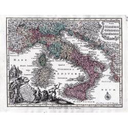
Nova Totius Italiae cum adjacentibus majoribus et minorib insulis tabula …
A detailed map of Italy and the islands of Corsica, Sardinia and Sicily together with its possessions along the Dalmatian coastFrom: Atlas Minor Praecipua Orbis Terrarum ...
Date: Augsburg, circa 1744
Selling price: ????
Please login to see price!
Sold in 2023
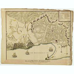
Plan of the City of Barcelona.
From Rapin's History of England , a nicely detailed plan of Barcelona, the capital of Catalonia. The plate contains a 19 point legend and the presentation is enhanced wit...
Date: London, c.1745
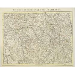
Partie Meridionale De Champagne. . .
Very detailed, topographical map of the southern Champagne. Showing fortified cities, roads, towns, rivers, lakes, forests, etc. The map is from a Dutch edition of De L'I...
Date: Amsterdam c. 1745
Selling price: ????
Please login to see price!
Sold
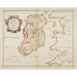
Irlande Royaume divisé en ses quatre Provinces..
SANSON'S MAP OF IRELAND IN ITS THIRD AND RAREST STATE BY GILLES ROBERT.Sanson's 1665 map of Ireland, in it THIRD AND RAREST STATE, with the 1741 imprint of Gilles Robert....
Date: Paris 1741/c.1745
Selling price: ????
Please login to see price!
Sold
Le Gouvern.t Général du Dauphiné. . .
With decorative cartouche with dolphins.
Date: Paris, 1745
Selling price: ????
Please login to see price!
Sold
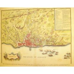
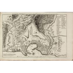
Plan of the city and Castle of Alicant..
A handsome and highly decorative plan of the town of Alicante in south-eastern Spain. The piece contains a 35 point legend along with a cartouche and sailing ships in bat...
Date: London, c. 1745
Selling price: ????
Please login to see price!
Sold
"Plan of Attack of Camaret Bay, on the Coast of Bretagne ..."
An interesting and attractive map of Camaret bay in Brittany. The piece depicts a battle scene between British and French naval forces in the vicinity of Brest.It feature...
Date: London, ca 1745
Selling price: ????
Please login to see price!
Sold in 2008
Carte de la Souveraineté de Neufchatel et de Vallangin..
Very beautiful map of Neufchatel in Switzerland, prepared by David François de Merveilleux in 1710.
Date: Paris, 1745
Selling price: ????
Please login to see price!
Sold
Le cours du Rhin de Bale à Hert près Philisbourg contenant L\'Alsace et partie du Brisgau..
The first map of the Rhine valley on such a large scale. To the lower left a scale cartouche and a small inset of Basle.With fine title cartouche upper rightLe Rouge (171...
Date: Paris, 1745
Selling price: ????
Please login to see price!
Sold in 2008
![[2 maps] Le cours du Rhin de Constance a Bale : en deux feuilles contenant le Fricqthal les Quatre Ville Forrestieres et partie de la Souabe / verifié sur les lieux par l'auteur.](/uploads/cache/17795-250x250.jpg)
[2 maps] Le cours du Rhin de Constance a Bale : en deux feuilles contenant le Fricqthal les Quatre Ville Forrestieres et partie de la Souabe / verifié sur les lieux par l'auteur.
Two maps forming an early map of the Rhine valley on such a large scale.1:100 000 Le Rouge (1712-1778) was born in Hanover and may have spent his youth there, though his ...
Date: Paris, 1745
Selling price: ????
Please login to see price!
Sold in 2011
Carte topographique du cours du Rhin de Philisbourg a Mayence. . .
Early map of the Rhine valley on such a large scale.1:100 000. Including towns as Mainz, Manheim, Worms, Spier, Heidelberg, Philisbourg.Le Rouge (1712-1778) was born in H...
Date: Paris, 1745
Selling price: ????
Please login to see price!
Sold in 2011
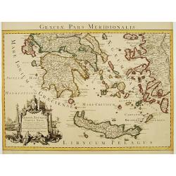
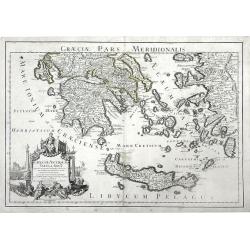
Graeciae Pars Meridionalis..
Very decorative map illustrating the southern part of Greece and a small part of Turkey. It represents the Aegean Islands and Crete as well as some islands in the Ionian ...
Date: Amsterdam c. 1745
Selling price: ????
Please login to see price!
Sold
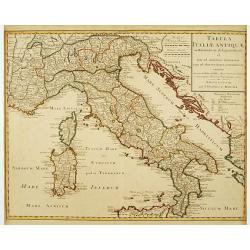
Tabula Italiae Antiquae..
Very decorative map of the Italian peninsula.The map is from a Dutch edition of De L'Isle's work entitled, Atlas Nouveau, Contenant Toutes Les Parties Du Monde, Ou sont e...
Date: Amsterdam c. 1745
Selling price: ????
Please login to see price!
Sold
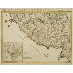
Regionum Italiae Mediarum Tabula Geographica.
Very decorative map of the central Italy showing Rome at the centre of the sheet. An interesting inset on lower left corner of the map illustrates topographical features ...
Date: Amsterdam, c. 1745
Selling price: ????
Please login to see price!
Sold in 2014
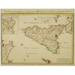
Siciliae Antiquae quae et Sicania et Trinacria dicta tabula geographica.
Detailed map of Sicily in outline color. Shows forests, a smoking Mount Etna, etc. Covers also Malta and Lipari Islands. Relief shown pictorially. Inset map: Veterum Syra...
Date: Amsterdam c. 1745
Selling price: ????
Please login to see price!
Sold
Land-Charte des Chur-Fürstenthums Brandenburg.
Highly detailed copper-engraved map of Brandenburg. After von Gundling, this was the most accurate map of the region at the time. Centered on Berlin, the map also include...
Date: Amsterdam c. 1745
Selling price: ????
Please login to see price!
Sold
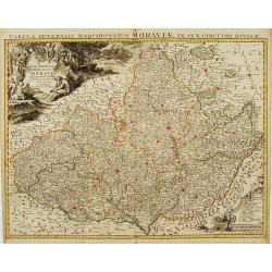
Carte Générale du Marquisat de Moravie Divisée en six Cercles
Detailed copper-engraved map representing Moravia divided in districts. With decorative title cartouche and legend cartouche on upper left and lower right corners. Shows ...
Date: Amsterdam c. 1745
Selling price: ????
Please login to see price!
Sold
Carte de la Souverainité de Neuchatel et Vallangin.
Fine ornamental map representing the lake of Neufchatel. With explanatory text on both sides of the decorative title cartouche which is situated at the centre of the map....
Date: Amsterdam, c. 1745
Selling price: ????
Please login to see price!
Sold in 2012
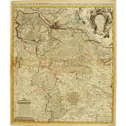
L'Electorat de Hannover ou les Domaines du Roi de la Grande Bretagne..
Detailed copper-engraved map representing the Electorate of Hanover with the Duchies of Lunenburg, Bremen, Ferden etc. With decorative title cartouche on upper right corn...
Date: Amsterdam c. 1745
Selling price: ????
Please login to see price!
Sold in 2009
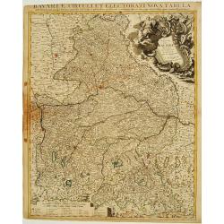
Le Cercle de Baviere Divisée en touts les Estats qui le Composent &c.
Highly detailed copper-engraved map of Bavaria. With decorative title cartouche on upper right corner and scale of miles cartouche. Includes illustrated topography with t...
Date: Amsterdam c. 1745
Selling price: ????
Please login to see price!
Sold in 2009
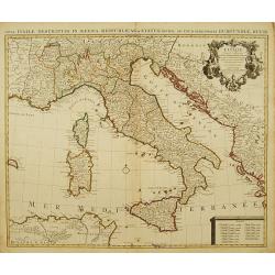
L' Italie, Dressee sur les Observations de Mrs. De L' Academie Royale des Sciences..
A large, highly detailed map of the Italian peninsula and the surrounding parts of France and the Balkans. Includes Sardinia and Corsica. Decorated with a fine title cart...
Date: Amsterdam c. 1745
Selling price: ????
Please login to see price!
Sold
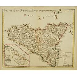
Carte de l'Isle et Royaume de Sicile.
Large, highly detailed map of Sicily. Shows illustrated topography with fortresses, churches, abbeys, ancient ruins, and aqueducts. The most prominent feature is the larg...
Date: Amsterdam c. 1745
Selling price: ????
Please login to see price!
Sold
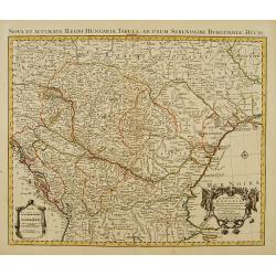
Le Royaume de Hongrie et des pays qui en dependoient autrefois..
Detailed copper-engraved map of Hungary with its neighbouring countries. The map is also improved after the observations by Marsigli, who published an important descripti...
Date: Amsterdam c. 1745
Selling price: ????
Please login to see price!
Sold
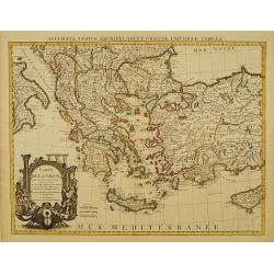
Carte de la Grece dressée sur un grand nombre de memoires..
Detailed copper-engraved map of Greece with its neighbouring countries, including southern Italy and part of Cyprus. Relief shown pictorially. With large decorative title...
Date: Amsterdam c. 1745
Selling price: ????
Please login to see price!
Sold
Carte du Piemont et du Monferrat Dressée sur plusieurs Cartes..
Large, detailed map of Valle d'Aosta and most part of Piedmont. Includes illustrated topography with notations about towns, roads, passes, mountains, etc. Relief shown pi...
Date: Amsterdam, c. 1745
Selling price: ????
Please login to see price!
Sold in 2008
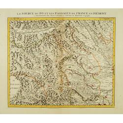
La Source du Po, et les passages de France en Piémont.
First of 5 detailed maps illustrating the flow of the river Po, in northern Italy, this maps depicts the mountainous area at the border between Italy and France. Relief s...
Date: Amsterdam c. 1745
Selling price: ????
Please login to see price!
Sold

Le Cours du Po dans le Piemont et le Montferrat.
Second of 5 detailed maps illustrating the flow of the river Po, in northern Italy, this maps depicts the stretch of river flowing through the Piedmont and the Monferrato...
Date: Amsterdam c. 1745
Selling price: ????
Please login to see price!
Sold
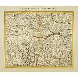
Le Cours du Po dans le Milanez.
Third of 5 detailed maps illustrating the flow of the river Po, in northern Italy, this maps depicts the stretch of river marking the natural border between Lombardy and ...
Date: Amsterdam c. 1745
Selling price: ????
Please login to see price!
Sold
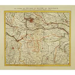
Le Cours du Po dans le Duche de Mantoue.
Fourth of 5 detailed maps illustrating the flow of the river Po, in northern Italy, this maps depicts the stretch of river flowing through the province of Mantua as far a...
Date: Amsterdam c. 1745
Selling price: ????
Please login to see price!
Sold
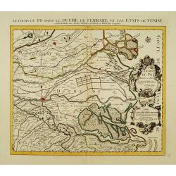
Le Cours du Po dans le Duché de Ferrare et les Etats de Venise..
Last of 5 detailed maps illustrating the flow of the river Po, in northern Italy, this maps depicts the last stretch of river from Ravalle as far as its delta into the Ad...
Date: Amsterdam c. 1745
Selling price: ????
Please login to see price!
Sold
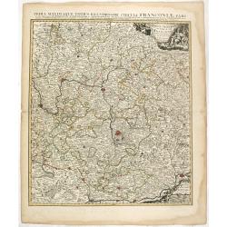
Partie Orientale du Cercle de Francofonie dressée sur les Mémoires..
Large, detailed map of Eastern Franconia. Includes illustrated topography with notations about towns, roads, fortresses, abbeys and monasteries, etc. Relief is shown pict...
Date: Amsterdam c. 1745
Selling price: ????
Please login to see price!
Sold in 2023
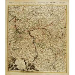
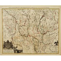
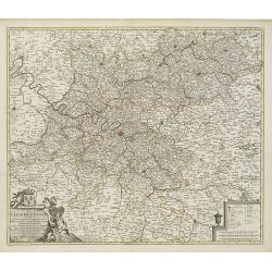
L'Electorat de Mayence, le Bas Palatinat et une Partie du Pays de Hesse..
Large, detailed map of Rhenish Franconia. Includes illustrated topography with notations about towns, roads, fortresses, abbeys and monasteries, etc. Relief shown pictori...
Date: Amsterdam c. 1745
Selling price: ????
Please login to see price!
Sold in 2009
Carte du Comté du Brabant, Dressée sur plusieurs Cartes particulières..
Map of the old Duchy of Brabant, which covers parts of the Netherlands and Belgium largely between the Meuse or Maas River and the North Sea. Highly detailed with depicti...
Date: Amsterdam c. 1745
Selling price: ????
Please login to see price!
Sold
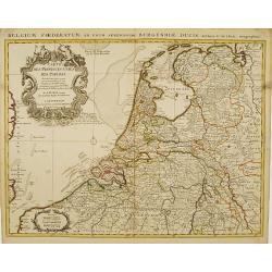
Carte des Provinces Unies des Pays Bas..
Very fine large decorative early 18th century engraved folio sheet map of the Netherlands with original outline hand color. Highly detailed with depictions of topography...
Date: Amsterdam c. 1745
Selling price: ????
Please login to see price!
Sold
Carte exacte des Postes et Routes de l' Empire d' Allemagne divisee en ses Cercles..
Richly engraved and highly detailed map showing the postal routes and roads in Germany, Bohemia, Austria and Switzerland. Much additional information including topography...
Date: Amsterdam c. 1745
Selling price: ????
Please login to see price!
Sold
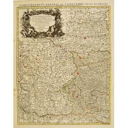
Le Gouvernement General de Languedoc Divisé..
Detailed map of the Southwest of France centred on Toulouse. The map is densely engraved with information with particular emphasis on the fortified cities, which are coll...
Date: Amsterdam c. 1745
Selling price: ????
Please login to see price!
Sold
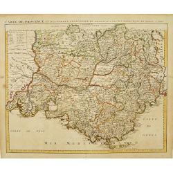
Carte de Provence et des Terres Adjacentes.
Topographically detailed map of the region of Provence in south-eastern France. Relief shown pictorially.The map is from a Dutch edition of De L'Isle's work entitled, Atl...
Date: Amsterdam c. 1745
Selling price: ????
Please login to see price!
Sold
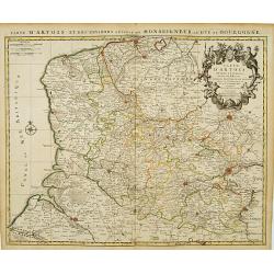
Carte D'Artois ET Des Environs..
Topographically detailed regional map of the Artois region in northern France. The map extends from Dunkirk and Abeville in the West to Doui, Cambrai and Lille in the Eas...
Date: Amsterdam c. 1745
Selling price: ????
Please login to see price!
Sold
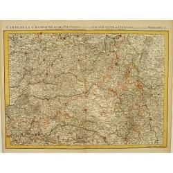
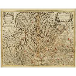
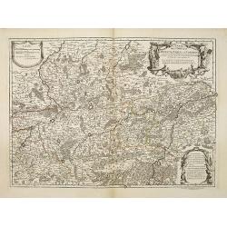
Carte De La Champagne et des Pays Voisins.. Chalons.. Soissons &c.
Very detailed, topographical map of Champagne and surrounding regions of Chalons and Soissons, Reims, Vedun, Mouzon, Sean, Charlemont, etc. Showing fortified cities, road...
Date: Amsterdam c. 1745
Selling price: ????
Please login to see price!
Sold
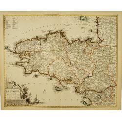
Duché et gouvernement General de Bretagne Divisé..
Highly detailed map of Brittany, in north-western France. Beautifully engraved with a decorative title cartouche depicting Poseidon and Hermes, a compass rose and table o...
Date: Amsterdam c. 1745
Selling price: ????
Please login to see price!
Sold
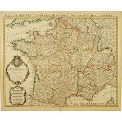
Carte De France Dressée pour l'usage du Roy..
Beautifully engraved, detailed general map of France, illustrating towns, roads, rivers, forests, etc. Embellished by 2 decorative cartouches: a title cartouche surmounte...
Date: Amsterdam c. 1745
Selling price: ????
Please login to see price!
Sold
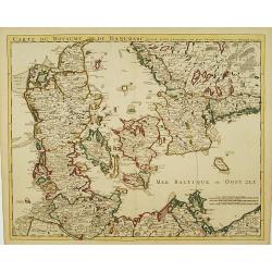
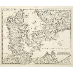
Carte Du Royaume De Danemarc..
Beautifully engraved, highly decorative map showing all of Denmark and southern Sweden, extending north to Warberg.The map is from a Dutch edition of De L'Isle's work ent...
Date: Amsterdam c. 1745
Selling price: ????
Please login to see price!
Sold
![Cartes Des Courones Du Nord Qui Comprend les Royaumes de Danemark, Suede & Nowege, &c.. [and] Seconde Carte des Courones du Nord..](/uploads/cache/21528-250x250.jpg)
Cartes Des Courones Du Nord Qui Comprend les Royaumes de Danemark, Suede & Nowege, &c.. [and] Seconde Carte des Courones du Nord..
Large, highly detailed two sheet map of Scandinavia. Beautifully engraved with a decorative title cartouche and 2 compass roses.Shows illustrated topography with roads, r...
Date: Amsterdam, c. 1745
Selling price: ????
Please login to see price!
Sold in 2009
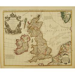
Les Isles Britanniques ou sont le Royaumes d'Angleterre.. d'Ecosse.. d'Irlande..
Beautifully engraved, decorative map of the British Isles. Detailed to show towns, roads, rivers, lakes, counties, etc. Embellished with a decorative distance scale and a...
Date: Amsterdam c. 1745
Selling price: ????
Please login to see price!
Sold
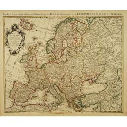
Carte d'Europe Dressée pour l'Usage du ROY..
Beautifully engraved map of Europe. Detailed to show towns, roads, rivers, lakes, counties, etc. Embellished with a decorative title cartouche surmounted by the French cr...
Date: Amsterdam c. 1745
Selling price: ????
Please login to see price!
Sold
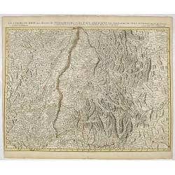
Le Cours du Rhin au dessus de Strasbourg et les Païs Adjacens.
Large, detailed map illustrating part of the flow of the river Rhine. It particularly depicts the stretch of river marking the natural border between Switzerland, France ...
Date: Amsterdam c. 1745
Selling price: ????
Please login to see price!
Sold in 2016
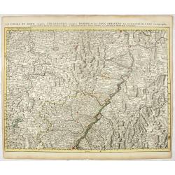
Le Cours du Rhin depuis Strasbourg jusqu'à Worms et les Païs Adjacens.
Large, detailed map illustrating part of the flow of the river Rhine. It particularly depicts the stretch of river from Strasbourg in the South as far as Worms in the Nor...
Date: Amsterdam c. 1745
Selling price: ????
Please login to see price!
Sold in 2021
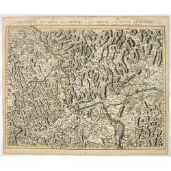
Le Cours du Rhin depuis Worms jusqu'à Bonne, et les Païs Adjacens.
Large, detailed map illustrating part of the flow of the river Rhine. It particularly depicts the stretch of river from Worms in the South as far as Bonn in the North Wes...
Date: Amsterdam c. 1745
Selling price: ????
Please login to see price!
Sold in 2021
![Carte du Bourdelois du Perigord.. [and] Carte Du Bearn de La Bigorre de L'Armagnac.. (2 sheets)](/uploads/cache/21538-250x250.jpg)
Carte du Bourdelois du Perigord.. [and] Carte Du Bearn de La Bigorre de L'Armagnac.. (2 sheets)
Large, detailed map of South-western France, encompassing the Aquitaine région (first sheet) and extending to the Spanish Border and Toulouse (second sheet).The map is f...
Date: Amsterdam c. 1745
Selling price: ????
Please login to see price!
Sold
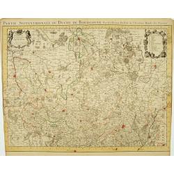
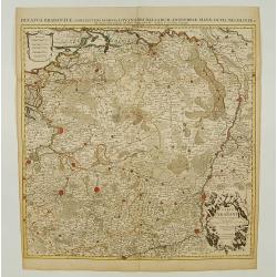
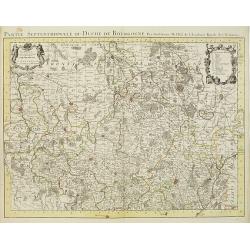
Partie Septentrionale du Duche de Bourgogne..
Large, detailed map of northern Burgundy, covering the region from Bar-sur-Seine in the North to Dijon and Auxonne in the South East. Shows illustrated topography with ma...
Date: Amsterdam c. 1745
Selling price: ????
Please login to see price!
Sold
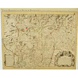
Partie Meridionale du Duche de Bourgogne..
Large, detailed map of northern Burgundy, covering the region from Autun and Dole in the North to Charolles and Mâcon in the South. Shows illustrated topography with man...
Date: Amsterdam c. 1745
Selling price: ????
Please login to see price!
Sold
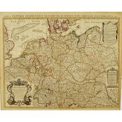
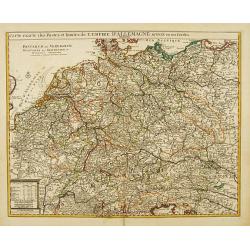
L' Allemagne, Dressee sur les Observations de Tycho-Brahe, de Kepler, de Snellius, sur celles de Messieurs de l' Academie Royale des Sciences &c..
Large, highly detailed map of Germany, including the Netherlands and Belgium. Based on the geography of Nicolas Sanson and Guillaume Delisle, and the observations of Tych...
Date: Amsterdam c. 1745
Selling price: ????
Please login to see price!
Sold
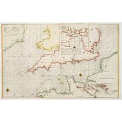
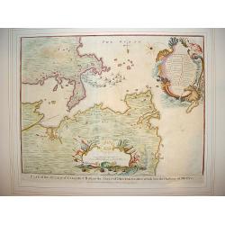
A new and correct chart of the channel between England & France..
The chart includes the South Coast of England from North of the Bristol Channel and of the Thames Estuary, there are insets for Plymouth Sound and the Isle of Wight.
Date: London 1745
Selling price: ????
Please login to see price!
Sold
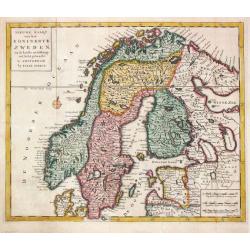
Niewe Kaart van het Koninkrijk Zweden.
Izaak Tirion (d. 1769) Amsterdam publisher. His ' Nieuwe en beknopte handatlas' saw 6 editions between before 1740 and after 1784. Also ' Tegenwoordige staat van alle vol...
Date: Amsterdam, c. 1745
Selling price: ????
Please login to see price!
Sold in 2018
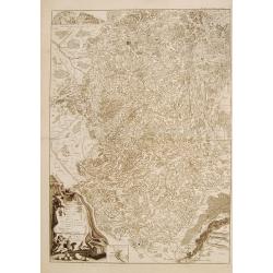
Partie Meridionale du Piemont et du Monferrat..
Map covering the southern part of the Piedmont and the "Riviera di ponente", the sea coast at the east of Genoa. It includes par of France and the Principality ...
Date: Paris 1745
Selling price: ????
Please login to see price!
Sold

Vue du Château de Marli. Prise du bas du grand parterre. . .
A magnificent view of a stunning Château de Marli by the celebrated landscape engraver Jacques Rigaud (1681-1754). At the Château of Marly, Louis XIV of France escaped ...
Date: Paris, c. 1745
Selling price: ????
Please login to see price!
Sold in 2009
Charte derer von der Russischkeyser Armee im Jahr 1736 zwischen und an dem Dnieper und Donn wieder die Turcken und Tartarn siegreich unternommenen Kriegs-Operationen.
Scarce map illustrating the territories between the rivers Dnieper and Donn felt under Russian domination in 1736. The map is sometimes bound in the Atlas Russicus, print...
Date: Srt. Petersbourg, 1745
Selling price: ????
Please login to see price!
Sold in 2008
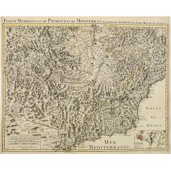
Partie Meridionale du Piemont et du Monferrat . . . plusieurs Cartes..
Large, detailed map of Valle d'Aosta and most part of Piedmont. Includes illustrated topography with notations about towns, roads, passes, mountains, etc. Relief shown pi...
Date: Amsterdam, c. 1745
Selling price: ????
Please login to see price!
Sold
Partie Septentrionale du Duche de Bourgogne . . .
Large, detailed map of northern Burgundy, covering the region from Bar-sur-Seine in the North to Dijon and Auxonne in the South East. Shows many villages, towns, roads an...
Date: Amsterdam, ca. 1745
Selling price: ????
Please login to see price!
Sold
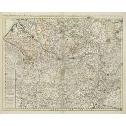
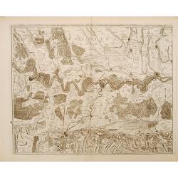
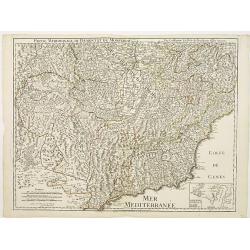
Partie meridionale de Picardie dressee sur les operations geometriques de Mrs. Lesperson & de Rousseville et sur plusieurs autres memoires Par Guillaume Del'isle . . .
Engraved map of the Picardie region in northern France. Urban areas in color. Relief is shown pictorially. Shows forests, Roman roads, churches, abbeys by religious order...
Date: Amsterdam, 1745
Selling price: ????
Please login to see price!
Sold in 2009
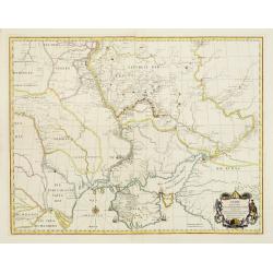
Gouvernement Général de L'Isle de France . . .
A fine engraved map centered on Paris metropolitan area and its vicinities in the Isle de France region. Decorative title and scale cartouches.The map is from a Dutch edi...
Date: Paris, ca. 1745
Selling price: ????
Please login to see price!
Sold in 2012
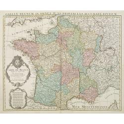
Carte De France Dressée pour l'usage du Roy. . .
Beautifully engraved, detailed general map of France, illustrating towns, roads, rivers, forests, etc. Embellished by two decorative cartouches: a title cartouche surmoun...
Date: Amsterdam, c. 1745
Selling price: ????
Please login to see price!
Sold
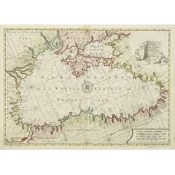
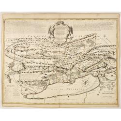
Pontus Euxinus of niewe en Naaukeurige paskaart van de Zwarte Zee. . .
Beautifully engraved map of the Black Sea prepared by Willem Witsen. This is the rare Ottens edition, where the address of Renard is replaced by the address of R. and J. ...
Date: Amsterdam, 1745
Selling price: ????
Please login to see price!
Sold in 2010
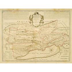
Tabula geographica exhibens regnum Sclavoniae. . .
Detailed copper-engraved map of Slavonia, the region in eastern Croatia. Belgrade to the east with the Danube, with the Sava a right side tributary of the Danube river.Ma...
Date: Nuremberg, 1745
Selling price: ????
Please login to see price!
Sold in 2011
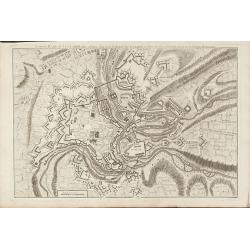
Nouveau Plan de Luxembourg
A rare plan of Luxembourg by Le Rouge. Showing the fortified city with the adjacent streets, title on top.
Date: Paris, 1745
Selling price: ????
Please login to see price!
Sold in 2010
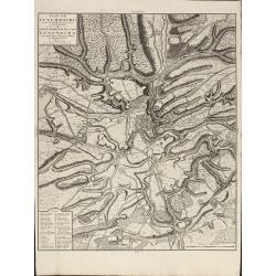
Plan de Luxembourg de ses Nouvelles Fortifications et de ses Environs
A large, scarce of Luxembourg by Covens & Mortier. Based on an earlier Jaillot map. Including a key showing 41 place names. Printed on heavy paper.
Date: Amsterdam, 1745
Selling price: ????
Please login to see price!
Sold in 2010
Plan de Genes
A rare plan of Genoa by Le Rouge. Showing the fortified city with the adjacent streets, title on top, key on the right. Decorated with a compass rose.
Date: Paris, 1745
Selling price: ????
Please login to see price!
Sold in 2011
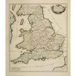
Le royaume d'Angleterre divisé en Comte et Baronies. . .
Fine map of England and Wales. As well as country details, including the main post roads. Le Rouge was active from 1740- till 1780 as a publisher, and was appointed engin...
Date: Paris, 1745
Selling price: ????
Please login to see price!
Sold in 2011
Carte des Comtéz de HAINAUT de NAMUR et de CAMBRESIS.
Map of the region of Mons, Maubeuge, Valencienes in the North of France and Namen and Huy in Belgium.Philippe Buache de la Neuville was born in Neuville-en-Pont (France) ...
Date: Paris, 1745
Selling price: ????
Please login to see price!
Sold in 2020
Graeciae Antiquae Tabula Nova . . .
Finely detailed map of Greece, Crete and the southeastern coast of Asia Minor based on a 1707 map by de L'Isle, and later republished by Buache in 1745. Cities, villages,...
Date: Paris, 1745
Selling price: ????
Please login to see price!
Sold in 2010
![Cartes Des Courones Du Nord Qui Comprend les Royaumes de Danemark, Suede & Nowege, &c.. [together with] Seconde Carte des Courones du Nord..](/uploads/cache/29997-250x250.jpg)
Cartes Des Courones Du Nord Qui Comprend les Royaumes de Danemark, Suede & Nowege, &c.. [together with] Seconde Carte des Courones du Nord..
Large, highly detailed two sheet map of Scandinavia. Beautifully engraved with a decorative title cartouche and 2 compass roses.Shows illustrated topography with roads, r...
Date: Amsterdam c. 1745
Selling price: ????
Please login to see price!
Sold in 2010
Carte Du Royaume de Danemarc.
Beautifully engraved, highly decorative map showing all of Denmark and southern Sweden, extending north to Warberg.The map is from a Dutch edition of De L'Isle's work ent...
Date: Amsterdam, c. 1745
Selling price: ????
Please login to see price!
Sold in 2011
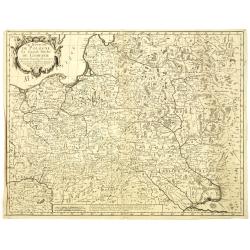
Le Royaume de Pologne, Le Grand Duché de Lithuanie suivant les nouvelles Observations.
Rare map of Poland. Le Rouge, who was lieutenant in the regiment of Saxe before establishing himself as publisher, compiler and editor of maps at the rue des Grands Augus...
Date: Paris, 1745
Selling price: ????
Please login to see price!
Sold in 2010