Browse Listings in Europe
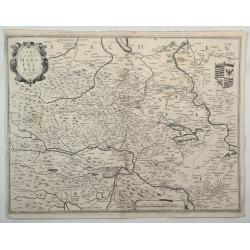
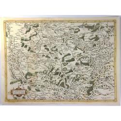
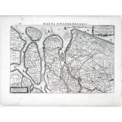
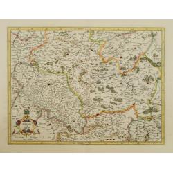
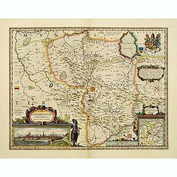
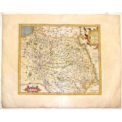
Comitatus Mansfeldia.
A copper engraved map of Saxony-Anhalt by Hondius. It features a decorative cartouche, a coats-of-arms and a mileage scale. Showing the area between Halle a. d. Saale, As...
Date: Amsterdam, 1630
Selling price: ????
Please login to see price!
Sold in 2022
![[Lot of 7 maps/ views of Achaia, Greece.] Achaiae Nova accurata Descriptio. Autore L. Laurenbergio.](/uploads/cache/20638-(1)-250x250.jpg)
[Lot of 7 maps/ views of Achaia, Greece.] Achaiae Nova accurata Descriptio. Autore L. Laurenbergio.
Johannes Laurenberg’s uncommon and very decorative map of Achaia. Embellished with two large cartouches. Johannes Janssonius, the great rival of Willem Blaeu, was the s...
Date: Amsterdam, c. 1630
Selling price: ????
Please login to see price!
Sold in 2022
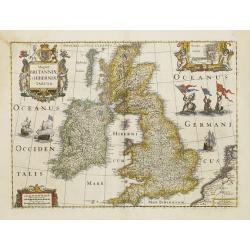
Magnae Britanniae et Hiberniae Tabula.
A finely engraved, boldly embellished map of the British Isles from the most important Dutch map publishers of the 17th century, densely packed with information.It includ...
Date: Amsterdam 1631
Selling price: ????
Please login to see price!
Sold
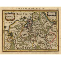
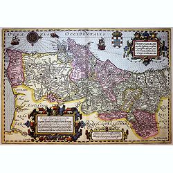
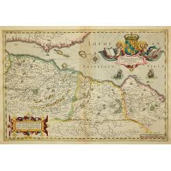
Westphalia Cum Diocesi Bremensi.
Map depicting a part of Germany with Bremen and Emden. Decorated with a small strapwork title cartouche. German text on verso.
Date: Amsterdam, 1631
Selling price: ????
Please login to see price!
Sold
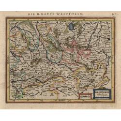
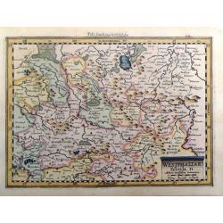
Westphalia tabula II
This little map covers part of North Rhein-Westphalia north of the Lippe River, with southern portions of Lower Saxony as far as Meppen and Diepholz. The strapwork title ...
Date: Amsterdam, 1631
Selling price: ????
Please login to see price!
Sold
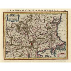
Walachia Servia, Bulgaria, et Romania.
Small map of the Eastern Balkans centered on Bulgaria. Includes the Bosphorus and Constantinople. Adorned with decorative title and distance scale cartouches. German text...
Date: Amsterdam, 1631
Selling price: ????
Please login to see price!
Sold
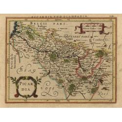
Picardia.
Fine small map reduced from Jansson's folio map of this historic region including the cities of Abbeville, Amiens, Cambrai, Laon, and Compiegne. Fully engraved with citie...
Date: Amsterdam, 1631
Selling price: ????
Please login to see price!
Sold
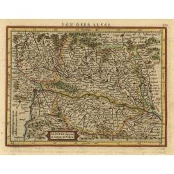
Alsatia superior cu Suntgoia & Brisboia.
Handsome map covering the Alsace region and the course of the Rhine River from Basel to Strasburg. North is oriented to the right. German text on verso.
Date: Amsterdam, 1631
Selling price: ????
Please login to see price!
Sold
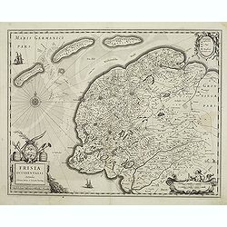
Frisia occidentalis.
Finely engraved map of the northern part of the Netherlands. The map has no text on the verso and is a very good and dark impression, indicating the map originates from t...
Date: Amsterdam, 1631
Selling price: ????
Please login to see price!
Sold in 2013
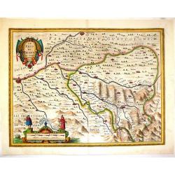
Lorraine, Vers le Midy
A detailed map of Lorraine, published by Le Clerc, based on a map by Mercator. The map is from Le Clerc's "Theatre Geographique du Royaume de France". It is sig...
Date: Paris, 1631
Selling price: ????
Please login to see price!
Sold in 2016
GALLIAE supra omnes ... exactissima descriptio. auctore Henrico Hondio . . .
Fine decorative map of France, including present-day Belgium. Jodocus Hondius Jr. planned to produce a new modern atlas less dependent on the Mercator plates that his fat...
Date: Amsterdam, 1631
Selling price: ????
Please login to see price!
Sold in 2019
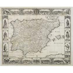
Portugalliae que olim Lusitania...
The best-known map of Portugal, after Alvares Secco (1560), orientated west to the top of the sheet. Secco's map was copied by many mapmakers and publishers for upwards o...
Date: Amsterdam, 1631
Selling price: ????
Please login to see price!
Sold in 2018
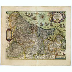
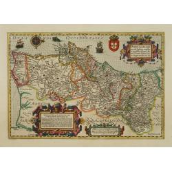
Novus XVII Inferioris Germaniae Provinciarum Typus.
One of the most decorative maps of present day Netherlands, Belgium and Luxembourg.With the signature of "Willem Jansz. op't Water in de Vergulde Zonnewyzer."Su...
Date: Amsterdam, ca. 1631
Selling price: ????
Please login to see price!
Sold in 2018
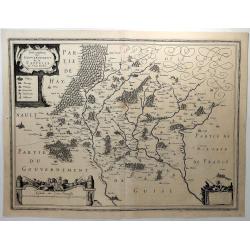
Description du Gouvernement de la Cappelle.
A decorative map of Cappellein, in the region of the Nord-Pas-de-Calais in France. Features three figural decorative cartouches.Pierre Petit Bourbon (1598-1667) was a Fre...
Date: Amsterdam, 1631
Selling price: ????
Please login to see price!
Sold in 2018
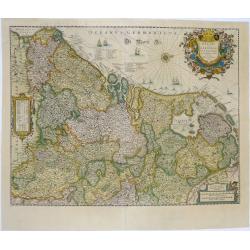
Belgii Sive Germaniae Inferioris accuratissima tabula.
Wonderful and detailed map with the title cartouche in the shape of a shield surrounded by the coats of arms of the XVII Provinces and the names of the Provinces in a ban...
Date: Amsterdam, 1631
Selling price: ????
Please login to see price!
Sold in 2019
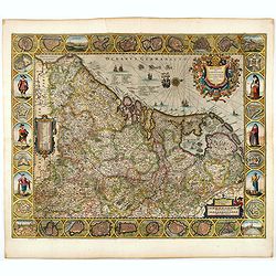
Belgii sive Germaniae Inferioris accuratissima tabula.
Very rare and very decorative map with in the right and left borders costumed figures and town plans alternately. In top and bottom border town plans and views.Separate p...
Date: Amsterdam, 1631
Selling price: ????
Please login to see price!
Sold in 2024
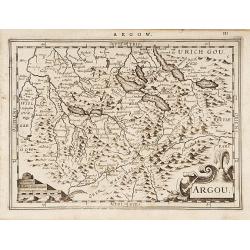
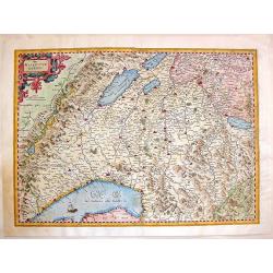
Argou.
Finely engraved map including the towns of Lucerne, Bern and Thuner- and Lucerner See.A profusion of place names and a nice title cartouche. From the scarce first Dutch e...
Date: Amsterdam 1632
Selling price: ????
Please login to see price!
Sold
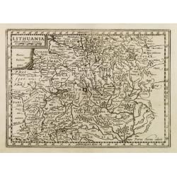
Lithuania.
Early map of Lithuania. No text on verso. Engraved by Petrus Kaerius.
Date: Amsterdam, 1632
Selling price: ????
Please login to see price!
Sold in 2009
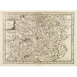
Lithuania.
Early map of Lithuania. With French text on verso. Engraved by Petrus Kaerius.
Date: Amsterdam, 1632
Selling price: ????
Please login to see price!
Sold in 2008
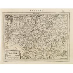
Polonia.
Early map of Poland. With Latin text on verso.
Date: Amsterdam, 1632
Selling price: ????
Please login to see price!
Sold in 2009
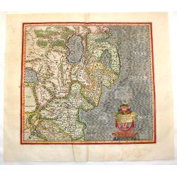
![Lithuania. [Lithuanie.]](/uploads/cache/22805-250x250.jpg)
Lithuania. [Lithuanie.]
Early map of present-day Poland and Lithuania. The map is fully engraved with rivers, lakes, forests and mountains and scores of place names. The Baltic is filled with a ...
Date: Amsterdam, 1632
Selling price: ????
Please login to see price!
Sold in 2010
Novissima Tabula Insular, Dordracensis, Alblasser, Crimper, Clundert etc...
A small, highly detailed map of Southern Holland published by Henricus Hondius(fl. 1624-1651) based on the survey by Floriszoon van Berckenrode. Includes the cities of Br...
Date: Amsterdam, 1632
Selling price: ????
Please login to see price!
Sold in 2010
Novissima Delflandiae, Schielandiae et circumiacentium insularum ut Voornae, Overflackeae, Goeree, Iselmonde aliarumque tabula.
A small, highly detailed map of Southern Holland published by Henricus Hondius(fl. 1624-1651) based on the survey by Floriszoon van Berckenrode. Includes the cities of Ro...
Date: Amsterdam, 1632
Selling price: ????
Please login to see price!
Sold in 2010
Totius Hollandiae Septentrionalis vulgo Westfrisiae novissima tabula. . .
A small, highly detailed map of Northern Holland, including the Westfrisia region, published by Henricus Hondius(fl. 1624-1651) based on the survey by Floriszoon van Berc...
Date: Amsterdam, 1632
Selling price: ????
Please login to see price!
Sold in 2010
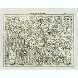
Tuscia.
An attractive, detailed and early map of Tuscany region from the rare Cloppenburg edition slightly larger format and more scarce edition of the Mercator/Hondius "Atl...
Date: Amsterdam, 1632
Selling price: ????
Please login to see price!
Sold in 2012
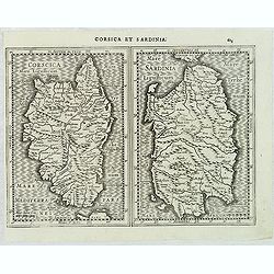
Corsica. / Sardinia.
An attractive, detailed and early maps of the islands of Corsica and Sardinia from the rare Cloppenburg edition slightly larger format and more scarce edition of the Merc...
Date: Amsterdam, 1632
Selling price: ????
Please login to see price!
Sold in 2012
Westphaliae, Tabula II, Miliaria Westfalica Communia.
Fine map by Gerard Mercator from "ATLAS MINOR". Engraved by Peter Kaerius in 1632 in Amsterdam.
Date: Amsterdam, 1632
Selling price: ????
Please login to see price!
Sold in 2016
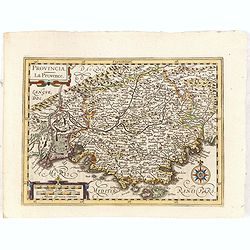
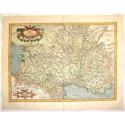
Provincia.
Early map of Southern France. With Latin text on verso. Engraved by Petrus Kaerius. Shortly after the publication of big folio-atlases the need was apparently felt for a ...
Date: Amsterdam, 1632
Selling price: ????
Please login to see price!
Sold in 2015
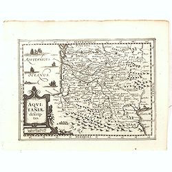
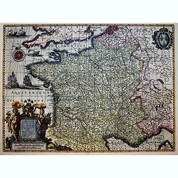
Aquitaniae Descriptio.
Early map of South western France. With Latin text on verso. Engraved by Petrus Kaerius. Shortly after the publication of big folio-atlases the need was apparently felt f...
Date: Amsterdam, 1632
Selling price: ????
Please login to see price!
Sold in 2015
Burgundiae Comitatus Franche comte.
North to the east. Part of France and Switzerland. With Latin text on verso. Engraved by Petrus Kaerius. Shortly after the publication of big folio-atlases the need was a...
Date: Amsterdam, 1632
Selling price: ????
Please login to see price!
Sold in 2018
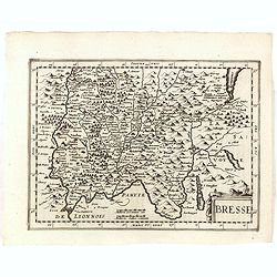
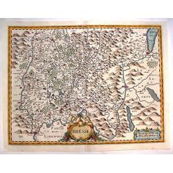
Bresse.
Early map of Eastern France and part of Switzerland. Geneva in upper right corner. With Latin text on verso. Engraved by Petrus Kaerius. Shortly after the publication of ...
Date: Amsterdam, 1632
Selling price: ????
Please login to see price!
Sold in 2018
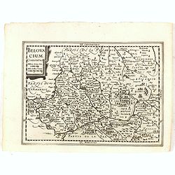
Belovacium comitatus.
Early map centered north of Paris. With Latin text on verso. Engraved by Petrus Kaerius. Shortly after the publication of big folio-atlases the need was apparently felt f...
Date: Amsterdam, 1632
Selling price: ????
Please login to see price!
Sold in 2018
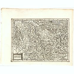
Lorraine Vers Le Midi.
Early map of Lorraine. With Latin text on verso. Engraved by Petrus Kaerius. Shortly after the publication of big folio-atlases the need was apparently felt for a smaller...
Date: Amsterdam, 1632
Selling price: ????
Please login to see price!
Sold in 2018
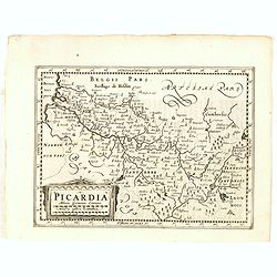
Picardia.
Early map of Northern France. With Latin text on verso. Engraved by Petrus Kaerius. Shortly after the publication of big folio-atlases the need was apparently felt for a ...
Date: Amsterdam, 1632
Selling price: ????
Please login to see price!
Sold in 2018
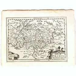
L'Isle de France..
Early map of Paris and surroundings. With Latin text on verso. Engraved by Petrus Kaerius. Shortly after the publication of big folio-atlases the need was apparently felt...
Date: Amsterdam, 1632
Selling price: ????
Please login to see price!
Sold in 2018
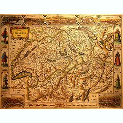
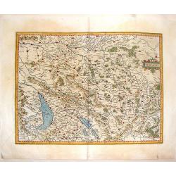
Nova Helvetiae Tabula.
A most decorative map with panoramic views of Lucerne, S.Gal, Bern, Solothurn, Schaffhausen in upper border and Basel and Zurich in lower left and right hand corner. In t...
Date: Amsterdam, 1632
Selling price: ????
Please login to see price!
Sold in 2016
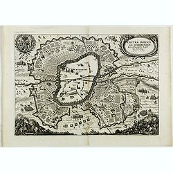
Castra Suecica ad Norimbergam. Kön. Schwedische Läger zu Nürnberg.
Nice print published by Mathias Merian publishing house. The Merian Journal presents the comprehensive defensive measures ordered by the Swedish king Gustav Adolf. Nuremb...
Date: Frankfurt, 1632
Selling price: ????
Please login to see price!
Sold in 2018
Belgicarum Provinciarum Descriptio. Gedruckt te Haerlem. . .
Very rare 2nd state of the map of the Low Countries, first published by Johannes and Baptist van Doetecum, in Haarlem 1588. This state of the map was only discovered in 1...
Date: Amsterdam, 1588/ The Hague, Henricus Hondius, 1632
Selling price: ????
Please login to see price!
Sold in 2019
Patriarchatus Romanus . . .
A rare map of the Roman Empire, extending from North Africa to Great Britain and east to the Balkans, adorned with a beautiful cartouche with 2 mermaids. From Melchior Ta...
Date: Paris, 1632
Selling price: ????
Please login to see price!
Sold in 2021
Hispaniae nova describtio..
Map of Spain and Portugal. Engraved by Petrus Kaerius.
Date: Amsterdam 1633
Selling price: ????
Please login to see price!
Sold
Corsica et Sardinia.
Early depiction of the two islands, each with their own titles and scale-bars. A number of place-names and with mountains in relief appearance.Mercator was born in Rupelm...
Date: Amsterdam 1633
Selling price: ????
Please login to see price!
Sold
Cambriae Typus..
Ancient map of Wales, prepared by Humphrey Lhuyd. With fine cartouche, part of a compass-rose and a sea monster.
Date: Amsterdam 1633
Selling price: ????
Please login to see price!
Sold
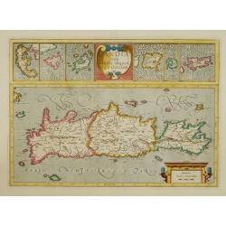
Candia cum insulis aliquot..
Early map of Crete, Greece. With inset maps in top of Corfu, Zante, Milo, Nicosia, Santorini and Scarpanto.
Date: Amsterdam 1633
Selling price: ????
Please login to see price!
Sold
Polonia et Silesia.
Mercator was born in Rupelmonde in Flanders and studied in Leuven under Gemma Frisius, Dutch writer, astronomer and mathematician. The excellence of his work brought him ...
Date: Amsterdam 1633
Selling price: ????
Please login to see price!
Sold
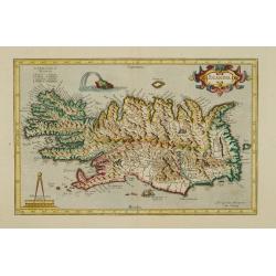
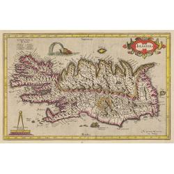
Islandia.
A very nice map from Iceland showing a sea monster and exploding volcano.Mercator was born in Rupelmonde in Flanders and studied in Leuven under Gemma Frisius, Dutch writ...
Date: Amsterdam 1633
Selling price: ????
Please login to see price!
Sold
Portugalliae que olim Lusitania..
The best-known map of Portugal, after Alvares Secco (1560), orientated west to the top of the sheet. Secco's map was copied by many mapmakers and publishers for upwards o...
Date: Amsterdam 1633
Selling price: ????
Please login to see price!
Sold
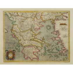
Graeciae.
Mercator's fine map of Greece, based on Nikolaus Sophianos (1500-1552).
Date: Amsterdam 1633
Selling price: ????
Please login to see price!
Sold
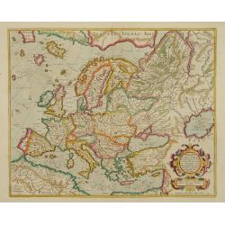
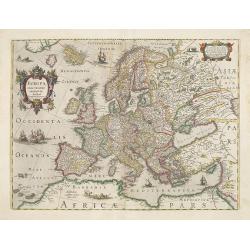
Europa, ad magnae Europae Gerardi Mercatoris..
General map of Europe by one of the greatest mapmakers.
Date: Amsterdam 1633
Selling price: ????
Please login to see price!
Sold
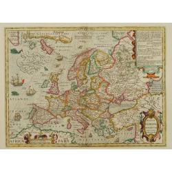
Nova Europae Descriptio.
Very decorative map of Europe decorated with many ships and sea monsters.
Date: Amsterdam 1633
Selling price: ????
Please login to see price!
Sold
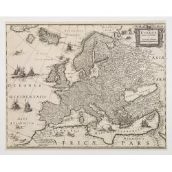
Europa recens descripta à Guilielmo Blaeuw.
During the printing process the figured borders have been covered. No text on verso. There exists a continent map of the Americas and Asia which has been printed in the s...
Date: Amsterdam 1633
Selling price: ????
Please login to see price!
Sold
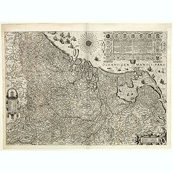
Osnabrugensis episcopatus.
A beautiful map of Münster centered on the city of Osnabruck. Prepared by Joannes Michael Gigas (1580-1650+), a doctor, mathematician and geographer. Showing an inset wi...
Date: Amsterdam, 1633
Selling price: ????
Please login to see price!
Sold in 2017
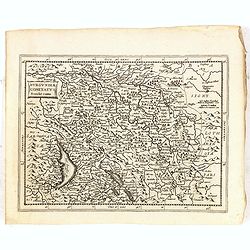
Bresse
Detailed map of Bresse in the Burgundy region of France. French text describing Bresse is on verso. Large decorative cartouche. From Atlas, das ist, Abbildung der Gantzen...
Date: Amsterdam, 1633
Selling price: ????
Please login to see price!
Sold in 2013
A New Description of the Shyres Lothian and Linlitquo. Be T.Pont.
A Scottish clergyman, Timothy Pont's survey of Scotland of 1595-1608 made that country the best mapped in the world. However it was not until Blaeu issued the maps as Vol...
Date: Amsterdam, 1633
Selling price: ????
Please login to see price!
Sold in 2011
Europa exactissime descripta.
Very decorative map of Europe decorated with many ships and sea monster. Dated 1631.
Date: Amsterdam, 1633
Selling price: ????
Please login to see price!
Sold in 2009
Islandia.
A very nice map from Iceland showing a sea monster and exploding volcano.Mercator was born in Rupelmonde in Flanders and studied in Leuven under Gemma Frisius, Dutch writ...
Date: Amsterdam, 1633
Selling price: ????
Please login to see price!
Sold in 2009
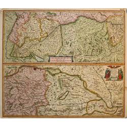
Maximi Totius Europae Fluminis Danubii
Two copper engraved maps on one sheet that detail the flow of the Danube from its source in Germany near the Boden See (Lake Constance) to Belgrade. Very fine detail alon...
Date: Amsterdam, 1633
Selling price: ????
Please login to see price!
Sold in 2009
Nova et accurata Tabula Hispaniae . . .
An extremely rare "carte à figures" map of Spain and Portugal. Second state. The map shows the geographical image introduced by Hessel Gerritsz's 1612 wall map...
Date: Amsterdam, 1633
Selling price: ????
Please login to see price!
Sold in 2009
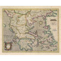
Graeciae.
Mercator's fine map of Greece, based on Nikolaus Sophianos (1500-1552).
Date: Amsterdam, 1633
Selling price: ????
Please login to see price!
Sold in 2022
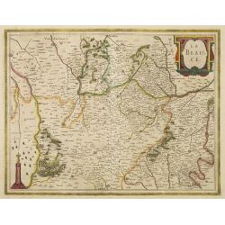
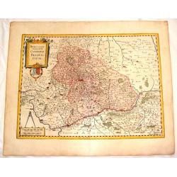
La Beauce.
A very decorative map with beautiful title cartouche of the Beauce region of France - flanked by Paris on the Seine to the north and Orleans on the Loire to the south. A ...
Date: Amsterdam, 1633
Selling price: ????
Please login to see price!
Sold in 2012
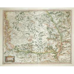
Lorraine, vers le Midy.
Copper-engraving, Decorative map showing the center of the Lorraine. The map provides an enormous amount of place names, small villages, and towns. As well rivers, lakes,...
Date: Amsterdam, 1633
Selling price: ????
Please login to see price!
Sold in 2012
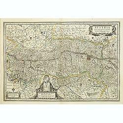
Austria Archiducatus auctore Wolfgango Lazio.
Showing the Danube and its cities. Bordering Bohemia, Moravia, Salzburg, Corinthian and Styria. Vienna is prominently featured and the map is filled with villages, cities...
Date: Amsterdam, 1633
Selling price: ????
Please login to see price!
Sold in 2012
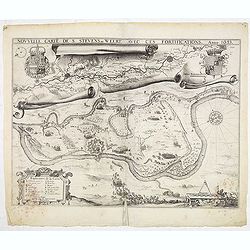
Nouvelle carte de S. Stevens=Weert avec ces fortifications. Anno 1633.
A very rare map of the siege of Stevensweert. In upper part a second map of the river Maas from Maastricht until Venlo. Prepared P. Chatel and F. Boullain, engraved by A....
Date: Brussels, 1633
Selling price: ????
Please login to see price!
Sold in 2015
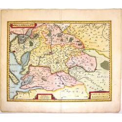
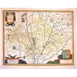
Carte du Pais de Xaintonge.
Decorative copperplate map of the Xaintonge region of France extending from the Atlantic Ocean (La Rochelle, Ille Oleron) to the River Tardoire in the department of Poito...
Date: Amsterdam, 1633
Selling price: ????
Please login to see price!
Sold in 2016
Das Wiflispur Gergov.
This fine copperplate map of Switzerland features the region north east of Geneva. It is decorated by a fancy belted title cartouche and a ship. It is from "Atlas, d...
Date: Amsterdam, 1633
Selling price: ????
Please login to see price!
Sold in 2013
Ultoniae Orientalis Pars.
Early map featuring the Down & Antirm counties of Northern Ireland. Interesting, decorative combination title / scale cartouche and the sea is in moire pattern. Frenc...
Date: Amsterdam, 1633
Selling price: ????
Please login to see price!
Sold in 2015
Miliaria Burgundie Comitatus Commonia.
Fine 381 year old map of Franche Comte (France & Switzerland) including detail of cities,mountains, rivers, lakes and trees. Small decorative combination title & ...
Date: Amsterdam, 1633
Selling price: ????
Please login to see price!
Sold in 2015
France, Picardie, Champaigne cum Regionibus Adiacentibus.
Pleasant copperplate map of Picardie-Champagne featuring matching chain title & scale cartouches. Notice the crow perched on the title cartouche.Gerard Mercator (1512...
Date: Amsterdam, 1633
Selling price: ????
Please login to see price!
Sold in 2015
Aquitania Australis Regnu Arelatense Cum Consinijs.
Map of Southern France (from the Pyrenees to Monaco),featuring Auvergne, Bourgogne, Limousine, Provence and Languedoc. Decorated with two matching strapwork cartouches (...
Date: Amsterdam, 1633
Selling price: ????
Please login to see price!
Sold in 2013
Le Pais de Bearn, avec Privilege du Roy.
Handsome copperplate map of Southern France featuring the Bearn region. The major cities shown include Bayonne, Oloron, St. Esprit, Pau, Orthes etc. The Pyrenese Mountain...
Date: Amsterdam, 1633
Selling price: ????
Please login to see price!
Sold in 2014
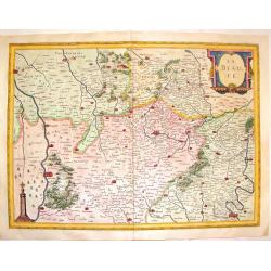
Description du Blaisois, Anno 1630.
Superb copperplate map of the Blois region of France with THREE very fancy cartouches. The title and scale cartouches have faces of monsters. The map features the Loire R...
Date: Amsterdam, 1633
Selling price: ????
Please login to see price!
Sold in 2016
Totius Lemovici et Confinium Provinciarum.
A very decorative map of Limoge, France prepared by Jean du Fayen featuring FOUR lovely cartouches. The cartouche in the upper right corner shows a bird's-eye view of Lim...
Date: Amsterdam, 1633
Selling price: ????
Please login to see price!
Sold in 2015
Beauvaisis Comitatus Belovacium.
Pleasing map of the Beuavais region of France. Decorative title cartouche with royal arms and drapery style scale cartouche with comapass. Gerard Mercator (1512-1594) wa...
Date: Amsterdam. 1633
Selling price: ????
Please login to see price!
Sold in 2016
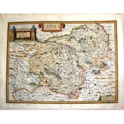
Biturigum, le Duche de Berry.
Fine detailed copper engraving of the Duchy of Berry including the cities of Nancy, Bourges and St. Marceau. Three decorative cartouches including a rare castle cartouche...
Date: Amsterdam, 1633
Selling price: ????
Please login to see price!
Sold in 2015
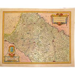
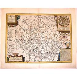
Gastinois et Senonois.
Pleasant copperplate map of regional France with detailed presentation of rivers, lakes, cities towns and forests. Cities include Orleans, Montargis, Sens, Corbeil and Me...
Date: Amsterdam, 1633
Selling price: ????
Please login to see price!
Sold in 2016
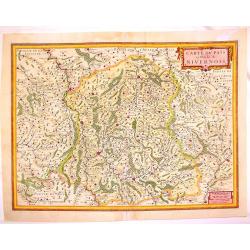
Carte du Pais et Duche de Nivernois.
Fin e map of the Duchy of Nivernois in the Burgogne region of France. Fully detailed with cities, towns, mountains, rivers, lakes and forests. Features tht towns of Bourg...
Date: Amsterdam, 1633
Selling price: ????
Please login to see price!
Sold in 2013
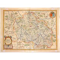
Bourbonois Borbonium Ducatus.
Fine copper engraved map of the Bourbonois region of France. The map shws the Loire River and the cities of Rendan, Moulins, bourbon, Nevers and Brulles. The title/scale ...
Date: Amsterdam, 1633
Selling price: ????
Please login to see price!
Sold in 2013
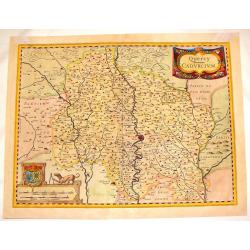
Quercy Cadurcium.
Striking map of the Quercy region of France. The major city is Caors or Cahors. There are two truly remarkable cartouches including the scale cartouche featuring a dog wi...
Date: Amsterdam, 1633
Selling price: ????
Please login to see price!
Sold in 2016
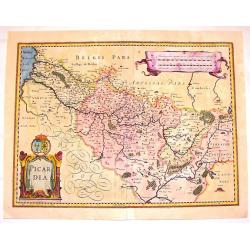
Picardia.
Attractive hand-colored, copper engraved map of Picardie, the most northwestern region of France, bordering with Belgium. It features the cities of Amiens, Abbeville and ...
Date: Amsterdam, 1633
Selling price: ????
Please login to see price!
Sold in 2016
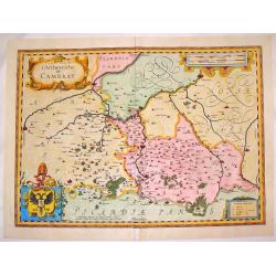
L'Archevesche de Cambray.
Beautiful hand-colored, decorative map of the Cambray region of France that features the cities of Cambray, Valencenne, Douay, and Bouchain. It has four cartouches, one i...
Date: Amsterdam. 1633
Selling price: ????
Please login to see price!
Sold in 2016
La Beauce.
Decorative, hand-colored, copperplate map featuring the Beauce Region of France.Showing miniature views of Paris, Orleans, Chartres, Oriens and Blois. Seine and Loire riv...
Date: Amsterdam, 1633
Selling price: ????
Please login to see price!
Sold in 2016