Browse Listings in America > North America > North Pole
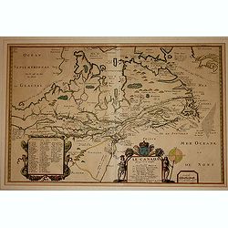
Le Canada faict par le St. de Champlain..
The fourth printed state of Champlain's 1616 plate of Canada. According to Wroth, Du Val somehow came into possession of the Champlain plate, printed a proof state, then ...
Place & Date: Paris, 1677
Selling price: $3700
Sold in 2012
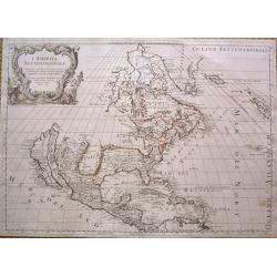
L'America Settentrionale.
Full title: 'L' America Settentrionale. Nuouamente corretta, et accresciuta secondo le relationi piu moderne, da GVGLIELMO SANSONE Geografe di S M Chrisftianis. E data in...
Place & Date: Rome, 1677
Selling price: $1700
Sold in 2015
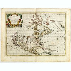
L' America Settentrionale. Nuouamente corretta, et accresciuta secondo le relationi piu moderne, da GVGLIELMO SANSONE. . .
Rossi's map of North America, based upon Sanson's seminal map, but with revised Italian nomenclature. Includes a detailed California as an Island on Sanson's model, and e...
Place & Date: Rome, 1677
Selling price: $1000
Sold in 2015
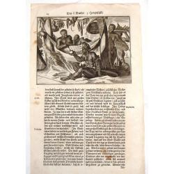
American Family at Rest.
Interesting map of a Native American family at rest. It gives an indication of dress, foods and customs. Olfert Dapper (1635 – 1689) was a Dutch physician and writer....
Place & Date: Amsterdam, 1681
Selling price: $20
Sold in 2015
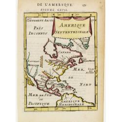
Amerique Septentrionale.
A charming late 17th century French map of North America, showing California to 40 degrees North and labelled I.Calfornie.
Place & Date: Paris 1683
Selling price: $110
Sold
Canada ou Nouvelle France.
A charming late 17th century French map of east coast of Canada and North America.Greenland drawn close to the Canadian coast. The Great Lakes are shown open-ended in the...
Place & Date: Paris, 1683
Selling price: $50
Sold
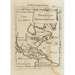
Amerique Septentrionale.
A charming late 17th century French map of North America, showing California to 40 degrees North and labelled I.Calfornie.
Place & Date: Paris, 1683
Selling price: $50
Sold in 2008
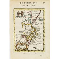
Canada ou Nouvelle France. (together with) United States.
A strange early depiction of the Eastern Seaboard, from Terres Arctiques Incognues to Virginie, including also an outline of the Great Lakes. Native Indians appear at the...
Place & Date: Paris, 1683
Selling price: $120
Sold in 2012
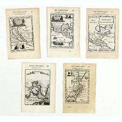
(Five maps of North American interest from Description de l\'Univers)
Finely etched maps entitled : Nouveau Mexique et Californie, Mexique et nouvelle Espagne, Amerique Septentrionale, De l'Amerique, Groenlande".From the French text ed...
Place & Date: Paris, 1683
Selling price: $275
Sold in 2015
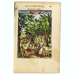
Hurons.
Attractive copper engraving, depicting Huron Indians or Wynadot / Wendat people hunting and gathering .
Place & Date: Paris, 1683
Selling price: $25
Sold in 2016