Search Listings matching "anville" in Atlases
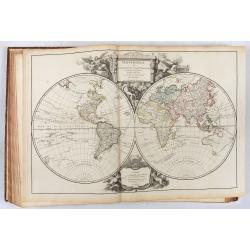
Atlas Universel Par M. Robert Geographe ordinaire du Roy
The first edition of one of the most important 18th-century atlases and one of the great achievements of the French Enlightenment and one of the first atlases based on sc...
Place & Date: Paris, 1757
Atlas in elephant folio.
Most of D'Anville's atlases were made up for the individual customer, so no two appear alike. Many of the 59 pages are multi-sheet maps, so the actual map sheet count is ...
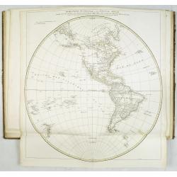
Place & Date: Paris, 1771-1786

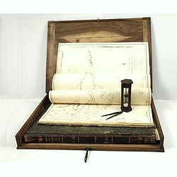
Neptune des Côtes Occidentales de France.
Large maritime atlas illustrated with a handwritten title, a table and 47 single or double page charts. The charts show the western coasts of France as well as the Spanis...
- $12000 / ≈ €10513
Place & Date: Paris, 1776-1822
J.Horsburgh/ R.H.Bate / G.H.Stapleton. The two chart books are bound in contemp. half calf, and include together 57 of the most up-to-date French (Depot général de la marine) and English (Hydrographic Office) charts available in 1847 for sailing t
BOOK 1 : Mainly charts by "Dépôt Général de la Marine" including 20 folding charts. The binding measuring 665x275mm, the charts mostly 595x910mm.1. Dépôt ...
- $50000 / ≈ €43804
Place & Date: Paris, London, Hong Kong, 1835 - 1849