Browse Listings in Asia > Tartary / Siberia

Homme-nord-est de l'Asie.
Originally hand-colored costume mezzotint of a man of Nord East Russia engraved by Félix Mixelle and Lachaussée Jeune after Jacques Grasset de Saint-Sauveur.As an etche...
- $25 / ≈ €23
Place & Date: Paris,1801-1806
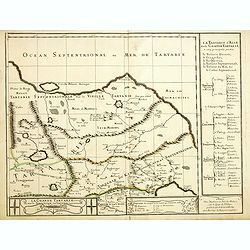
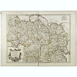
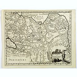
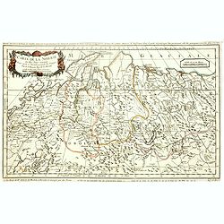
Grande Tartarie vers l'orient où sont le Turquestan, la Tartarie septentrionale, et la Tartarie du Kin. . .
Early edition of this rare map of Tartary which incorporates Turkestan (including East Turkestan), Greater Mongolia, Giacathai.The Great Wall is shown in the lower center...
- $750 / ≈ €702
Place & Date: Paris, 1677
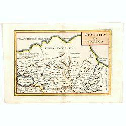
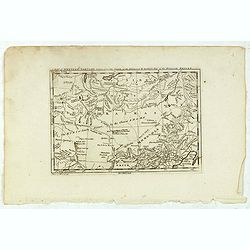
Scythia et Serica.
Covering the region between the Caspian and the Sea of China, much of which is Terra Incognita in the North and East. With title in upper right corner.Engraved by W.H.Tom...
Place & Date: London, 1755

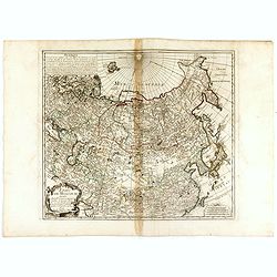
Siberie ou Russie Asiatique, Tartarie Chinoise, Pays des Eluts et Isles du Japon.
Map of the Kamchatka peninsula, Russian Far East., Korea, Japan, with Hokkaido labeled "Terre del Jeso".By C. F. Delamarche, successor of Robert de Vaugondy, Ge...
Place & Date: Paris, 1794 - 1806
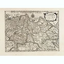
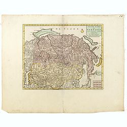
La grande Tartarie.
Map of Central Asia showing major cities, places and water bodies. Relief shown pictorially. Engraved by Anthony de Winter.
- $150 / ≈ €140
Place & Date: Amsterdam, Utrecht, ca. 1653
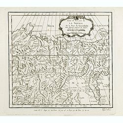
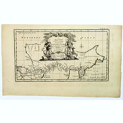
Suite de la carte de La Sibérie et le pays de Kamtschatka...
An interesting map of Siberia, with a view on Ochozk Sea. Prepared by Jacques Nicolas Bellin after Dutch sources and included in Prévost d' Exile's "Histoire des Vo...
- $75 / ≈ €70
Place & Date: Paris, 1738-1775
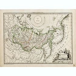
Sibérie avec l'Amérique Russe.
Prepared by Pierre Lapie and published by François Buisson and included in "Atlas Complet Du Precis De La Geographie Universelle De M. Malte-Brun". Engraved by...
- $120 / ≈ €112
Place & Date: Paris, 1812
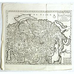
Nieuwe kaart van Tartarie.
A map of Tartary, Korea and part of Japan. The map is most notable for the confusion between Kamchatka and Iesso. Hokkaido labelled Compagnie LandReflecting the recent di...
- $250 / ≈ €234
Place & Date: Amsterdam, 1750
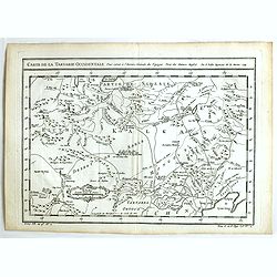
Carte de la Tartarie Occidentale.
An interesting map of Tartary and northeast Asia, from Lake Baykal, Partie du Siberia in the north, Pays des Kalkas at the center, as well as Desert de Sable, and down to...
- $95 / ≈ €89
Place & Date: Paris, ca. 1775
Nieuwe kaart van Tartarie. . .
A map of Tartary, Korea and part of Japan. Map place names in Korea are marked. The map is most notable for the confusion between Kamchatka and Jesso.Engraved by J.Keyser...
- $200 / ≈ €187
Place & Date: Amsterdam, 1731 / 1750
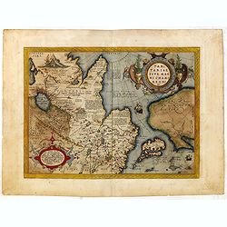
Tartariae sive Magni Chami Imperium.
This is a very early depiction of the northern Pacific, with the first mapping of Northwest Coast of America and probably the first map to name California 'C. Califormio'...
- $1750 / ≈ €1638
Place & Date: Antwerp, c. 1590
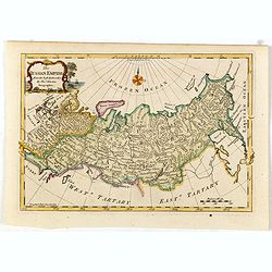
The Russian Empire, from the Best Authorities, by Thos. Kitchin, Geographer.
Showing the Asian part of Russia, with interesting note to a coast line north of Siberia "Land seen in 1723", likely referring to Vitus Bering (1681–1741), wh...
- $150 / ≈ €140
Place & Date: London, c. 1773
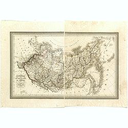
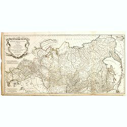
Carte Generale de la Russie d'Asie ou Siberie. Par L. Vivien, Geographe . . .
First edition, with a second edition in 1834 listed by Phillips. The map is well done, slightly smaller than the contemporary Brue and Lapie maps. Showing Asian part of R...
- $230 / ≈ €215
Place & Date: Paris, Ménard et Desenne, 1825
Tartaria.
An original early 17th century copper engraved miniature antique map of Tartary, China and part of America by Petrus Bertius.The title is displayed in a strap work cartou...
- $150 / ≈ €140
Place & Date: Amsterdam, J.Hondius, 1618
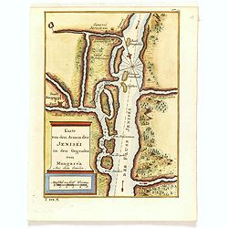
Karte von den Armen des Jeniséi in den Gegenden von Mangaséa Aus dem Gmélin.
Attractive and detailed map of Jenisëi River with the town of Mangasea in Siberia. The composition is nicely balanced with a large title and scale cartouche.
- $75 / ≈ €70
Place & Date: Leipzig, Arkstee & Merkus, 1746
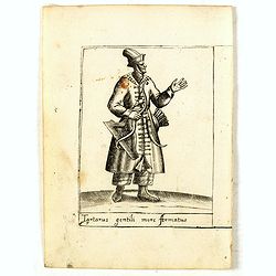
Tartarus gentili more Armatus.
Costume plate published by Pietro Bertelli in his "Diversarum nationum habitus", a sixteenth-century Italian costume book. The work was published with fold-out ...
- $60 / ≈ €56
Place & Date: Padua, 1589
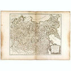
Troisième partie de la carte d'Asie, contenant la Sibérie, et quelques autres parties de la Tartarie. . .
Engraved map of Tartary on two sheets, with country boundaries in out line color. Includes geographic notes and ornamental cartouche by "H. Gravelot, invenit., DeLaf...
- $750 / ≈ €702
Place & Date: Paris, 1754
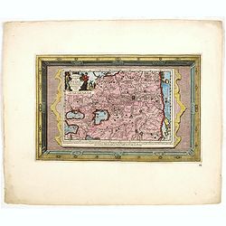
Naaukeurige Kaart Van Tartaryen . . .
This attractive map of Tartary is formed of two separate engravings, first is the map itself (23 x 16 cm) and second is the engraved framework border. Map detail extends ...
- $500 / ≈ €468
Place & Date: Amsterdam, 1713
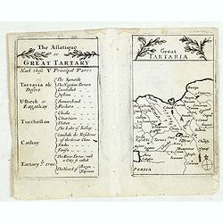
Lesser Tartaria.
A late seventeenth-century English map of Siberia / Tartary.A scarce little map with accompanying engraved text (94x55mm) from "Atlas Minimus, or, A book of geograph...
- $200 / ≈ €187
Place & Date: London, 1679
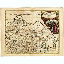
La Gran Tartaria divisa nelle sue parti pricipali da Giacomo Cantelli. . .
In upper right hand corner a large title cartouche with dedication to Tavernier and Thévenot. The cartographer was Giacomo Cantelli (1643-1695) who was active in Modena ...
Place & Date: Rome, 1683
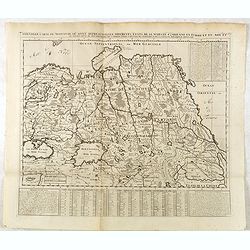
Nouvelle Carte de Moscovie où sont representés les differents etats de sa Maiesté Czarienne..
Map of Russia Tartary and part of China with key tables to the towns. Depicting the different states belonging to the Czar in Asia and Europe, showing the path of one of ...
- $200 / ≈ €187
Place & Date: Amsterdam, ca. 1732
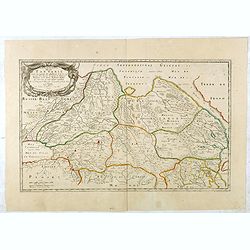
Description de la Tartarie. . .
Detailed map of Tartary, northern China and Korea as an island. The Caspian Sea in the utmost left. Numerous place-names of counties, cities, towns, physical features.Ala...
- $250 / ≈ €234
Place & Date: Paris, 1679

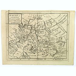
Great or Asiatick Tartary, Agreable to Modern History.
Map of Tartary to Peking. The eastern coastline of Asia is almost flat, with no attempt to mark Kamchatka.
- $275 / ≈ €257
Place & Date: London, 1727
Carte de Tartarie.
Covering north east Asia, Tibet, Korea and part of "Terre d'Eso". Nova Zembla joined with the mainland.With good detail in Korea, several cities a labeled: Ch...
- $300 / ≈ €281
Place & Date: Paris, 1706
A Map of Western Tartary Drawn from the Survey of the Jesuits and Mr. Kyrillow's Map of the Russian Empire.
Uncommon map of the Gobi Desert and the eastern portion of the Silk Route region by Thomas Kitchin. Covers from Lake Baikal in the north as far south as Beijing, east to ...
- $110 / ≈ €103
Place & Date: London, 1745-1747
A Map of Little Bochara, and the Adjacent Countrys Drawn from the Survey of the Jesuits and Mr. Kyrillows Map of the Russian Empire.
An uncommon map of the Gobi Desert and Bochara region. Engraved by Thomas Kitchin - with his signature in the lower bottom.From Astley, Thomas, "A New General Collec...
- $110 / ≈ €103
Place & Date: London, 1745-1747
Partie Orientale de l'Empire de Russie en Asie.. et les Confins de la Tatarie Chinoise. . .
Large map with mostly topographical detail of mountains, deserts, rivers and forests. Covers the region from Tomsk eastward and includes Sakhal from his "Atlas Unive...
Place & Date: Paris, 1750
ETATS DE MOSCOVIE.
A detailed map of the Russian Empire West to East from Poland, Finland to the Baring Strait and North to South from China to Spitzbergen. The Siberian coastline is based ...
Place & Date: Paris, 1744

Kamchatka according to A.Erman . . .
FIRST EDITION Map of the Kamchatka Peninsula, Siberia, from Gazetteer of the World. Drawn by Augustus Petermann, engraved by G. H. Swanston.
Place & Date: London / Edinburgh, 1850
![Calmuk Tartars from Isbrant Ides [ together with] Tartars from Isbr. Ides.](/uploads/cache/36951-250x250.jpg)
Calmuk Tartars from Isbrant Ides [ together with] Tartars from Isbr. Ides.
Two engravings on one sheet, taken from "A New General Collection of Voyages and Travels", printed for Thomas Astley. Engraved by Thomas Kitchin and N.Parr afte...
- $40 / ≈ €37
Place & Date: London, 1746
![Tartars of Koko Nor [ together with] Nothern Tartary Woman at Lafsa.](/uploads/cache/36952-250x250.jpg)
Tartars of Koko Nor [ together with] Nothern Tartary Woman at Lafsa.
Two engravings on one sheet, taken from "A New General Collection of Voyages and Travels", printed for Thomas Astley. Engraved by Thomas Kitchin and N.Parr afte...
- $45 / ≈ €42
Place & Date: London, 1746
![Uzbek Tartars [ together with] Eastern Tartars, from Nieuhof.](/uploads/cache/36953-250x250.jpg)
Uzbek Tartars [ together with] Eastern Tartars, from Nieuhof.
Two engravings on one sheet, taken from "A New General Collection of Voyages and Travels", printed for Thomas Astley. Engraved by Thomas Kitchin and N.Parr afte...
- $50 / ≈ €47
Place & Date: London, 1746

The Russian Empire in Europe and Asia . . .
Detailed map of the whole of Russia, extending from Poland to the Pacific and from Nova Zembla to Tartaria.The map is of interest for the use of Corea Gulf for the sea be...
Place & Date: London, 1790
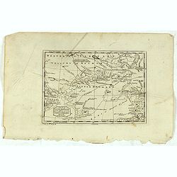
Scythia et Tartaria Asiatica.
A decorative and interesting eighteenth century map of Tartary and Scythia from an atlas first published in Leiden in 1624. Philipp Clüverius (1580–1623) was virtually...
- $125 / ≈ €117
Place & Date: Leiden, 1697
Great or Asiatick Tartary, Agreeable to Modern History.
A map from the Frozen Ocean in the north to Usbec Tartary in the south, from Moscow in the west to China Tartary and Peking in the east. Rivers and mountains feature prom...
- $125 / ≈ €117
Place & Date: London, ca. 1727
An exact chart of the countries through wich Capt. Behring travelled from Tobolsky capital of Siberia ti the country of Kamtschatka.
The earliest English language map to show Vitus Behring's Route.After retiring from a tour as Captain in the Czar's Navy, Behring, originally from Denmark, settled in Vyb...
- $200 / ≈ €187
Place & Date: London, 1744
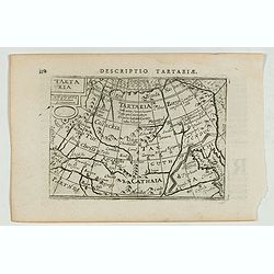
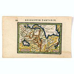
Descriptio Tartariae / Tartaria.
A rare miniature map of Tartary and China, showing the Great Wall. Title cartouche on the upper left corner.First published in 1598 in his Caert-Thresoor, the plates were...
- $300 / ≈ €281
Place & Date: Amsterdam, Cornelis Claes, 1606
Carte de la sibérie et des Pays voisins.
An interesting detailed map of Siberia, extending from the White Sea and the Caspian Sea in the west to Irkuckoi Province .Prepared by Jacques Nicolas Bellin after Dutch ...
- $50 / ≈ €47
Place & Date: Paris, 1738-1775
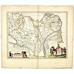
Tartaria sive Magni Chami Imperium.
Detailed and decorative map of Tartary and Northern part of China. Northern tip of Korea included. The Chinese Great Wall is depicted, with Central Asia, extending from M...
- $550 / ≈ €515
Place & Date: Amsterdam, 1645
![[Tartaria].](/uploads/cache/37427-250x250.jpg)
[Tartaria].
One text page with a woodcut map of Tartary. On verso, a woodcut of a horse and a figure holding a wipe, from Münster's Cosmographia Universalis.The Cosmographia by Seba...
- $80 / ≈ €75
Place & Date: Basle, ca. 1564