Browse Listings in Asia > Tartary / Siberia
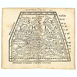
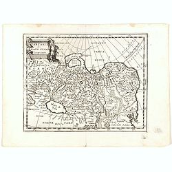
Scythia.
Woodblock engraved map covering the region between the Caspian and the Sea of China, much of which is Terra Incognita in the North and East. In 1546 Honter’s Cosmograph...
- $190 / ≈ €178
Place & Date: Zürich, 1546
![[Tartaria].](/uploads/cache/37427-250x250.jpg)
[Tartaria].
One text page with a woodcut map of Tartary. On verso, a woodcut of a horse and a figure holding a wipe, from Münster's Cosmographia Universalis.The Cosmographia by Seba...
- $80 / ≈ €75
Place & Date: Basle, ca. 1564
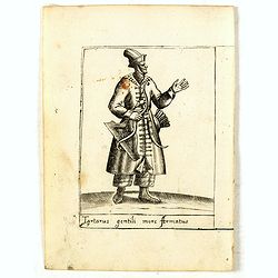
Tartarus gentili more Armatus.
Costume plate published by Pietro Bertelli in his "Diversarum nationum habitus", a sixteenth-century Italian costume book. The work was published with fold-out ...
- $60 / ≈ €56
Place & Date: Padua, 1589
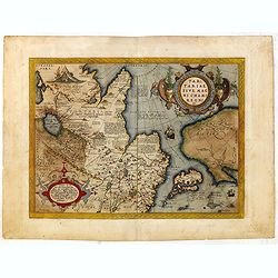
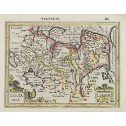
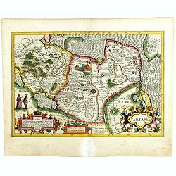
Tartariae sive Magni Chami Imperium.
This is a very early depiction of the northern Pacific, with the first mapping of Northwest Coast of America and probably the first map to name California 'C. Califormio'...
- $1750 / ≈ €1638
Place & Date: Antwerp, c. 1590
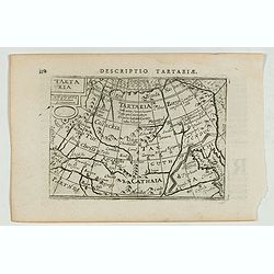
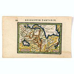
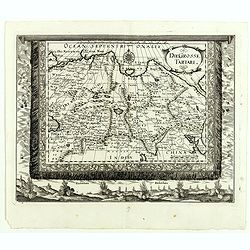
Descriptio Tartariae / Tartaria.
A rare miniature map of Tartary and China, showing the Great Wall. Title cartouche on the upper left corner.First published in 1598 in his Caert-Thresoor, the plates were...
- $300 / ≈ €281
Place & Date: Amsterdam, Cornelis Claes, 1606
Tartaria.
Very fine and decorative engraving showing China, Korea and the northern Pacific coast of America.The two continents are separated by the Straits of Anian. From the first...
- $100 / ≈ €94
Place & Date: Amsterdam, 1608
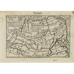
Tartaria.
A miniature map showing China, Korea and Russia. Title cartouche on the upper left corner.First published in 1598 in his Caert-Thresoor, the plates were executed by the m...
- $300 / ≈ €281
Place & Date: Amsterdam, 1609

Tartariae sive Magni Chami Imperium.
This is a very early depiction of the northern Pacific, with the first mapping of Northwest Coast of America and probably the first map to name California 'C. Califormio...
- $2500 / ≈ €2339
Place & Date: Antwerp, c. 1608-1612
Tartaria.
An original early 17th century copper engraved miniature antique map of Tartary, China and part of America by Petrus Bertius.The title is displayed in a strap work cartou...
- $150 / ≈ €140
Place & Date: Amsterdam, J.Hondius, 1618
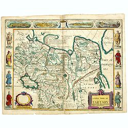
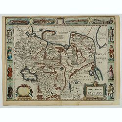
A newe mape of Tartary.
Early edition of one of the most decorative maps of Tartary, known for its figured borders with costume figures, while above are vignettes of the cities of Astrakhan, Sam...
- $2500 / ≈ €2339
Place & Date: London, 1627

A newe mape of Tartary.
Early edition of one of the most decorative "carte à figures"- map of Tartary, known for its figured borders with costume figures, while above are vignettes of...
Place & Date: London, 1627
Tartaria.
Published in Hondius' editions of the Mercator Atlas from 1606 onwards, showing China, Korea as an island, and the northern Pacific coast of America showing the two conti...
Place & Date: Amsterdam, 1633
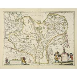
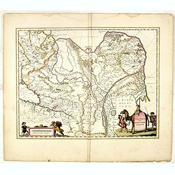
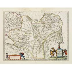
Tartaria sive Magni Chami imperium.
Detailed and decorative map of Tartary and Northern part of China. Northern tip of Korea included. The Chinese Great Wall is depicted, with Central Asia, extending from M...
- $500 / ≈ €468
Place & Date: Amsterdam, 1638
Tartaria sive Magni Chami Imperium.
A detailed and decorative map of Tartary and the northern part of China. The very northern tip of Korea included. The Chinese Great Wall is depicted, with Central Asia, e...
- $500 / ≈ €468
Place & Date: Amsterdam, 1644
Tartariae sive Magni Chami Imperium.
Fine map of Tartary, including northern part of China, and tip of Korea.
- $500 / ≈ €468
Place & Date: Amsterdam, 1645
Tartaria sive Magni Chami Imperium.
Detailed and decorative map of Tartary and Northern part of China. Northern tip of Korea included. The Chinese Great Wall is depicted, with Central Asia, extending from M...
- $550 / ≈ €515
Place & Date: Amsterdam, 1645
Tartaria sive Magnichami Imperiorum.
Stretching from the Caspian Sea in the west to the top of the island Korea . Decorated with finely engraved mountains and the Chinese wall.
- $175 / ≈ €164
Place & Date: Frankfurt, 1650
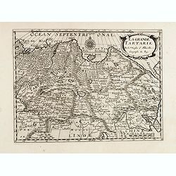
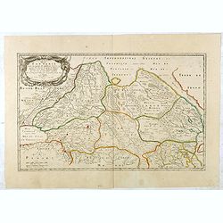
La grande Tartarie.
Map of Central Asia showing major cities, places and water bodies. Relief shown pictorially. Engraved by Anthony de Winter.
- $150 / ≈ €140
Place & Date: Amsterdam, Utrecht, ca. 1653
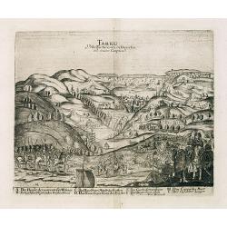
Tarku Urbs Tartaroum in Dagestan ad mare Caspium.
An early view of Tarku, in the Republic of Dagestan. From "Voyages en Moscovie, Tartarie et Perse, par Adam Olearius".Adam Olearius was a seventeenth-century G...
- $400 / ≈ €374
Place & Date: Paris, Abraham de Wicquefort , 1656
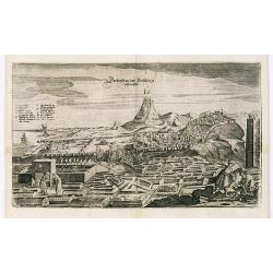
View of Derbendt an der Persischen Grentze.
An early view of Derbent, in the Republic of Dagestan. From "Voyages en Moscovie, Tartarie et Perse, par Adam Olearius".Adam Olearius was a seventeenth-century ...
- $400 / ≈ €374
Place & Date: Paris, Abraham de Wicquefort , 1656
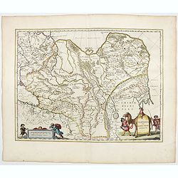
Tartaria sive Magni Chami imperium.
Detailed and decorative map of Tartary and Northern part of China, and the Chinese Great Wall is depicted. Including the Caspian Sea and the Volga River east as far as th...
- $575 / ≈ €538
Place & Date: Amsterdam, 1658
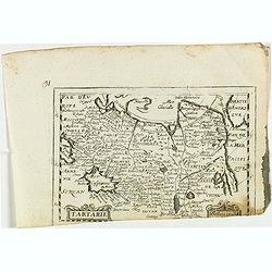
Tartarie. (20).
Scarce map of Tartary published by Antoine de Fer in 1661 or 1662 in "Cartes de géographie revues et augmentées". With number 20 in lower right bottom of the ...
- $100 / ≈ €94
Place & Date: Paris, Antoine de Fer, 1657 but 1661 or 1662

Noordoost Cust van Asia van Japan tot Nova Zembla.
Important for its early depiction of Hokkaido and the Islands to the North of Japan. Ships navigate the seas around the Siberian, Chinese and Japanese coast extending as ...
- $3000 / ≈ €2807
Place & Date: Amsterdam, 1666
Noordoost Cust van Asia van Japan tot Nova Zemla.
An eye-catching chart of Hokkaido and the Islands to the North of Japan. Ships navigate the seas around the Siberian, Chinese and Japanese coasts extending as far west as...
- $2500 / ≈ €2339
Place & Date: Amsterdam, 1666

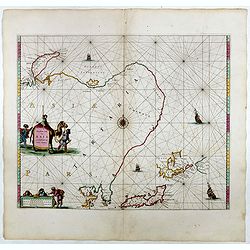
Noordoost Cust van Asia van Japan tot Nova Zemla.
An eye-catching chart of Japan, Hokkaido and the Islands to the North of Japan. In the lower left Korea and part of northern China. Korea has three names mentioned: "...
- $2000 / ≈ €1871
Place & Date: Amsterdam, 1666
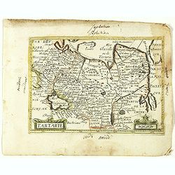
Tartarie.
Rare map of Tartary published by Jollain in 1667. In lower right corner Korea as a peninsular and part of America in upper right corner. Published in "Trésor Des Ca...
- $150 / ≈ €140
Place & Date: Paris, 1667

Impery sino Tartarici Supremus Monarcha.
Decorative costume plate showing Kam Hi son of the Shunzhi Emperor of China [1638 - 1661?], the second emperor of the Manchu Qing dynasty, who apparently supported the fo...
Place & Date: Amsterdam, 1668
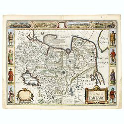
A newe mape of Tartary.
An early edition of one of the most decorative maps of Tartary, known for its figured borders with costume figures, while above are vignettes of the cities of Astrakhan, ...
- $2000 / ≈ €1871
Place & Date: London, 1676
A newe mape of Tartary.
One of the most decorative maps of Tartary, known for its figured borders with costume figures, while above are vignettes of the cities of Astrakhan, Samarkand and Cambal...
- $2000 / ≈ €1871
Place & Date: London, Bassett & Chiswell, 1627-1676
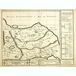
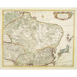
Grande Tartarie vers l'orient où sont le Turquestan, la Tartarie septentrionale, et la Tartarie du Kin. . .
Early edition of this rare map of Tartary which incorporates Turkestan (including East Turkestan), Greater Mongolia, Giacathai.The Great Wall is shown in the lower center...
- $750 / ≈ €702
Place & Date: Paris, 1677
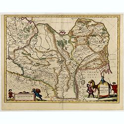
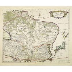
Description de la Tartarie. . .
Detailed map of Tartary, northern China and Korea as an island. The Caspian Sea in the utmost left. Numerous place-names of counties, cities, towns, physical features.Ala...
- $250 / ≈ €234
Place & Date: Paris, 1679
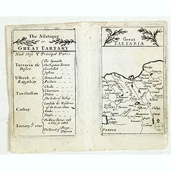
Lesser Tartaria.
A late seventeenth-century English map of Siberia / Tartary.A scarce little map with accompanying engraved text (94x55mm) from "Atlas Minimus, or, A book of geograph...
- $200 / ≈ €187
Place & Date: London, 1679
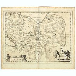
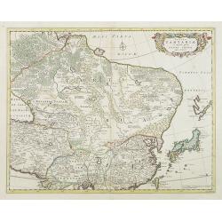
Tabula Tartariae et majoris partis regni Chinae.
Stretching from the Caspian Sea in the west to Formosa in the south-east. Including the peninsula of Korea, Japan and the east coast of Yedso. The Great Wall of China is ...
- $650 / ≈ €608
Place & Date: Amsterdam, 1680
Tabula Tartariae et majoris partis regni Chinae.
Stretching from the Caspian Sea in the west to Formosa in the south-east. Including the peninsula of Korea, Japan, Taiwan and the east coast of Yedso. Decorated with fine...
- $900 / ≈ €842
Place & Date: Amsterdam, 1680
Tabula Tartariae et majoris partis regni Chinae.
Stretching from the Caspian Sea in the west to Formosa in the south-east. Including the peninsula of Korea, Japan and the east coast of Yedso. Decorated with finely engra...
- $800 / ≈ €749
Place & Date: Amsterdam, 1680
Tartaria sive Magni Chami imperium.
Detailed and decorative map of Tartary and Northern part of China. Northern tip of Korea included. The Chinese Great Wall is depicted.
- $120 / ≈ €112
Place & Date: Amsterdam, 1683
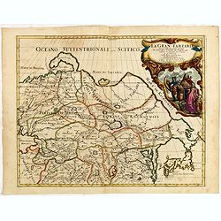
La Gran Tartaria divisa nelle sue parti pricipali da Giacomo Cantelli. . .
In upper right hand corner a large title cartouche with dedication to Tavernier and Thévenot. The cartographer was Giacomo Cantelli (1643-1695) who was active in Modena ...
Place & Date: Rome, 1683
Die Grosse Tartari.
Rare map showing Siberia, Korea with part of the Caspian Sea to the West, as well as India and North Russia. The title in an oval cartouche in upper right cornerThe map r...
- $1000 / ≈ €936
Place & Date: Augsburg, 1689
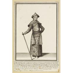
Kam Hi Fils de Chien chi Empereur des Tartares orientaux?.plusieurs titres d'honneur Ecrits de sa propre main.
Very rare and decorative costume plate. Underneath the plate a descriptive text in French. Bears the address AParis Chez Nolin rue St. Jacques à l'Enseigne de la Place d...
- $300 / ≈ €281
Place & Date: Paris ca. 1690
Tarku Urbs Tartaroum in Dagestan ad mare Caspium.
An early of Tarku, in the Republic of Dagestan. From the scarce Hamburg edition "Viel Vermehrte Moscowitische und Persianische Reisebeschreibung" by Adam Olear...
- $500 / ≈ €468
Place & Date: Hamburg, 1696