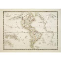
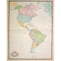
Carte d'Amerique dressée par Pierre Tardieu. . .
Detailed map prepared by Pierre Tardieu. With good detail on Alaska. Including New Zealand.
- $450 / ≈ €421
Place & Date: Paris, 1831
Amérique. . .
Very detailed map from Atlas Sphérodidal & Universel de géographie , Prepared by F.A.Garnier and edited by Jules Renouard, rue de Tournon, Paris. With decorative ti...
- $300 / ≈ €281
Place & Date: Paris, 1861
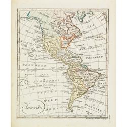
Amerika
Scarce miniature map of the Western Hemisphere.
- $200 / ≈ €187
Place & Date: Augsburg, 1824
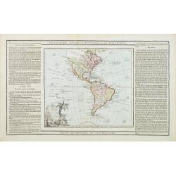
L' Amerique dressée pour l'étude de la géographie . . .
Map showing the American continent. California with a large inlet. Some major cities, bodies of water, and geographic features are marked. There are illustrations of ship...
- $200 / ≈ €187
Place & Date: Paris, 1790
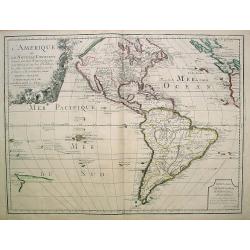
L'Amerique divisée en ses principaux Etats..
Uncommon map published by Lattré. This map is most notable for its depiction of "Mer de L'Ouest" or "Sea of the West". A great sea, easily the size o...
- $900 / ≈ €842
Place & Date: Paris, 1760
Amérique..
Very detailed map from Atlas Sphéroïdal & Universel de géographie. Prepared by F.A.Garnier and edited by Jules Renouard, rue de Tournon, Paris. With decorative tit...
- $175 / ≈ €164
Place & Date: Paris, 1861
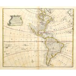
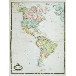
A new general map of America drawn from several..
Extremely faint strip of age toning on part of the centerfold, otherwise fine condition. The Pacific Northwest is left open with the note Parts Undiscovered. The coastlin...
- $500 / ≈ €468
Place & Date: London, 1747
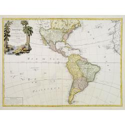
L'Amerique ou le Nouvelle Continent.. Dedieé et presenteé a monseigneur Law.
State one. The map has been prepared by Jean Baptiste Nolin (the elder) has a dedication to Monseigneur LAW controlleur general des finances .Rare general map of the Amer...
- $2200 / ≈ €2059
Place & Date: Paris, 1720
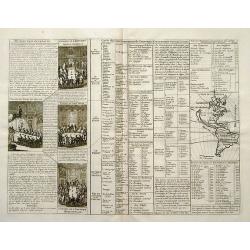
Carte du gouvernement de l'Amerique.
A double page sheet including a fine map of America, with California with indented northern coastline (130x92mm.) and New Mexico extending across most of western North Am...
- $300 / ≈ €281
Place & Date: Amsterdam, 1705

Americae Nova Tabula.
The delineation of the coast and the nomenclature on both the Pacific and Atlantic coasts are basically Spanish in origin and follow the maps of Ortelius and Wytfliet. To...
- $7500 / ≈ €7018
Place & Date: Amsterdam, 1645