Search Listings matching "dare" in America
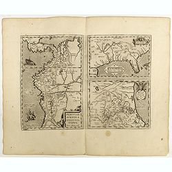
La Florida/ Peruviae Auriferae regionis Typus/ Guastecan.
The Chaves map of Florida is a prime example of an explorer's map since it records the recent discoveries of Cabeza de Vaca, De Soto, and Moscoso. The map revealed little...
Date: Antwerp, 1598
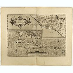
Culiacanae Americae regionis.. / Hispaniolae, Cubae..
Two virtually identically sized inset maps on one sheet, each with a decorative scroll title cartouche. Culiacanae depicts the coastal and inland western region in North ...
Date: Antwerp, 1598
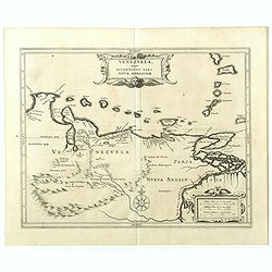
Venezuela, atque Occidentalis Pars Novæ Andalusiae.
The coastline of Venezuela with little interior development. Including Aruba, Bonaire, Curaçao, etc. This scarce map was prepared by Hessel Gerritsz (1581-1632), a forme...
- $600 / ≈ €515
Date: Leiden, 1625

Pas kaart vande Zuyd kust van Cuba en van Geheel Jamaica…
A nautical chart covers the southern part of Cuba, Jamaica, the western tip of Hispaniola, and some Honduran coastline. Insets of "Baya Oristan in Yamaica ent Groodt...
Date: Amsterdam, J. van Keulen, 1697-1709