Browse Listings

Atlas géographique des quatre parties du monde.
Interesting atlas printed during the French Revolution (1789-1799) by Ph. Dezauche. The title cartouche of the newly made map (6bis) "Carte de France, suivant sa nou...
Place & Date: Paris, Dezauche, De L'Isle et Buache, 1789-1799

Le globe terrestre representé en deux plans-hemispheres, Dressé sur la Projection de Mr. De la Hyre...
“This splendid GlobeTerrestre originally published by J.B. Nolin is one of the finest large-scale world maps to be produced and is a fitting bridge between the geograph...
Place & Date: Paris, c. 1780

Nansenbushu bankoku shoka no zu.
This map is a great example of Japanese world maps representing Buddhist cosmology with real-world cartography. It is the earliest one and - therefore - the prototype for...
Place & Date: Kyoto, (Hoei 7 = Year of the Tiger) 1710

Americae Nova Descriptio.
Final state. According to Philip Burden, "this scarce map is America's first single-sheet map with decorative borders." A re-issue of the 1614 plate by Pieter v...
Place & Date: Amsterdam, 1652

Chorographica descriptio provinciarum, et conventum fratrum minorum S. Francisci Capucinorum...
All maps are good and dark impressions. Several maps with slight foxing and browning, the folding map with 2 splits (top right part 10 cm and lower left part 6 cm into en...
Place & Date: Turin, 1649

Les Provinces confederées du Pais-Bas
The first wall map of the Seven Provinces of 1651, re-issued as 'Stoel des Oorlogs' by Covens & Mortier. The first issue of the present wall-map is known to be includ...
Place & Date: Amsterdam, c. 1740

Asia carta di ciasete piu moderna. (Japan)
Rare FIRST STATE of this important map for Korea and Japan map of the Blancus/Moreira type, but adds a huge 'Jesso' filling the top of this old map. The map is of interes...
Place & Date: Florence, 1646-1647
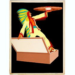
20 advertising gouaches for tobacco industry.
A stunning collection of 20 original square and rectangular decorative commercial designs for the Tabaco industries in gouache and watercolor by the artist and graphic de...
Place & Date: Paris, ca. 1930

Nocturnal in boxwood and brass.
Nocturlabe in boxwood and brass, the wheels maintained by a central nut presenting an annual calendar divided into months and days, an hour disc and a mobile alidade, the...
Place & Date: England, Thomas Cooper, dated 1701

A Map of the British Empire in AMERICA with the French, Spanish and Hollandish Settlements Adjacent Thereto. by Henry Popple. / Nouvelle Carte Particuliere de L'Amerique . . .
The four sheet Dutch edition of Popple's monumental map of North America, in mint condition. Encompassing the West Indies, Florida, Louisiana, Texas and Central America.T...
Place & Date: Amsterdam, ca. 1737