Browse Listings in Atlases
![[Collection of six maps of Australia and New Zealand.]](/uploads/cache/48412-250x250.jpg)
[Collection of six maps of Australia and New Zealand.]
Collection of maps including 6 engraved maps by 19th century German, French and English cartographers depicting Australia and New Zealand.This made to order atlas contain...
Place & Date: Germany, 1832-1852

Nieuw Nederlandtsch Caertboeck. Waer in volkomentlijcker als oyt te voren vertoont werden de XVII. Nederlanden.
Rare first edition of this atlas of the provinces of the Netherlands, Belgium and Luxemburg. Engraved title page, with : "Gedruckt t' Amsterdam by Abraham Goos Plaet...
Place & Date: Amsterdam, 1616
![Ch'onha chido. [Atlas of all under Heaven]](/uploads/cache/44640-250x250.jpg)
Ch'onha chido. [Atlas of all under Heaven]
A late 18th century Ch'onha chido atlas with 10 woodblock maps showing the World, China and the 8 province maps of Korea, bound into thicker mulberry paper covers. One ma...
Place & Date: Korea, ca. 1780
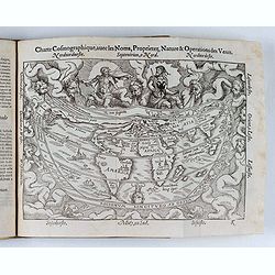
Cosmographie, ou description des quatre parties du Monde...
Fourth French edition (first French collective edition), considerably enlarged with the double-page truncated cordiform world map "Charte cosmographique", in us...
Place & Date: Antwerp, Jean Bellere, a l'Aigle d'Or, 1581
![ATLAS RUSSICUS mappa una generali et undeviginti specialibus vastissimum Imperium Russicum cum adiacentibus regionibus [repeated in French].](/uploads/cache/27877-250x250.jpg)
ATLAS RUSSICUS mappa una generali et undeviginti specialibus vastissimum Imperium Russicum cum adiacentibus regionibus [repeated in French].
After an unnumbered general map of Russia there are 13 numbered maps that cover European Russia (scale 1, 1.527.000). The other (last) 6 maps cover Asian Russia (Siberia,...
Place & Date: St Peterburg, Akademie von Wissenschaften. 1745

Itinerarium Sacrae Scripturae. Das ist: Ein Reisebuch...
Itinerarium Sacrae Scripturae. Das ist: Ein Reisebuch, Uber die gantze heilige Schrifft, in zwey Bücher geteilet... Zuvor gemehret mit einem Büchlein De monetis et mens...
Place & Date: Magdenburg, 1587

Kort begrip der oude en nieuwe staatkundige Geographie: behelzende eene beschryving der heerschappyen, in welken de aarde verdeeld is, haare gelegenheid. . .
Sixth edition- Interesting geographical compendium, prepared by Johann Hubner en W.A. Bachiene. Of particular interest is the section starting with pages 589 with "O...
Place & Date: Amsterdam, Covens / Mortier, Utrecht, Poolsum, 1758

Cartes pour le tom V de mineraux. (Atlas des cartes des déclinaisons et inclinaisons de l'aiguille aimantée, rédigées d'après la Table des observations ...
Cartes pour le tom V de mineraux. (Atlas des cartes des déclinaisons et inclinaisons de l'aiguille aimantée, rédigées d'après la Table des observations magnétiques ...
Place & Date: Paris, 1783-1788

Atlas des Missions de la Société des Missions-Étrangères. . .
This scarce atlas contains maps showing the locations of the Catholic missions belonging to the Société des Missions Étrangères in Asia. It covers India, Burma, Siam,...
Place & Date: Lille, 1890

Composite atlas of the Low Countries.
A composite atlas comprising 18 double-page engraved maps by or after Hessel Gerritsz, Theodoor Galle, Jacob van Deventer, Gerard Mercator, Peter Verbiest, Jean Surhon, C...
Place & Date: [Antwerp, c. 1633