Browse Listings in America > Caribbean & Atlantic Ocean > Puerto Rico
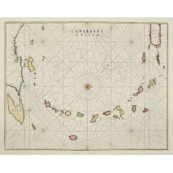
Canibales Insulae.
Rare, early Dutch nautical chart of the Caribbean from Puerto Rico southward.
Place & Date: Amsterdam, 1670
Rare, early Dutch nautical chart of the Caribbean from Puerto Rico southward.
Decorative and detailed map of Tuscany, from the 1574 or 1575 Latin text edition of Ortelius' Theatrum Orbis Terrarum, the first modern atlas of the world. The map is bas...
Colorful promotional map of the 20th century spice trade.What better way to showcase the global composition of a multi-national company than with a world map? This lovely...
This shows Sebald van de Weert, the Dutch sailor who emerged from the Magellan Straits in 1600 and spotted the rocky islands off the coast of South America. For most of t...
This map presents a highly detailed treatment of the region from Cabo Del Norte to the Apalachiola River, centered on the mouth of the Mississippi and extending inland to...