Wish List
With WishList / Virtual Collection, you can save and collect your favorite items in one place, it is free and you can delete an item from your list at any time.
Save any of the 30.000+ maps, prints or Medieval manuscripts from our BuyNow Catalog or Catalog Archive.
Unless logged in, an item is only saved for that session. If you want to save the items permanently, please log in first.
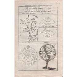
The Terms and Principles of Geography with their Astronomical Connections.
An interesting set of 4 images, including an orrery sphere, model of the solar system, geographical circles and model of the various geographical features of the world. E...
Place & Date: London, 1777

Znojmo,- Znaymum vulgo Znaym, Moraviae Civitas Primaria.
RARE only included in part VI of his town book. Panoramic town-view of Znojmo in Moravia by G. Hoefnagel and son, 1617. Key to twelve locations, costumes. CAPTION: Znaym...
Place & Date: Cologne, 1617
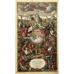
Titlepage: Atlas Novus Terrarum orbis Imperia.
Title page from "Atlas Novus" printed by Johann Ernst Udelbulner. Large elaborately engraved sheet with numerous allegorical figures. A large globe, showing the...
Place & Date: Nuremberg, 1807
![One of the Earliest, Southeast Asia Maps. Myanmar (Burma) / Thailand/ India. [On verso:] Tabula XI Asiae.](/uploads/cache/82203-250x250.jpg)
One of the Earliest, Southeast Asia Maps. Myanmar (Burma) / Thailand/ India. [On verso:] Tabula XI Asiae.
The scarce second edition of one of the earliest acquirable maps to focus on a specific region of Southeast Asia. The general area depicted on the map, primarily today’...
Place & Date: Strasbourg, 1522-1525
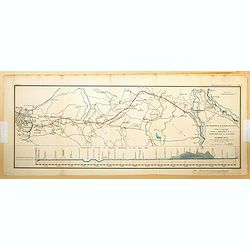
'Metropolis Water Supply. Plan and section of a line of aqueduct from the River Verulam above Watford to Primrose Hill for the supply of the districts on the north side of the River Thames.
An unusual and interesting plan submitted by the Scottish civil engineer Thomas Telford in 1834, for the proposed supply of fresh water from near Watford in Hertforshire ...
Place & Date: London, 1834
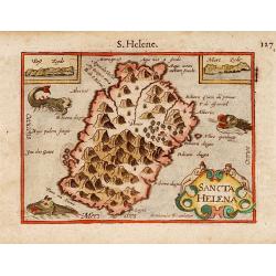
Sancta Helena.
Two years after the publication of Linschoten's Itinerario, the first map of St. Helena appeared in 1598 in a miniature world atlas, the Caert-Thresoor, inhoudende de taf...
Place & Date: Amsterdam 1606
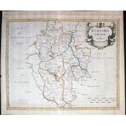
Bedfordshire.
Beautiful map of Bedfordshire. First edition of Robert Morden's map of Bedfordshire. Cartouche at upper right, scales at lower right. From the 1695 edition of Camden's Br...
Place & Date: London, Abel Swale / John Churchill, 1695
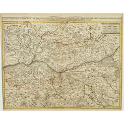
Cart Particuliere D'Anjou Et De Touraine ou de la Partie Meridionale De La Generalité De Tours.
Detailed regional map, showing towns, roads, rivers, lakes, forests, castles, etc. Centered on the Loire River, from Ancenis to Blois. Remarkable detail.The map is from a...
Place & Date: Amsterdam c. 1745
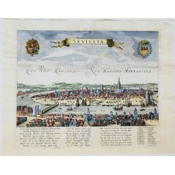
Sevillia
Panoramic view of the city of Seville in Andalusia, Spain, seen from the West, from across the Guadalquivir river. Title in a banner at top centre, left and right coats-o...
Place & Date: Amsterdam, ca. 1720
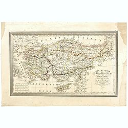
Asiae Minoris Stappa generalis ad Caesarum tempus.
A lovely steel engraved map of Turkey, Cyprus and Minor Asia. From Louis de Saint-Martin Vivien's Atlas Universel. Engraved by Giraldon-Bovinet.
- $50 / ≈ €45
Place & Date: Paris, 1826
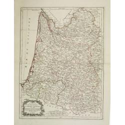
Carte des Gouvernements de Guienne et Gascogne, avec celui de Bearn et basse Navarre. . .
Attractive map of the south western part of France, covering the area south of the river Gironde until the Spanish border. The map was prepared by R. Bonne, who is given ...
Place & Date: Venice, 1777 - 1784
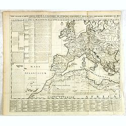
Nouvelle carte pour servir a l'Histoire de l'Empire d'Occident depuis les premiers Empereurs Romains jusques apres les successeurs de l'Empereur Theodose avec des tables et des remarques trés instructives.
Interesting sheet with a map showing the Roman Empire in Europe and northern Africa, with descriptive French text, from Chatelain's monumental 7-volume "Atlas Histor...
Place & Date: Amsterdam, 1720

La Place du Dôme à Milan.
Uncommon and decorative lithography of a the main square in the center of the city of Milan, with the Duomo di Milano, published by Carl Johan Billmark and printed by Lem...
Place & Date: Paris, c.1859

Costumes Europeenes.
A large and striking, old colored sheet with illustrated European couples men and women wearing their regional costumes. Engraved by J. M. Mixelle.
Place & Date: Paris, c 1790
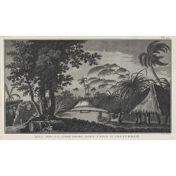
Afia-too-ca, cimetiere dans l'Isle d'Amsterdam.
From the French edition of James Cook's second voyage entitled Voyage dans l'Hémisphère Austral, et autour du Monde, fait sur les Vaissseaux de Roi, l'Aventure, la Rés...
Place & Date: Paris, 1778
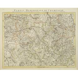
Partie Meridionale De Champagne. . .
Very detailed, topographical map of the southern Champagne. Showing fortified cities, roads, towns, rivers, lakes, forests, etc. The map is from a Dutch edition of De L'I...
Place & Date: Amsterdam c. 1745

Description de l'Empire de la Chine et de la Tartarie chinoise.
Titles printed in red and black and incorporating an engraved pictorial vignette by Baquoy after Humblot, fine engraved maps (many folding) and plates, text printed in do...
Place & Date: Paris, P. G. Le Mercier, 1735
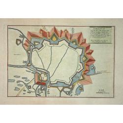
Schlestat.
Nice city plan of Schlestat near Colmar with the fortification walls around the city.
Place & Date: Paris 1705

Océanie..
Very detailed map from Atlas Sphéroïdal & Universel de géographie dresse a l'aide des documents officiels, recemment publies en France et a l'etranger par M.F.A. G...
Place & Date: Paris, 1862
![[Pair of 2 prints] Bewohner der Sandwich-Inseln; Tammeamea König der Sandwichinseln. Naba-Leba König von Solor;](/uploads/cache/94412-250x250.jpg)
[Pair of 2 prints] Bewohner der Sandwich-Inseln; Tammeamea König der Sandwichinseln. Naba-Leba König von Solor;
Two rare lithographs showing native Hawaiians. From Heinrich Rudolf Schinz's "Naturgeschichte und Abbildungen des Menschen".
Place & Date: Zurich, ca. 1827
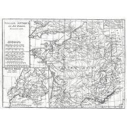
Gallia Antiqua Ex Aevi Romani.
Gallia Antiqua Ex Aevi Romani 1795 by Samuel John Neele Published May 10th 1795 by Cadell & Davies of the Strand London.18th century map of Ancient France. Inset of t...
Place & Date: London, 1795
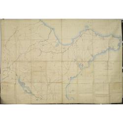
A map of the Province of Shantung compiled under the direction of Thomas T.Fergusson of Chefoo Stanfords geographical Establisment 1873 with projected raiway to coal mines and Tsi-Nan-Foo.
A manuscript map of the province Shantung (or the present-day standard pinyin, Shandong) compiled under the direction of Thomas T.Fergusson of Chefoo Stanfords geographic...
Place & Date: China, ca 1873

Atlas von Hellas und den hellenischen Kolonien.
In 1840, in collaboration with Karl Ritter, Heinrich Kiepert issued his first work, Atlas von Hellas und den hellenischen Kolonien, which brought him at once into eminenc...
Place & Date: Berlin, 1846
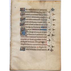
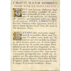
Leaf on vellum from a manuscript Book of Hours.
Nice vellum leaf from a French Book of Hours, written in the style of the scriptoriums of Rouen. Written in brown ink with red rubrics, line fillers, initials and decorat...
Place & Date: France ca.1460
L' Asie Dressee selon les Observations de Mrs. De l' Academire Royales des Sciences.
Delightful little map that conforms to the standard French model of the period. Hokkaido is attached to the mainland and Terre de Iesso is off the coast partially obscure...
Place & Date: Paris, 1719

Americae Nova Tabula.
A map of the Americas, early third state with the impressum 'Amst : Guiljelmo Blaeuw' in the title cartouche bottom left. A nice early map with good detail, especially al...
Place & Date: Amsterdam, 1634/1635
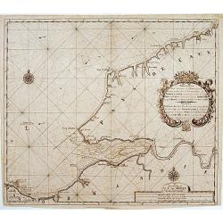
Nouvelle Carte marine.. NORMANDIE.. Pays de Caux..
Very decorative sea-chart of part of Normandy, including Le Havre, Honfleur, etc. Decorated with large title-cartouche with text in French and Dutch. Number 17 in lower r...
Place & Date: Amsterdam 1730
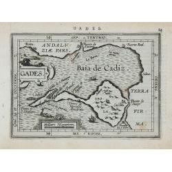
Gades.
Miniature map of Cadiz, with major cities named. Strapwork title cartouche. Latin text on verso.
Place & Date: Antwerp, 1601
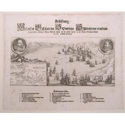
Abbildung welcher Gestalt die Spanischen Silberflotta von dem Hollaendischen General Peter Peters Hayn an der Insel Cuba in der Baya Matanca Anno 1628 erobert worden
Copper engraved map; overall size 37 x 45 cm by Thomas de Bry, published by Merian for a German edition of de Bry's 'Grand Voyages'.This map depicts the Spanish silver fl...
Place & Date: Hanau, 1630
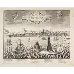
Barcellona
Extremely rare town-view of Barcelona. Engraved by Francesco Ambrosi.With a numbered key (1-37) to the principal places of interest in town.The author is Giovanni Remondi...
Place & Date: Bassano del Grappa, .1780
![Noweav Mexiqve. [California as an Island]](/uploads/cache/26133-250x250.jpg)
Noweav Mexiqve. [California as an Island]
Scarce miniature map of California as a island, from Pierre Duval's La Geographie Universeille. The second earliest map to focus on just California and the contiguous coa...
Place & Date: Paris, 1672
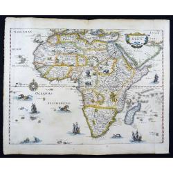
Nova Descriptio Africae
A handsome map of Africa, published by M. Merian in Frankfurt in 1636.Merian based this map on Blaeu's influential earlier work. This map is richly embellished with anima...
Place & Date: Frankfurt, 1636
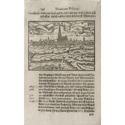
Wien.
This superb miniature view of the city of Vienna is from an edition of the famous Abraham Saur's Theatrum Urbium.The Theatrum Urbium was republished numerous times. The w...
Place & Date: Frankfurt, 1605
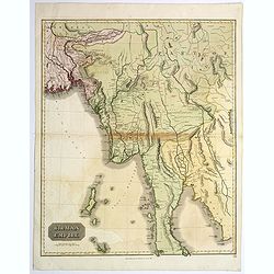
Birman Empire.
A lovely large map of the Birman Empire, now known as Burma or Myanmar, by J. Thomson, published in his "New General Atlas".The map is centred on the old capita...
Place & Date: Edinburgh, 1817

Nouvelle carte de l\'Etat de Milan avec une partie du Monferrat, du Piemont et de la Suisse..
Finely and crisply engraved map illustrating centered on Milan. With an inset map of the dukedom of Mantua in the upper right corner.Large decorative title cartouche in t...
Place & Date: Venice, 1776 - 1784
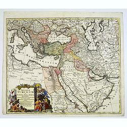
Imperium Turcicum in Europa, Asia et Africa.
Johann Baptist Homann's well-engraved map of the Turkish Empire with a fine decorative title cartouche.Johann Baptist Homann (1663-1724) was a German engraver and publish...
Place & Date: Nurnberg, 1737
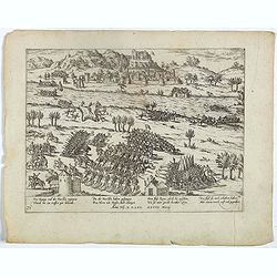
Des Kunigs vnd der Fursten regiment, Thundt hie eintreffen gar behendt . . Plate 74.
Early print showing the battle of the Rhone at Le Pouzin (Ardèche department).Plate from the series about the " Eighty Years War" or the independence war of Ho...
Place & Date: Cologne, ca. 1620
Selling price: $50
Sold in 2023
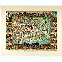
Oxford.
A comprehensive pictorial overview of Oxford’s rich history, especially in education.This image of Oxford is one of several pictorial maps Kerry Lee created to promote ...
Place & Date: London, 1948
Selling price: $425
Sold in 2022
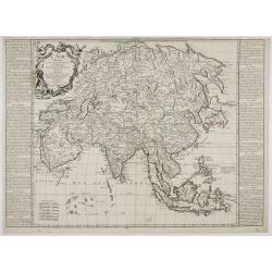
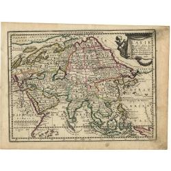
L'ASIE Divisée en ses Grandes Régions et Empires Subdivisée en ses Principaux Estats. . .
A rare map of Asia, originally prepared by J.B. Nolin and re-issued by J. F. Daumont. It comes with two columns on left and right hand side, describing the different regi...
Place & Date: Paris, 1754
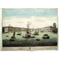
Prospectus de neva Orientum .. Petroburgae
Print of a harbour of Petersburg in Russia.Probst was a well-known publisher of optical prints, established in Augsburg.In the eighteenth and nineteenth centuries there w...
Place & Date: Augsburg 1760
![Enchusa [Enkhuizen].](/uploads/cache/83969-250x250.jpg)
Enchusa [Enkhuizen].
A rather scarce and handsome folio-sized city map of Enkhuizen. Title in a cartouche top left, next to a person holding the city's coat-of-arms. Legend a-w top right. Sho...
Place & Date: Amsterdam, ca. 1690
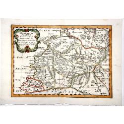
ROYAUME de MAROC divise en sept-Provinces &c.
A very fine, old color, decorative map of Morocco, first published by Nicholas Sanson in 1654. The map is based in part on the maps in the atlas of Livio Sanuto.
Place & Date: Paris 1654
![Franckenlandt am Main. . . [Franconia/Franken]](/uploads/cache/85020-250x250.jpg)
Franckenlandt am Main. . . [Franconia/Franken]
A double-page woodcut map of Franconia [today partly in Bavaria - partly in Hesse], published in Basel, circa 1550. Munster's important early regional map of Germany, cen...
Place & Date: Basel, ca 1550
![Nansenbushu Bankoku Shoka no Zu - [Map of all the countries in Jambudvipa]](/uploads/cache/97908-250x250.jpg)
Nansenbushu Bankoku Shoka no Zu - [Map of all the countries in Jambudvipa]
The much rarer 2nd state of this highly important East Asian world map.Possibly one of only 6 known copies.The first Japanese map to depict the world, including Europe an...
Place & Date: Bundaiken Uhei, Kyoto, 1710
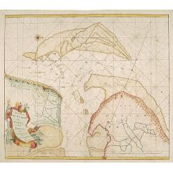
Nieuwe Pas-Kaart van Texel en den Horst.
A RARE and decorative chart of the entrances to the Zuiderzee between Holland and Texel. Decorated with a fine title cartouche.
Place & Date: Amsterdam 1760
![[Lake Hangzhou.]](/uploads/cache/47547-250x250.jpg)
[Lake Hangzhou.]
A chromolithograph bird's eye view of West Lake in Hanzhou in China. West Lake is a freshwater lake. It is divided into sections by causeways. There are numerous temples,...
Place & Date: China, ca 1955
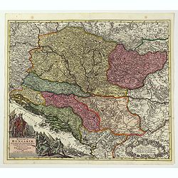
Regnorum Hungariae, Dalmatiae, Croatiae. . .
Johann Baptist Homann's well-engraved map of Hungary. With a fine decorative title cartouche showing the Hapsburg victors of war and the vanquihsed Ottomans in equal meas...
Place & Date: Nuremberg, 1744
Selling price: $300
Sold in 2022
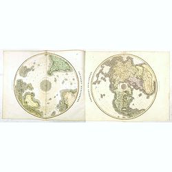
Northern Hemisphere / Southern Hemisphere.
A later edition map of the twin hemispheres, taken from John Thomson's. A New General Atlas, (Edinburgh), first published in 1814.When assembled this large pair of maps m...
Place & Date: Edinburgh, 1817
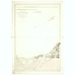
Carte particuliere de la cote septentrionale d'Afrique. (13eme feuille)
A fine French Service Hydrograhique de la Marine chart no. 3424, showing Cape Rose and Cap Nègre, in Algeria, drawn in 1873 by E. Mouchez, updated to 1913. Chart engrave...
- $80 / ≈ €71
Place & Date: Paris, 1873 / 1913
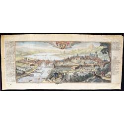
Geneve / Genff.
Wide copper engraving with a beautiful view on Geneva, with a large index on both sides of the image. Published in; "Atlas Curieux oder Neuer und Compendieuser Atlas...
Place & Date: Augsburg, 1712
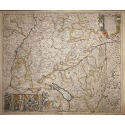
SRI Sueviae Circulus et Ducatus, Comprehendens Wirtenbergi Ducatus Augustanum et Constantiae.
A large highly detailed map of central Germany.
Place & Date: Amsterdam, 1680
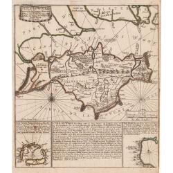
Isle de Wight.
Map of the Isle of Wight with a block of text dealing with the area and 2 insets depicting the Sorlingues Islands and Tor Bay.Engraved by H. Van Loon, from De Fer's Atlas...
Place & Date: Paris, 1705
![Prospect des Plazes vor dem Rath Haus zu Boston. Vuë de la Rue et de la Maison de Ville a Boston. [together with] Prospect der König[lichen] Strasse gegen das Land Thor zu Boston. Vue de la Rue du Roy vers la Porte de la Campagne a Boston.](/uploads/cache/34216-250x250.jpg)
Prospect des Plazes vor dem Rath Haus zu Boston. Vuë de la Rue et de la Maison de Ville a Boston. [together with] Prospect der König[lichen] Strasse gegen das Land Thor zu Boston. Vue de la Rue du Roy vers la Porte de la Campagne a Boston.
Two so-called optical prints showing a decorative imaginary view of the old state house, built in 1657, which was the center of government for the colony of Massachusetts...
Place & Date: Augsburg, ca. 1776
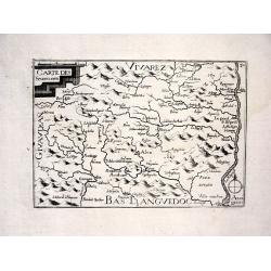
CARTE DES SEUENNES
Nice map from Tassin's desirable and scarce Atlas "Cartes generales de toutes les Provinces de France et d'Espaigne..." published by Berey in 1648. Very detail...
Place & Date: Paris, 1648
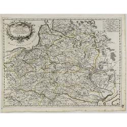
Stati Della Corona di Polonia Divisa Nelle Sue Principali Provincie e Palatinati...
Giacomo Rossi’s fine late 17th century map of Poland. Showing the Polish-Lithuanian Commonwealth at a time when it was one of the largest and most populous countries of...
Place & Date: Rome, 1678.
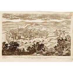
Cazal.
A very RARE panoramic view of the city of Cazal.The plate is numbered in red pencil in upper right corner.Engraved by Pierre Aveline (Paris, c.1656 - 23 May 1722). He was...
Place & Date: Paris 1690-1720
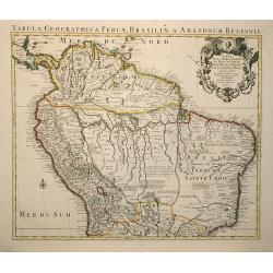
Carte de la Terre Ferme du Perou, du Bresil ?
A very detailed map including Brazil, Peru and the Amazonian part. Very decorative title cartouche on the upper right corner.
Place & Date: Amsterdam, 1720
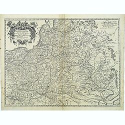
Tabula nova totius regni Poloniae. . .
Map of Poland, Lithuania, Latvia, Belarus and Ukraine with decorative cartouche in the upper left corner.Published by Nicolaas Visscher after N. Sanson.
Place & Date: Amsterdam, 1690

Death of Richard II, engraved by A. Smith, after Francis Wheatley R.A 1795
Death of Richard II, engraved by A. Smith, after F, Wheatley R.A 1795 illustration from David Hume's 'The History of England', pubished by R. Bowyer, at the Historic Gal...
Place & Date: London 1795
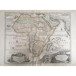
L'Afrique. Dresse selon les dernieres Relations.
A rare seperately published map in excellent condition.
Place & Date: Paris, 1705
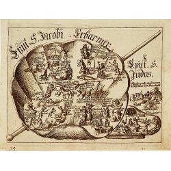
Illustration from a popular German Bible.
Illustration of a german popular bible in several small scenes represented in a shell.For the Germans, heart had a visual and symbolic significance derived from the study...
Place & Date: 17th century
Leaf on vellum from a manuscript Book of Hours.
A very interesting vellum leaf with two initials decorated the style of the Renaissance, but I cannot certainly tell the age of this leaf!! In the 19th century there was ...
Place & Date: France ca.1850
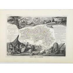
Dépt. De L'Orne. N°60.
Map of the Orne region in France.Lovely map from one of the last decorative atlases of the nineteenth century.The rather simple map is framed by medallion portraits and c...
Place & Date: Paris, A. Combette, 1852
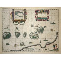
Moluccae Insulae Celeberrimae.
Showing the geographical features of the islands, and decorated with ships, sea monsters and a handsome cartouche. With an inset of Bachian island.
Place & Date: Amsterdam 1640
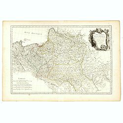
Carte Générale de la Pologne.
Detailed map of Poland, prepared by Rizzi Zanoni from his "Atlas moderne ou collection de cartes...", map N° 19.
Place & Date: Paris, 1762
Selling price: $170
Sold in 2023
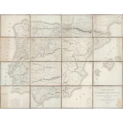
Carte-Itinéraire de l'Espagne et du Portugal dressée par ordre de S. E. M. Le Maréchal Duc de Bellune Ministre de la Guerre sous la direction de M. Le Lieutenant Général Comte Guilleminot, Directeur Général du Dépôt de la Guerre.
Military map of Spain and Portugal in 16 separate sheets of 34x44cm each, on a scale of 1:745.000. With a conversion table on sheet 13 for conventional measurements used ...
Place & Date: Paris, 1823
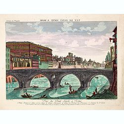
Vue du Pont Sixte a Rome. 1. Palais Farnese, 2. Eglise de la Mort, 3. Palais Falconieri, 4. Eglise St. Jean des Florentins, 5. Hopital du St. Esprit.
Rare so-called optical print illustrating Ponte Sisto in Rome. Like the Sistine Chapel constructed under pope Sixtus IV (1414-1484). Behind the bridge the Palazzo Farnese...
Place & Date: Augsburg, 1760
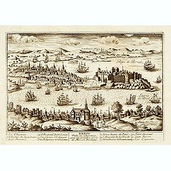
Brest.
"A very RARE panoramic view of the city of Brest, including a numbered legend in both lower corners. The plate is numbered in black pencil in upper right corner. Pub...
Place & Date: Paris, 1760
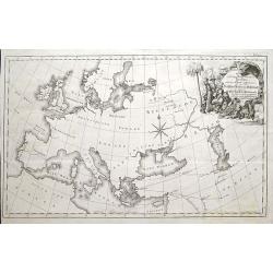
Die verschiedenen Reisen nach und von Persien, nach der Charte aufgenommen die von der Russischen Handlungs Gesellschaft dem Ober Hause des Parlaments im Jahr 1740 vorgelegt und seit dem nach Erfahrungen verbessert worden.
A very rare German map of Europe and Russia extending until the Caspian Sea.Shows a travel route from Moscow to St. Petersburg, around Europe by sea, onward to Bagdad, cr...
Place & Date: Hamburg, ca 1750
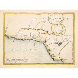
Descripcion del destricto del audiencia de la nueva galicia..
Early map of Mexico from Novus Orbis, sive Descriptio Indiae Occidentalis. This collection of voyages is often referred to as an edition of Herrera, which is not strictly...
Place & Date: Amsterdam 1622
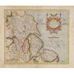
Eboracum, Lincolnia, Derbia, Staffordia, Notinghamia. . .
Map of the eastern part of England from about Middlesbrough to Yarmouth, inland to include Coventry, Nottingham, Sheffield, Leeds, and York. Title cartouche in a banner h...
Place & Date: Amsterdam, 1630
Selling price: $75
Sold in 2022
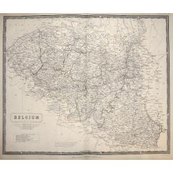
Belgium.
Large scale map of Belgium. Steel plate engraved map. From Johnston’s National Atlas of Historical, Commercial, and Political Geography. 1850, Edinburgh, Scotland.
Place & Date: Edinburgh, 1850
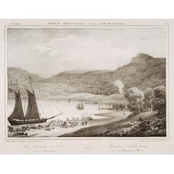
Haverstraw or Warren landing.
Decorative print after Jacques Milbert, and lithographed by Deroy.From Amérique Septentrionale. Printed by de Bove and Noöl ainé &Cie. An outstanding view from Mil...
Place & Date: Paris, 1829
Selling price: $85
Sold in 2022
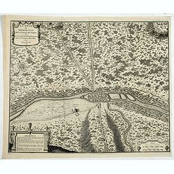
Lutece ou Premier Plan de la Ville de Paris Tiré de Cesar . . .
Paris est nommée Lutetia par les Romains, et se limite à l’île de la Cité avec ses maisons de forme ronde, bâties de bois et de terre, et couvertes de roseaux ou d...
Place & Date: Paris, 1728
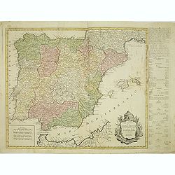
Los reynos de España y Portugal, según las últimas y nuevas observaciones de las Academias de Paris y de Londres.
Very rare, likely separately issued map of Spain and Portugal with text in Spanish. Based on a map by William Faden from London.
Place & Date: Spain or London, c.1780
Selling price: $190
Sold in 2023
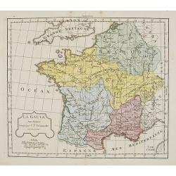
La Gaule.
Map of France . By C. F. Delamarche, successor of Robert de Vaugondy, Geographer.
Place & Date: Paris, 1794 -1806
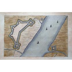
Cadsant.
Plan of the fortifications of Cadzand. On verso with Latin text about the town. With small decorative sailing ships and full coloring!
Place & Date: Amsterdam, 1649

Angelica Archangelca L./ Die edle Engelswurz.
Orginal colored copper engraving. paper size 48 x 33 cm; laid paper; watermarked. from: Icones plantarum medicinalium, Vienna, 1788-1803. Joseph Jacob Pleck (1735 - 1807...
Place & Date: Vienna, 1788-1803
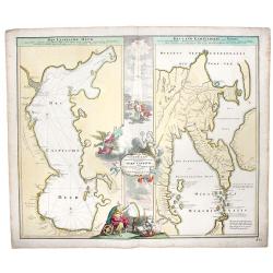
Caspian Sea+Kamtchatka.-Geographica Nova... MARE CASPIUM altera Kamtzadaliam seu Terram Jedso curiote exhibet.
A decorative pair of maps on one sheet, depicting then recent discovery, focusing on the Caspian Sea and Northeastern Russia and Kamtchatka.
Place & Date: Nuremberg, 1730
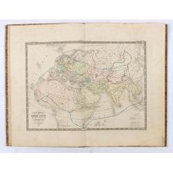
Atlas historique ancien et moderne renfermant toutes les cartes anciennes, du Moyen Age, et Modernes....
This comprehensive atlas includes 33 maps of the known World as described by sources from Antiquity, the Middle Ages, the Rennaissance and Age of Discovery, the Early Mo...
Place & Date: Paris, chez l'Auteur, 1838
Selling price: $960
Sold in 2024