Subscribe to be notified if similar examples become available.
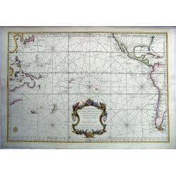
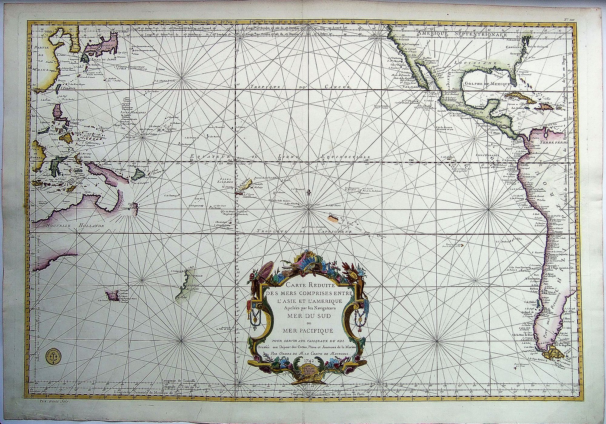
AUSTRALIA - PACIFIC, - CARTE REDUITE DES MERS .. ENTRE L'ASIE ET L'AMERIQUE .. MER DU SUD.. |
||||||||||||||||||||
|
||||||||||||||||||||
|
|
||||||||||||||||||||
Estimated value: $1000 - $1500 |
Virtual Collection - Save and collect your favorite items in one place.
Unless logged in, the item is only saved for that session. If you want to save the items permanently, please Login first Learn more [+] |
|||||||||||||||||||
Description
French Chart of the Pacific Ocean on the Eve of the Great Voyages of Discoveries
Fascinating sea chart, depicting the Pacific Ocean immediately before the wave of exploration that occurred from the 1760s to the 1790s. This fine chart, issued by the French Depôt de la Marine, depicts the Pacific world as it was known by Europeans in the 1750s, a time of their renewed interest in the world’s largest ocean.
The chart depicts the entire west coast of the Americas up to roughly 40 degrees north latitude. California is correctly shown to be a peninsula, but Japan retains its horizontal depiction, a representation typical of mid-eighteenth-century maps. The Korean Peninsula takes on an exaggerated size, and the area where Japan's Hokkaido should be located is left blank; the area not been extensively explored and was subject to diverse cartographic interpretations.
In line with changing cartographic standards that preferred fewer decorative additions, especially for working charts, this chart has few embellishments. The exception is the ornate title cartouche situated in the center of the South Pacific. A large frame surrounds the title. It is topped with various items which Europeans associated with the Pacific, including a parasol, a conical hat, a feathered headdress, and a parrot.
The coasts of South America are quite well-defined, having been corrected by Jorge Juan and Antonio de Ulloa in the 1740s. The men, both Spanish naval officers, were attached to a French expedition sent to the Andes to measure a degree of latitude as part of a larger effort to determine the shape of the earth. When Commodore George Anson’s squadron rounded Cape Horn and began to menace Spanish settlements along the west coast of South America in the early 1740s, Juan and Ulloa came to the coast to help strengthen defenses. They later published a book about their adventures in 1748.
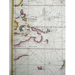
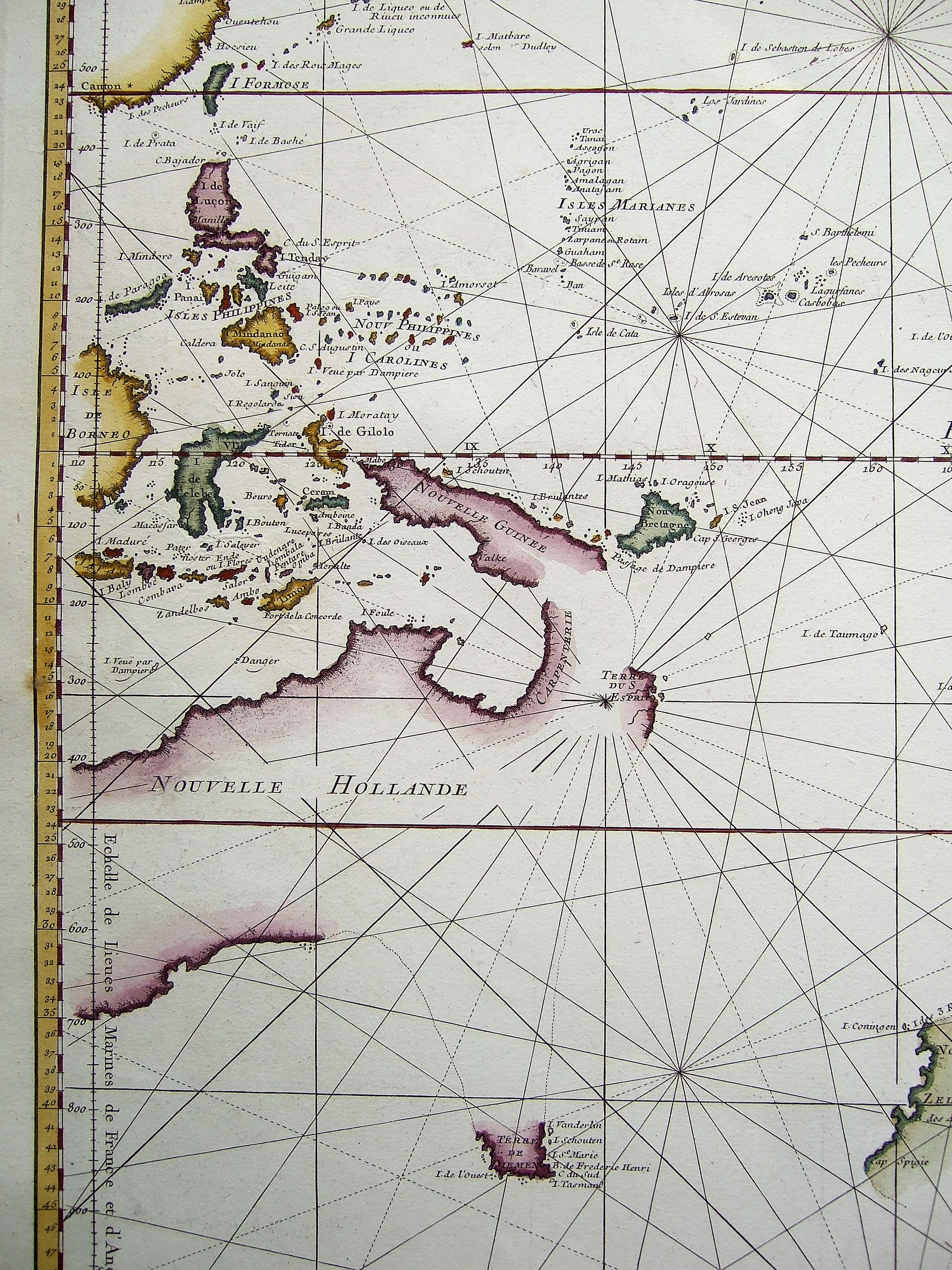
The depiction of Australasia is reflective of the European interest in and ignorance of the area. The north coast of Australia up the western shores of the Gulf of Carpentaria reveals the discoveries of various Dutch explorers, particularly Willem Janszoon's voyage of 1605-6 in what is today Queensland. Janszoon was in command of the Duyfken, a Dutch East India Company (VOC) ship, and explored the eastern shore of the Gulf of Carpentaria, just below the Cape York Peninsula. This venture was famously the first recorded European contact with Australia.
Another VOC expedition is also recorded on the chart, as it had one of the largest influences on Pacific cartography of any voyage before Cook. Abel Tasman was charged by the Governor-General of the Dutch East Indies, Antonie Van Diemen, to seek out the possible southern continent. He set out in 1642 and was the first known European to chart Tasmania, initially named for Van Diemen, and to visit New Zealand. Both coasts are included on this chart, along with Tasman’s place names like Murderer’s Bay in New Zealand, where Tasman lost several men in an altercation with Maori.
On his second voyage, Tasman coasted part of the New Guinea coast and the Gulf of Carpentaria, as well as the entirety of the north of Australia. Although Tasman was responsible for entirely new additions to European maps, his superiors, including Van Diemen, considered his voyages a failure and did not send further expeditions to search for the southern continent. Here, New Guinea’s coasts are partially based on Tasman, Janszoon, and Luís Vaz de Torres. Torres sailed through the strait now named for him in 1606, but that knowledge was suppressed by the Spanish government and not made public until after this chart was published.
The cartographers at the Depôt have added a dotted line between Van Diemen’s Land and the southern coast of Australia, as well as between Van Diemen’s Land and the east coast of Carpentaria and New Guinea. Van Diemen’s Land would not be proven to be an island until the very end of the century in which this chart was made. Interestingly, the west coast of Carpentaria is not attached to New Guinea, a nod to the need for more information about the area.
Various islands dot the mid-Pacific. Those north and west of the equator were mostly discovered by Spanish vessels as part of the treasure galleon route between Acapulco and Manila. South of the equator, the various Dutch place names stem from several Dutch voyages, but especially that of le Maire and Schouten in 1615 to 1617. Jacob Le Maire, along with Willem Schouten, circumnavigated via Cape Horn, the first ship to sail round South America instead of through the Straits of Magellan.
Some of the islands here were only hypotheses or fantasies. For example, a small unfinished coastline off the coast of Atacama, in Chile, marks land seen by David Ang in 1686. This refers to an island purportedly sighted by the English buccaneer Edward Davis in that year and reported by the pirate-authors Lionel Wafer and William Dampier around the turn of the eighteenth century. Whereas the island became a fixture on maps, it was later proven to be a mis-identification of islands further east, due most likely to an editing error which placed the island 500 leagues, rather than 500 miles, from the Chilean coast.
The chart therefore depicts the Pacific just before the explorers John Byron, Louis-Antoine de Bougainville, Samuel Wallis, Philip Carteret, and James Cook began to answer many of the geographic questions raised in this chart.
Jacques-Nicolas Bellin (1703-1772)
Jacques-Nicolas Bellin, a French geographer, was among the most important mapmakers of the eighteenth century. In 1721, at the age of 18, he was appointed hydrographer of the Ministry of the Navy following the French hydrographic office's creation and the Dépot of charts and plans of the Navy. Appointed hydrographic engineer in August 1741. Member of the Academy of the Navy and the Royal Society of London.
Over the course of a 50-year career, he drew the maps of several major works of his time such as Histoire et description générale de la Nouvelle-France de Charlevoix (1744); Histoire générale des voyages de l'Abbé Prévost (published between 1746 and 1759) ); Neptune François (1753), Hydrographie Françoise (1756-1765), and Petit Atlas Français (1763) - reissued as Petit Atlas Maritime (1765). He is the most copied cartographer of the 18th century.
Reference: Tooley (Australia) - #152; Clancy - p. 93
FAQ - Guarantee - Shipping
Buying in the BuyNow Gallery
This item is available for immediate purchase when a "Add to Cart" or "Inquire Now" button is shown.
Items are sold in the EU margin scheme
Payments are accepted in Euros or US Dollars.
Authenticity Guarantee
 We provide professional descriptions, condition report (based on 45 years experience in the map business)
Paulus Swaen warrants the authenticity of our items and a certificate of authenticity is provided for each acquired lot.
Condition and Coloring
We indicate the condition of each item and use our unnique HiBCoR grading system in which four key items determine a map's value: Historical Importance, Beauty, Condition/Coloring and Rarity.
Color Key
We offer many maps in their original black and white condition. We do not systematically color-up maps to make them more sellable to the general public or buyer.
Copper engraved or wood block maps are always hand colored. Maps were initially colored for aesthetic reasons and to improve readability. Nowadays, it is becoming a challenge to find maps in their original colors and are therefor more valuable.
We use the following color keys in our catalog:
Original colors; mean that the colors have been applied around the time the map was issued.
Original o/l colors; means the map has only the borders colored at the time of publication.
Colored; If the colors are applied recently or at the end of the 20th century.
Read more about coloring of maps [+]
Shipping fee
A flat shipping fee of $ 30 is added to each shipment by DHL within Europe and North America. This covers : International Priority shipping, Packing and Insurance (up to the invoice amount).
Shipments to Asia are $ 40 and rest of the world $50
We charge only one shipping fee when you have been successful on multiple items or when you want to combine gallery and auction purchases.
Read more about invoicing and shipping
FAQ
Please have a look for more information about buying in the BuyNow gallery
Many answers are likely to find in the general help section.
Virtual Collection
![]()
With Virtual Collection you can collect all your favorite items in one place. It is free, and anyone can create his or her Virtual map collection.
Unless you are logged in, the item is only saved for this session. You have to be registed and logged-in if you want to save this item permanently to your Virtual Collection.
Read More[+]
Register here, it is free and you do not need a credit card.
Add this item to
Virtual Collection
or click the following link to see my Virtual Collection.
| High-Resolution Digital Image Download | |
|
Paulus Swaen maintains an archive of most of our high-resolution rare maps, prints, posters and medieval manuscript scans. We make them freely available for download and study. Read more about free image download |
Click this image for a free HR-image download. |
In accordance with the EU Consumer Rights Directive and habitually reside in the European Union you have the right to cancel the contract for the purchase of a lot, without giving any reason.
The cancellation period will expire 14 calendar days from the day after the date on which you or a third party (other than the carrier and indicated by you) acquires, physical possession of the lot. To exercise the right to cancel you must inform Paulus Swaen Europe bv, which is offering to sell the lot either as an agent for the seller or as the owner of the lot, of your decision to cancel this contract by a clear statement (e.g. a letter sent by post, or e-mail (amsterdam@swaen.com).
To meet the cancellation deadline, it is sufficient for you to send your communication concerning your exercise of the right to cancel before the cancellation period has expired.