Browse Listings
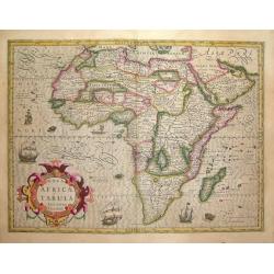
Nova Africae Tabula, Auctore Jodoco Hondio
A beautiful map of Africa from the prestigeous Hondius company.This map is from one of the great Hondius/Mercator atlases of the early 17th century. Jodocus Hondius (1563...
Date: Amsterdam, c 1636
Selling price: ????
Please login to see price!
Sold
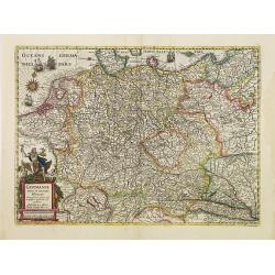
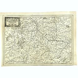
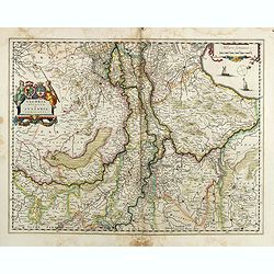
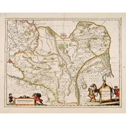
Germaniae nova et accurata delineatio.. 1631.
Striking example of Hondius' map of the German Empire, extending from the Low Countries in the Northwest to the Baltic and Russia in the Northeast and Italy and the Balka...
Date: Amsterdam 1636
Selling price: ????
Please login to see price!
Sold
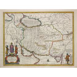
Persia Sive Sophorum Regnum.
In 1636 the by then obsolete map of Persia by Jodocus Hondius is replaced by a new map by J. Janssonius. Embellished with two cartouches.
Date: Amsterdam, 1636
Selling price: ????
Please login to see price!
Sold
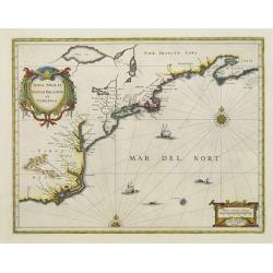
Nova Anglia Novum Belgium et Virginia.
In the 1636 edition of the Appendix , Johannes Janssonius inserted this important and influential map of the eastern seaboard from C. of Feare (Cape Look out) to Nova Sco...
Date: Amsterdam 1636
Selling price: ????
Please login to see price!
Sold
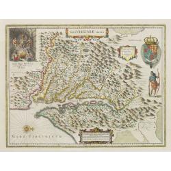
Nova Virginiae Tabula.
One of the most important maps of the Chesapeake Bay region, credited with disseminating knowledge of the English settlement in Virginia throughout Europe in the 17th cen...
Date: Amsterdam, ca. 1636
Selling price: ????
Please login to see price!
Sold
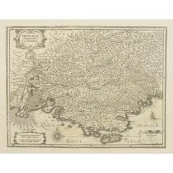
Provincia. La Provence.
Detailed map of the Province including the towns of Marseille, Avignon, Nice, Aix-en-Provence, Sisteron, etc.
Date: Amsterdam, 1636
Selling price: ????
Please login to see price!
Sold
![[ A lot of 3 maps of Spain. ]](/uploads/cache/20678-250x250.jpg)
[ A lot of 3 maps of Spain. ]
Hendrik Hondius' map is based on the map in 6 sheets of the Portuguese cartographer Jaoa Baptista Labanna of 1610-14. In association with Johannes Janssonius, Hendrick co...
Date: Amsterdam, 1636
Selling price: ????
Please login to see price!
Sold in 2021
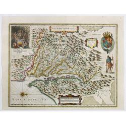
Nova Virginiae Tabula.
One of the most important maps of the Chesapeake Bay region, credited with disseminating knowledge of the English settlement in Virginia throughout Europe in the 17th cen...
Date: Amsterdam, ca. 1636
Selling price: ????
Please login to see price!
Sold in 2022
Nova et accurata Tabula Episcopatuum Stavangriensis, Bergensis et Asloiensis Vicinarumque aliquot territoriorum
Original old colored map of southern Norway by J. Janssonius. Showing the area between Oslo, Stavanger and Bergen. Decorated with a figural cartouche with mileage scale, ...
Date: Amsterdam, 1636
Selling price: ????
Please login to see price!
Sold in 2009
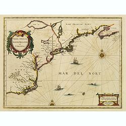
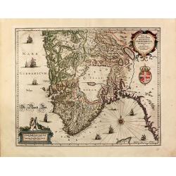
Nova Anglia Novum Belgium et Virginia.
In the 1636 edition of the "Appendix," Johannes Janssonius inserted this critical and influential map of the eastern seaboard from C. of Feare (Cape Lookout) to...
Date: Amsterdam, 1636
Selling price: ????
Please login to see price!
Sold in 2021
Silesiae Ducatus Accurata et vera delineatio. . .
A standard map of south western Poland, Centered on Wroclaw (Breslau), including the cities of Dresden, Prague, Krakow, Frankfurt, etc. The map is dedicated to the Silesi...
Date: Amsterdam, 1636
Selling price: ????
Please login to see price!
Sold in 2010
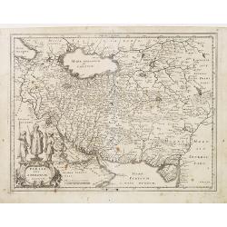
Persia Sive Sophorum Regum.
Decorative map of Persia extending from Saudi Arabia and Turkey to the Indus River, centered on Persia, with the Red Sea and the Persian Gulf in the South and Caspian and...
Date: Frankfurt, 1636
Selling price: ????
Please login to see price!
Sold in 2011
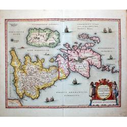
Insularum Britannicarum Acurata Delineatio ex Geographicis Conatibus Abraham Ortelii by Jan Jansson 1636 First state
Attractive original Scarce first state of Jansson's map of the Ancient British Isles. Includes decorative cartouche, sea monsters and 7 sailing vessels. Engraved by Peter...
Date: Amsterdam, 1636
Selling price: ????
Please login to see price!
Sold in 2011
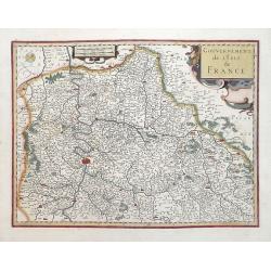
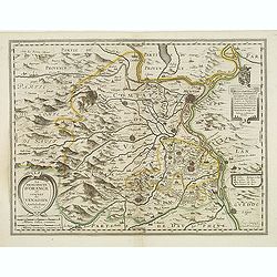
Gouvernement de L\'Isle de France.
Attractive map of Paris and its environs published in the rare English edition of Mercator's Atlas published by Henricus Hondius and Jan Jansson in 1636. This map is in ...
Date: Amsterdam, 1636
Selling price: ????
Please login to see price!
Sold in 2013
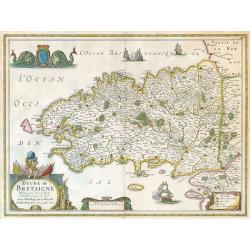
Duche de Bretagne.
Janssonius' Brittany map.
Date: Amsterdam, 1637
Selling price: ????
Please login to see price!
Sold in 2009
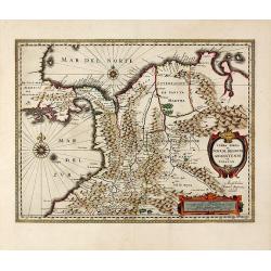
Terra Firma et Novum Regnum Granatense et Popayan.
Decorative, old colored copper engraved map of Colombia by J. Janssonius. Shows parts of Ecuador with Esmeraldas in the south-west, up to Venezuela in the East. With the ...
Date: Amsterdam, 1637
Selling price: ????
Please login to see price!
Sold in 2015
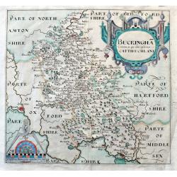
Buckingha Comitatus, in quo olim insederunt Cattieuchlani.
A fine early map of Buckinghamshire engraved by William Hole after Christopher Saxton. From the 1607 or 1637 edition of Camden's 'Britannia'. Very detailed, extending fro...
Date: London, 1637
Selling price: ????
Please login to see price!
Sold in 2020
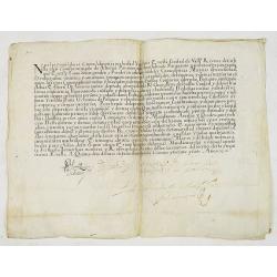
Spanish inquisition document, manuscript on vellum.
A large Spanish inquisition document on proceedings against heresy, by the Holy Office. Written on vellum in dark brown ink. Signed by many important persons.VERSO: Dated...
Date: Spain, 15th July 1637
Selling price: ????
Please login to see price!
Sold in 2012
La Principaute D'Orange et combat de Venaissin.
Very decorative copper engraved map featuring the cities of Avignon and Orange, as well as several smaller villages. The mountainous and forested topography is graphicall...
Date: Amsterdam, 1637
Selling price: ????
Please login to see price!
Sold
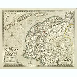
Frisia occidentalis.
This fine map of Friesland was made by the Franeker scientist Adrian Metius. The main towns are shown by miniature plan, attractive title cartouche bottom left, key carto...
Date: Amsterdam, 1637
Selling price: ????
Please login to see price!
Sold in 2012
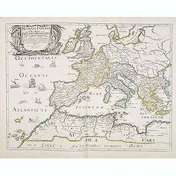
Romani Imperii Qua Occidens est Descriptio Geographica. . .
A fine map of the Roman Empire and includes Europe, Northern Africa, and the Near and Middle East. The map is embellished with ships in the Atlantic and a fine title cart...
Date: Paris, after 1637
Selling price: ????
Please login to see price!
Sold
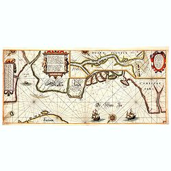
Pascaarte vande witte zee, vertoonende de rechte ghelegentheijt vande zeecusten, mitsgaders aller Havenen, Inwijcken, . . .
Very rare chart by Willem (Jansz) Blaeu from his chart book "Het Licht der Zee-vaert". The complete title of the map reads : "Pascaarte vande witte zee, ve...
Date: Amsterdam, 1608-1637
Selling price: ????
Please login to see price!
Sold in 2014
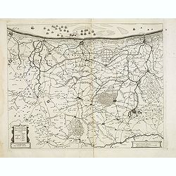
Carte des Duches de Luxembourg Iuliers et Partie de Brabant et Comte de Namur.
Detailed map of Luxembourg, published in "Theatre des Gaules", in 1637. Interestingly the title is printed from a separate copper plate. No date or publishers n...
Date: Paris, 1637
Selling price: ????
Please login to see price!
Sold
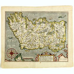
Viri Clarissimi Britannia..
A very attractive and decorative early 17th century map of Ireland which appeared in William Camden's Britannia. Based on Mercator's map of 1595, it was engraved by Willi...
Date: London, W.Hole, ca. 1637
Selling price: ????
Please login to see price!
Sold in 2015
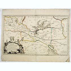
Galatia cujus populi Tolistobogi, Tectosages, Trocmi, mox provincia sub romanis in primam et secundam divisa et in ea romana itineraria ex tabula Peutingeriana. . .
Rare map of northern Turkey, centered around Ancyra (Ankara) and illustrates the provinces inhabited by the three Celtic tribes (Tolistobogi, Tectosages, and Trocmi) that...
Date: Paris, after 1637
Selling price: ????
Please login to see price!
Sold in 2015
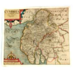
Cumbria Sive Cumberlandia Quae Olim par Brigantum.
A pleasing map of Cumberland from “Camden’s Britannia”. The 'Britannia' was the first publication that contained a complete set of individual county maps of England...
Date: London, 1610-1637
Selling price: ????
Please login to see price!
Sold in 2016
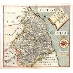
Northumbriae Comitatus, Olim Sedes Otadinorum.
An attractive map of Northumberland based on the first survey of England and Wales by Christopher Saxton and published in William Camden's “BRITANNIA” (London: 1607-...
Date: London, 1610-1637
Selling price: ????
Please login to see price!
Sold in 2016
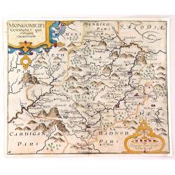
Montgomery Comitatus Qui Osim Pars Ordovicum.
Fine copper engraving of the county of Montgomery in England. The title is in a strapwork cartouche. Prepared and engraved by William Kip and William Hole based on Chris...
Date: London, 1637
Selling price: ????
Please login to see price!
Sold in 2016
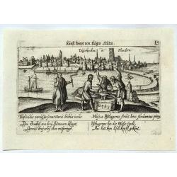
Duynkirchen in Flandern.
A city view of Dunkerque in Flanders based on that of Braun & Hogenberg. Published in Nuremberg by Paulus Furst. From 'Sciographia Cormica'.The authors of this work ...
Date: Nuremberg, 1637
Selling price: ????
Please login to see price!
Sold in 2021
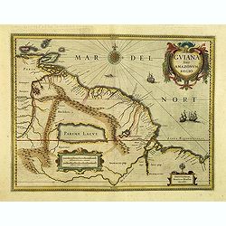
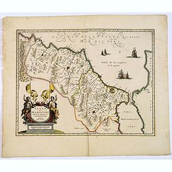
Guiana sive Amazonum Regio.
Copper engraving, hand colored in outline when published. A highly decorative map showing Guiana extending westwards to Trinidad and Margarita Island, dominated by a huge...
Date: Amsterdam, 1638
Selling price: ????
Please login to see price!
Sold in 2012
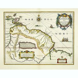
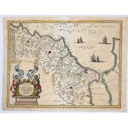
Guiana sive Amazonum Regio.
Important map extending from the Isla Margarita in the northwest to the coast of northern Brazil near Sao Luis east of the Amazon delta. The map locates at its center a l...
Date: Amsterdam, 1638
Selling price: ????
Please login to see price!
Sold in 2012
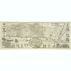
Chorographia Terrae Sanctae in Angustiorem formam Redacta et ex Variis Auctoribus a Multis Erroribus Expurgata . . .
Large attractive plan of the Holy Land in east orientation. First published in Antwerp 1632. Centered a city plan of Jerusalem after Villalpando 'Hierosolymae Veteris Ima...
Date: Antwerp, 1638
Selling price: ????
Please login to see price!
Sold in 2013
Fezzae et Marocchi regna Africae celeberrima.
North to the right. Showing the Atlas Mountains in the south to the southern coast of Spain, along the coast at Ceuta, Tangiers, and Arzilla.A finely engraved, decorative...
Date: Amsterdam, 1638
Selling price: ????
Please login to see price!
Sold in 2015
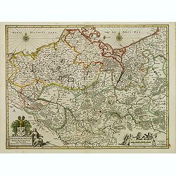
Flandriae pars occidentalis.
Rare map of Flanders with the city of Dunkerque shown and a huge fleet of ships. The interior is well engraved with forests and towns. With nice cartouche with agricultur...
Date: Amsterdam, ca. 1638
Selling price: ????
Please login to see price!
Sold
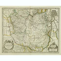
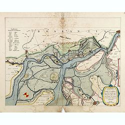
Novissima et Accuratissima Brabantiae Ducatus Tabula.
North is to the right. Like all other maps of Brabantiae Ducatus, it encloses the area between the rivers Rhine, Maas and Schelde, with Namur as the most southern town. O...
Date: Amsterdam, 1638
Selling price: ????
Please login to see price!
Sold in 2012
Brandeburgum Marchionatus cum Ducatibus Pomeraniæ et Mekelenburgi.
Decorative map of part of Pomerania, Mecklenburg, Rugia and part of present Poland with excellent detail of forests, rivers, towns and villages. Ornamented with two compa...
Date: Amsterdam, 1638
Selling price: ????
Please login to see price!
Sold in 2016
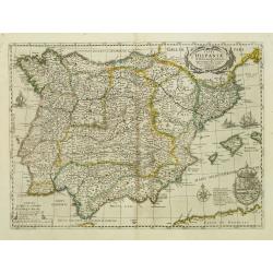
Typus Hispaniae ab Hesselo Gerardo delineata. . .
Decorative map of the kingdom of Spain and Portugal by Joan. Janssonius after the cartographic source by Hessel Gerard. Embellished by sailing ship, compass roses, and co...
Date: Amsterdam, 1638
Selling price: ????
Please login to see price!
Sold
Clivia Ducatus.
Detailed map of the area around Arnhem, Cleve, Wesel, Geldern, etc.Latin text on verso.
Date: Amsterdam, 1638
Selling price: ????
Please login to see price!
Sold in 2012
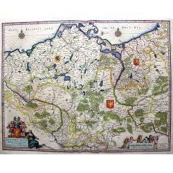
Poloniae Nova et Acurata Descriptio.
A good example of a scarce map of Poland extending from Stettin and Crossen to Cracow, to Lublin and Warsaw and north to the Baltic. Imposing figures support the title pi...
Date: Amsterdam, 1638
Selling price: ????
Please login to see price!
Sold in 2012
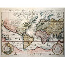
Nova Totius Terrarum Orbis Geographica ac Hydrographica Tabula
This beautifully engraved world map is presented on Mercator's projection with cartography closely copied from Blaeu's world map of 1606. The Latin title is printed at to...
Date: Frankfurt, 1638
Selling price: ????
Please login to see price!
Sold in 2014
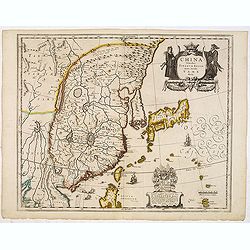
China Veteribus Sinarum Regio.
This was the first of Blaeu's maps of China. In 1655 he was to publish the famous map of Father Martini, with many of the earlier inaccuracies present on this map correct...
Date: Paris / Amsterdam, 1638
Selling price: ????
Please login to see price!
Sold in 2013
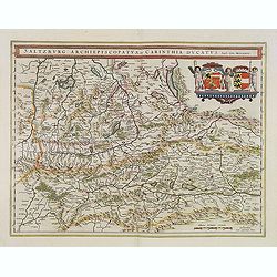
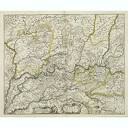
Saltzburg Archiepiscopatus, et Carinthia Ducatus.
Handsome map of the archbishopry of Salzburg and the Duchy of Carinthia.Title in banner form with two coats of arms and three cherubs decorating the map.As Willem Blaeu d...
Date: Amsterdam, 1638
Selling price: ????
Please login to see price!
Sold in 2013
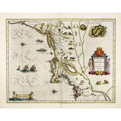
Nova Belgica et Anglia Nova.
Orientated with north to the right. This is one of the earliest maps to concentrate solely on this area of the colonies, excluding Virginia and the extreme north east coa...
Date: Amsterdam, 1638
Selling price: ????
Please login to see price!
Sold in 2013
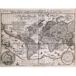
Nova totius terrarum orbis geographica...
Famous world map by Merian after Blaeu's map of the World on Mercators projection. With lots of interesting details: *California and the Sierra Nevadas are prominently n...
Date: Frankfurt, 1638
Selling price: ????
Please login to see price!
Sold in 2014
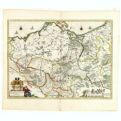
Brandeburgum Marchionatus cum Ducatibus Pomeraniæ et Mekelenburgi.
Decorative map of part of Pomerania, Mecklenburg, Rugia and part of present Poland with excellent detail of forests, rivers, towns and villages. Ornamented with two compa...
Date: Amsterdam, 1638
Selling price: ????
Please login to see price!
Sold in 2015
Geldria Ducatus et Zutphania Comitatus.
Map of Gelderland orientated west at the top, including Northern Limburg, eastern part of Brabant, Veluwe and Zutphen. Including the towns of Utrecht, Enschede, Rhunbeck,...
Date: Amsterdam, 1638
Selling price: ????
Please login to see price!
Sold in 2017
Osnabrugensis episcopatus.
A beautiful map of Munster centered on the city of Osnabruck. Prepared by Joannes Michael Gigas (1580-1650+), a doctor, mathematician and geographer. Showing an inset wit...
Date: Amsterdam, 1638
Selling price: ????
Please login to see price!
Sold in 2017
Tabula Bergarum ad Zoman Stenbergae.
A small section of the center has been rubbed: otherwise excellent. Rather rare to see an early road map in this time. It shows the city of Bergen op Zoom in Brabant.As W...
Date: Amsterdam, 1638
Selling price: ????
Please login to see price!
Sold in 2017
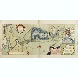
Tabula Castelli ad Sandflitam,..Bergas ad Zomam et Antverpi
East is at the top. The map pictures the complex military situation that had developed after the Dutch blockade of Antwerp. All entrenchment's and fortresses marked by a ...
Date: Amsterdam, 1638
Selling price: ????
Please login to see price!
Sold in 2017
Trevirensis Archiepiscopatus, et Lutzenburgi Ducatus.
Includes the region between Mass and Mosel. Title in decorative cartouche surrounded with coats of arms : Archbishopric of Trier and Duchy of Luxembourg.As Willem Blaeu d...
Date: Amsterdam, 1638
Selling price: ????
Please login to see price!
Sold in 2016
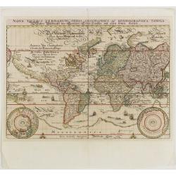
Nova Totius Terrarum Orbis Geographica ac Hydrographica Tabula.
This beautifully engraved world map is presented on Mercator's projection with cartography closely copied from Blaeu's world map of 1606. The Latin title is printed at to...
Date: Frankfurt, 1638
Selling price: ????
Please login to see price!
Sold in 2015
Brandeburgum Marchionatus cum Ducatibus Pomeraniae et Meklenburgi.
Very Decorative map of part of Pomerania, Mecklenburg, Rugia and part of present Poland with excellent detail of forests, rivers, towns and villages. Ornamented with two ...
Date: Amsterdam, 1638
Selling price: ????
Please login to see price!
Sold in 2016
Tractus Rheni et Mosae totusq Vahalis.
Shows that part of the central Netherlands where the three great rivers flow to within but a few kilometers of each below Wesel. The scale allows most of the larger towns...
Date: Amsterdam, 1638
Selling price: ????
Please login to see price!
Sold in 2017
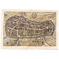
Reims en Champagne.
Striking birdseye view of Reims in Champagne, from Merian's “Neuwe Archontologica Cosmica”, published in 1638. It shows the detailed town plan of Reims and Champagne,...
Date: Frankfurt, 1638
Selling price: ????
Please login to see price!
Sold in 2018
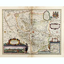
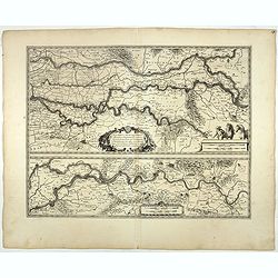
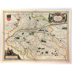
![Magni Ducatus Lithuaniae. . . (together with] Campus Inter Bohum et Borystenem. . .](/uploads/cache/36645-250x250.jpg)
Magni Ducatus Lithuaniae. . . (together with] Campus Inter Bohum et Borystenem. . .
Six sheet wall map of Lithuania and parts of Poland, Russia, Ukraine, Latvia, etc., extending to Cracow, Kyiv, Warsaw, Riga, Konigsberg, Danzig, Leopolis, etc.This is the...
Date: Amsterdam, 1638
Selling price: ????
Please login to see price!
Sold in 2015
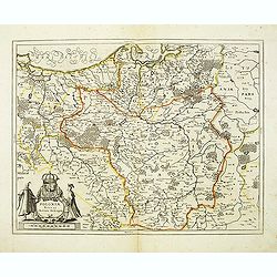
Ducatus Turonensis....
Lovely decorative map of the Touraine region of France with Tours and the Loire River at center. Two decorative cartouches feature allegorical renderings of Mother Earth ...
Date: Amsterdam, ca. 1638
Selling price: ????
Please login to see price!
Sold in 2018
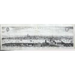
London
A panoramic, early view of London before the fire 1666, it has a key noting 43 places within the City. This large view extends from the King's Palace at Whitehall to the ...
Date: Frankfurt, 1638
Selling price: ????
Please login to see price!
Sold in 2016
![EVROPAM sive CELTICAM VETEREM sic describere conabar Abrahamus Ortelius. [CELTIC EUROPE]](/uploads/cache/37626-250x250.jpg)
EVROPAM sive CELTICAM VETEREM sic describere conabar Abrahamus Ortelius. [CELTIC EUROPE]
Possibly derived to some extent from Ortelius' own two sheet map of the Roman Empire, which appeared in 1571. Further, this map is based on classical sources, such as Sal...
Date: Amsterdam, 1638
Selling price: ????
Please login to see price!
Sold in 2017
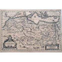
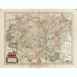
Nova Barbariae Descriptio
Fantastic and highly decorative map of North Africa covers from Morocco to the Nile delta, and large parts of the Mediterranean from Portugal to Cyprus. Africa is filled ...
Date: Amsterdam, ca. 1638
Selling price: ????
Please login to see price!
Sold in 2016
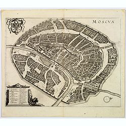
Moscua.
Striking birds-eye view of Moscow, from Merian's" Neuwe Archontologica Cosmica" . . ., published in 1638. With Moscow River, Iausa River, Neglina River, Kremlin...
Date: Frankfurt, 1638
Selling price: ????
Please login to see price!
Sold in 2017
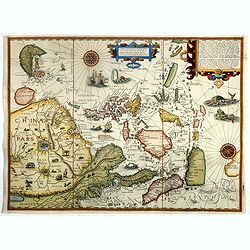
Exacta & accurata.. regionibus China, Cauchinchina, Camboja..
...the Far East and the Malay Archipelago are represented in such detail as was known only to the Portuguese at that time and had never before shown on a printed map. (S...
Date: Amsterdam, 1599-1638
Selling price: ????
Please login to see price!
Sold in 2018
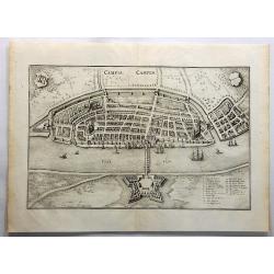
Campia Campen. (Kampen)
Striking view of Kampen on the Ysel River, with 2 coats of arms (one blank) and several sailing ships. Shows town plan, fortified walls, bridge, canals, etc. Matthäus ...
Date: Frankfurt, 1638
Selling price: ????
Please login to see price!
Sold in 2019
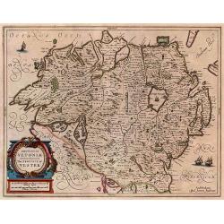
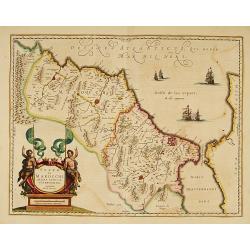
Provincia Ultoniae The Province of Ulster.
A finely engraved map of Ulster in northern Ireland. Adorned with vessels and a decorative title cartouche. Relief shown pictorially. Illustrated topography shows towns, ...
Date: Amsterdam, 1638
Selling price: ????
Please login to see price!
Sold in 2017
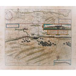
Pascaert vande Custe van Vlaenderen, van Walcheren tot Cales en Bouloigne in Vranckrijck.
A very decorative, large sea map, oriented south-westward. The upper part depicts the coastal region of Flanders, the lower part specifically the cost of Dünkirchen. Wit...
Date: Amsterdam, 1638
Selling price: ????
Please login to see price!
Sold in 2018
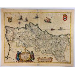
Portugallia et Algarbia quae olim Lusitania.
A striking map of Portugal with north oriented to the right. This lovely map by Jansson is adorned with numerous artistic embellishments including ships, coats-of-arms, t...
Date: Amsterdam, 1638
Selling price: ????
Please login to see price!
Sold in 2018
Fezzae et Marocchi regna Africae celeberrima.
A finely engraved, decorative map of Fez and Morocco by Blaeu, who cartography greatly influenced subsequent maps for the rest of the century. North is orientated to the ...
Date: Amsterdam, 1638
Selling price: ????
Please login to see price!
Sold in 2017
Fezzae et Marocchi Regna Africae Celeberrima.
A fine and detailed map of Morocco showing the large fortified towns of Marakesh, Taradante and Fez. A large decorative cartouche depicts two Centaurs holding flags, and ...
Date: Amsterdam, 1638
Selling price: ????
Please login to see price!
Sold in 2019
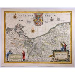
Pomeraniae Ducatus Tabula.
A detailed map of the Duchy of Pomerania, that between Poland and Germany. The map is highly decorated, including a title cartouche with five figures, fruit, a scale wit...
Date: Amsterdam, 1638
Selling price: ????
Please login to see price!
Sold in 2018
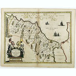
Fezzae et Marocchi regna Africae celeberrima.
An attractive map of northwest Africa and Morocco. The Pillars of Hercules & Straits of Gibraltar, and Spain are shown to the right of the map (north is to the right ...
Date: Amsterdam, 1638
Selling price: ????
Please login to see price!
Sold in 2018
![Hafnia Metropolis et Portus Celeberrimus Daniae. [Coppenhagen]](/uploads/cache/82076-250x250.jpg)
Hafnia Metropolis et Portus Celeberrimus Daniae. [Coppenhagen]
A striking birds-eye view of Copenhagen, from Merian's Neuwe Archontologica Cosmica . . ., published in 1638. It shows town, buildings, churches, harbour, bridges, ships,...
Date: Frankfurt, 1638
Selling price: ????
Please login to see price!
Sold in 2018
![[Title page] Theatre des principales villes de tout l'univers, Liber VI](/uploads/cache/43305-250x250.jpg)
[Title page] Theatre des principales villes de tout l'univers, Liber VI
A very attractive title page from Theatre des principales villes de tout l'univers, Liber VI. Showing With personifications, portraits and war scenes. In attractive origi...
Date: Cologne, 1638
Selling price: ????
Please login to see price!
Sold in 2019
![[Title page] Theatre des principales villes de tout l'univers, Liber V.](/uploads/cache/43306-250x250.jpg)
[Title page] Theatre des principales villes de tout l'univers, Liber V.
The most decorative frontispiece of the 5th part of the 'Theatre des principales villes de tout l'univers'. Showing heraldic figures, representations of the four continen...
Date: Cologne, 1638
Selling price: ????
Please login to see price!
Sold in 2020
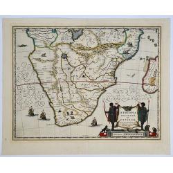
Aethiopia inferior, vel exterior. 

The standard map of South Africa throughout the 17th century. The lake out of which the 'Zambere' - the Zambesi flows is probably based on reports of Lake Ngami, undiscov...
Date: Amsterdam, 1638
Selling price: ????
Please login to see price!
Sold in 2019
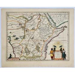
Aethiopia Superior vel Interior; vulgo Abissinorum. 

An attractive map of the Eastern African and the fictitious kingdom of 'Prester John'. The map shows a major section of central and eastern Africa including Mozambique no...
Date: Amsterdam, 1638
Selling price: ????
Please login to see price!
Sold in 2019
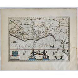
Guinea.
A detailed and decorative map of Guinea, showing the length of a coast important to African-European trade, including the slave trade. Embellished with numerous animals i...
Date: Amsterdam, 1638
Selling price: ????
Please login to see price!
Sold in 2019
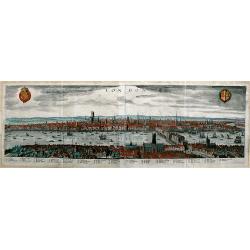
London.
A panoramic, early view of London before the fire of 1666, it has a key noting 43 places within the City. This large view extends from the King's Palace at Whitehall to ...
Date: Frankfurt a. M., 1638
Selling price: ????
Please login to see price!
Sold in 2019
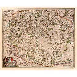
Hungaria Regnum.
Detailed map of Hungary centered on Budapest. Including the towns of Vienna, Zagreb as well.
Date: Amsterdam 1638
Selling price: ????
Please login to see price!
Sold
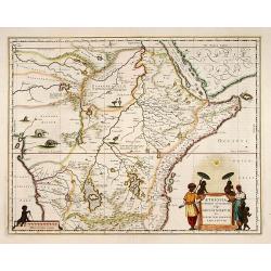
Aethiopia Superior vel Interior; vulgo Abissinorum.
An attractive map of the Eastern African and the fictitious kingdom of Prester John. The map shows a major section of central and eastern Africa including Mozambique nort...
Date: Amsterdam 1638
Selling price: ????
Please login to see price!
Sold

Jutia Septentrionalis.
Early and detailed map of Jutland. Prepared by Gerard Mercator.
Date: Amsterdam 1638
Selling price: ????
Please login to see price!
Sold
Tartariae sive Magni Chami Imperium.
Fine map of Tartary, including northern part of China, and tip of Korea.
Date: Amsterdam 1638
Selling price: ????
Please login to see price!
Sold