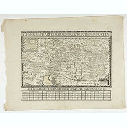
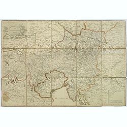
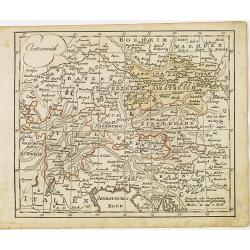
General Charte der Oesterreichischen Staaten.
Uncommon map of Eastern Europe.
Place & Date: Germany, 1796
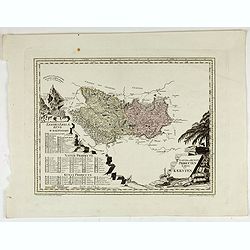
Natur und Producten Karte von Kaernten.
Nature and products map of Carinthia. Map of J.W. Engelmann after H.W. von Blum, taken from "Natur und Kunst Producten Atlas der Oesterreichischen, deutschen Staaten...
Place & Date: Viena, 1796
Selling price: $200
Sold in 2022
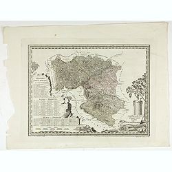
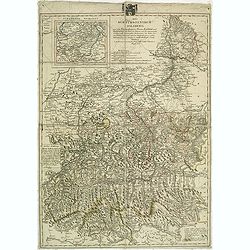
Natur und Producten Karte von Steyermark.
Nature and products map of Styria. Map of J.W. Engelmann after H.W. von Blum, taken from "Natur und Kunst Producten Atlas der Oesterreichischen, deutschen Staaten&qu...
Place & Date: Viena, 1796
Selling price: $200
Sold in 2022
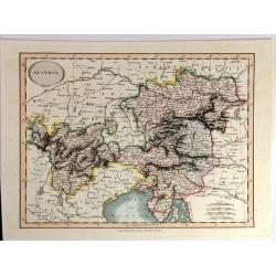
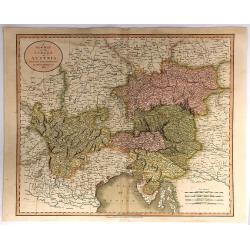
Austria By John Cary
A fine map of Austria and Slowenia. John Cary (1754 –1835) was an English cartographer. He served his apprenticeship as an engraver in London, before setting up his own...
Place & Date: London, 1801
Selling price: $95
Sold in 2015
Der Osterreichische Kreiss. Nach dem neusten Grenz=Berichtigung verlast.
Folding map of Austria, engraved by F. Reisser and published by Tranquillo Mollo in Vienna. Maria Laurentio Tranquillo Mollo (born August 10, 1767 in Bellinzona, Ticino, ...
Place & Date: Vienna, 1803
Selling price: $95
Sold in 2013
Das Kurfüstenthum Salzburg. . .
Map of Salzburg in Austria. Many annotation in black lead-pencil. More about folding maps. [+]
Place & Date: Nurmberg, 1805
Selling price: $30
Sold in 2013
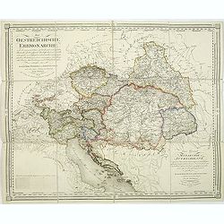
Die Oestreichische Erbmonarchie nach ihrem gegenwärtigen Zustande Kartenmaterial mit vorzüglicher Rücksicht auf ihre physische Beschaffenheit. . . / Carte générale de la monarchie autrichienn.
Detailed map showing Central Europe and showing the Austria-Hungarian Monarchy. The map includes Austria, with parts of Poland, Germany, Italy, prepared by Joseph Wüstin...
Place & Date: Vienna, Kunst und Industrie Comptoirs,1806
Selling price: $110
Sold in 2013
A New Map of the Circle of Austria, From the Latest Authorities . . .
A detailed map of John Cary’s Austria, from the important early 19th century “NEW UNIVERSAL ATLAS”. It covers from Lake Constance and eastward as far as Lake Pelso...
Place & Date: London, 1811
Selling price: $110
Sold in 2018
Oesterreich.
Nice small map of Austria by Johannes Walch in his rare Allgemeiner Atlas Nach den bewährsten Hülfsmitteln und astronomischen Ortsbestimungen…, edition of 1812.Johann...
Place & Date: Augsburg, 1812
Selling price: $80
Sold in 2015
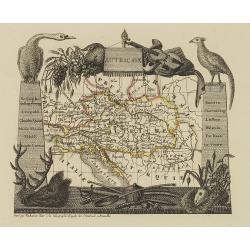
Autriche
Attractive map of Austria with decorative borders depicting typical artifacts and produce of the continent. Published in Les jeunes voyageurs en Europe.. . Engraved by va...
Place & Date: Brussels, 1824
Selling price: $80
Sold in 2013