Browse Listings in America > South America > Chile
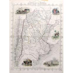
Chili and La Plata.
A very decorative steel-engraved map extending from the border of Bolivia until Patagonia, with northern Chile and northern Argentina. Very detailed with place names, riv...
Place & Date: London, ca. 1850
Selling price: $65
Sold in 2017
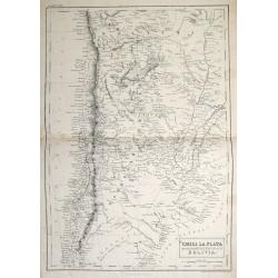
Chile, La Plata or the Argentine Republic and Bolivia.
A fine example of Adam and Charles Black's 1851 map of Chile, the Argentine Republic and part of Bolivia. The map illustrates Bolivia's claims to the Atacama Desert and a...
Place & Date: Edinburgh, 1851
Selling price: $60
Sold in 2013
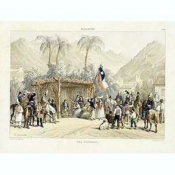
Historia de Chile. No. 20. Una chingana.
From "Historia de Chile." by Claudio Gay, a French naturalist, who was working under contract to the Chilean government between 1830-1833. Upon his return to Fr...
Place & Date: Paris, 1854
Selling price: $35
Sold in 2014
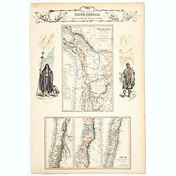
West Coast of South America including Chile & part of Bolivia & Peru.
A decorative regional map of South America, which contains 4 maps. The top map shows Peru and the neighboring Bolivian Table Lands, while and the 3 maps at the bottom dep...
Place & Date: Edinburgh, 1854
Selling price: $65
Sold in 2020
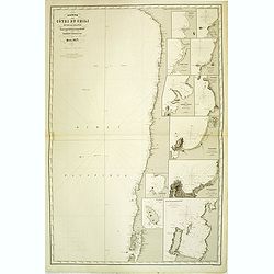
Carte des côtes du Chili et de la Bolivie dressée d'après les Traveux du Cap.e Fitz-Roy par Robiquet . . .
Large chart of the coast of Chili, with 11 detailed insets. Engraved by Louis A. Sengteller.
Place & Date: Paris, 1857
Selling price: $190
Sold in 2012
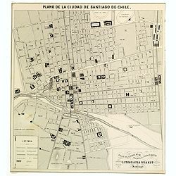
Plano de la Ciudad de Santiago de Chile.
A nice sized plan of the Chilean capital of Santiago towards the end of the nineteenth century. This orderly plan lays out the cities divisions and sub divisions, churche...
Place & Date: Santiago, ca 1878
Selling price: $65
Sold in 2016
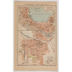
Valparaiso und Santiago.
Eye-bird view of Valparaiso bay, together with a city plan of Santiago. The print has been printed by F.A.Brockhaus Geogr. - artist. Anstalt, Germany in 1895.
Place & Date: Germany, 1895
Selling price: $25
Sold in 2020
Mensura de las minas.
Pen and ink drawing of mines in South America by Belisaeio Vergara and other sources of the mines "Porvenir", "Defensa" and "Amparo" in Chil...
Place & Date: Chile, 1906
Selling price: $20
Sold in 2014
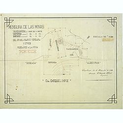
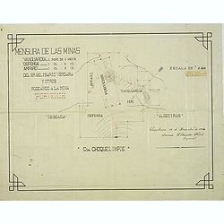
Mensura de las minas. . . Choquelimpie. (manuscript map)
Pen and ink drawing of the mines "Porvenir", "Defensa" and "Amparo" in Choquelimpe region in Chili by Belisaeio Vergara and E.Basadre Forero...
Place & Date: Chile, Choquelimpie, 19 December 1906
Selling price: $75
Sold in 2015