Browse Listings in America > Caribbean & Atlantic Ocean > Martinique
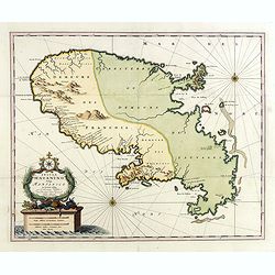
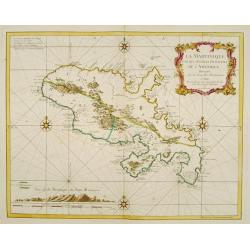
Insula Matanino vulgo Martanico in lucem edita / per Nicolaum Visscher cum Priviliegio Ordin: General Belgii Faederati.
Uncommon map, showing the portion of the island which had been taken from the Caribs up to that time. In lower left corner a title cartouche with fruit, tobacco, sugar.
Place & Date: Amsterdam, ca. 1680
Selling price: $800
Sold in 2019
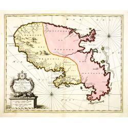
Insula Matanino vulgo Martanico in lucem edita / per Nicolaum Visscher cum Priviliegio Ordin: General Belgii Faederati.
Uncommon map, showing the portion of the island which had been taken from the Caribs up to that time. In lower left corner a title cartouche with fruit, tobacco, sugar.
Place & Date: Amsterdam, ca. 1680
Selling price: $900
Sold
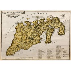
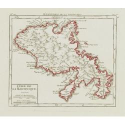
L'Isle de la Martinique.
Map of the island of Martinique, engraved by F.Starckman, from De Fer's Atlas Curieux.
Place & Date: Paris, 1704
Selling price: $330
Sold in 2009
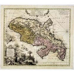
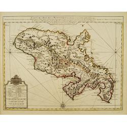
Representation la plus nouvelle et exacte De L'Ile Martinique, la premiere des Iles Del' Amerique Antilles Nommees Barlovento, Aux depens...
Fine map of Martinique with an extremely decorative cartouche that depicts the native islanders meeting and trading with Europeans. Engraved by Albrecht Carl Seutter (172...
Place & Date: Augsburg, c. 1740
Selling price: $600
Sold
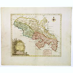
Carte de L' Isle de la Martinique Colonie Francoise de l'une des Isles Antilles de l'Amerique..
A very well executed plan of the island after Delisle. Excellent detail throughout includes realistic depictions of bays, mountains, islets, lagoons, forests, etc., which...
Place & Date: Amsterdam c. 1745
Selling price: $330
Sold
La Martinique une des Antilles Françoises de L'Amerique..
Fine map of Martinique. George Louis Le Rouge was active from 1740- till 1780 as a publisher, and was appointed engineer for the King of France.
Place & Date: Paris 1748
Selling price: $400
Sold
L\'Isle de la Martinique.
Nice small map of Martinique. From Atlas Portatif Universel, by Robert de Vaugondy.Page 563 and 96 outside border top right. To the left Pl. 110.Mary Sponberg Pedley does...
Place & Date: Paris, later than 1748
Selling price: $130
Sold in 2008
Het Westindisch Eiland Martenique
Taken from Isaac Tirion's atlas 'Nieuwe en Beknopte Hand-Atlas, bestaande in eene Verzameling van eenige der algemeenste en nodigste Landkaarten …' Decorative tropical ...
Place & Date: Amsterdam, 1750
Selling price: $150
Sold in 2016
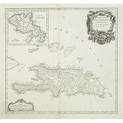
Isles de Saint Domingue ou Hispaniola, et de la Martinique.
A large map of Santo Domingo, with an inset showing the island of Martinique from his "Atlas Universel".Gilles Robert de Vaugondy (1688–1766), also known as L...
Place & Date: Paris, 1750
Selling price: $55
Sold in 2011
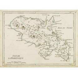
Isle de la Martinique.
Detailed map on the island of Martinique in the Caribbean. Villages, forts, mountains and bays all around the island are named. George Louis Le Rouge was active from 1740...
Place & Date: Paris 1756
Selling price: $65
Sold