Browse Listings in America > Caribbean & Atlantic Ocean > Haïti / St. Domingo
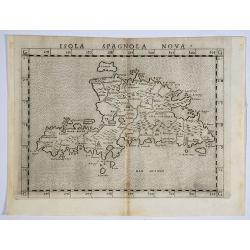
Isola Spagnola Nova.
One of the earliest separately published maps of Hispaniola, from an early edition of Ruscelli's version of Ptolemy's Geography, published in 1561. Ruscelli's map is a la...
Place & Date: Venice, 1562
Selling price: $70
Sold in 2019
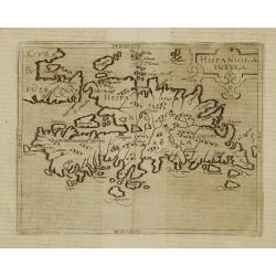
Hispaniola Insula.
Very rare sixteenth century map of the Hispaniola Island and the eastern tip of Cuba.Published in the German edition of José de Acosta's De Natura Nova Orbis, first publ...
Place & Date: Cologne 1598
Selling price: $600
Sold
![[Black slaves work the sugar plantations].](/uploads/cache/41111-250x250.jpg)
[Black slaves work the sugar plantations].
After the veins of precious ore became depleted on Hispaniola, the Spanish set the Black slaves to work on the sugar plantations. This soon became a highly profitable ven...
Place & Date: Frankfurt, M.Merian, 1633
Selling price: $100
Sold in 2019
![[Sir Francis Drake attacks the town of Santa Domingo.]](/uploads/cache/40367-250x250.jpg)
[Sir Francis Drake attacks the town of Santa Domingo.]
The town of Santo Domingo on the island of Hispaniola was once the capital of Spanish America but in 1586, when Drake arrived, it had deteriorated somewhat in stature. Be...
Place & Date: Frankfurt, M.Merian, 1633
Selling price: $100
Sold in 2017
![[lot of 8 maps/ prints of the Caribbean] Cuba Insula, inset: Havanna portus; Hispanolia Insula; Insula Iamaica; Ins. S. Ioannis; I.s. Margareta.](/uploads/cache/20279-(4)-250x250.jpg)
[lot of 8 maps/ prints of the Caribbean] Cuba Insula, inset: Havanna portus; Hispanolia Insula; Insula Iamaica; Ins. S. Ioannis; I.s. Margareta.
Re-issue of Gerard Mercator's small atlasA lot of 8 maps and prints of the Caribbean.
Place & Date: Amsterdam, 1630-1636
Selling price: $120
Sold in 2022
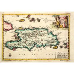
Hispaniola.
A map of the island of Hispaniola with an attractive cartouche. Pieter van der Aa was a prolific publisher. He published a.o. "Naauwkeurge versameling der gedenkwaar...
Place & Date: Leiden, 1707
Selling price: $80
Sold in 2020
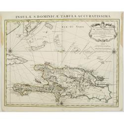
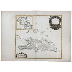
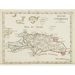
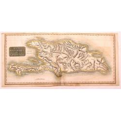
Carte de l'Isle de Saint Domingue Dressée en 1722 pour l'usa
Map of the island Hispaniola, now Haiti and the Dominican Republic. Embellished with a charming title cartouche and two compass roses. Shows the south easternmost part of...
Place & Date: Amsterdam, 1720
Selling price: $300
Sold in 2008
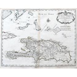
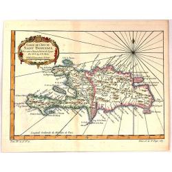
Carte de l'Isle de Saint Domingue Dressee en 1722. . .
An excellent map of Hispaniola with many details: Towns are connected with roads, many small rocks and islands shown, including Tortuga. Extends to show a tip of Cuba, an...
Place & Date: Paris, 1725
Selling price: $119
Sold in 2020
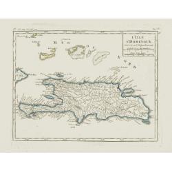
L'Isle St. Domingue.
Nice small map of Hispaniola. Including the Caicos Islands and the Great Inagua. From Atlas Portatif Universel, by Robert de Vaugondy.Page 535 and 95 outside border top r...
Place & Date: Paris, later than 1748
Selling price: $60
Sold in 2012
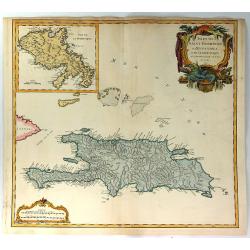
ISLES DE SAINT DOMINIGUE ou HISPANIOLA et de la Martinique.
This is a fine map of Hispaniola or Santo Domingo (modern day Haiti and the Dominican Republic) by Robert de Vaugondy. It includes the tip of Cuba and the Inagua Islands ...
Place & Date: Paris, 1750
Selling price: $70
Sold in 2020
Isles de Saint Domingue ou Hispaniola, et de la Martinique.
This is a fine map of Hispaniola or Santo Domingo (modern day Haiti and the Dominican Republic) by Robert de Vaugondy. It includes the tip of Cuba and the Inagua Islands ...
Place & Date: Paris, 1750
Selling price: $75
Sold in 2020
Isle de St. Domingue.
Fine map of Haiti and the Dominican Republic. Striking map of the island with detailed rendering of roads and topography. George Louis Le Rouge was active from 1740- till...
Place & Date: Paris 1756
Selling price: $70
Sold
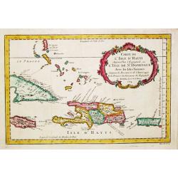
Carte de L'Isle de Saint Dominique.
A fine map of the island of Saint Dominique or Santo Domingo or Hispaniola, divided by the countries of Haiti and Dominican Republic. From the atlas “Histoire Generale ...
Place & Date: Paris, 1757
Selling price: $19
Sold in 2018
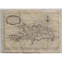
Carte de L'Isle de Saint Domingue.
A fine 1758 Bellin map of the Dominican Republic and Haiti. Taken from a later edition of Abbe A.F. Prevost d'Exiles's "Histoire generale des voyages". It featu...
Place & Date: Paris, 1758
Selling price: $43
Sold in 2020
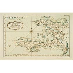
la Partie Francoise de l'Isle de Saint Domingue.
This chart shows the territories of what is today Haiti.The only issue of this version of Bellin's map, slightly larger than the common version. From Bellin's Petit atlas...
Place & Date: Paris 1764
Selling price: $80
Sold
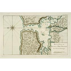
Baye et Ville de Bayaha ou Port Dauphin dans l'Isle de Saint-Domingue.
A detailed chart of the harbour of Banana on the north coast of what is today Haiti.The only issue of this version of Bellin's map, slightly larger than the common versio...
Place & Date: Paris 1764
Selling price: $60
Sold
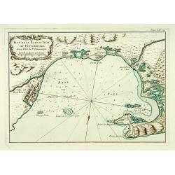
Plan de la Rade et Ville du Petit Goave dans l'Isle de St Domingue.
A very detailed chart of Petit Goave and l'Acul on the north coast of what is today Haiti.The only issue of this version of Bellin's map, slightly larger than the common ...
Place & Date: Paris 1764
Selling price: $50
Sold
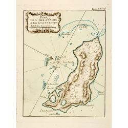
Plan de l'Isle A Vache a la Coste Sud de S. Domingue.
This chart shows the little island l'Isle à Vache on present day Haiti.The only issue of this version of Bellin's map, slightly larger than the common version. Depths sh...
Place & Date: Paris 1764
Selling price: $60
Sold
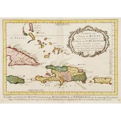
Carte de L'Issle d'Hayti, Aujour d'hui.. St.Domingue..
Uncommon edition of this fine map of Hispaniola and the neighboring islands Jamaica, Caymans, Porto Ricco and eastern part of Cuba. Hispaniola divided into the five major...
Place & Date: Amsterdam, 1773
Selling price: $200
Sold in 2020
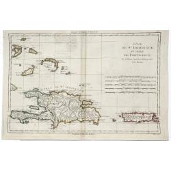
Carte de l' Isle d' Hayti, Aujourd'hui l' Espagnole, ou l' Isle de St. Dominique, Avec les Isles voisines.
Jaques Nicolas Bellin (1702-720) was the most important French hydrographer of the 18th century. Sea-atlas 'Hydrographique Français' , 1756-65, atlas to accompany Prévo...
Place & Date: Amsterdam, 1773
Selling price: $200
Sold in 2008
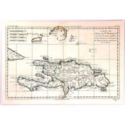
Carte de L'Isle de St. Domingue une des Grande Antilles
A copperplate map of the island of Hispaniola by Rigobert Bonne in 1774. With the two sovereign states of the Dominican Republic and Haiti. Also with nearby Caicos and th...
Place & Date: Paris, 1774
Selling price: $25
Sold in 2017

Carte de la Dominique prise par les François Le 7 septembre 1778. . .
A rare, one of the finest maps of Dominica ever produced, with insets of Charlottesville with its attack by the French on 7 September 1778. Also small inset map of the Ca...
Place & Date: Paris, 1778
Selling price: $850
Sold
![[Dominican Republic and Haiti. No Title, but contains] "Plan de la Baye de l'Acul; Baye de Dame- Marie; Le Port François; Plan du Môle St. Nicolas; Baye des Irois."](/uploads/cache/swaen122-1001-250x250.JPG)
[Dominican Republic and Haiti. No Title, but contains] "Plan de la Baye de l'Acul; Baye de Dame- Marie; Le Port François; Plan du Môle St. Nicolas; Baye des Irois."
Large copper engraved nautical map from the rare and beautifully produced atlas recording the results of an official French coastal survey of the island of Hispaniola,...
Place & Date: Paris, ca 1785
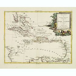
Stabilimenti de Francesi, Inglesi, E Spagnuoli nelle Isole Antille. . .
Uncommon map of Caribbean, including Florida, Bahamas and coast of Venezuela, including Curacao, Artiba I, Buenayre , etc. Engraved by G.Pitteri.
Place & Date: Venice, 1785
Selling price: $200
Sold in 2022
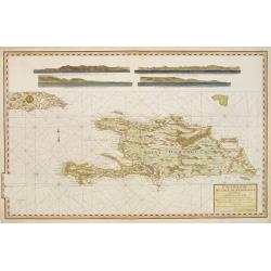
Carte reduite de L'Isle de Saint Domingue.
Very detailed chart made for the official French hydrographical office "Depot générale de la Marine". In top 4 coastal profiles.
Place & Date: Paris, 1787
Selling price: $250
Sold
L'Isle de St. Domingue et Celle de Porto-Rico.
A detailed map of Santa Domingo, Puerto Rico, etc. Includes substantial topographical detail. Includes Eastern Bahamas. From Bonne's "Atlas Supplement".Rigobert...
Place & Date: Paris, 1787
Selling price: $32
Sold in 2019
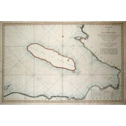
CARTE DE LA GONAVE...
Fantastic large-scale chart of the island of Gonave. Includes also the coasts of Haiti, with Saint-Marc, Port-au-Prince, Leogane, Petit and Grand Goave. Filled with numer...
Place & Date: Paris, 1788
Selling price: $60
Sold in 2013
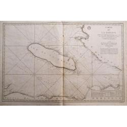
Carte de la Gonave...
Fantastic large-scale sea-chart of the island of Gonave. Includes also the coasts of Haiti, with Saint-Marc, Port-au-Prince, Leogane, Petit and Grand Goave. Highly detail...
Place & Date: Paris, 1788
Selling price: $22
Sold in 2014
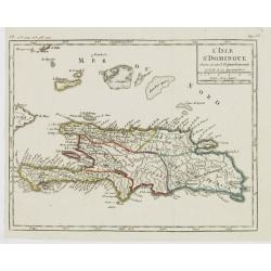
L'Isle St. Domingue Divisée en 5 Département.
Map of the island of Hispaniola, from Atlas de la Géographie de toutes les parties du monde .. Ouvrage destiné pour l'education, et nécessaire aux négocians, aux voya...
Place & Date: Paris, Prudhomme, Levrault, Debray, 1806
Selling price: $17
Sold in 2022
Haiti, Hispaniola or St. Domingo.
Fine Thomson map of Haiti or th island of St. Domingo. Originally paired with the map of Porto Rico, this map has been professionally split into two maps.
Place & Date: Edinburgh, 1814
Selling price: $15
Sold in 2015
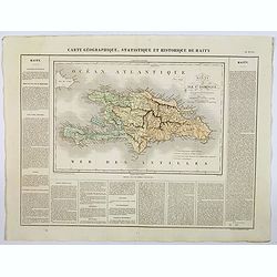
Carte Geographique, Statistique et Historique de Haity.
A nice detailed map of the island of Haiti, from Buchon's Atlas Gégraphique Statistique, historique et chronologique des deux Ameriques et des isles adjacentes traduit d...
Place & Date: Paris, 1825
Selling price: $50
Sold in 2019
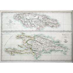
Jamaica; Hayti.
Two maps on one sheet, both very detailed with many place names, roads, hills, etc.The Weekly Dispatch newspaper was published in London between the years 1856 and 1862,...
Place & Date: London, ca 1860
Selling price: $25
Sold in 2018
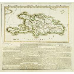
Hayti.
This is the map of Haiti is from a plano edition of the very scarce German edition of Carey & Lea's "A Complete Historical, Chronological, and Geographical Ameri...
Place & Date: Weimar, 1822-25
Selling price: $190
Sold