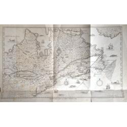
Champlain's Map of New France 1632.
FROM 1850 NEW YORKSTATE HISTORY. A nineteenth century lithograph reproduction of a seminal map.
Place & Date: New York, 1850
Selling price: $100
Sold in 2015
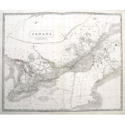
Canada
A large and highly detailed map of the area between Lake Huron and the Gulf of the Saint Lawrence River, complete with references to the Townships, notes about Indians, a...
Place & Date: Edinburgh, ca 1850
Selling price: $40
Sold in 2016
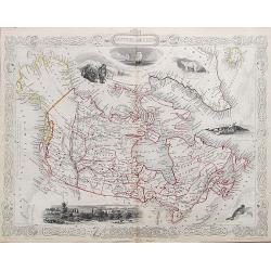
British America.
A very decorative steel-engraved map of Canada, highly detailed with place names, rivers, mountains, islands, bays, etc. Attractively illustrated with vignette style vie...
Place & Date: London, ca. 1850
Selling price: $25
Sold in 2017
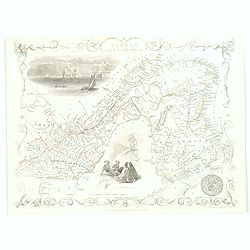
East Canada and New Brunswick.
This is John Tallis’ map of East Canada, or what is now Quebec and New Brunswick. Includes Montreal, Quebec City, and the St. Lawrence River valley. Features five vigne...
Place & Date: London, 1851
Selling price: $55
Sold in 2016
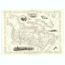
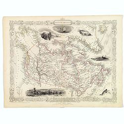
British America.
A decorative and useful map of modern day Canada, when it was still under British rule in the mid nineteenth century. Provinces are outlined in red, with additional annot...
Place & Date: London, 1851
Selling price: $170
Sold in 2016
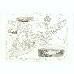
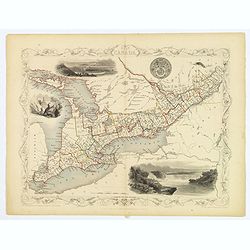
West Canada.
This is John Tallis’ attractive map of West Canada. The map is surrounded by a number of topical steel engraved vignettes, including Niagara Falls, Kingston, Indians, B...
Place & Date: London, 1851
Selling price: $55
Sold in 2016
British America.
A decorative and useful map of modern day Canada, when it was still under British rule in the mid nineteenth century. Provinces are outlined in red, with additional annot...
Place & Date: London, 1851
Selling price: $75
Sold in 2022
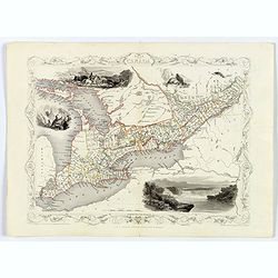
West Canada.
This is John Tallis’ attractive map of West Canada. The map is surrounded by a number of topical steel engraved vignettes, including Niagara Falls, Kingston, Indians, B...
Place & Date: London, 1851
Selling price: $58
Sold in 2018
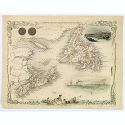
Nova Scotia and Newfoundland.
A decorative and attractive map of the Canadian provinces of Nova Scotia and Newfoundland. The map is enhanced by the seals of both provinces, plus delightful vignettes o...
Place & Date: London, 1851
Selling price: $48
Sold in 2020
West Canada.
This is John Tallis’ attractive map of West Canada. The map is surrounded by a number of topical steel engraved vignettes, including Niagara Falls, Kingston, Indians, B...
Place & Date: London, 1851
Selling price: $48
Sold in 2019