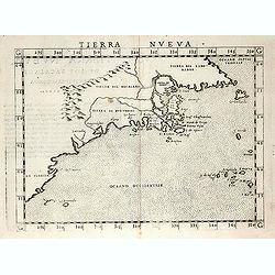
Terra Nueva
Gastaldi's map of Eastern USA from Giacomo Gastaldi's Atlas of 1548 which has been called the most comprehensive atlas, produced between Martin Waldseemüller's Geographi...
Place & Date: Venice, 1548
Selling price: $3400
Sold in 2023
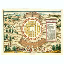
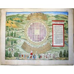
(MONTREAL). La Terra de Hochelaga nella Nova Francia.
The first printed plan of Montreal, from Delle navigationi et viaggi, and prepared Jacques Cartier, the great French explorer. visited the village of Hochelaga on the isl...
Place & Date: Venice, 1556
Selling price: $2250
Sold in 2014
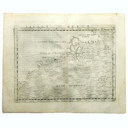
Tierra Nveva.
Rare first edition of the map of east coast of North America..According to Shirley, most likely engraved by the brothers Giulio and Livio Sanuto. Ptolemaic world map, con...
Place & Date: Venise, 1561
Selling price: $850
Sold in 2008
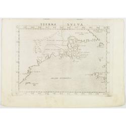
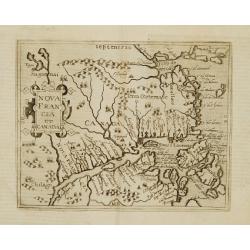
Tierra Nveva.
Early map of the east coast is an enlarged version of Giacomo Gastaldi's published in 1548. Nomenclature and cartography are unchanged, with the exception of the depictio...
Place & Date: Venise, 1561
Selling price: $475
Sold in 2012
La Terra de Hochelaga nella Nova Francia... (MONTREAL).
Large, very rare woodcut depicting the first printed plan of Montreal, from the famous book "Delle navigationi et viaggi", prepared Jacques Cartier, the great F...
Place & Date: Venice, ca 1565
Selling price: $1490
Sold in 2019
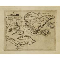
Estotilandia et Laboratoris terra.
This is an important and influential map depicting the first detailed record of the discoveries of Davis and Frobisher in their search for the Northwest Passage. The attr...
Place & Date: Cologne 1598
Selling price: $1050
Sold
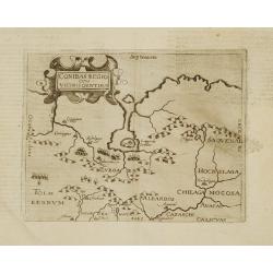
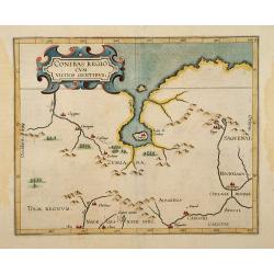
Conibas regio cum vicinis gentibus.
This is, however, the first printed map of present-day central Canada. The basic cartography derives from Gerard Mercator's world map of 1569, which first depicted a larg...
Place & Date: Cologne 1598
Selling price: $1250
Sold
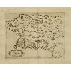
Limes occidentis et quiuira Anian.
Very rare sixteenth century map: One of the first printed map to focus on present day Alaska, here labeled "Anian Regnum." It encompasses most of the western co...
Place & Date: Cologne 1598
Selling price: $1550
Sold
Nova Francia et Canada.
Very rare sixteenth century map: the second printed map to use CANADA in its title, and the second to concentrate on the river and Gulf of St.Lawrence. It summarises sixt...
Place & Date: Cologne 1598
Selling price: $2200
Sold
Conibas Regio cum uicinis gentibus.
2nd State. The first printed map of present day central Canada issued by Cornelis van Wytfliet in editions of his Descriptionis Ptolemaicae Augmentum first published in L...
Place & Date: Lovain 1597-1600
Selling price: $500
Sold