Browse Listings

AN EXCEPTIONAL AND VERY RARE PAIR OF CELESTIAL AND TERRESTIAL GLOBES.
BLAEU, Willem Janszoon (1571-1638) AN EXCEPTIONAL AND VERY RARE PAIR OF CELESTIAL AND TERRESTRIAL GLOBES, 9inch / 23cm, with an overall height of 38 cm, Amsterdam, dat...
Place & Date: Amsterdam, dated 1602, but published after 1621
![[Manuscript chart on vellum of the Java Sea]](/uploads/cache/33613-250x250.jpg)
[Manuscript chart on vellum of the Java Sea]
One of the few manuscript charts on vellum in private hands, signed by Isaac de Graaf. ORIGINAL MANUSCRIPT MAP IN RED, GREEN AND BLACK INK showing the Java Sea centered o...
Place & Date: Amsterdam, 1743

Le Théâtre du monde dédié au roi contenant les cartes générales et particulières des royaumes et états qui le composent.
The present example of the Théâtre du monde is the reissue of 1746 by Jean-Baptiste Nolin II. This scarce atlas is illustrated with 123 maps mostly double-page, in orig...
Place & Date: Paris, 1746

Composite atlas of the Low Countries.
A composite atlas comprising 18 double-page engraved maps by or after Hessel Gerritsz, Theodoor Galle, Jacob van Deventer, Gerard Mercator, Peter Verbiest, Jean Surhon, C...
Place & Date: [Antwerp, c. 1633
![Claudii Ptolemaei Alexandrini mathematicor[um] ...Octo libri Geographie. . .](/uploads/cache/62656-250x250.jpg)
Claudii Ptolemaei Alexandrini mathematicor[um] ...Octo libri Geographie. . .
Third edition of "Géographie" by Ptolemy and published in Strasbourg. Illustrated with 50 maps engraved in wood. One of the more important maps is showing the ...
Place & Date: Strasbourg, J. Grüninger, 1522
![[Set of five maps] Carte Générale de la Terre ou Mappe Monde](/uploads/cache/41145X-250x250.jpg)
[Set of five maps] Carte Générale de la Terre ou Mappe Monde
Rare and decorative set of five wall maps of the world and the four continents, prepared by Clouet, in very fine bright contemporary coloring. Each map ca. 965 x 1230 mm ...
Place & Date: Paris and Cadiz, Mondhare, 1785-1793
Histoire de la Navigation.
A fine example of Linschoten's classic illustrated travelogue to the East and West Indies, termed by Lach “the most important of the firsthand accounts published indepe...
Place & Date: Amsterdam, Evert Cloppenburgh, 1638

Le Nouveau miroir des voiages marins de la navigation de la mer occidentale & orientale.
A second and final French edition of this important sea atlas. Two engraved frontispieces, figure with volvelle, full-page figure, 48 double-page charts (one numbered 19....
- $120000 / ≈ €112286
Place & Date: Antwerp, Chez Iean Bellere, a l’Aigle d’or, l’An M.CCCCCC (1600

French composite atlas made up of rare maps published by Parisian editors from the 17th century , mainly by G. Jollain including scarce maps of America.
A rare French composite atlas including 90 maps, published by Parisian publishers from the 17th century, mainly by Gérard I Jollain, or by maps bought from Dutch publish...
Place & Date: Paris, ca. 1675
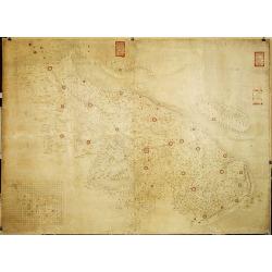
Militairy manuscript map of the end of Yangzi River across Shanghai, Jiangsu, and Zhejiang areas, with 3 red seals of the Ever-Victorious Army.
In lower left corner an inset plan of Songjiang District with Shanghai with a grid and the area is divided with red doted border lines.The map has three red seals of the ...
Place & Date: China, ca 1862