Browse Listings in Europe > Netherlands
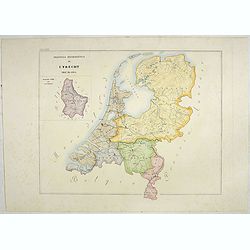
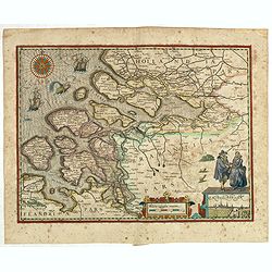
L'Utrecht. . .
Although not renowned for the originality of his work, Pieter van der Aa is highly thought of for the design and quality of his output. Showing Dutch province of Utrecht....
Place & Date: Amsterdam, 1713

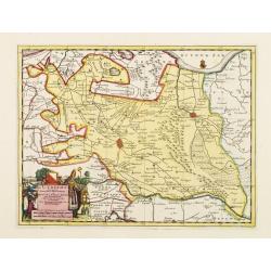
Belgium Foederatum emendate auctum et novissimé editum.
Fine detailed map of the area of the modern Netherlands less the southern part of Limburg. Title cartouche representing the commerce, the arts and the sciences. The Lion ...
Place & Date: Amsterdam, 1680
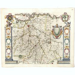
Quarta pars Brabantiae cujus caput Sylvaducis.
The coat of arms of Brabant and 's-Hertogenbosch do appear on the map. But the municipal arms in the columns on right and left-hand side have not yet been filled in. The ...
Place & Date: Amsterdam, 1645
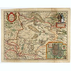
Comitatus Zutphania.
With an inset a plan of the town of Zutphen. Originally published by Petrus Kaerius in 1617. Published by Visscher in his "Belgium sive Germania Inferior continens p...
Place & Date: Amsterdam, 1634
![Lovenstein. [Loevestein]](/uploads/cache/13749-250x250.jpg)
Lovenstein. [Loevestein]
View of the castle Loevestein, near Gorinchem.. On the sky, three hands holding a quill, a stone and a stick are depicted. With a verse in two languages underneath the pi...
- $60 / ≈ €56
Place & Date: Frankfurt, 1624
Provincia ecclesiastica di Utrecht Nell' Olanda (Tav LXIII)
This large-format map of The Netherlands with its different dioceses. The map is finely engraved and beautifully colored and was prepared by Girolamo Petri, a lawyer who ...
- $250 / ≈ €234
Place & Date: Rome, 1858

A new mape of Ye XVII Provinces of Low Germanie.
Showing all 17 Provinces of the Netherlands before the split between Spain and the Protestant Provinces under the House of Orange. The map was published while the war of ...
- $2300 / ≈ €2152
Place & Date: London, George Humble, 1626 [1627
(Zeeland)
Rare map of Zeeland, first issued by Petrus Kaerius, than by Claes Jansz. Visscher. The copper plate was previously made by an anonymous engraver, and than came into the ...
- $1050 / ≈ €983
Place & Date: Amsterdam, 1631
![Flessingue Ville de l'Ile de Walcheren. [Vlissingen]](/uploads/cache/13105-250x250.jpg)
Flessingue Ville de l'Ile de Walcheren. [Vlissingen]
A very RARE panoramic view of the city of Vlissingen. The plate is numbered in red pencil in the upper right corner.Engraved by Jean Crepy (the father), who was active as...
- $400 / ≈ €374
Place & Date: Paris, 1690-1720
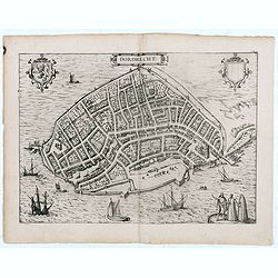
Dordrecht.
Very desirable and early town-plan of Dordrecht.From volume one of the greatest publication in this genre!. The Civitates was compiled and written by George Braun, Canon ...
- $200 / ≈ €187
Place & Date: Cologne, 1575