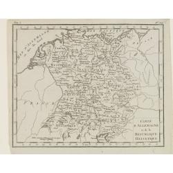
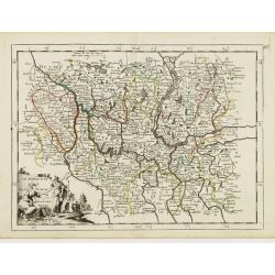
Carte d'Allemagne et de la Republique Helvetique.
Map of central Europe centered on Germany, extending southwards and eastwards to include Poland, the Czech Republic, Austria, Switzerland, Slovenia and part of Italy.From...
Place & Date: Paris, Prudhomme, Levrault, Debray, 1806
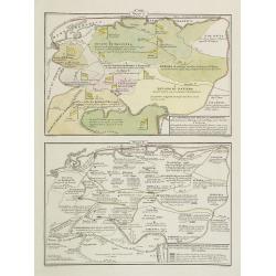
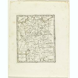
La Germania, suoi ducati e dependenze . . . /Origine e derivazione de principali stati . . .
Two rare maps of ancient Germany: Top map: 160 x 235mm. Bottom map: 160 x 235mm.Prepared by Las Casas for l'Atlante Storico, Letterario, Biografico, Archeologico. . . wi...
- $25 / ≈ €23
Place & Date: Venice, 1840
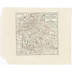
Cercle de Baviere où se trouvent le Palatinat de Baviere et l'Archev. De Saltzbourg.
Small detailed map of the southeastern part of Bavaria, including part of Austria. From Atlas Portatif Universel, by Robert de Vaugondy.Edited by : "Au dépôt de G�...
- $30 / ≈ €28
Place & Date: Paris, 1799
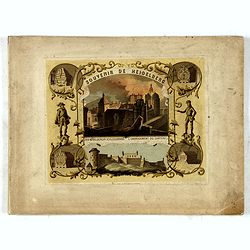
(Title page) Souvenir de Heidelberg.
Cover for a souvenir album with chromolithographed design and entitled: Souvenir de Heidelberg prepared by Louis Charles François. He emigrated with his family in May 17...
- $50 / ≈ €47
Place & Date: Graimberg, Heidelberg, ca. 1840
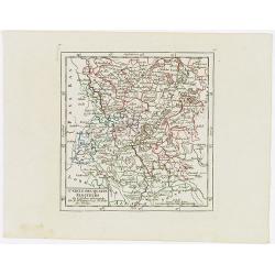
Cercle des quatre Electeurs.
Small detailed map of part of western Germany, centered on Frankfurt. From Atlas Portatif Universel, by Robert de Vaugondy.Edited by : "Au dépôt de Géographie, Ru...
- $25 / ≈ €23
Place & Date: Paris, 1799
La Germania divisa ne' suoi differenti stati
Rare map of Germany, from "Atlante Novissimo ad uso Dei Giovani Studiosi Contenuto In Carte XXVII.", published by Giovanni Zempel in Rome, ca. 1780.The map is b...
- $25 / ≈ €23
Place & Date: Rome, 1780
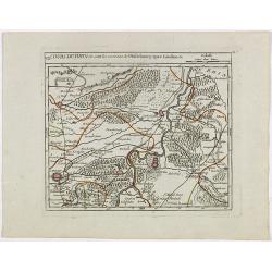
VII. Cours du Rhin où sont les environs de Philisbourg, Spire Landaw &c.
Small detailed map illustrating the stretch of the Rhine which flows between Germersheim and Speyer.From Atlas Portatif Universel, by Robert de Vaugondy. Edited by : &quo...
- $25 / ≈ €23
Place & Date: Paris, 1799
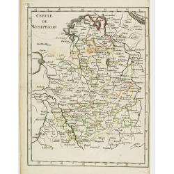
Cercle de Westphalie.
Fine map of North Rhine-Westphalia. George Louis Le Rouge was active from 1740 till 1780 as a publisher, and was appointed engineer for the King of France. From his Atlas...
- $30 / ≈ €28
Place & Date: Paris 1756
Le Marquisat et Electorat de Branderbourg.
Fine map of Brandenburg, with decorative title cartouche. George Louis Le Rouge was active from 1740- till 1780 as a publisher, and was appointed engineer for the King of...
- $30 / ≈ €28
Place & Date: Paris 1756
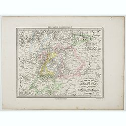
Le Vie Ferrate e le Strade Postali della Germania centrale e meridionale . . .
Uncommon map of Germany and part of France and Switzerland prepared by Francesco Costantino Marmocchi. Above the map "Geografia Commerciale". From "Il Glob...
- $25 / ≈ €23
Place & Date: Genova, Paolo Rivara fu Giacomo, 1858