Browse Listings in Asia > Holy Land & Jerusalem

Peregrinatie Jesu Christu Een ordentliche beschrijvinge des Heijligen landts....
Very rare separately map of the Holy Land engraved by Joannes van Doetecum Jr. Oriented to the east. The shoreline runs from "Antaradus" in Syria to "Rhino...
- $4000 / ≈ €3743
Place & Date: Amsterdam, ca. 1595
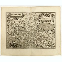
Terra Sancta A Petro Laicstain perlustrata, et ab eius ore
Oriented to the east. Shows the shoreline from Beirut to Gaza. P. Laicksteen, a Dutch astronomer… collected topographic material on Palestine during his stay there in 1...
Place & Date: Antwerp, 1598
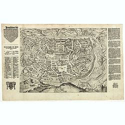
Jerusalem die Heijlighe Stadt van God. . .
Very rare separately plan of the Jerusalem engraved by Joannes van Doetecum Jr. Variant to Poortman, Kaarten in Bijbels, map 64. In lower part the copper plate has been s...
- $5000 / ≈ €4679
Place & Date: Amsterdam, 1598
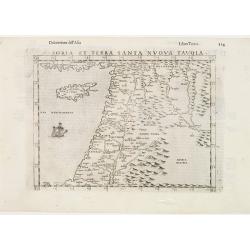
Soria et Terra Santa nuova tavola.
Early map of this classical map of the Holy Land, including Cyprus, prepared by Giovanni Botero. The copper plate was however later used by Giuseppe Rosaccio's expended e...
- $500 / ≈ €468
Place & Date: Venice, 1598

Jerusalem.
Very rare view of Jerusalem published in the first edition of "Viaggio da Venetia, a Costantinopoli. Per Mare, e per Terra, & infieme quello di Terra Santa. Da G...
Place & Date: Venice, Giacomo Franco, 1598

Quella Tavola E l'Antica Siria ch'Era destinta in dodici . . .
Very rare view of Holy Land published in the first edition of "Viaggio da Venetia, a Costantinopoli. Per Mare, e per Terra, & infieme quello di Terra Santa. Da G...
Place & Date: Venice, Giacomo Franco, 1598

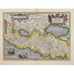
Terra Sancta.
This is the most modern of Ortelius' maps of the Holy Land. It focuses specifically on the Holy Land and is oriented with east of the top. Ortelius used as a model the wa...
Place & Date: Antwerp, 1603
Terra Sancta quae in Sacris Terra Promissionis ol: Palestina.
Map of Palestine on both sides of the Jordan, the shore line running from Berithus (Beirut) to Gaza.Oriented to the east.Largely based on Ortelius 1584 map. In lower left...
- $675 / ≈ €632
Place & Date: Amsterdam, 1606
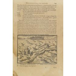
Montana Ivdeae. . .
Text page with copper engraved illustration of Mount Judea taken from Itinerarium Hierosolymitanum et Syriacum, in quo variarum Gentium Mores et Institua insularum, regio...
- $80 / ≈ €75
Place & Date: Antwerp, Verdussen, 1619
![[Atrii Sancti ac Tabernaculi Foederisorthographia].](/uploads/cache/26474-250x250.jpg)
[Atrii Sancti ac Tabernaculi Foederisorthographia].
Campment in Israel.From an uncommon edition of Kerckelycke Historie van Neder-Landt which was a Dutch text edition of Agostino Torniello's Annales Sacri et Profani by Her...
- $50 / ≈ €47
Place & Date: Holland, ca. 1625