
L'Amérique divisée en ses principaux Etats Dressée d'après les Cartes de Mr. Bonne?
Rare, wall map of America in 2 sheets, after R. Bonne. With 3 inset maps of Hispaniola, Martinique and Hudson Bay. Beautiful title cartouche depicting a Native American l...
Place & Date: Paris, 1788

Carte générale de l' Amérique divisée en ses principaux états . . .
Map of North and South America. By C. F. Delamarche, successor of Robert de Vaugondy, Geographer. Descriptive text to the left.
Place & Date: Paris, 1820
![Westelijk Halfrond. [Western hemisphere]](/uploads/cache/25524-250x250.jpg)
Westelijk Halfrond. [Western hemisphere]
Uncommon world map view of the western and eastern hemispheres of North and South America, Asia. Lithography by J.H. van Weijer, published in Atlas der geheele Aarde [?] ...
- $50 / ≈ €47
Place & Date: Groningen, ca. 1860
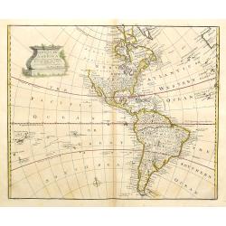
A new general map of America drawn from several..
Extremely faint strip of age toning on part of the centerfold, otherwise fine condition. The Pacific Northwest is left open with the note Parts Undiscovered. The coastlin...
- $500 / ≈ €468
Place & Date: London, 1747
America.
A very nice map of the American continent with California as an island and an adorned title cartouche.From Francisco Giustiniani for El Atlas abreviado o el nuevo compend...
- $300 / ≈ €281
Place & Date: Leon de Francia (Lyon), Jaime Certa, 1739
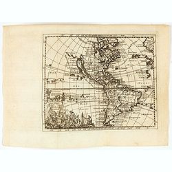
Nouvelle description de lamerique.
Jollain published this rare map of America in 1667. State 3, with the scale, erased, as it fictitious strait on the west coast of North America which Le Royaume de Quiuer...
- $450 / ≈ €421
Place & Date: Paris, 1667
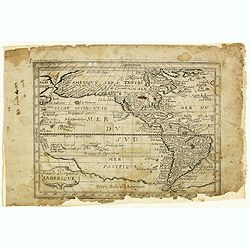
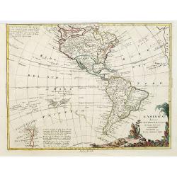
Carte du gouvernement de l'Amerique.
A double page sheet including a fine map of America, with California with indented northern coastline (130x92mm.) and New Mexico extending across most of western North Am...
- $300 / ≈ €281
Place & Date: Amsterdam, 1705
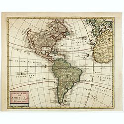
Nieuwe kaart van America.
An attractive map of both the Americas, by one of the leading mapmakers in 18th century Amsterdam. Isaak Tirion (d. 1769) was a Amsterdam publisher. His "Nieuwe en b...
- $350 / ≈ €328
Place & Date: Amsterdam, 1765
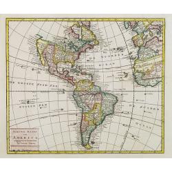
Nieuwe kaart van America.
An attractive map of both the Americas, by one of the leading mapmakers in 18th century Amsterdam. Isaak Tirion (d. 1769) was a Amsterdam publisher. His "Nieuwe en b...
- $400 / ≈ €374
Place & Date: Amsterdam, 1765
L'America divisa ne suoi principali Stati..
Attractive map of The Americas, with the first voyage of Capt. Cook (1768) depicted around South America and across the Pacific to New Zealand, which is well charted. Nor...
Place & Date: Venice, 1776
Selling price: $500
Sold in 2017