Browse Listings in Africa > Central Africa > East coast

Pas-Kaat vaneen gedeelte van de Aethiopische Zee behelsende de Kusten Zanguebar, Ajan en Abex, en een gedeelte van de Arabische Kust. . .
A finely engraved and detailed chart of the most eastern tip of Africa, including Somalia, Djibouti, Yemen, Mauritius, and many other islands in the Indian Ocean.Very rar...
Place & Date: Amsterdam, 1753
Insula D.Helenae sacra coeli Clementia . . .
A fine perspective view of the Island of St.Helena in the South Atlantic. The location of the Island directly on the navigation route from Europe to the Cape of Good Hope...
- $750 / ≈ €702
Place & Date: Frankfurt, 1609
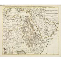
Carte de l'Egypte de la Nubie de L'Abissinie &c..
Detailed copper-engraved map of North-East Africa showing Guinea in the southwest through Ethiopia , the Red Sea to the Persian Gulf.In the northwest, Tunis through Egypt...
- $500 / ≈ €468
Place & Date: Amsterdam, c. 1745
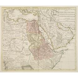
Carte de l'Egypte de la Nubie de l'Abissinie. . .
Detailed copper-engraved map of North-East Africa showing Guinea in the southwest through Ethiopia , the Red Sea to the Persian Gulf.In the northwest, Tunis through Egypt...
- $250 / ≈ €234
Place & Date: Amsterdam, 1745
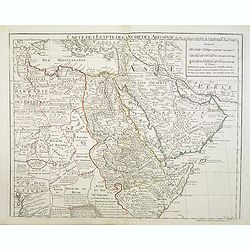
Carte de l'Egypte de la Nubie de l'Abissinie..
Map of east Africa showing South Arabia.
- $200 / ≈ €187
Place & Date: Paris, 1780
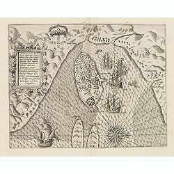
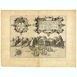
Insulae et arcis Mocambique descriptio ad fines Melinde sita ebano puriss.
Attractive bird's-eye view of Melinde harbor in Mozambique showing the fortifications with numerous ships at anchor in the protected harbor. The map is finely engraved an...
- $300 / ≈ €281
Place & Date: Frankfurt, 1607
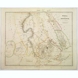
Nubia & Abyssinia.
A lovely looking steel engraved map of the portion of Africa that lies to the west of the Red sea. Mostly great deserts and the territories of nomadic African tribes are ...
Place & Date: London, 1839
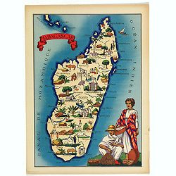
Madagascar.
Very decorative, informative map of Madagascar. The map is filled with buildings, animals, figures and two locals in their typical dress.In lower left corner "Imprim...
- $90 / ≈ €84
Place & Date: France, 1943
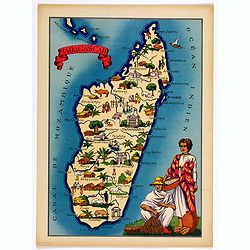
Madagascar.
Very decorative, informative map of Madagascar. The map is filled with buildings, animals, figures and two locals in their typical dress.In lower left corner "Imprim...
- $90 / ≈ €84
Place & Date: France, 1943