Browse Listings in Map Types

Hollandia Comitatus.
Orientated west to the top of the sheet, this presents the County of Holland in the classical orientation for seventeenth-century maps, with Amsterdam at the center. The ...
Place & Date: Amsterdam, 1660

Nieuwe Pascaert van al de Carnarisse Eylanden. . .
So-called "Blue-back" sea- charts of the Canary Islands.Latitude scale, compass rose and system of rhumb lines, soundings, anchorage's, etc. A wealth of cities ...
Place & Date: Amsterdam, 1700
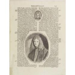
Illustriss et excellentiss D.Paulus Quirini divi Marci procurator.
Fine text page from Isolario Dell'Atlante Vento. with two copper engraved portraits printed within letter press. In top portrait of "Hieronymus Quirinus" (60x55...
Place & Date: Venice, 1691

Het Canaal tusschen Engeland en Vranciick.
An eye-catching chart of the Channel.Pieter Goos (ca. 1616-1675) was one of the most important cartographers, engravers, publishers and print sellers of Amsterdam. His wi...
Place & Date: Amsterdam, after 1666

Pascaerte van 't Westelyckste Deel van Oost Indien, van Cabo de Bona Esperanca tot C.Comorin..
An eye-catching chart of the western part of the Indian Ocean and its adjacent coasts of East Africa, Arabia with the Red Sea and the Arabian Gulf, Iran, Pakistan and we...
Place & Date: Amsterdam, 1666

Carta terza Generale del' Asia.
Rare first state of this important chart showing part of the north coast of New Guinea and islands of the Pacific Ocean. To the north of Japan the landmass of Isola di Ie...
Place & Date: Florence, 1646

Manuscript plan of Havana harbour.
Manuscript chart with good nautical detail and soundings of Havana harbour.
Place & Date: Spain c.1820

.Paskaarte om Achter Yrlandt om te Zeylen van Hitlant tot. . .
An eye-catching chart of Ireland, including the north of England and Scotland, with the West to the top.Pieter Goos (ca. 1616-1675) was one of the most important cartogra...
Place & Date: Amsterdam, 1673

North Pacific.
Huge three sheet so-called Blue-back sailing chart of the Northern Pacific including China, Korea (with Matu Is. and Liancourt), Japan, Philippines, Kamchatka, Hawaii, Al...
Place & Date: London, 1868

Carte D'Amerique Divisée en ses Principaux Pays. . .
Rare. Uncommon and decorative wall map of America, prepared by Clouet. With superb decorative borders, 170mm wide at the sides and 150mm at the bottom, containing twenty ...
Place & Date: Paris, Cadiz, 1785