Subscribe to be notified if similar examples become available.
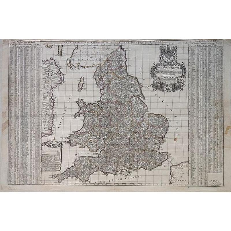
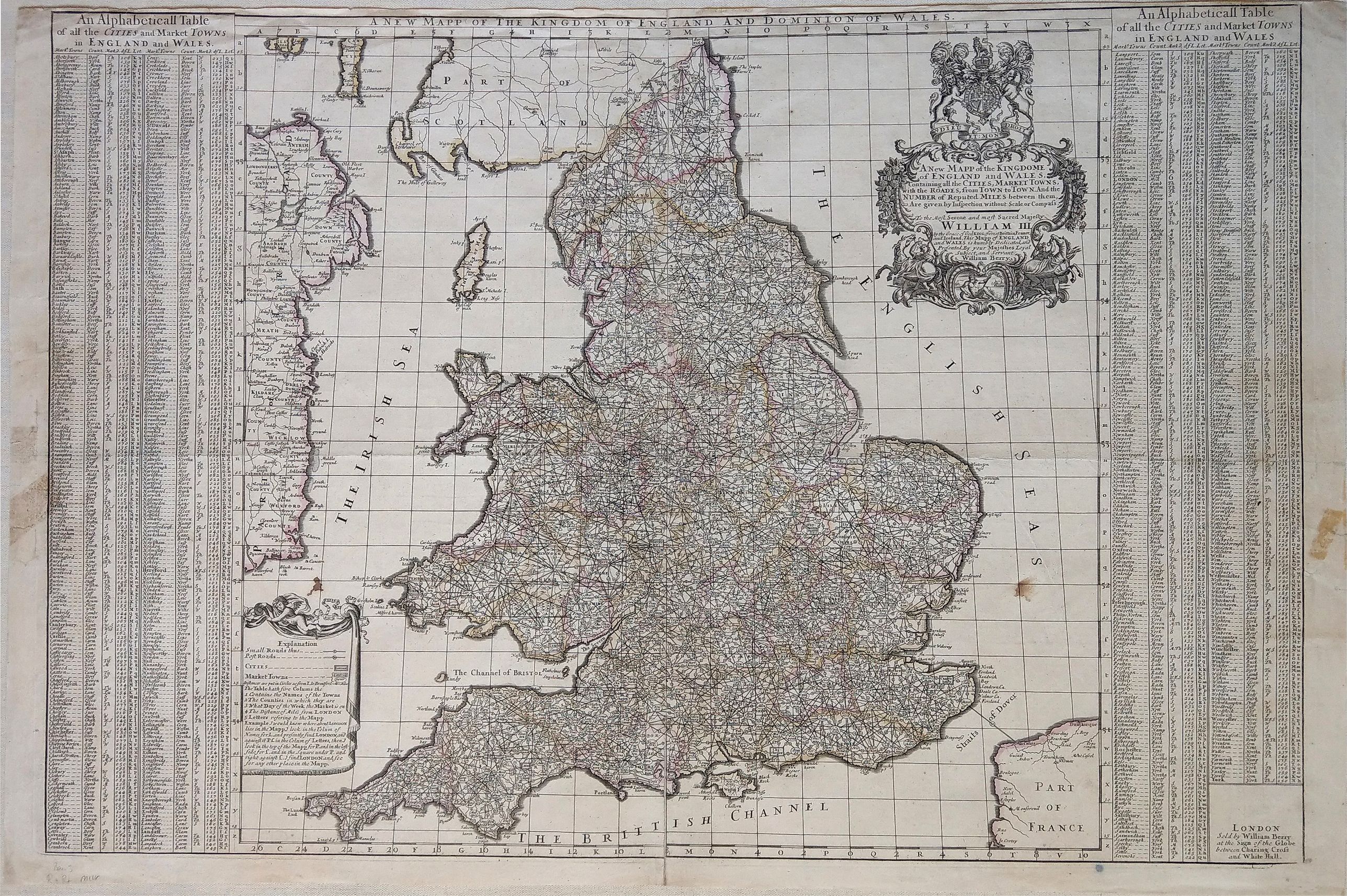
A New Mapp of the Kingdome of England and Wales. Containing all the Cities, Market Towns, with the Roades, from Town to Town. And the Number of Reputed Miles between them, Are given by Inspection without Scale or Compass. |
||||||||||||||||||||
|
||||||||||||||||||||
|
|
||||||||||||||||||||
Estimated value: $400 - $720 |
Virtual Collection - Save and collect your favorite items in one place.
Unless logged in, the item is only saved for that session. If you want to save the items permanently, please Login first Learn more [+] |
|||||||||||||||||||
Description
A hard-to-find, highly detailed map of England and Wales, focusing on road distances between towns.
This impressive and rare map by William Berry (1639-1718) exhaustively identifies counties, cities, market towns, postal routes, and roads, including direct, i.e. “as-the-crow-flies”, distances between settlements. The latter approach is based on the straight-line distance model established by the famous John Adams map of 1679, Anglia Totius Tabula. Relief is shown pictorially. A second map title, A New Mapp of the Kingdom of England and Dominion of Wales., is engraved at the upper border.
To the upper right, the map features an elaborate ornamented title cartouche, showing at the top the royal coat of arms of the Union of the Crowns – England, Scotland, and Ireland (plus France, signaling claim to the French throne) – while Poseidon, or Neptune, is depicted at the bottom.
Inside the title cartouche, there is a dedication to William III., King of England, Ireland, and Scotland from 1689 until his death in 1702. An earlier edition of this map bears an inscription to his predecessor, James II. William was Prince of Orange from birth, and Stadtholder of Holland, Zeeland, Utrecht, Gelderland, and Overijssel in the Dutch Republic from 1672. He became king through his marriage to Mary II and by challenging James to the throne. Mary was James’ daughter and reigned together with William, until her death in 1694.
Topped by a putto, there is a smaller cartouche to the lower left of the map. It contains the legend as well as a delightful explanation as to how to use the map’s coordinate system.
The lower right of the map features an annotation stating that it is sold by William Berry, “at the Sign of the Globe between Charing Cross and White Hall”, in London.
Alphabetical tables in the two side panels flanking the map list cities and market towns in England and Wales, including corresponding counties, market days, distance from London, and map coordinates.
Berry was an engraver, globemaker, publisher, and book and map seller, renowned as the publisher of a series of two-sheet maps based on originals by French mapmaker Nicolas Sanson. He also collaborated with Robert Morden, a map and book seller, and maker of instruments and globes, best known for his county maps for Camden’s Britannia.
A captivating map with an interesting historic background.
Reference: Shirley, R.W., Printed Maps of the British Isles 1650-1750, Berry 2.
FAQ - Guarantee - Shipping
Buying in the BuyNow Gallery
This item is available for immediate purchase when a "Add to Cart" or "Inquire Now" button is shown.
Items are sold in the EU margin scheme
Payments are accepted in Euros or US Dollars.
Authenticity Guarantee
 We provide professional descriptions, condition report (based on 45 years experience in the map business)
Paulus Swaen warrants the authenticity of our items and a certificate of authenticity is provided for each acquired lot.
Condition and Coloring
We indicate the condition of each item and use our unnique HiBCoR grading system in which four key items determine a map's value: Historical Importance, Beauty, Condition/Coloring and Rarity.
Color Key
We offer many maps in their original black and white condition. We do not systematically color-up maps to make them more sellable to the general public or buyer.
Copper engraved or wood block maps are always hand colored. Maps were initially colored for aesthetic reasons and to improve readability. Nowadays, it is becoming a challenge to find maps in their original colors and are therefor more valuable.
We use the following color keys in our catalog:
Original colors; mean that the colors have been applied around the time the map was issued.
Original o/l colors; means the map has only the borders colored at the time of publication.
Colored; If the colors are applied recently or at the end of the 20th century.
Read more about coloring of maps [+]
Shipping fee
A flat shipping fee of $ 30 is added to each shipment by DHL within Europe and North America. This covers : International Priority shipping, Packing and Insurance (up to the invoice amount).
Shipments to Asia are $ 40 and rest of the world $50
We charge only one shipping fee when you have been successful on multiple items or when you want to combine gallery and auction purchases.
Read more about invoicing and shipping
FAQ
Please have a look for more information about buying in the BuyNow gallery
Many answers are likely to find in the general help section.
Virtual Collection
![]()
With Virtual Collection you can collect all your favorite items in one place. It is free, and anyone can create his or her Virtual map collection.
Unless you are logged in, the item is only saved for this session. You have to be registed and logged-in if you want to save this item permanently to your Virtual Collection.
Read More[+]
Register here, it is free and you do not need a credit card.
Add this item to
Virtual Collection
or click the following link to see my Virtual Collection.
| High-Resolution Digital Image Download | |
|
Paulus Swaen maintains an archive of most of our high-resolution rare maps, prints, posters and medieval manuscript scans. We make them freely available for download and study. Read more about free image download |
Click this image for a free HR-image download. |
In accordance with the EU Consumer Rights Directive and habitually reside in the European Union you have the right to cancel the contract for the purchase of a lot, without giving any reason.
The cancellation period will expire 14 calendar days from the day after the date on which you or a third party (other than the carrier and indicated by you) acquires, physical possession of the lot. To exercise the right to cancel you must inform Paulus Swaen Europe bv, which is offering to sell the lot either as an agent for the seller or as the owner of the lot, of your decision to cancel this contract by a clear statement (e.g. a letter sent by post, or e-mail (amsterdam@swaen.com).
To meet the cancellation deadline, it is sufficient for you to send your communication concerning your exercise of the right to cancel before the cancellation period has expired.