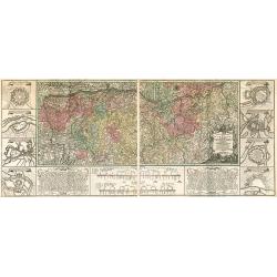
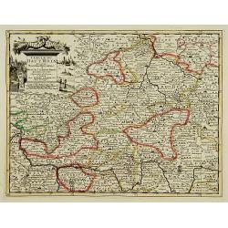
Charte Geographique de la Campagne du Haut Rhin...
Large map by J.F. Oettinger on 2 sheets.
Place & Date: Augsburg, 1740.
Selling price: $300
Sold in 2009
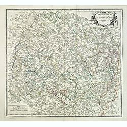
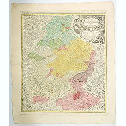
Cercle de Souabe. . .
Finely and crisply engraved map of south part of Germany. Ornamental title cartouche in the upper part of map from his "Atlas Universel".Gilles Robert de Vaugon...
Place & Date: Paris, 1751.
Selling price: $20
Sold in 2015
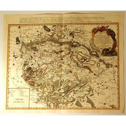
Partie Septentrionale du Cercle d'Autriche...
Map showing the postal routes in The Netherlands, Belgium, France, Poland, Austria, Switzerland and Northern Italy. With an ornamental cartouche.
Place & Date: Paris, 1752.
Selling price: $104
Sold
Carte Particuliere de la Principaute de Halberstadt
Carte Particuliere de la Principaute de Halberstadt. A large and rare map of Halberstadt, Germany, and its surroundings by Le Rouge. Showing the town in the German state...
Place & Date: Paris, 17576
Selling price: $112
Sold in 2015
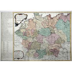
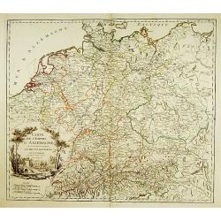
La ALEMANIA dividida en sus principales Estados segun las ultimas y nuevas observationes de las Accademias y de Paris y de Londres.
A beautiful, rare colored map of Germany by the Spanish cartographer Pedro Gendron. As in most 18th century maps published in Spain, which are based upon non-Spanish sour...
Place & Date: Madrid(?), ca 1760
Selling price: $150
Sold in 2020
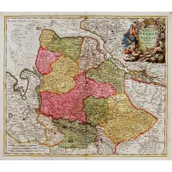
Bavariae Circulus et Electorat in suas quasque. . .
A large decorative map of Bavaria in southern Germany, published by Homann in the eighteenth century. It features a large decorative title cartouche with Greek gods, sold...
Place & Date: Nuremberg, ca. 1
Lot of 3 maps of Germany.
Robert de Vaugondy: Empire d'Allemagne, 24 cm x 28 cm. Van der AA : Cercle du Haut Rhin, 22,5cm x 29 cm: L'Allemagne, 22,5 cm x 29 cm.The three maps are well-engraved.
Place & Date: Paris/ Leiden
Selling price: $40
Sold
Ducatus Bremae et Ferdae nova tabula.
A very decorative and detailed map with Hamburg on the river Elbe. Also including Oldenburg and Bremen. With a very decorative title cartouche showing putti and allegoric...
Place & Date: Nuremberg, 18th century
Selling price: $150
Sold