Browse Listings in Catch All
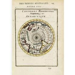
Continent Meridional Austral ou Antarctique.
A circular south-polar projection depicting the continents with partial coastlines for Antarctica, Australia and New Zealand. Includes the southern portions of Africa and...
Place & Date: Paris, 1683
Selling price: $90
Sold
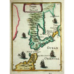
Terre de Jesso.
Alain Manneson Mallet (1603-1706) published in 1683 his ' Description de l' Univers' in 5 volumes. In 1686 a German edition appeared.An attractive little map of Japan fro...
Place & Date: Paris, 1683
Selling price: $120
Sold in 2016

Zodiaque.
Attractive print showing a putti with sphere, surveying instruments, a world map in double hemisphere and California as an island.From the French text edition of Descript...
Place & Date: Paris, 1683
Selling price: $120
Sold in 2014
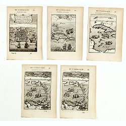
(Five engravings of Caribbean interest from Description de l\'Univers)
Finely etched maps entitled : Le plan de l'Isle de St Jan de P.to Rico, Hispagonla et P. Rico, I. de cuba et de Jamaica, Isles Caraibes, Isles Caraibes". From the Fr...
Place & Date: Paris, 1683
Selling price: $150
Sold in 2015
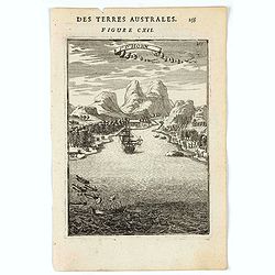
I. d'Horn.
A charming view of a bay at The Hoorn Islands (also Futuna Islands) , with a ship in the bay, with smaller vessels and natives along the shoreline. Title in curtain drape...
Place & Date: Paris, 1683
Selling price: $30
Sold in 2020
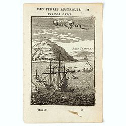
I. Cocos.
A charming view of the Cocos or Keeling Islands, located near Australia. Title in curtain draped at top. French text on verso.From the original 1683 text edition of "...
Place & Date: Paris, 1683
Selling price: $30
Sold in 2020
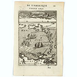
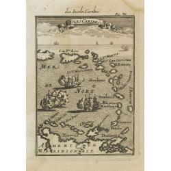
Isles Caribes.
A charming map of Caribbean islands, including Puerto Rico, Martinique, St. Christopher, and Aruba, among many others. Many small illustrations of ships in battle. Title ...
Place & Date: Paris, 1683
Selling price: $120
Sold in 2020
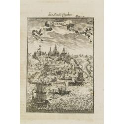
Quebec.
A charming late 17th century French view of Quebec.From the German text edition published by Davis Zunners. Allain Manneson Mallet (1630-1706), a well travelled military ...
Place & Date: Franckfurt, 1684
Selling price: $50
Sold in 2008
Isles Caribes.
Very handsome map of the Caribbean, extending to include the shores of South America. The map is inserted in a prospective view of the Caribbean Sea, where some vessels a...
Place & Date: Frankfurt, 1684
Selling price: $50
Sold in 2008
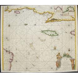
Pas kaart van de Zuyd kust van Cuba en van Geheel Yamaica
Fine sea chart covering the southern part of Cuba, all of Jamaica and the western tip of Hispaniola and a bit of the Honduras coastline Insets of "Baya Oristan in Ya...
Place & Date: Amsterdam, c.1684
Selling price: $850
Sold in 2010