Browse Listings in Asia > South East Asia
-250x250.JPG)
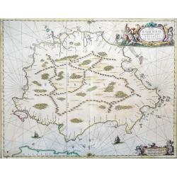
Insula Borneo et occidentalis pars Celebis cum adjacentibus insulis
Rare folio format map of the island of Borneo (Kalimantan) in Indonesia (with parts belonging to Malaysia and Brunei). North is on the right.This is the first large forma...
Place & Date: Amsterdam, 1659
-250x250.JPG)
Sumatrae et insularum locorumque nonnullorum circumiacentium tabula nova.
Very rare early (1659) version of this large folio sized map of Sumatra and the tip of the Malaysian Peninsula by Janssonius. The 1700 Valk/Schenk edition is more availab...
Place & Date: 1659
Insula Borneo et occidentalis pars Celebis cum adjacentibus insulis
Folio format map of the island of Borneo (Kalimantan) in Indonesia (with parts belonging to Malaysia and Brunei). North is on the right.This is the first large format map...
Place & Date: Amsterdam, 1659
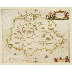
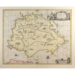
Insula BORNEO et occidentalis pars celibis cum adjacentibus Insulis.
An elegant map of Borneo. The map includes only coastal detail.The beautiful map is richly embellished with two fine cartouches featuring mermaids surrounding the scale o...
Place & Date: Amsterdam 1660
Selling price: $1105
Sold
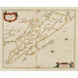
Sumatrae et insularum Locorumque nonnullorum circumiacentium
Fine chart depicting the Island of Sumatra and the southern coasts of Malaysia from Quedo to Johore. North is orientated to the left of the page. Singapore is probably id...
Place & Date: Amsterdam 1660
Selling price: $600
Sold
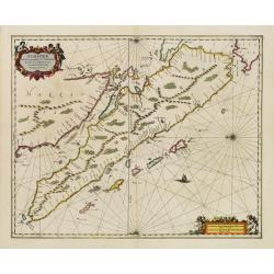
Sumatrae et insularum Locorumque nonnullorum circumiacentium..
Fine chart depicting the Island of Sumatra and the southern coasts of Malaysia from Quedo to Johore.North is orientated to the left of the page.Singapore is probably iden...
Place & Date: Amsterdam 1660
Selling price: $900
Sold
Insula Borneo et Occidentalis Pars Celebis cum Adjacentibus Insulis
Reissue of Jansson map.
Place & Date: Amsterdam, c.1660
Selling price: $700
Sold in 2009
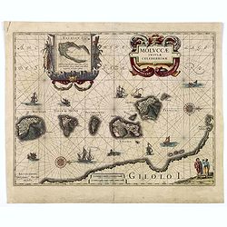
MOLUCCAE Insulae Celeberrimae.
A highly decorative map of the "Spice Islands".
Place & Date: Amsterdam, ca. 1660
Selling price: $250
Sold in 2018
Carta prima Generale dell' Asia.
Rare sea chart of India and Indonesia, in a first state. In outer right part of the Philippines islands with Manila.Engraved by Lucini.Sir Robert Dudley (1573-1649) was t...
Place & Date: Florence 1646/1661
Selling price: $2525
Sold
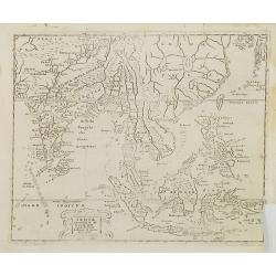
Indiae Orientalis et Insularum Antiqua et nova Descriptio.
Interesting map of South East Asia, including Indonesia, India, Taiwan from a German edition of Philipp Clüver's famous Introductionis in Universam geographicam, first p...
Place & Date: Wolfenbüttel, 1661
Selling price: $70
Sold in 2009
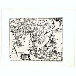
Indiae Orientalis et Insularum Antiqua et nova Descriptio.
Interesting map of South East Asia, including Indonesia, India, Taiwan, Philippines from Philipp Clüver's famous Introductionis in Universam geographicam, first publishe...
Place & Date: Wolfenbüttel, 1661
Selling price: $200
Sold in 2020
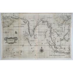
Carta prima Generale dell' Asia.
A rare sea chart of India and Indonesia, in a first state. The chart appeared in Dudley's Arcano del Mare, one of the rarest and most highly sought after sea atlases of t...
Place & Date: Florence, 1641/1661
Selling price: $4200
Sold in 2019
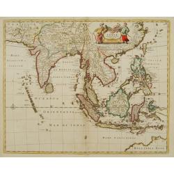
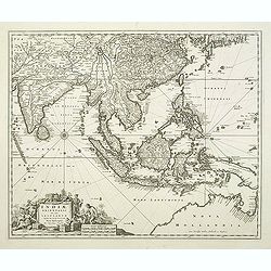
Tabula Indiae Orientalis.
An attractive and decorative map covering all South East Asia engraved by Johannes Lhuilier. The map encompasses the region from India to Southern China, Taiwan and the P...
Place & Date: Amsterdam, 1662
Selling price: $1600
Sold in 2011
Tabula Indiae Orientalis.
An attractive and decorative map covering all South East Asia engraved by Johannes Lhuilier. The map encompasses the region from India to Southern China, Taiwan and the P...
Place & Date: Amsterdam, 1662
Selling price: $2200
Sold in 2015
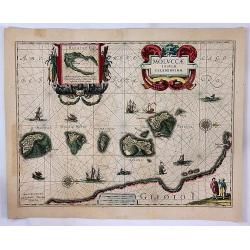
Moluccae Insulae Celeberrimae.
A striking map of the famous Spice Islands, originally described by Van Linschoten. This map was the first large-scale map of the region and depicts the islands that prov...
Place & Date: Amsterdam, 1662
Selling price: $230
Sold in 2017
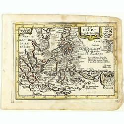
Les Isles des Indes Orientales. (23).
Scarce map of Indonesia and the Philippines published by Antoine de Fer in 1661 or 1662 in "Cartes de géographie revues et augmentées". With number 23 in lowe...
Place & Date: Paris, Antoine de Fer, 1657 but 1661 or 1662
Selling price: $150
Sold in 2018
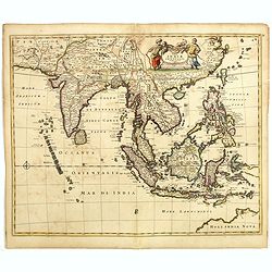
Tabula Indiae Orientalis.
An attractive and decorative map covering all South East Asia engraved by Johannes Lhuilier. The map encompasses the region from India to Southern China, Taiwan and the P...
Place & Date: Amsterdam, 1662
Selling price: $500
Sold in 2020
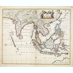
Tabula Indiae orientalis.
Detailed map of East Indies, the first of three maps of the East Indies that de Wit produced. It extending from Persia to northern Australia including the Philippine arch...
Place & Date: Amsterdam, 1662
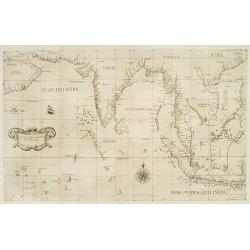
Map covering the area from India till Australia.
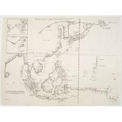
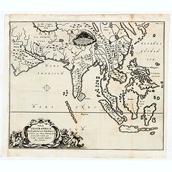
Probably of Portuguese origin, this chart appeared in Thevenot's Relations de divers Voyages , the greatest collection of travel accounts of the seventeenth century. Of p...
Place & Date: Paris, Langlois, 1663
Selling price: $4100
Sold
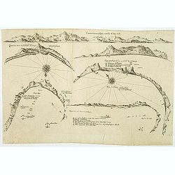
(6 coastal profiles)
A page with 6 coastal profiles of favorite anchor places and bays used by the Dutch and French vessels on their way to Asia : "Figure de la Terre de Saldagne",...
Place & Date: Paris, 1663
Selling price: $110
Sold in 2011
![[Map covering the area from India till Australia.]](/uploads/cache/36448-250x250.jpg)
[Map covering the area from India till Australia.]
Probably of Portuguese origin, this appeared in Thevenot's Relations de divers Voyages , the greatest collection of travel accounts of the seventeenth century. Of partic...
Place & Date: Paris, Langlois, 1663
Selling price: $3400
Sold in 2015
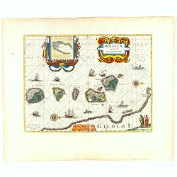
Moluccae Insulae Celeberrimae.
Showing the geographical features of the spice islands, and decorated with ships, sea monsters and a handsome cartouche. In addition to a sumptuous title cartouche, the m...
Place & Date: Amsterdam, 1663
Selling price: $650
Sold in 2016
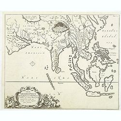
Tabula Geographica Hydrophylacium Asiae Majoris. . .
The Jesuit scholar Athanasius Kircher was one of the first compilers of semi-scientific knowledge about the physical features of the world. This very unusual map depicts ...
Place & Date: Amsterdam, 1665
Selling price: $425
Sold in 2011

Tabula Geographica Hydrophylacium Asiae Majoris exhibens, quo Omnia Flumina sive proxime sive remote per occultos maeandros Originem suam Sortiuntur.
Rare and Interesting map showing Asia from Arabia in the west until China, Japan, Korea and Philippines with Indonesia. From Kircher's "Mundus Subterranaeus". T...
Place & Date: Amsterdam, 1665
Selling price: $150
Sold in 2020
Tabula Geographica Hydrophylacium Asiae Majoris exhibens, quo Omnia Flumina sive proxime sive remote per occultos maeandros Originem suam Sortiuntur.
Rare and Interesting map showing Asia from Arabia in the west until China, Japan, Korea and Philippines with Indonesia. From Kircher's "Mundus Subterranaeus". ...
- $300 / ≈ €281
Place & Date: Amsterdam, 1665
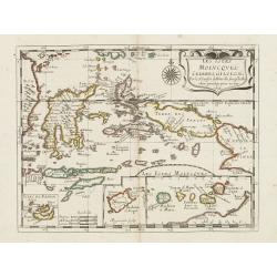
Les Iles Molvcques, Celebes, Gilolo. . .
Map of the Indian Ocean Islands of the Moluccas Islands prepared by N.Sanson and published by Pierre Mariette.Published in an early edition of the small Sanson atlas L'Eu...
Place & Date: Paris, P. Mariette, 1667
Selling price: $150
Sold in 2009
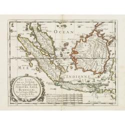
Les Isles de la Sonde entre lelquelles font Sumatra, Iava, Borneo. . .
Map of the islands of Java, Sumatra, Borneo and Bali. prepared by N.Sanson and published by Pierre Mariette.Published in an early edition of the small Sanson atlas L'Euro...
Place & Date: Paris, P. Mariette, 1667
Selling price: $450
Sold in 2013
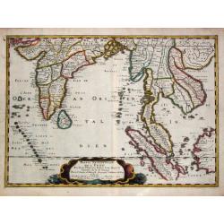
Partie meridionale de l'' Inde En deux Presqu'' Isles l'' une deçà et l'' autre delà Gange. 1654.
Nicolas Sanson?s map of southern Asia with the Indian subcontinent, Indochina, Malaysia, Sumatra and western Borneo.Nicolas Sanson (1600-67), "father of the French c...
Place & Date: Paris, 1658-1670
Selling price: $700
Sold in 2016
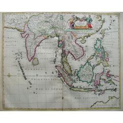
Tabula Indiae Orientalis.
The map shows from southeastern Persia to northwestern Australia. Focus is on India, Southeast Asia, and the East Indies with the Philippines. The many islands are clearl...
Place & Date: Amsterdam, 1670
Selling price: $900
Sold in 2012
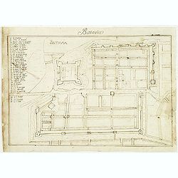
Batavia.
Manuscript town-plan of Batavia, nowadays Jakarta, as it was at about 1639, by which time the part of the town on the western bank of the Ciliwung had already been laid o...
Place & Date: France, 1650- 1670
Selling price: $1500
Sold in 2011
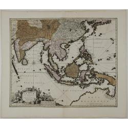
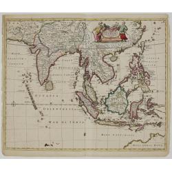
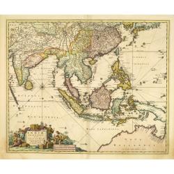
Indiae Orientalis nec non Insularum Adiacentium Nova Descriptio.
Detailed map of East Indies, extending from India to northern Australia. A decorative title cartouche, comprised of a carved stone block, surrounded by oriental figures, ...
Place & Date: Amsterdam, c. 1670
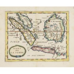
Isles de la Sonde.
Uncommon miniature map of the Indonesian islands (Java, Sumatra and Borneo) from Pierre Duval's La Geographie Universeille dated 1676. With "Sincapura" and &quo...
Place & Date: Paris, 1672
Selling price: $120
Sold in 2022
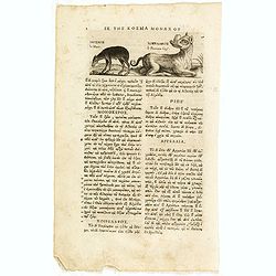
Le Musc. le Pourceau-cerf.
An early text engraving of a musk-deer and a babirusas, also called pig-deer published from 1672 onwards in "Relations de Divers Voyages Curieux" by the French ...
Place & Date: Paris, 1672
Selling price: $10
Sold in 2015
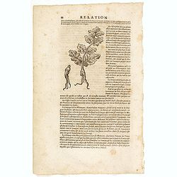
(Wood cut f a ginseng plant)
An early wood block engraving of a ginseng plant with a description by Thévenot citing Martini's explanation that "ginseng" was derived from ren (person). From...
Place & Date: Paris, 1672
Selling price: $20
Sold in 2015
![Orientaliora Indiarum Orientalium cum Insulis Adjacentibus a Promontorio C. Comorin ad Iapan. [together with] Occidentalior Tractus Indiarum Orientalium.](/uploads/cache/33091-250x250.jpg)
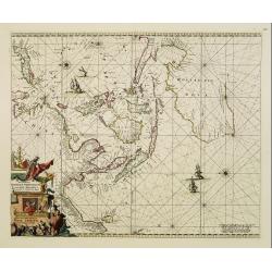
Orientaliora Indiarum Orientalium cum Insulis Adjacentibus a Promontorio C. Comorin ad Iapan. [together with] Occidentalior Tractus Indiarum Orientalium.
A matching set of two splendid sea charts covering the trading area of the Dutch V.O.C. and lavishly colored and hightened with gold by the Orientaliora Indiarum Oriental...
Place & Date: Amsterdam, 1675
Selling price: $22000
Sold
Indiae Orientalis nec non Insularum adiacentium.
Decorative map extending from India in the west, southern Japan in the north and the north coast of Australia is shown at bottom right with some coastal names till Cape Y...
Place & Date: Amsterdam 1680
Selling price: $600
Sold
Indiae Orientalis nec non Insularum Adiacentium Nova Descriptio.
This superb map of South East Asia presents a detailed image of the sphere of operations and Asian trading empire of the Dutch East India Company. The map extends from In...
Place & Date: Amsterdam, 1680
Selling price: $800
Sold
Orientaliora Indiarum Orientalium cum Insulis Adjecentibus.
Oriental figures in title piece bottom left. Orientated with East at the top of the map.A splendid sea chart of the Southeast Asia illustrating the Dutch sphere of influe...
Place & Date: Amsterdam, 1675-1680
Selling price: $3800
Sold
Indiae Orientalis nec non Insularum adiacentium.
Decorative map extending from India in the west, southern Japan in the north and the north coast of Australia is shown at bottom right with some coastal names till Cape Y...
Place & Date: Amsterdam, 1680
Selling price: $760
Sold in 2011
Indiae orientalis, nec non Insularum Adiacentium . . .
The north coast of Australia is shown at bottom right with some coastal names.
Place & Date: Amsterdam, 1680
Selling price: $2400
Sold in 2015