Browse Listings in Asia > India > Pakistan / Mongol
![Tabula IX Asiae [Pakistan & India] (Title on Verso)](/uploads/cache/42944-250x250.jpg)
Tabula IX Asiae [Pakistan & India] (Title on Verso)
Map of Gedrosia, Eastern Balochistan the southwestern province of Pakistan and parts of southwestern and south-central Afghanistan. Western Balochistan is divided between...
Place & Date: Vienna, 1490, 1535
Selling price: $355
Sold in 2023
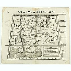
Tabula Asiae IX. (North India and Pakistan)
Double-page woodcut Ptolemaic-style map by Sebastian Münster figuring North India and Pakistan, published in the edition of Strabo by Henri Petri in 1571."Strabonis...
Place & Date: Basle, Henri Petri, 1571
Selling price: $65
Sold in 2020
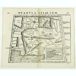
Tabula Asiae IX. (Pakistan, including part of India)
Double-page woodcut Ptolemaic-style map by Sebastian Münster figuring Pakistan, including part of India, published in the edition of Strabo by Henri Petri in 1571."...
Place & Date: Basle, Henri Petri, 1571
Selling price: $50
Sold in 2019
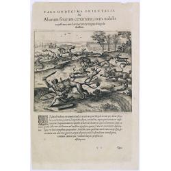
Pars undecima orientalis. IX. Aliarum ferarum certamina, item nobilis.
A scene with animals of Mongolia.Theodore de Bry, a German engraver and book dealer, began a compilation of early voyages in 1590 and had published six parts at the time ...
Place & Date: Frankfurt, 1609
Selling price: $50
Sold in 2016
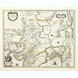
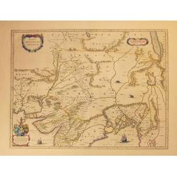
Magni Mogolis Imperium.
An attractive map of northern India and Central Asia bounded by Pakistan, Afganistan and Bangladesh and extening inland up the Ganges and Indus Rivers to Tartary and the ...
Place & Date: Amsterdam, 1647
Selling price: $300
Sold
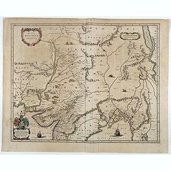
Magni Mogolis Imperium.
An attractive map of northern India and Central Asia bounded by Pakistan, Afghanistan and Bangladesh and extending inland up the Ganges and Indus Rivers to Tartary and th...
Place & Date: Amsterdam, 1647
Selling price: $375
Sold in 2012
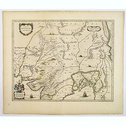
Magni Mogolis Imperium.
A most attractive map of northern India and Central Asia.
Place & Date: Amsterdam, 1639-1649
Selling price: $185
Sold in 2014
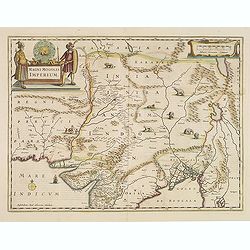
Magni Mogolis Imperium.
An attractive map of the region from Iran through Afghanistan, Tibet, and northern India across to Burma. The travel route from Kabul to Surat is the most prominent featu...
Place & Date: Amsterdam, 1650
Selling price: $200
Sold in 2018
Magni Mogolis Imperium.
An attractive map of the region from Iran through Tibet, and northern India to Burma. The travel route from Kabul to Surat is the most prominent feature of the map. Richl...
Place & Date: Amsterdam, 1650
Selling price: $100
Sold in 2022
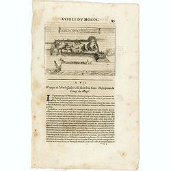
Cette figure represente un Retranchement que sirent les gens d'un Vaisseau Hollandois, qui eschoüa proche Damon, dont Rhoe parle dans ses memoires.
An early print showing Dutch ships arriving at Surat according to the memoirs of the English diplomat Thomas Roe (c. 1581 – 6 November 1644). Published from 1672 onward...
Place & Date: Paris, 1672
Selling price: $8
Sold in 2015