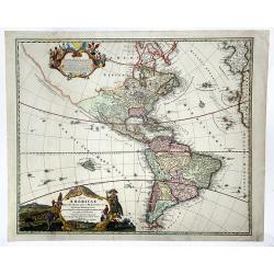
Totius AMERICAE Septentrionalis et Meridionalis novissima represestatio quam ex fingulis. . .
A richly ornamented map of North and South America. Title cartouche bottom left is copied from De Fer's map of 1699 and the cartouche containing text (top left) is based ...
Place & Date: Nuremberg, 1740 ca
Selling price: $600
Sold in 2020
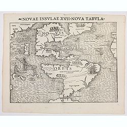
Novae Insulae XXVI Nova Tabula (America)
Rare first state of Münster's map of America which is the earliest map to show both continents of America and the first to use Magellan’s name, Mare Pacificum (Pacific...
Place & Date: Basel, (1540) 1542
Selling price: $6250
Sold in 2022
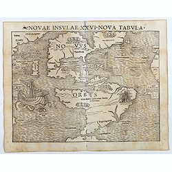
Novae Insulae XXVI Nova Tabula (America)
Rare second state of Münster's map of America which is the earliest map to show both continents of America and the first to use Magellan’s name, Mare Pacificum (Pacifi...
Place & Date: Basel, Heinrich Petri, 1545
Selling price: $3500
Sold in 2017
Tabula novarum insularum, quas diversis respectibus Occidentalis et Indianas vocant.
The earliest separate map to show both North and South America. One of the first maps also to include Japan, and the first to refer to Mare Pacificum or the Pacific Ocean...
Place & Date: Basle, 1550
Selling price: $9100
Sold in 2013
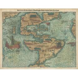
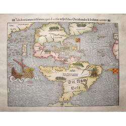
Die Neuwen Inseln so Hinder Hispanien Gegen Orient bey dem Land Indie Ligen
This is an authentic, antique map of the Western Hemisphere showing North and South America connected as true continents. It is the 5th state example published out of Bas...
Place & Date: Basel, 1550
Selling price: $4500
Sold in 2023
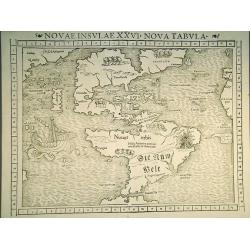
Novae Insulae XXVI Nova Tabula.
The earliest separate map of the western hemisphere, first published in the 1540 edition of Münster's "Geographia" and reprinted for subsequent editions of the...
Place & Date: Basel, 1552
Selling price: $4200
Sold in 2011
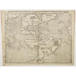
La table des Isles neufves, lequelles on appelle isles d'occident & d'Indie pour divers regardz
The rare 1552 edition of Münster's map showing all of North and South America. Münster's map is the earliest map to show all of the continent of America and the first t...
Place & Date: Basel, 1552
Selling price: $2800
Sold in 2018
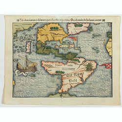
Tabula novarum insularum, quas diversis respectibus Occidentales & Indianas vocant.
The earliest separate map of the western hemisphere. State 5 of the Latin text edition incorporating the words 'Die Nüw Welt' in South America. It was first published in...
Place & Date: Basel, 1552
Selling price: $4000
Sold in 2023
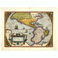
Americae Sive Novi Orbis, Nova Descriptio.
This is the second state of the first copperplate of Ortelius' map showing the western hemisphere, showing the prominent bulge in the South American coastline. An importa...
Place & Date: Antwerp, 1573
Selling price: $3800
Sold in 2014
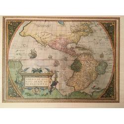
Americae Sive Novi Orbis, Nova Descripto.
A finely engraved and beautiful map and one of the most recognised and influential maps of the Americas from the 16th century. This example is from an early state of the ...
Place & Date: Antwerp, 1573
Selling price: $1350
Sold in 2019