Browse Listings in Africa > Central Africa > West coast / Ivory coast
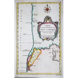
Carte d' une partie de la Coste d' Afrique Depuis Tanit jusq'a la Riviere de Senegal.
Jaques Nicolas Bellin (1702-720) was the most important French hydrographer of the 18th century. Sea-atlas 'Hydrographique Français' , 1756-65, atlas to accompany Prévo...
Place & Date: Paris, c. 1760
Selling price: $20
Sold in 2018
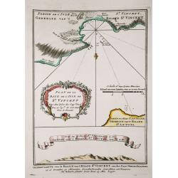
Plan de la Baye de l' Isles de St. Vincent / Vue de l' Isles de St. Vincent.
Jaques Nicolas Bellin (1702-720) was the most important French hydrographer of the 18th century. Sea-atlas 'Hydrographique Français' , 1756-65, atlas to accompany Prévo...
Place & Date: Amsterdam, c. 1760
Selling price: $40
Sold in 2018
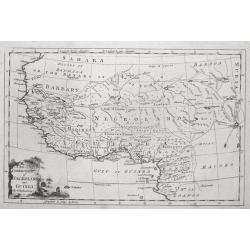
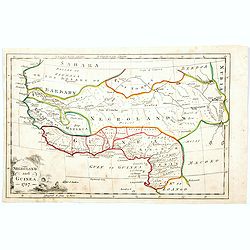
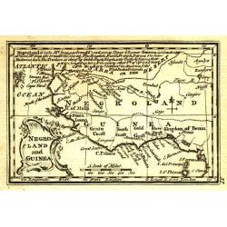
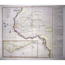
A New & Correct Map of Negroland and Guinea, by G.Rollos Geogr.
A detailed copper engraved map of West Africa published in Fenning's ‘A New System of Geography’.
Place & Date: London, 1760
Selling price: $60
Sold in 2018
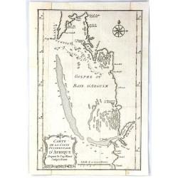
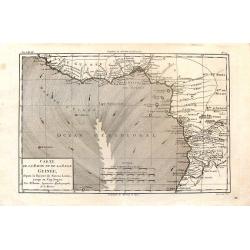
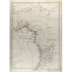
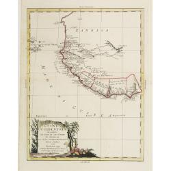
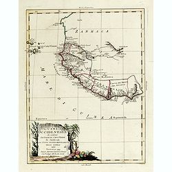
Carte de la Coste Occidentale D'Africa Depuis le Cap Blanc Jusqu'a Tanit
This map depicts the west coast of Africa along Mauritania, detailing the area around the Bay of Arguin.Islands, capes, and important towns surrounding the bay are labele...
Place & Date: Paris, 1760
Selling price: $13
Sold in 2017
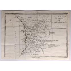
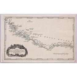
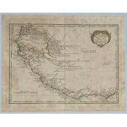
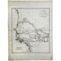
Carte du Congo en General ou de la Basse Guinnee.
A detailed map of the west coast of Africa, from Gabon to Namibia, and featuring the Congo. With detail and notations concerning recent explorations. Title in a plain blo...
Place & Date: Paris, 1760
Selling price: $41
Sold in 2017
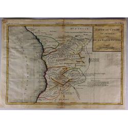
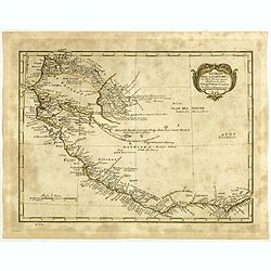
Carte du Congo en General ou de la Basse Guinee.
A detailed map of the west coast of Africa, from The Gabon to Namibia. Filled with detail and notations concerning recent explorations. Title in block style.Louis Brion d...
Place & Date: Paris, 1760
Selling price: $35
Sold in 2017
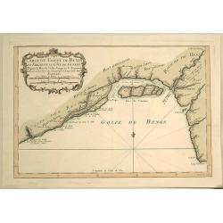
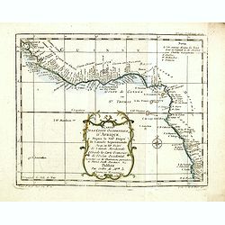
Carte du Golfe de Benin et Parte de la Cote de Guinee.
Attractive map of the infamous Slave Coast and the mouth of the Congo River showing soundings, anchorages and good coastal detail. The map features many place names, inc...
Place & Date: Paris, 1760
Selling price: $27
Sold in 2019
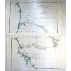
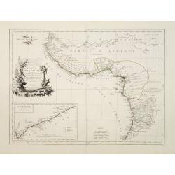
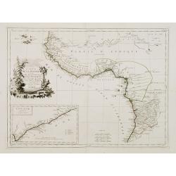
Carte particuliere de la Cote Occidnetale de L'Afrique.
Very large two-piece map of the West African coast from Cap de Verga to Cap Blanc. High detail along coast and main rivers. (Gambia & Senegal)Jean Baptiste d'Anville ...
Place & Date: Paris, 1761
Selling price: $14
Sold in 2016
A Large Chart of the Coast of Guinea From Sherbro To Cape Lopas
A large coastal sea chart with rhumb lines of mainly the Gold Coast, by Francis Lamb, published in 'The English Pilot, part V, 6th edition', London, Mount and Page, 1761....
Place & Date: London, 1761
Selling price: $200
Sold in 2022
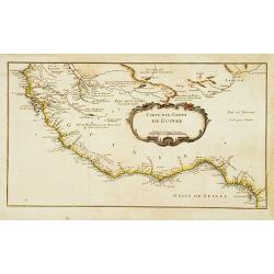
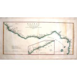
Carte des Costes de Guinée.
A very rare map of western part of Africa with the Ivory coast, from Le Commerce de l'Amérique par Marseille, ou Explication des Lettres-Patentes du Roi, portant Regleme...
Place & Date: Avignon 1764
Selling price: $80
Sold
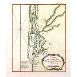
Carte de L'Entree de la Riviere de Sanaga ou Senegal.
The Sanaga River is a river of South Province, Cameroon. The map was published in 1764 by Nicholas Bellin in Paris.
Place & Date: Paris, 1764
Selling price: $21
Sold in 2016
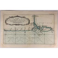
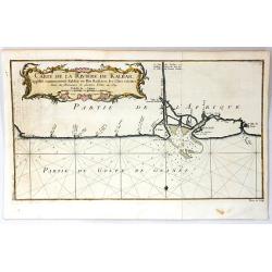
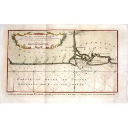
Carte de la Riviere de Kalbar...
A detailed coastal map of this Guinea coast area of Western Africa, based upon the 1699 voyage of James Barbot & John Grazilhier to New Kalabar, Bandi, and Doni River...
Place & Date: Paris, 1764
Selling price: $13
Sold in 2018
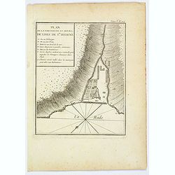
Plan de la Forteresse et Bourg, de Lisle de Ste. Helene.
A plan of the Fortress and Borough on the island of St. Helena by Bellin. With an inset legend of several important items and places of note, including the Govenor's hous...
Place & Date: Paris, 1764
Selling price: $18
Sold in 2021
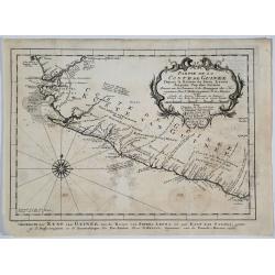
Partie de la Coste de Guinee.
A detailed map of the Guinea coast in West Africa, from the Sierra Leone River to Cape Palmas on the southern coast of what is now Liberia, from the atlas of Prevost d'Ex...
Place & Date: Paris, 1764
Selling price: $10
Sold in 2019
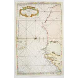
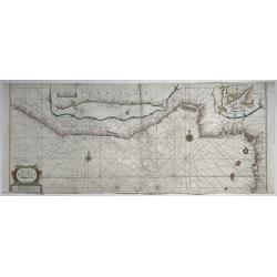
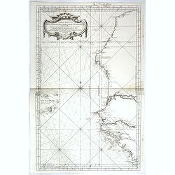
Carte Reduite des Costes Occidentales d'Afrique seconde feuille depuis le Cap Bojador jusqu'a la Riviere de Sierra Leona pour le service des Vaisseaux du Roy... Seconde feuille..
Sea chart of the West African coast, from Sierra Leone to southern Morocco, and including the Cape Verde Islands and part of the Canaries, all at a scale of about 1:3,000...
Place & Date: Paris 1754 corrected in 1765
Selling price: $150
Sold
Carte de la Riviere de Kalbar.
A splendid coastal map of this Guinea coast area of Western Africa, the chart is based upon the 1699 voyage of James Barbot & John Grazilhier to New Kalabar, Bandi, a...
Place & Date: Paris, 1765
Selling price: $27
Sold in 2016
Carte Reduite des Costes Occidentales d'Afrique seconde feuille depuis le Cap Bojador jusqu'a la Riviere de Sierra Leona pour le service des Vaisseaux du Roy... Seconde feuille..
Sea chart of the West African coast, from Sierra Leone to southern Morocco, and including the Cape Verde Islands and part of the Canaries, all at a scale of about 1:3,000...
Place & Date: Paris, 1753 corrected in 1765
Selling price: $150
Sold in 2018
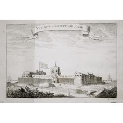
Vue nord ouest du Cap Corse.
The English fortresses at Cape Corse.From a French edition of Prévost d' Exile's ' Histoire. des Voyages', 1738-75.
Place & Date: Paris, 1769
Selling price: $50
Sold in 2018
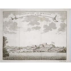
Plan of the English fortresses at Dickscove Vue du sud du fort de Dickscove.
The English fortresses at Dickscove.From a French edition of Prévost d' Exile's ' Histoire. des Voyages', 1738-75.
Place & Date: Paris, 1769
Selling price: $30
Sold in 2020
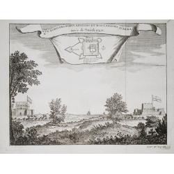
Vue nord des forts anglois et Hollandois d'Akra.
The Dutch and English forts at Accra. From a French edition of Prévost d' Exile's "Histoire des Voyages", 1738-1775. Crevecoeur, the Dutch fort and the English...
Place & Date: Paris, 1769
Selling price: $30
Sold in 2018
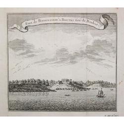
Fort de Badenstein a Boutri.
Fortress Badenstein at Boutri.From a French edition of Prévost d' Exile's ' Histoire. des Voyages', 1738-75.
Place & Date: Paris, 1769
Selling price: $50
Sold in 2018
Carte de la Riviere de Kalbar.
Detailed coastal map of the Guinea coast of West Africa based on the 1699 voyage of James Barbot and John Grazilhier to the Kalabar River. This was the heart of the slave...
Place & Date: Amsterdam, 1770
Selling price: $16
Sold in 2015
Guinee Guinee IIe. Feuille.
An example of Bonne's 1770 decorative map of West Africa. It covers from the Gold Coast (Ghana), south around the Bight of Benin (Biafara) to Gabon, Congo and Angola. It...
Place & Date: Paris, 1770
Selling price: $19
Sold in 2022
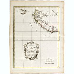
Carte de la Guinee, contenant les Isles du Cap Verd, le Senegal, la Cote de Guinee proprement dite, les Royaumes de Loango, Congo, Angola et Benguela....
A map of the Gulf of Guinea by Jean Lattré, a Paris-based engraver and publisher. He worked with Robert de Vaugondy, J. Janvier and R. Bonne. From his "Atlas Modern...
Place & Date: Paris, 1771
Selling price: $40
Sold in 2017
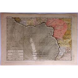
Carte de la Haute et de la Basse Guinee.
Fine copper engraved map featuring the west coast of northern Africa from The Sierra Leone River to Cape Negro. Engraved by Dien for R. Bonne's "RAYNAL'S HISTOIRE PH...
Place & Date: Paris, 1774
Selling price: $18
Sold in 2016
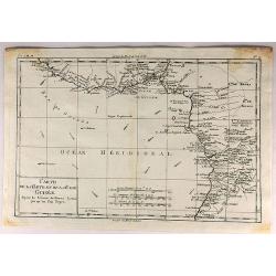
Guinee Entre Serre-Lione et le Passage de la Ligne.
Copper engraved map of the coast of the West African country of Guinee between Serre-Leone and the Equator. This was one of the top sources of slaves during the Historica...
Place & Date: Paris, 1775
Selling price: $31
Sold in 2014
Coste occidentale d'Afrique depuis le Détroit de Gibraltar.
An interesting map of the North-West coast of Africa, from the Straits of Gibraltar to the Gambia River and Cachau. The detailed map includes the Canary Islands, Madeira,...
Place & Date: Paris, 1738-1775
Selling price: $20
Sold in 2016
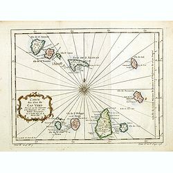
Carte des Isles du Cap Verd.
An interesting map of the islands of the Cap Verd.Prepared by Jacques Nicolas Bellin after Dutch sources and included in Prévost d' Exile's "Histoire des Voyages&qu...
Place & Date: Paris, 1738-1775
Selling price: $20
Sold in 2016
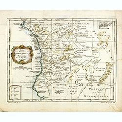
Carte des Royaumes de Congo, Angola et Benguela, avec les Pays voisins.
An interesting map of the kingdoms of Congo, angola and Benguela .Prepared by Jacques Nicolas Bellin after Dutch sources and included in Prévost d' Exile's "Histoir...
Place & Date: Paris, 1738-1775
Selling price: $20
Sold in 2014
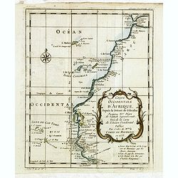
Carte de la Coste occidentale d'Afrique.
An interesting map of the West Coast of Equatorial Africa, from the Rio Grande in Senegal to just south of Angola .Prepared by Jacques Nicolas Bellin after Dutch sources ...
Place & Date: Paris, 1738-1775
Selling price: $10
Sold in 2018
Carte de la Guinée contenant les Isles du Cap Verd le Senegal, la Côtede Guinée proprement dite les Royaumes de Loango, Congo..
Detailed map of Southwest African coast, from Guinea to Congo.Santini gives credit to R.Bonne in the cartouche. With inset map of the "Gold Coast" after d'Anvil...
Place & Date: Venise 1776
Selling price: $675
Sold
Partie Occidentale de L'Ancien Continent.
"Western part of the old continent, from Lisbon to the river Sierra Leona, etc." Antique map from the "Atlas de Toutes les Parties Connues du Globe Terrest...
Place & Date: Paris, 1780
Selling price: $30
Sold in 2017
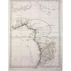
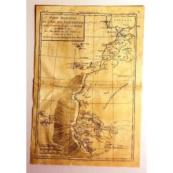
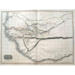
Carte de la Haute et de la Basse Guinee Depuis la Riviere de Sierra Leona Jus qu' au Cap Negro.
A fine map of Africa's Guinea coast by Rigobert Bonne and G. Raynal's in 1780. The map corresponds to modern day Liberia, Ivory Coast, Ghana, Nigeria, Cameroon, Gabon, Co...
Place & Date: Paris, 1780
Selling price: $25
Sold in 2017
Carte de la Haute et de la Basse Guinee.
An engraved map showing the entire Guinea coast from the Sierra Leone River to Cape Negro. Locates many towns and villages, lakes and coastal features. Today this is Libe...
Place & Date: Paris, 1780
Selling price: $30
Sold in 2019
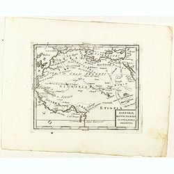
Barbaria, Egitto, Nigrizia, Guinea, Nubia Abissina.
Rare map of the northern half of Africa, from "Atlante Novissimo ad uso Dei Giovani Studiosi Contenuto In Carte XXVII.", published by Giovanni Zempel in Rome, c...
Place & Date: Rome, 1780
Selling price: $80
Sold in 2021
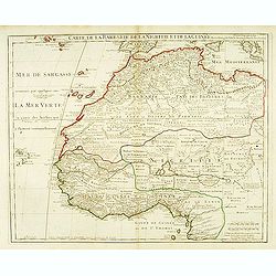
Carte de la Barbarie de la Nigritie et de la Guinée. . .
Detailed engraved map of north west Africa including the Canary and Cape Verde Islands. The title is displayed along the top of the map. In this map De L'Isle corrects hi...
Place & Date: Paris, 1781
Selling price: $170
Sold in 2015
Carta Dell Coste Della Guinea Dal Capo di Verga Sino al Paese d'Issini.
A fine copperplate map of Sierra Leone, including Liberia and the Ivory Coast, from the Italian edition by D’Anville. It features a decorative Rococo cartouche. Jean Ba...
Place & Date: Paris, 1781
Selling price: $65
Sold in 2018
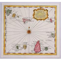
Carta dell Isole di Capo Verde.
A pleasant little map of the Cape Verde Islands off the coast of Africa, by Bellin in Paris dated 1781. This map is from the Italian edition. It features an attractive ti...
Place & Date: Paris, 1781
Selling price: $30
Sold in 2017
![[Two maps] Carte de la Guinée contenant les Isles du Cap Verd, le Senegal, la Côte de la Guinée proprement dite, les Royaumes de Loango, Congo, Angola, Benguela . . .](/uploads/cache/42837-250x250.jpg)
[Two maps] Carte de la Guinée contenant les Isles du Cap Verd, le Senegal, la Côte de la Guinée proprement dite, les Royaumes de Loango, Congo, Angola, Benguela . . .
Attractive map of the African west Coast, with Cap Verde island, ornated with a decorative title cartouche. Boundaries outlined in hand color.Prepared by Le Sieur Janvier...
Place & Date: Paris, ca 1783
Selling price: $22
Sold in 2019
Carte de la Guinée contenant les Isles du Cap Verd, le Senegal, la Côte de Guinée proprement dite, les Royaumes de Loango, Congo..
Detailed map of Southwest African coast, from Guinea to Congo.Santini gives credit to R.Bonne in the cartouche. With inset map of the "Gold Coast" after d'Anvil...
Place & Date: Venice, 1776 - 1784
Selling price: $190
Sold in 2018
Negroland and Guinea. 1787
Negroland, or Nigritia, is an archaic and outdated term in European mapping, describing the inland and poorly explored region in West Africa as an area populated with neg...
Place & Date: London, 1787
Selling price: $60
Sold in 2020
Untitled Map of West Africa (Cyrillic)
A rare cyrillic edition of the Bonne & Lattré copper engraved map of West Africa. It covers from the Gold Coast (modern day Ghana), south around the Bight of Benin t...
Place & Date: St Petersburg, 1790
Selling price: $46
Sold in 2019
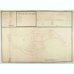
Plan de l'Isle de Goree.
A unusual map of the island of Goree. Includes an inset map of Senegalese coast, and a view of the port on the opposite upper corner. The title includes also a lettered k...
Place & Date: ca. 1790
Selling price: $500
Sold in 2020
Negroland and Guinea.
Uncommon miniature map from Gibson's "Atlas Minimus, or a New Set of Pocket Maps of the several Empires, Kingdoms and States of the known World".
Place & Date: London, 1792
Selling price: $35
Sold
La Guinea Occidentalle..
An engraved chart of the coast from Sierra Leone to Cape delle Tre Punte.
Place & Date: Venise, 1794
Selling price: $140
Sold in 2010
Bowles's new one-sheet map of the coast of Africa :from S.ta Cruz, lat. 30°N. to Angola, lat. 11°.S. with explanatory notes; and a correct chart of the Gold Coast.
Very interesting map of Western Africa, extending from the Canary Islands to Angola. Large scale with much information and interesting annotations. Lists Kingdoms and are...
Place & Date: London, c1794
Selling price: $120
Sold in 2014
La Guinea Occidentale...
An engraved chart of the coast from Sierra Leone to Cape delle Tre Punte.
Place & Date: Venise, 1794
Selling price: $55
Sold in 2018
Le Coste Dell' Alta Guinea.
A rare and detailed outline map of the coast of West Africa.
Place & Date: Sienna, 1796
Selling price: $12
Sold in 2018
Le Coste Dell' Alta Guinea.
A rare and detailed outline map of the coast of West Africa beginning with the Gold Coast to the west and to Senegal to the north. Many slaves were exported from this reg...
Place & Date: Siena, 1796
Selling price: $100
Sold in 2019
Carte de la Cote Ociidentale de l' Afrique.
A map showing the west Africa coasts, from Sierra Leone to Senegal and Gambia. Engraved by Tardieu. Shows all the up to then explored areas in the region.
Place & Date: Paris, 1804
Selling price: $60
Sold in 2020
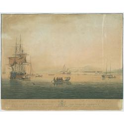
Cape Coast Castle, a British Settlement on the Gold Coast, Africa...
The image views Cape Coast Castle from the sea, it is positioned to the right of centre, a large ship is on the right with several smaller sailing ships, in the foregroun...
Place & Date: G. Webster & J. Barrow, London Oct. 26th 1806
Selling price: $120
Sold in 2009
Western Africa.
Elephant folio sized map of Western Africa, extending from the Kingdom of Brak and Damel's Kingdom to the Gold Coast and the Slave Coast, and inland to Bibbie Lake, Jinba...
Place & Date: London, 1813
Selling price: $70
Sold in 2016
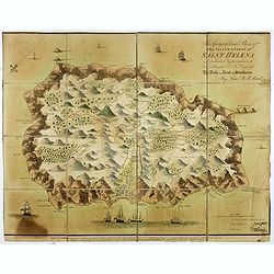
This Geographical Plan of the Island & Forts of St Helena is Dedicated by permission to Field Marshal His Ro.l Highness The Duke of Kent and Strathearn By Lieu.t R.P. Read.
FIRST EDITION. A map of the island of St Helena, decorated with trees, ships, cannons, residences, and even whales (perhaps sperm whales) firing powerful jets of water fr...
Place & Date: London: Burgess & Barfoot, October 1815
Selling price: $1200
Sold in 2021
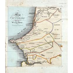
Map of the Countries Inhabited by the Wolofs
Rare map of Senegal and Gambia. The map is shows good detail of villages, regionas, and topographical features. Published in Ackermann's The World in Miniature. Africa.....
Place & Date: London, 1822
Selling price: $150
Sold in 2022
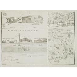
Carte du Sénégal / Plan de l\'Isle St. Louis / Vue du Fort St. Louis du côté de la mer. / Environs de l' Isle St. Louis.
Four maps on one sheet showing the position of the French stronghold of Fort St. Louis in Senegal.
Place & Date: Paris, ca. 1835
Selling price: $98
Sold in 2009
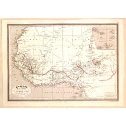
Afrique Occidentale Comprenant le Sahara, Le Soudan...
Detailed map of Western Africa including the Sahara Desert and the Soudan. Published by Aubree Armand in Paris in 1837. Engraved by I. Grenier and printed by Mangeon.Inse...
Place & Date: Paris, 1837
Selling price: $40
Sold in 2015
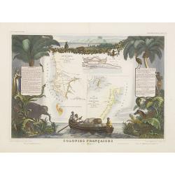
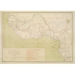
Colonies Françaises (en Afrique).
A very decorative 19th century map of western coast of Africa and includes a map of the coast of Madagascar. The map is surrounded by portraits, animals, vegetation, etc....
Place & Date: Paris, 1850
Selling price: $100
Sold in 2018
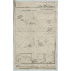
A Chart of the Cape Verde Islands, Drawn from the Latest Authorities by J.W. Norie, Hydrogrpher.
An original and striking, mariners chart of the Cape Verde Islands in the Atlantic Ocean, off the coast of Africa. It is by J. W. Norie one of the most important chart ma...
Place & Date: London, 1855
Selling price: $150
Sold in 2018
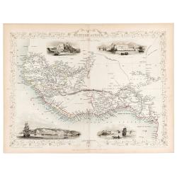
Western Africa.
Original steel engraved map of Western Africa. Map accompanied by vignette scenes of Christiansborg, Cape Coast Castle, Sierra Leone and Bakel. Decorative scrolling and t...
Place & Date: London & New York: John Tallis & Company, 1856
Selling price: $70
Sold in 2023
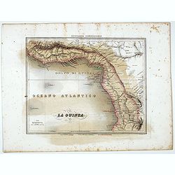
La Guinea.
Uncommon map of Guinea prepared by Francesco Costantino Marmocchi. Above the map "Geografia Commerciale". From "Il Globo Atlante di carte Geografiche compi...
Place & Date: Genova, Paolo Rivara fu Giacomo, 1858
Selling price: $15
Sold in 2021
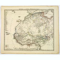
Mittel und Nord-Africa. Westl. Theil.
An informative and detailed map of middle, western and northern Africa, published in Gotha by Perthes in Stieler's Hand Atlas in 1863. It shows elevations, cities, tracks...
Place & Date: Gotha, 1863
Selling price: $50
Sold in 2019
![[Title in Ottoman Turkish: WEST AFRICA AND THE MAGHREB].](/uploads/cache/44731-250x250.jpg)
[Title in Ottoman Turkish: WEST AFRICA AND THE MAGHREB].
A fine Ottoman map of West Africa and the Maghreb from Ali Seref Pasa’s rare ‘Yeni cografya atlasi’, published by the press of Matbaa-i Amire, the successor of Ibra...
Place & Date: Beyazit, Istanbul: Matbaa-i Amire 1311 or 1895
Selling price: $250
Sold in 2019
Carte des Missions .. Du Soudan Français..
Uncommon and detailed map of Western part of Africa, prepared by P.Vuillot. The map has a key to the 19 different missionary territories. Published as a supplement to Jou...
Place & Date: Lyon/Paris 1897
Selling price: $220
Sold
![[Equatorial Africa - map with Ottoman script]](/uploads/cache/44740-250x250.jpg)
[Equatorial Africa - map with Ottoman script]
Post card size map in Ottoman script of Sub-Saharan West Africa from Mehmet Esref’s ‘Küccük Atlas’, a rare portfolio of loose-leaf maps with text in Ottoman Turki...
Place & Date: Istanbul, Matbaasi 1325 or 1909
Selling price: $100
Sold in 2019
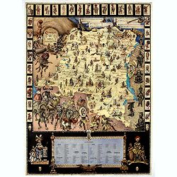
Congo Nova Descriptio.
Beautiful and decorative pictorial map of Congo, showing different tribes of this area. The poster carries a wealth of information and presents a selection of traditional...
Place & Date: Paris, 1930
Selling price: $750
Sold in 2021
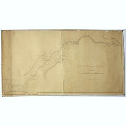
Mission d'études du Haut fleuve Sénegal.
Five maps likely prepared by "La Mission d'Etudes du Fleuve Sénégal" (MEFS) which was a public body responsible for the conduct and execution of all th...
Place & Date: Senegal, ca. 1935-1938
Selling price: $300
Sold in 2017
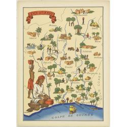
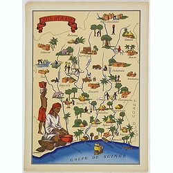
Cote d'Ivoire
Very decorative, informative map of the Ivory coast. The map is filled with buildings, animals, a ship, figures and two locals in their typical dress.In lower left corner...
Place & Date: France, 1943
Selling price: $90
Sold in 2012
Cote d'Ivoire
Very decorative, informative map of the Ivory coast. The map is filled with buildings, animals, a ship, figures and two locals in their typical dress.In lower left corner...
Place & Date: France, 1943
Selling price: $55
Sold in 2016
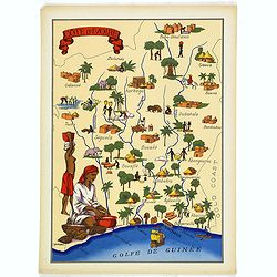
Cote d'Ivoire
Very decorative, informative map of the Ivory coast. The map is filled with buildings, animals, a ship, figures and two locals in their typical dress.In lower left corner...
Place & Date: France, 1943
Selling price: $60
Sold in 2018
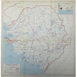
Sierra Leone
A 1948 map of Sierra Leone published by the Directorate of Colonial Surveys, and printed by the War Office.
Place & Date: London, 1948
Selling price: $45
Sold in 2017
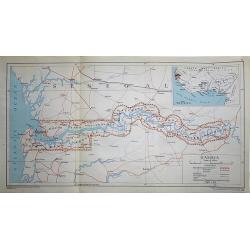
Gambia
A 1948 map of Gambia under the British Protectorate, published by the Directorate of Colonial Surveys, and printed by the War Office.
Place & Date: London, 1948
Selling price: $45
Sold in 2017
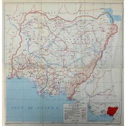
Nigeria
A 1948 map of Nigeria published by the Directorate of Colonial Surveys, printed by the War Office.
Place & Date: London, 1948
Selling price: $45
Sold in 2017
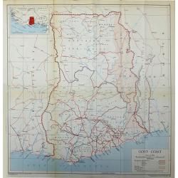
Gold Coast
The African Gold Coast published by the Directorate of Colonial Surveys, and printed by the War Office in 1948.
Place & Date: London, 1948
Selling price: $45
Sold in 2017
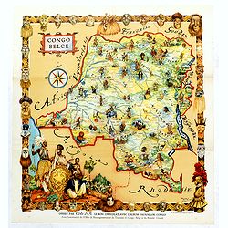
Congo Belge.
This poster was included in the picture book "Faunaflor-Kongo" of the chocolate manufacturer Côte D'or. Printed in Belgium by Ets. Leon Beyaert-Sioen N.V. Kort...
Place & Date: Kortrijk, ca. Ca. 1950
Selling price: $35
Sold in 2019
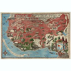
Afrique Occidentale Française AOF.
Beautiful and decorative lithograph pictorial map of French West Africa, showing tribes, animals, monuments, landscapes. Made for Ministere de la France d'Outre-mer, agen...
Place & Date: Imprimerie Jombart, Asnières, ca. 1950
Selling price: $1000
Sold in 2020
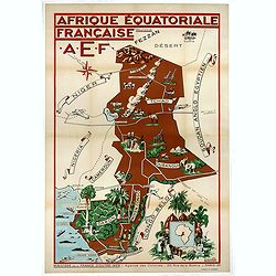
Afrique Equatoriale Française AEF.
Beautiful and decorative lithograph pictorial map of Equatorial Africa, showing tribes, animals, landscapes… Made for Ministere de la France d'Outre-mer, agence des Col...
Place & Date: Imprimerie Jombart, Asnières, ca. 1951
Selling price: $950
Sold in 2020
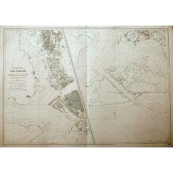
Port d'Abidjan.
An unusual sea-chart of Abidjan, Côte d'Ivoire. With excellent detail of the coasts, and the city. The left chart shows the harbour, and the chart on the right shows the...
Place & Date: Paris, 1965
Selling price: $21
Sold in 2018