Browse Listings in Polar maps
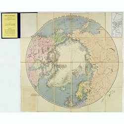
Stanford's Map of the countries round the North Pole.
A scarce example of Edward Stanford’s map depicting the entire Arctic Region. In the Russia section, the map extends until the Caspian Sea.To the left an explanation of...
- $500 / ≈ €468
Place & Date: London, 1875

Région arctique.
Decorative map of the North Pole, prepared by Louis Vivien de Saint-Martin (* 22. Mai 1802 in Saint-Martin de Fontenay, died 3 January 1897 in Paris). He was one of the m...
$450 / ≈ €421
Place & Date: Paris, Hachette, 1877
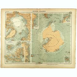
Régions Polaires.
Eight maps on one sheet, showing the North and South Poles, with adjective regions. Taken from "Atlas Universel" by Chesneau and Ch. Bonnesseur. Engraved by R. ...
- $50 / ≈ €47
Place & Date: Paris, 1931