Browse Listings in Polar maps
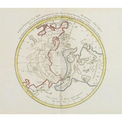
Carte Phisique de la Mer Glaciale Arctique. . .
Very unusual thematic map designed to illustrate the watersheds of the world, after Buache and prepared by J.B.Nolin and published by Monhare for his Atlas Général a l'...
- $300 / ≈ €281
Place & Date: Paris, 1783
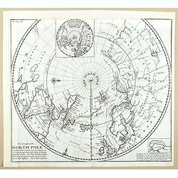
This Draught of the North Pole is to show all the Countries near and adjacent to it . . .
The polar map shows the latest discoveries and routes of numerous explorers during their attempts to find a Northwest and Northeast Passage, including James, Hudson, and ...
- $300 / ≈ €281
Place & Date: London, ca. 1728
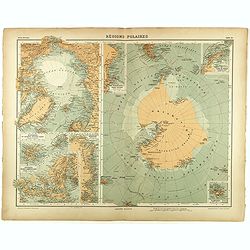
Régions Polaires.
Eight maps on one sheet, showing the North and South Poles, with adjective regions. Taken from "Atlas Universel" by Chesneau and Ch. Bonnesseur. Engraved by R. ...
- $50 / ≈ €47
Place & Date: Paris, 1931