Browse Listings
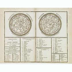
Représentation du Globe céleste En deux Plans Hémisphères Coupés par l'Ecliptique.
Scarce double armillary sphere prepared by Nolin and published by L.J. Mondhare for his Atlas Général a l'usage des colleges et maisons d'education.. Louis Joseph Mondh...
- $75 / ≈ €70
Place & Date: Paris, 1783
![[Javanese gamelan orchestra]](/uploads/cache/37960-250x250.jpg)
[Javanese gamelan orchestra]
Two text engravings from "Premier livre de l'histoire de la navigation aux Indes Orientales, par les hollandois, et des choses a eux advenues . . . ", being the...
- $75 / ≈ €70
Place & Date: Amsterdam, Cornille Nicolas, 1609

Pas kaart Van Rio Oronoque Golfo De Paria met d'Eylanden Trinidad, Tabago, Granada, Granadillos, en Bequia . . .
A highly detailed and rare sea chart of the mouth of the Orinoco River, Trinidad, Tabago, St.Vincent and neighboring islands. Oriented with north to the right by two comp...
- $900 / ≈ €842
Place & Date: Amsterdam, 1684

Paris fashion plate. (120)
From Les Modes Parisiennes. Underneath the print are the names of the shops where the clothing's, perfumes, porcelains, flowers, etc., depicted in the engraving, are to b...
- $25 / ≈ €23
Place & Date: Paris, 1866
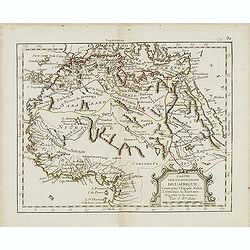
Partie septentrionale de l'Afrique contenant l'Egipte. . .
Scarce map of northern part of Africa, prepared by Nolin and published by L.J. Mondhare for his Atlas Général a l'usage des colleges et maisons d'education.. Louis Jose...
- $150 / ≈ €140
Place & Date: Paris, 1783
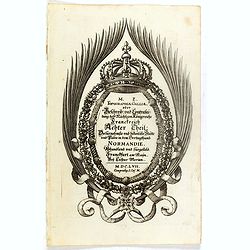
(Title page ) Topographia Galliae. . .
Title page from Casper Merian's Topographia Galliae...See other Title Pages [+]
- $30 / ≈ €28
Place & Date: Frankfurt, 1658
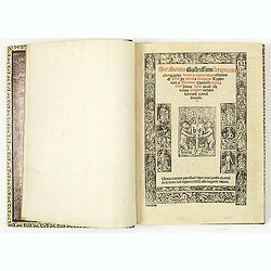
Strabonis illustrissimi scriptoris Geographia decem et septem libros continens.
First edition was published in Paris in the sixteenth century and the first with the preface by Thibaud Pigenat. Translation from Greek into Latin by Gregorio Tifernate a...
- $5000 / ≈ €4679
Place & Date: Paris, Hémon Le Fèvre, 1512
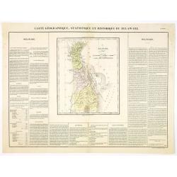
Carte Géographique .. Delaware.
Detailed map of Delaware. From J.A. Buchon, Atlas Gégraphique Statistique, historique et chronologique des deux Ameriques et des isles adjacentes, traduit de l'atlas ex�...
- $300 / ≈ €281
Place & Date: Paris, 1825
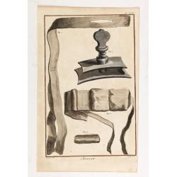
Chirurgie, plate XVIII
Showing bondage from the medical section of Diderot's Encyclopaedia. Engraved by Bernard after a design of Goussier. Very important work as it is giving an inventory of t...
- $100 / ≈ €94
Place & Date: Paris 1779
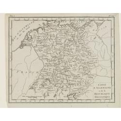
Carte d'Allemagne et de la Republique Helvetique.
Map of central Europe centered on Germany, extending southwards and eastwards to include Poland, the Czech Republic, Austria, Switzerland, Slovenia and part of Italy.From...
Place & Date: Paris, Prudhomme, Levrault, Debray, 1806