Browse Listings in Europe > Switzerland
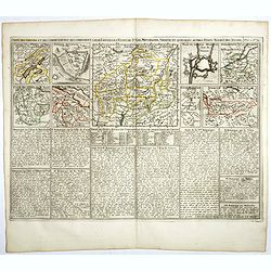
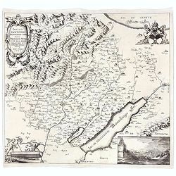
Carte des Grisons et des Communautez qui Composent leurs Ligues, les Etats de St. Gal, Neuchastel, Geneve et Quelques Autres Etats Alliez des Suisse.
This finely engraved sheet provides the history of various cities and regions allied with Switzerland at the beginning of the eighteenth century. The top section of the s...
- $150 / ≈ €140
Place & Date: Amsterdam, 1720
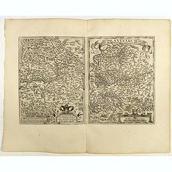
Basiliensis territorii descriptio nova./Circulus sue Liga. . .
Left-hand map centered on Basel, east to top. With credit to Sebastian Münster in the title cartouche. Right-hand map with Boden See, Strasbourg and Augsburg. The map wa...
- $300 / ≈ €281
Place & Date: Antwerp, 1598
![Zurichgow et Basiliensis Provincia [ Zurich].](/uploads/cache/60807-250x250.jpg)
Zurichgow et Basiliensis Provincia [ Zurich].
Finely engraved map including the towns of Basel, Lucerne, Zurich, etc.
- $400 / ≈ €374
Place & Date: Amsterdam, 1635
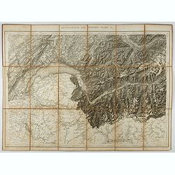
Generalkarte der Schweiz. Blatt III.
Folding map showing Leman lake. The map, engraved by Müllhaupt, is probably part of the 'Topographical Atlas of the Federal General Staff reduced under the direction of ...
- $75 / ≈ €70
Place & Date: Bern, 1873
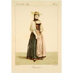
Bernoise.
A decorative costume print from "Costume de div. Pays", No.17. Engraved by Getine after Lanté.
- $80 / ≈ €75
Place & Date: Paris, c. 1827
Incliti Cantonis Friburgensis Tabula, autore Francisco Petro VON DER WEID. Senatore et Commissario generale Friburgi. anno Domini 1668.
Very rare 2-sheet map and the first map of the canton Fribourg (Freiburg) in a scale of Scale 1:120.000. South to the top.The area shown on the map encompasses the whole ...
- $7500 / ≈ €7018
Place & Date: Fribourg, 1668
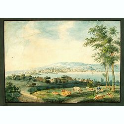
Vue de Zurich.
Good sized panoramic view of Zürich in the style of BLEULER with the foreground a resting shepherd with his sheep's under a tree. The engraving/etching is hand colored a...
- $900 / ≈ €842
Place & Date: Ca. 1800
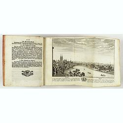
Neue und vollständige Topographie der Eidgnossschaft, in welcher die in den dreyzehen und zugewandten auch verbündeten Orten und Landen dermal befindliche Städte, Bischthümer, Stifte, Klöster, Schlösser, Amts-Häuser, Edelsitze und Burgställe...
The first edition of Herrliberger's work on the topography of Switzerland. - The rarest book on Switzerland rarely found complete.Illustrated with an engraved allegorical...
- $5500 / ≈ €5146
Place & Date: Zurich, Johann Kaspar Ziegler, 1754-1773
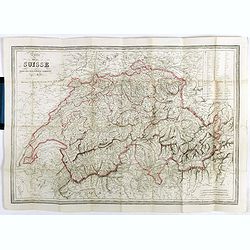
Carte de la Suisse . . .
Detailed canvas map of Switzerland.
- $75 / ≈ €70
Place & Date: Paris, 1850
![[Voyage en Suisse / Reise die Schweiz.]](/uploads/cache/48396-250x250.jpg)
[Voyage en Suisse / Reise die Schweiz.]
A first edition children's folding board game of Switzerland and its many places and sights to visit. Although it is missing most of its original components (dice, cards,...
Place & Date: Switzerland, 1891