Browse Listings in Europe > Switzerland
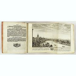
Neue und vollständige Topographie der Eidgnossschaft, in welcher die in den dreyzehen und zugewandten auch verbündeten Orten und Landen dermal befindliche Städte, Bischthümer, Stifte, Klöster, Schlösser, Amts-Häuser, Edelsitze und Burgställe...
The first edition of Herrliberger's work on the topography of Switzerland. - The rarest book on Switzerland rarely found complete.Illustrated with an engraved allegorical...
- $5500 / ≈ €5146
Place & Date: Zurich, Johann Kaspar Ziegler, 1754-1773
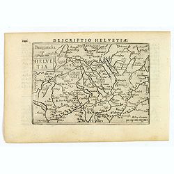
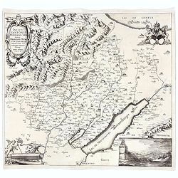
Helvetia.
A lovely miniature map of Switzerland, published by Petrus Bertius, in Amsterdam at the beginning of the seventeenth century.Full of facinating topographical detail, and ...
Place & Date: Amsterdam, 1606
Diocesi della Svizzera (Tav IV)
This large-format Switzerland map is finely engraved and beautifully colored and was prepared by Girolamo Petri, a lawyer who served as a senior official within the Vatic...
- $750 / ≈ €702
Place & Date: Rome, 1858
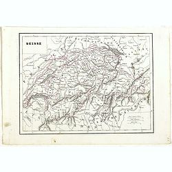
Suisse.
Detailed map of Switzerland, prepared by Charles V. Monin (fl.1830-1880) a French cartographer of Caen and Paris. Published in Atlas Universel de Géographie Ancienne &am...
- $45 / ≈ €42
Place & Date: Paris, 1845
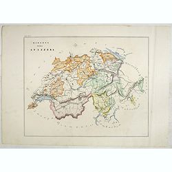
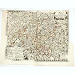
Incliti Cantonis Friburgensis Tabula, autore Francisco Petro VON DER WEID. Senatore et Commissario generale Friburgi. anno Domini 1668.
Very rare 2-sheet map and the first map of the canton Fribourg (Freiburg) in a scale of Scale 1:120.000. South to the top.The area shown on the map encompasses the whole ...
- $7500 / ≈ €7018
Place & Date: Fribourg, 1668
![[Map of the Alps].](/uploads/cache/46164-250x250.jpg)
[Map of the Alps].
Alexey Afinogenovich Ilyin was a lieutenant general and cartographer (1832-1889). In 1856, after graduating from the Academy of the General Staff, he was at the military ...
- $45 / ≈ €42
Place & Date: St. Petersburg, 1899
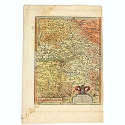
Basiliensis territorii descriptio nova.
Left hand map centered on Basle, east to top. With credit to Sebastian Münster in title cartouche.
- $200 / ≈ €187
Place & Date: Antwerp, 1573
Les Suisses leurs sujets et leurs alliez. . .
Un uncommon map of Switzerland by Nolin.
- $250 / ≈ €234
Place & Date: Paris, ca. 1760
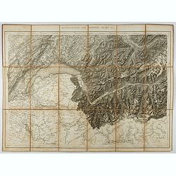
Generalkarte der Schweiz. Blatt III.
Folding map showing Leman lake. The map, engraved by Müllhaupt, is probably part of the 'Topographical Atlas of the Federal General Staff reduced under the direction of ...
- $75 / ≈ €70
Place & Date: Bern, 1873
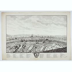
Prospect der Statt Basel von Seiten der Kleinen Statt - Vüe et Perspective de la Ville de Bâle du côté de la petite Ville.
Very decorative view of Basle, after a design by Emanuel Büchel and engraved by Johann Martin Weiss. The legend inscribed under the engraving, numbered from 1 to 10, des...
Place & Date: Basle, 1745